Abstract
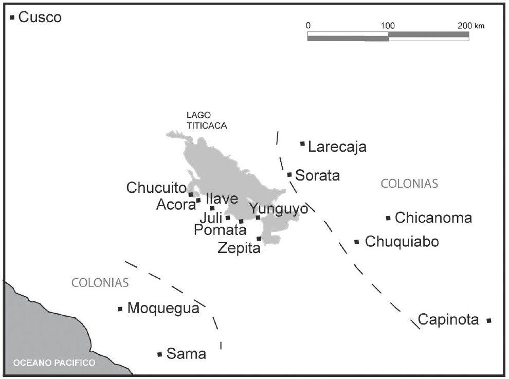
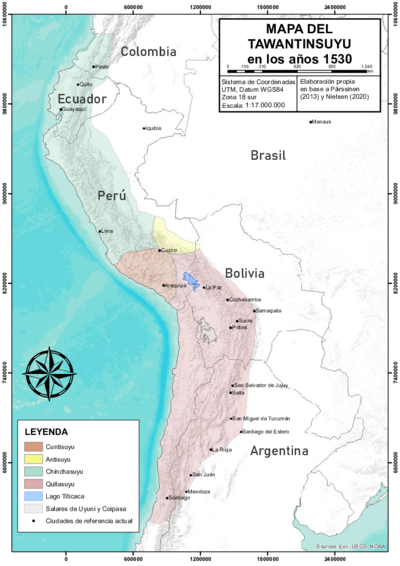
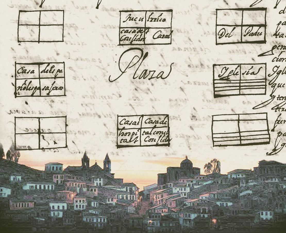
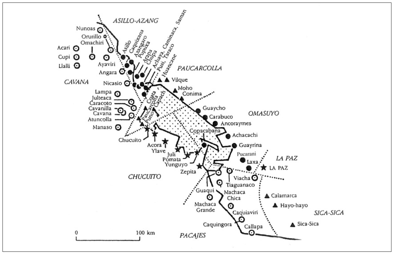
Focusing on the area of the high plateau around the Titicaca Lake, the **map shows the nucleated ‘Indian Royal Towns’ the Spanish colonial state established in this area through a massive forced resettlement program**.[^1] Before Spanish colonization, this area was part of the [*Qullasuyu*](/en/content/BOL0002Y/), the southern district of the Inca state or [*Tawantinsuyu*](/en/content/BOL0001Y/) and it was the area in which the core settlements of large and powerful Aymara polities AYMARA POLITIES of THE QULLASUYU in the 16th CENTURY were located. Under Spanish colonial rule, the *Qullasuyu* became the southern district of the Viceroyalty of Peru called *Distrito de la Audiencia de Charcas or La Plata* divided into two large provinces, Charcas and La Paz. The area on the map was part of the latter which was further divided into smaller territorial administrative units. The territorial units (sort of rural districts) assigned to the indigenous population were called *Corregimientos de Indios* (indicated on the map in capital letters) and encompassed a number of ‘Indian Royal Towns’ also called [*reducciones*](/en/content/TL003Reducciones/) represented by the dots on the map with each style of dot corresponding to a *Corregimiento de Indios*.Spanish conquerors arrived in the region of the Qullasuyu in the late 1530s, but it was only in the 1570s that the Spanish crown was able to implement major transformations in order to institutionalize the presence of the Spanish colonial state in the region, consolidate its role as agent of metropolitan interests and revitalize the production of silver in the mines of Potosi. These transformations included the enforcement of a new political administrative organization of the territory of the viceroyalty, the monetization of indigenous tribute, the rationalization of a system of indigenous draft labor, mita, and an ambitious program of forced resettlement of dispersed indigenous hamlets into fixed concentrated towns where the indigenous population could be managed, evangelized and taxed more efficiently. In these so called ‘Indian Royal Towns’ or ‘reducciones’, ethnic authorities were to become state paid functionaries in charge of collecting tribute and delivering levied labor under the close supervision of parish priests, and other colonial officials. Dismantling what was left from pre-Columbian ethnic territories and stripping the Aymara polities from their traditional land rights, Spanish colonial officials drove people away from their ancient lands and often joined them with members of different polities. This process entailed the disarticulation of the large macro-ethnic Aymara polities, their fragmentation into smaller ‘Indian communities’ and a thorough reconfiguration of ethnic identities and claims. The memory of belonging to the larger Aymara polities faded away and the reconstituted communities within the ‘Indian Royal Towns’ eventually became the main identity reference.
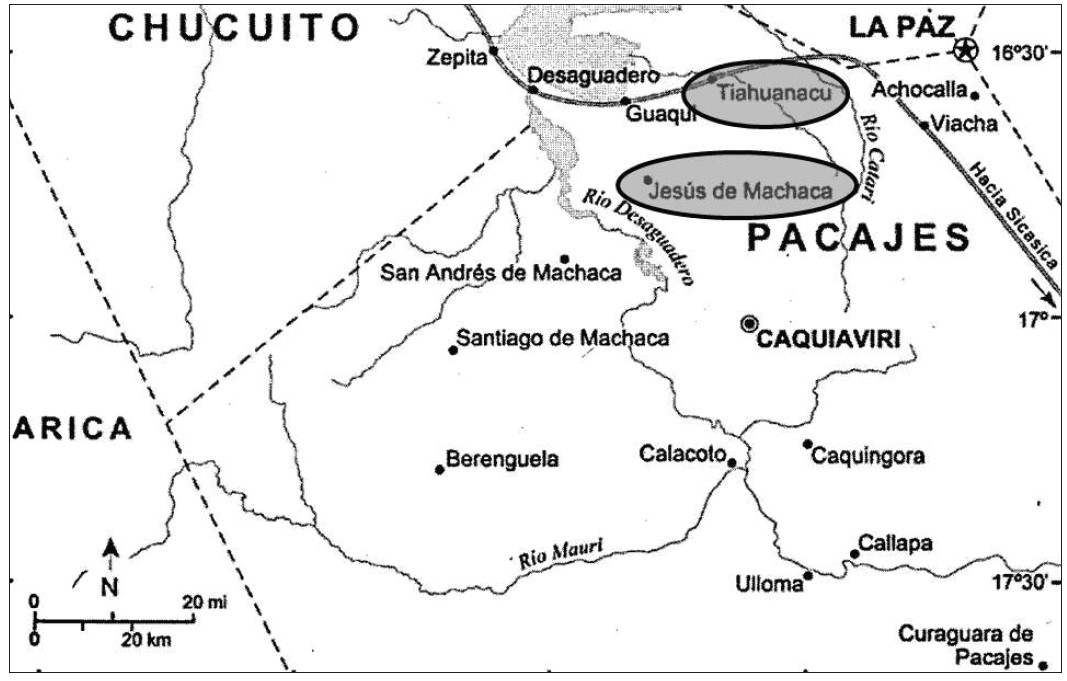
In the case of this map, the main Aymara polities affected by these colonial reconfigurations of the space and the “violent and disintegrating” forced resettlement programs were the Lupaqas, the Pakaxa (or Pacajes or Paka Jaqi), and the Qullas (or Collas).1 Nowadays, the majority of the population living in this area are Aymara speakers (or bilingual Spanish / Aymara) who tend to identify themselves with the Aymara nation.
REFERENCES:
Andrade Alvarez, Norby. “La Mita en los Andes Bolivianos de la Provincia Colonial de
Omasuyos en el Siglo XVII.” Estudios Latinoamericanos 1 (June 2017): 28-33.
Choque, Roberto. Jesús de Machaca: La Marka Rebelde. vol 1. La Paz: CIPCA, 2003.
Morrone, Ariel. “El Lago de los Curas: Mediación Sociopolítica y
Cultural en los Corregimientos del Lago Titicaca (1570 - 1650).”
Estudios Atacameños de Arqueología y Antropología Surandinas 55 (June 2017) 183-202.
Wachtel, Nathan. El Regreso de los Antepasados: Los Indios Urus de Bolivia, del Siglo
XX al XVI: Ensayo de Historia Regresiva. México: El Colegio de México,
Fideicomiso Historia de las Américas, 2001.
Norby Andrade Alvarez, Norby. “La mita en los Andes bolivianos de la provincia colonial de Omasuyos en el siglo XVII. Estudios Latinoamericanos 1 (June 2017), 30. ↩︎