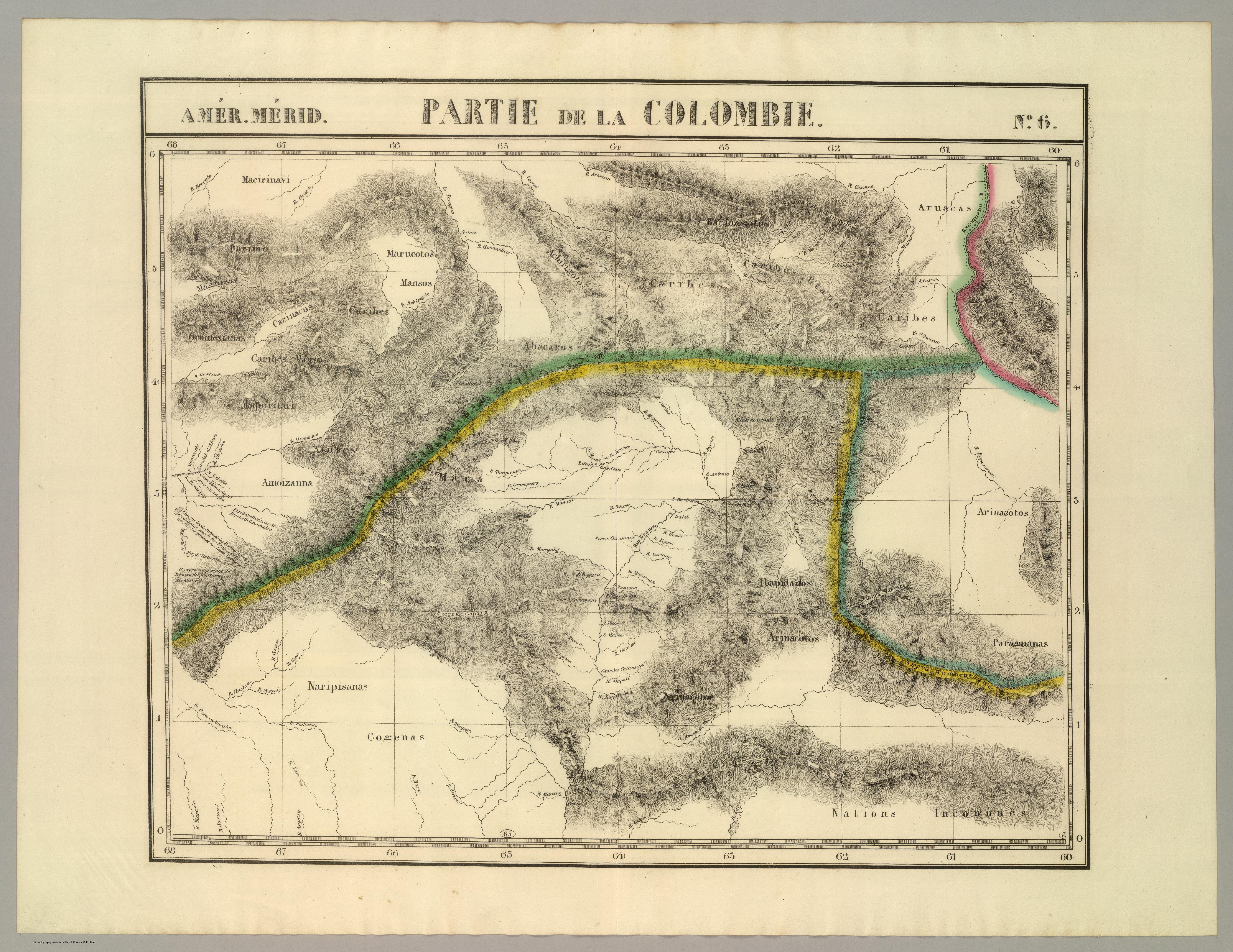
Povos
- PARIME
- YEKUANA
- MARUCOTOS
- ACHIRIGOTO
- PEMON
- CARIBE
- ARUACA
- ABACARA
- CARINACO
- OCOMESIANA
- MAGNISAS
- ATURES
- AMOIZANA
- MACOS
- ARNACOTO
- IBAPIDANOS
- MARIPISANAS
- KAKETIO
- COGENAS
- INCONNUES
Citação
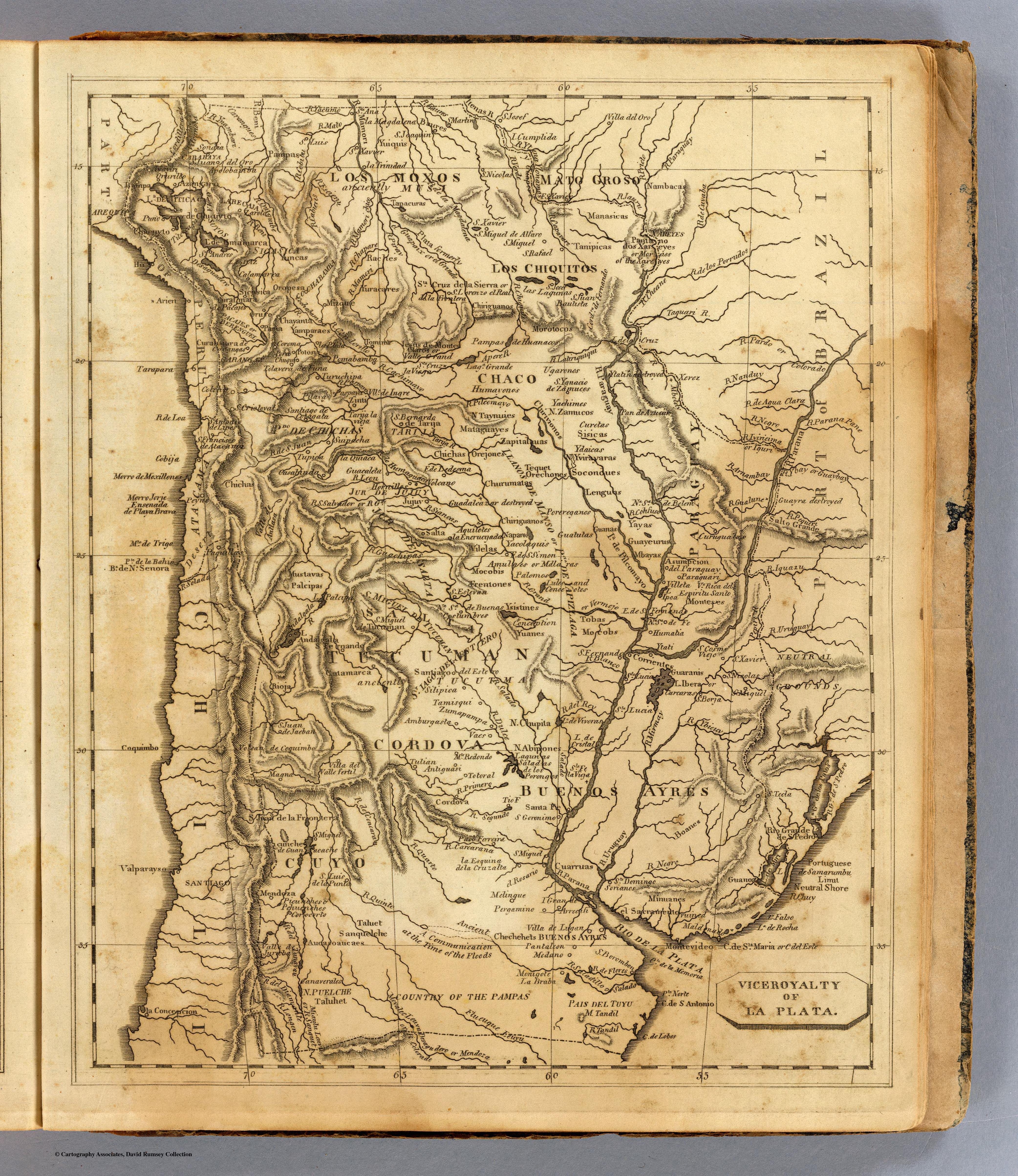
Vandermaelen;Philippe. Partie de la Colombie. Amer. Merid. no. 6. Map. Brussels: Ph. Vandermaelen;1827. Accessed December 28;2022. https://www.davidrumsey.com/luna/servlet/detail/RUMSEY~8~1~25245~5500105:Partie%2C-Colombie--Amer--Merid--6-?sort=pub_list_no_initialsort%2Cpub_date%2Cpub_list_no%2Cseries_no&qvq=w4s:/where%2FVenezuela;q:venezuela;sort:pub_list_no_initialsort%2Cpub_date%2Cpub_list_no%2Cseries_no;lc:RUMSEY~8~1&mi=170&trs=267#.
![[Cartes de S. Domingue, de Cuba, de la Martinique et de la Guadeloupe]](https://dnet8ble6lm7w.cloudfront.net/maps/CNT/CNT0219.jpeg)
![[Carta particolare della costa di Guiana]](https://dnet8ble6lm7w.cloudfront.net/maps/CNT/CNT0213.jpg)
![De cuando el río dejó de ser río para convertirse en otra cosa [Quando o rio deixou de ser rio para se transformar em outra coisa]](https://dnet8ble6lm7w.cloudfront.net/art_sm/APER061.png)