Citação
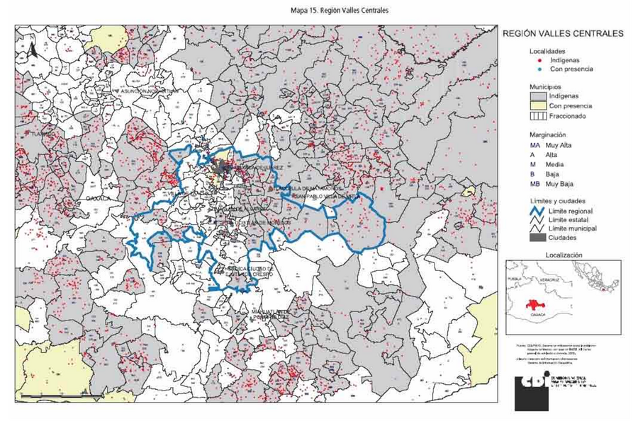
Comisión Nacional para el Desarrollo de los Pueblos Indígenas. Regiones indígenas de México. Publication no. 330.972. 2006. https://www.gob.mx/cms/uploads/attachment/file/35735/cdi-regiones-indigenas-mexico.pdf.
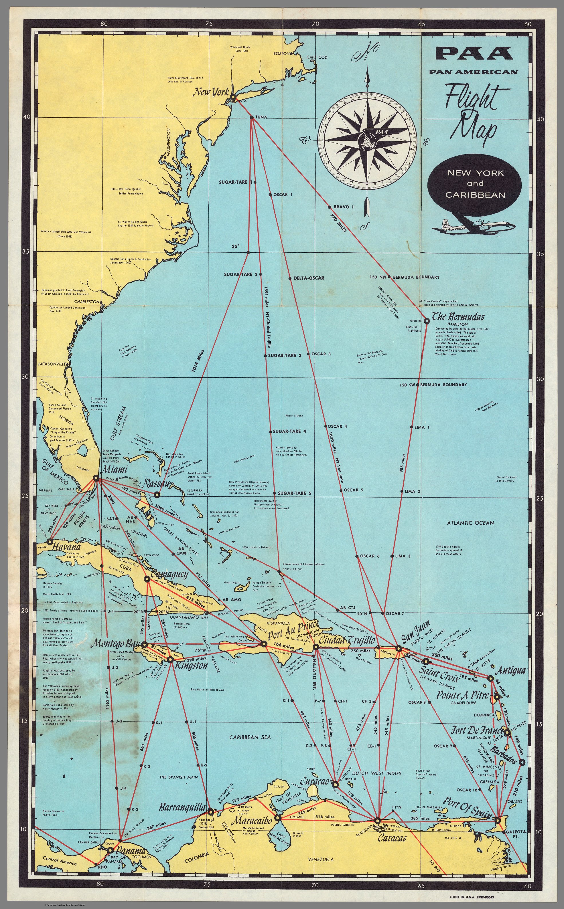
PAA. Pan American Flight Map. New York and Caribbean.
Mapa 1508 - 1783![[Carta particolare della costa di Guiana]](https://dnet8ble6lm7w.cloudfront.net/maps/CNT/CNT0213.jpg)
[Carta particolare della costa di Guiana]
Mapa 1600 - 1699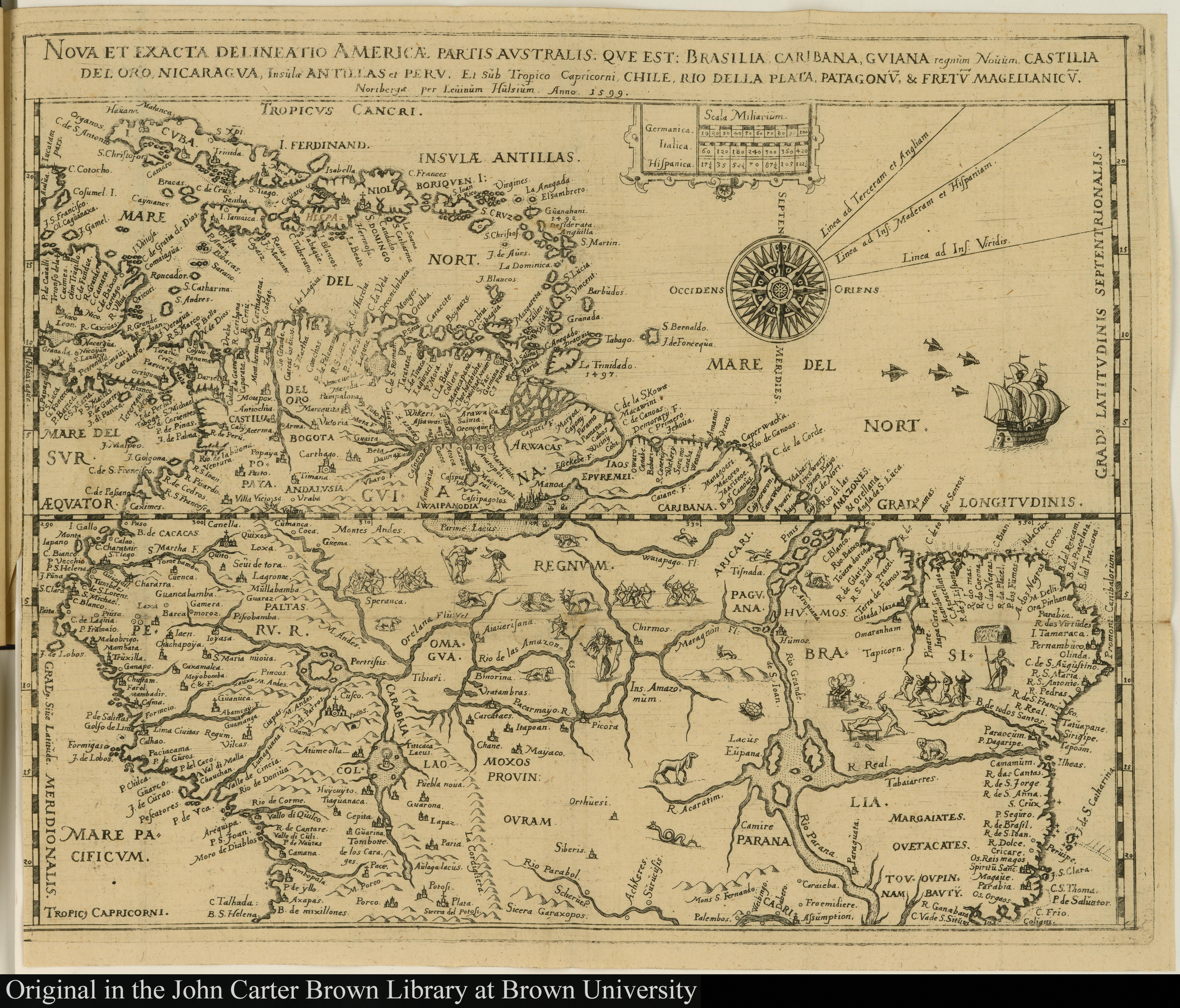
Nova et exacta delineatio Americae partis australis que est: Brasilia, Caribana, Guiana regnum Novum...
Mapa 1500 - 1599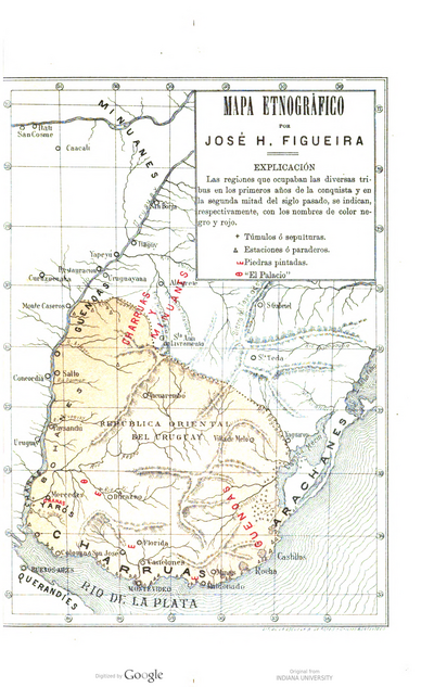
MAPA ETNOGRÁFICO
Mapa 1500 - 1900
Government map of Nicaragua : from the latest surveys ordered by President Patricio Rivas and Genl. William Walker ;executed under the supervision of the Señor Fermín Ferrer;Governor of the Western Department;1856
Mapa 1800 - 1856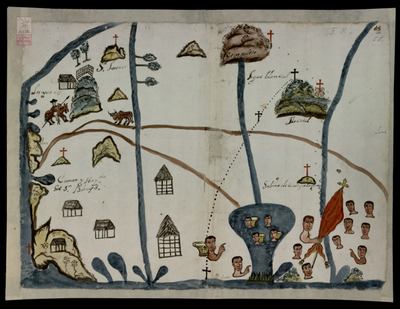
San Dionisio del Mar, Tehuantepec. Oaxaca, 1740
Mapa 1740
A Sequel of the Seat of War in the West Indies containing… Sub-map title: A large & accurate MAP of part of the Isthmus of Panama, taken from a Spanish drought exhibiting the Country adjacent to that City and Puerto Bello, with the Roads and Course of the River CHAGRE, by which the Treasure of the South Sea is conveyed a cross the Isthmus
Mapa 1740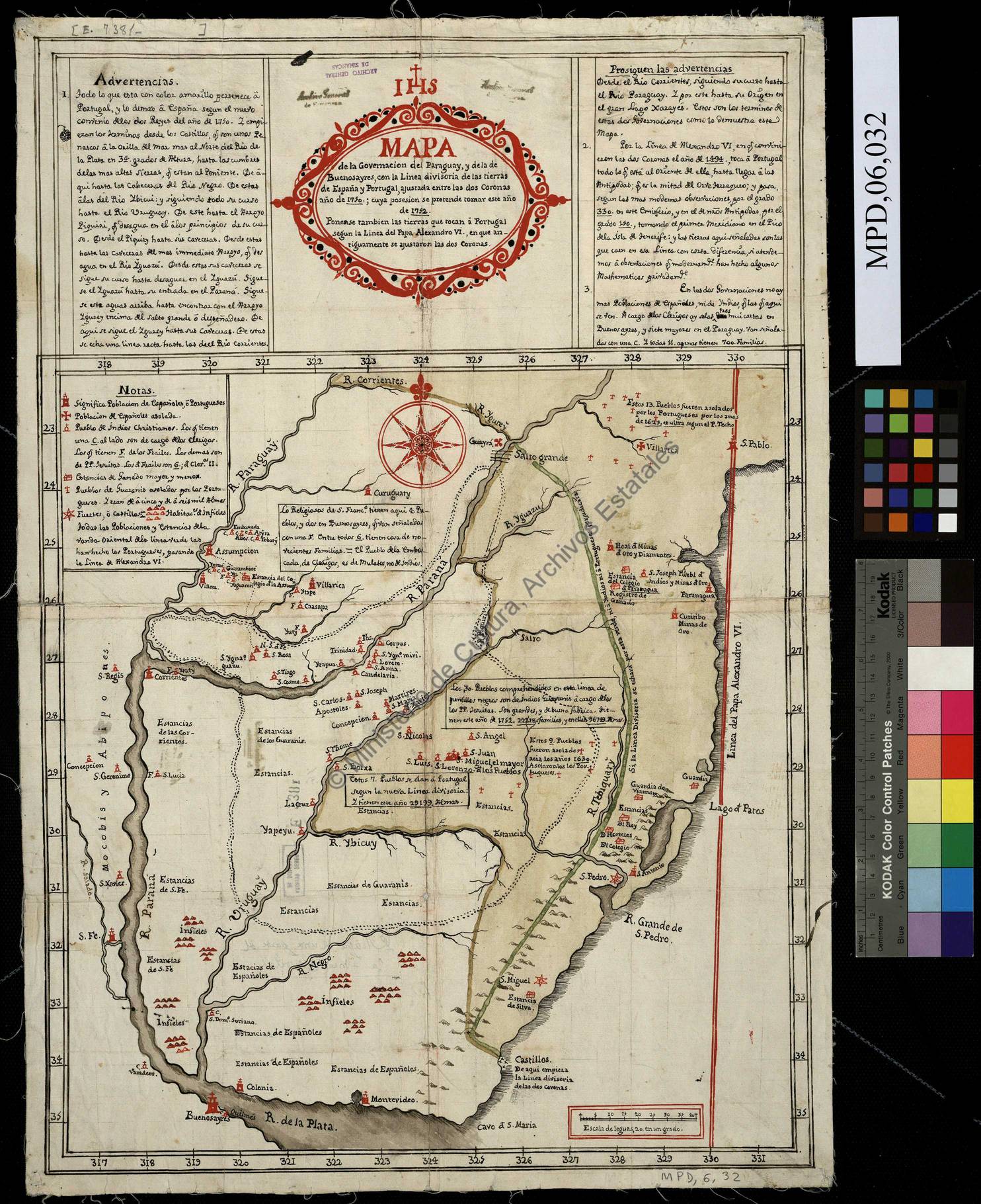
Mapa de la Governacion del Paraguay y de la de Buenos Ayres con la linea divisoria de las tierras de España y Portugal ajustada entre las dos Coronas año 1750 cuya posesion se pretende tomar este año de 1752
Mapa 1752