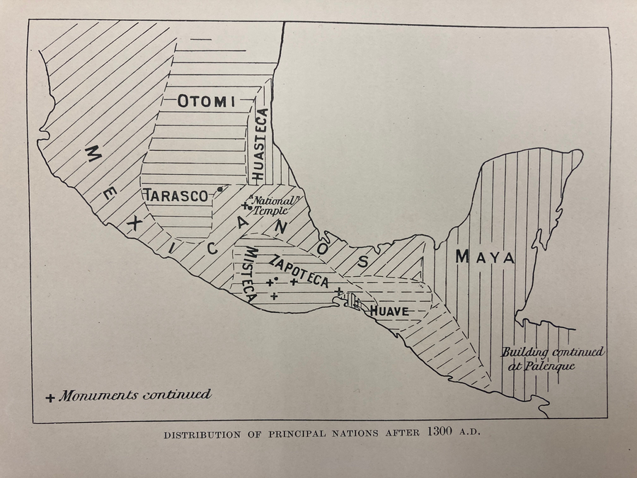
Povos
- MEXICANO
- OTOMI
- TARASCO
- HUASTECA
- MISTECA
- ZAPOTECA
- HUAVE
- MAYA
Citação
Gadow. "Distribution of Principal Nations After 1300 A.D." Map. 1908. H280. Latin American Library Map Collection. Tulane University, New Orleans.
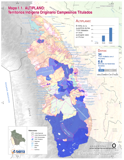
TITLED INDIGENOUS TERRITORIES (TIOCs) IN THE BOLIVIAN HIGH PLATEAU by 2011
Mapa 2011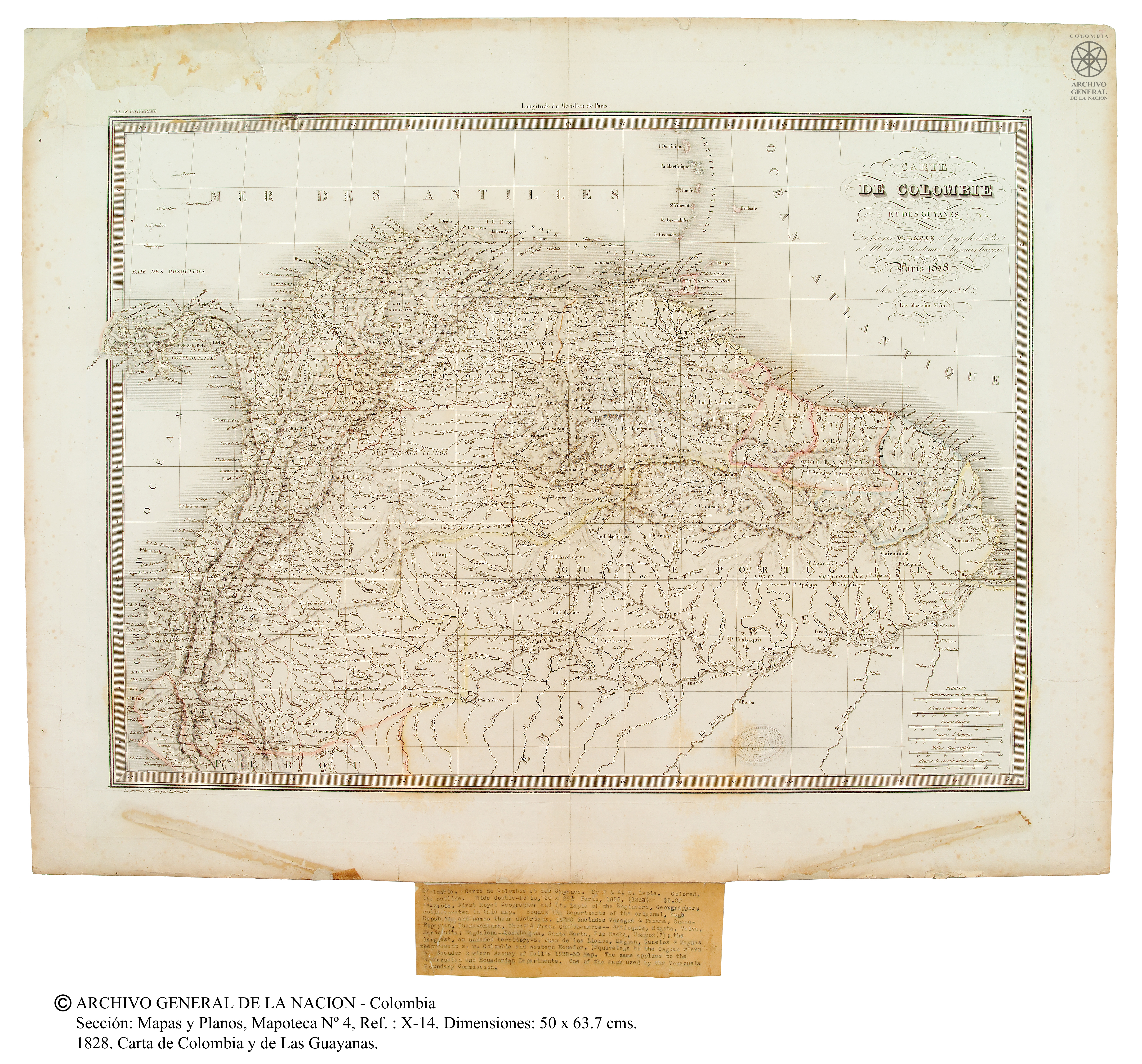
Carte de Colombie et des Guyanes
Mapa 1800 - 1899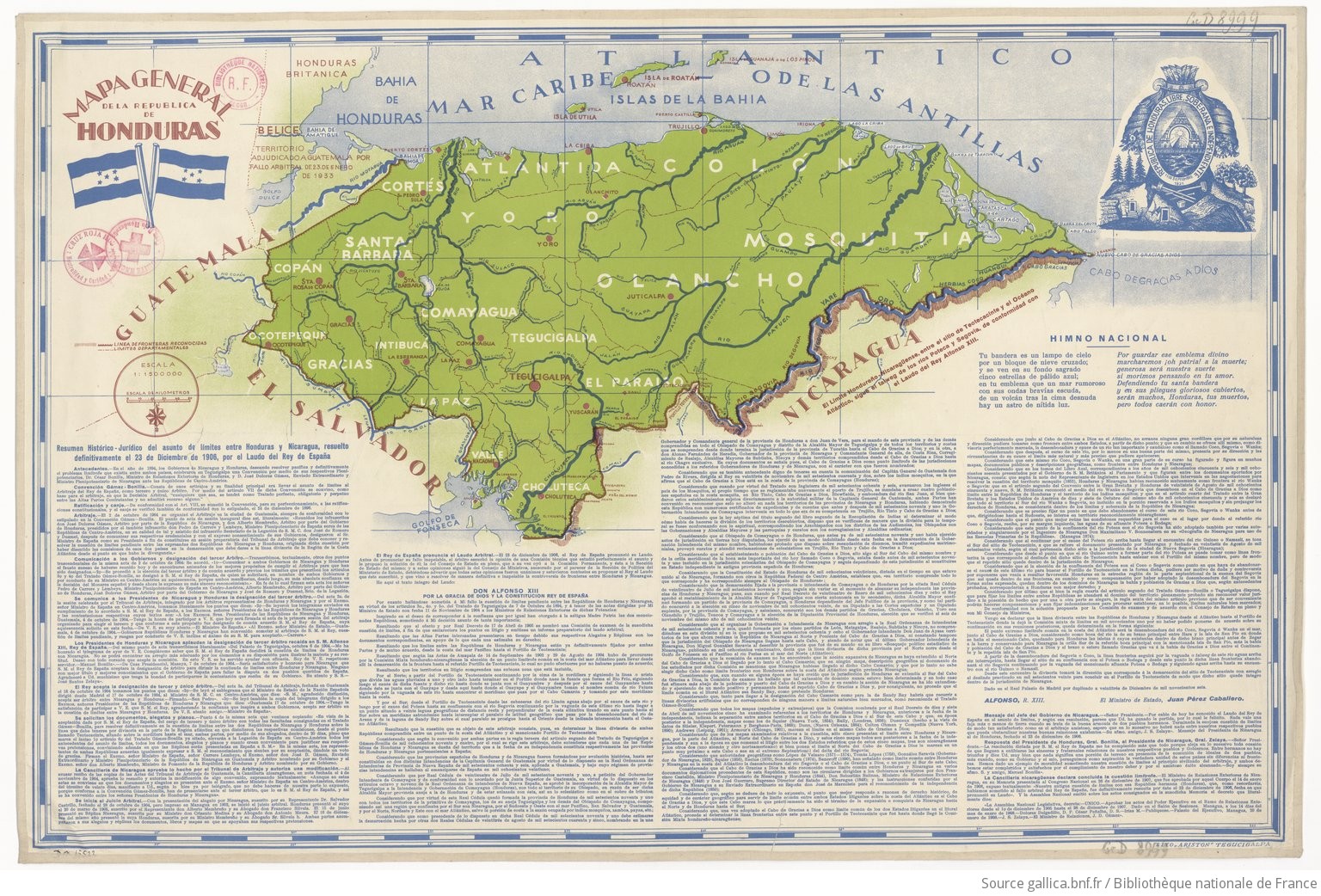
Mapa general de la Republica de Honduras
Mapa 1900 - 1999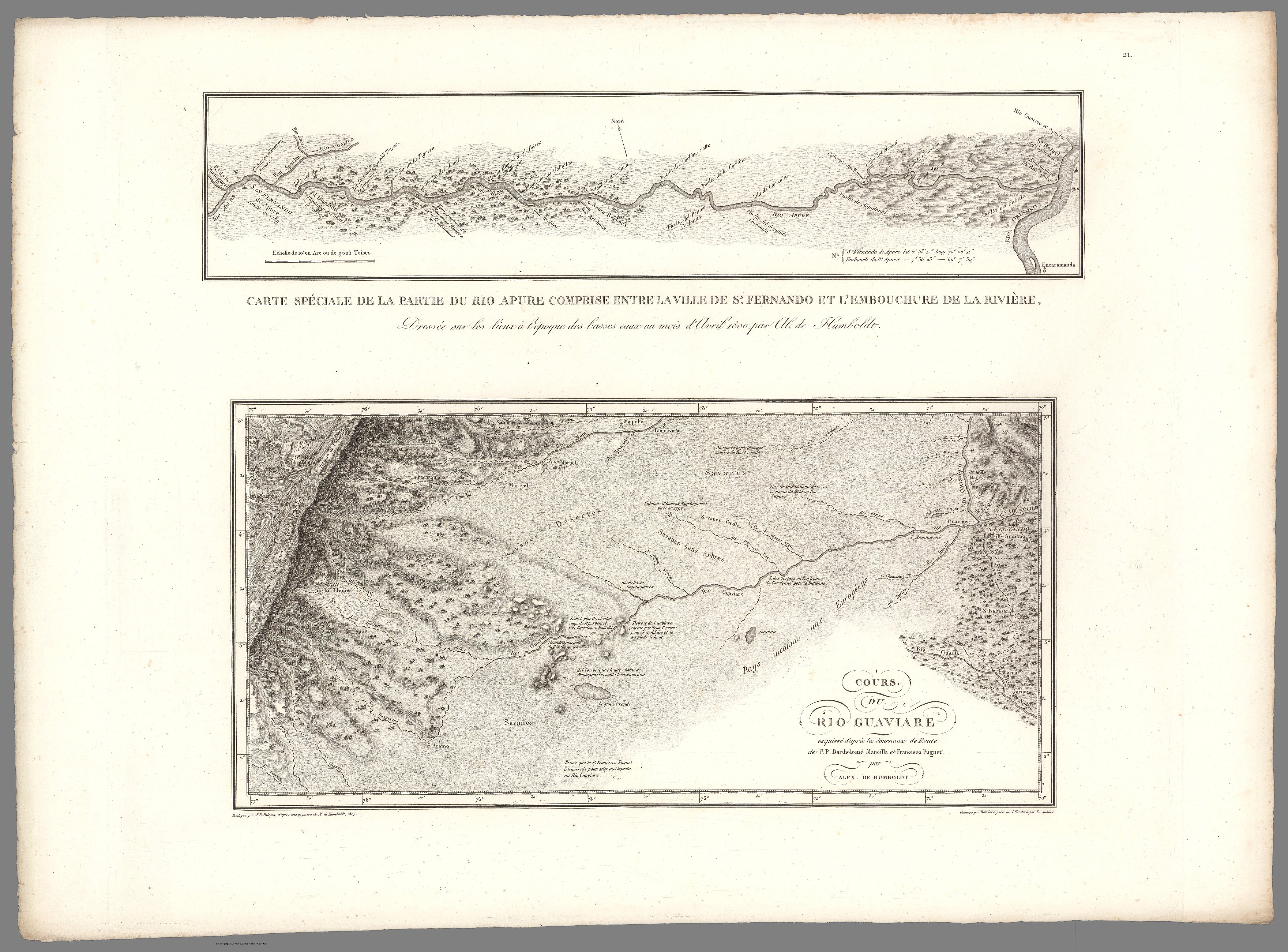
XXI. Cours du Rio Guaviare et de la partie de l'Apure comprise entre la ville de San-Fernando et le confluent de l'Apure avec l'Orenoque.
Mapa 1799 - 1804![Tawahka homeland, 1916: Showing Río Wampú (Wanpo), Río Patuca (Butuk), Cerro Quigungun (Wangkibila Volc [anol]), and the first cartographical rendering of Krautara (Moravian Archives, Bethlehem, Pennsylvania, Heath 1916)](https://dnet8ble6lm7w.cloudfront.net/maps_sm/HON/HON0014.png)
Tawahka homeland, 1916: Showing Río Wampú (Wanpo), Río Patuca (Butuk), Cerro Quigungun (Wangkibila Volc [anol]), and the first cartographical rendering of Krautara (Moravian Archives, Bethlehem, Pennsylvania, Heath 1916)
Mapa 1916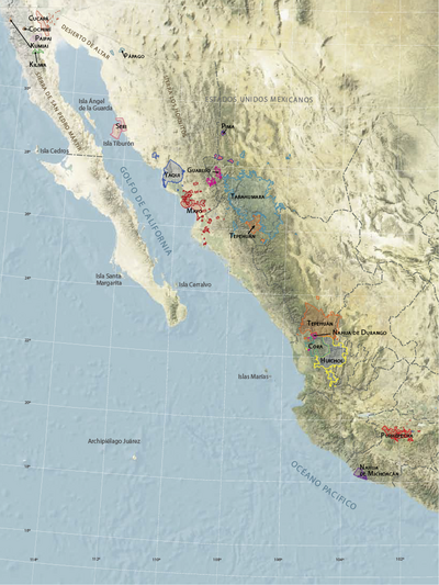
Territorios actuales de los pueblos indígenas en México
Mapa 2008![La Rebelión de las Raíces [A rebelião das raízes]](https://dnet8ble6lm7w.cloudfront.net/art_sm/AECU009.png)
La Rebelión de las Raíces [A rebelião das raízes]
Obra de arte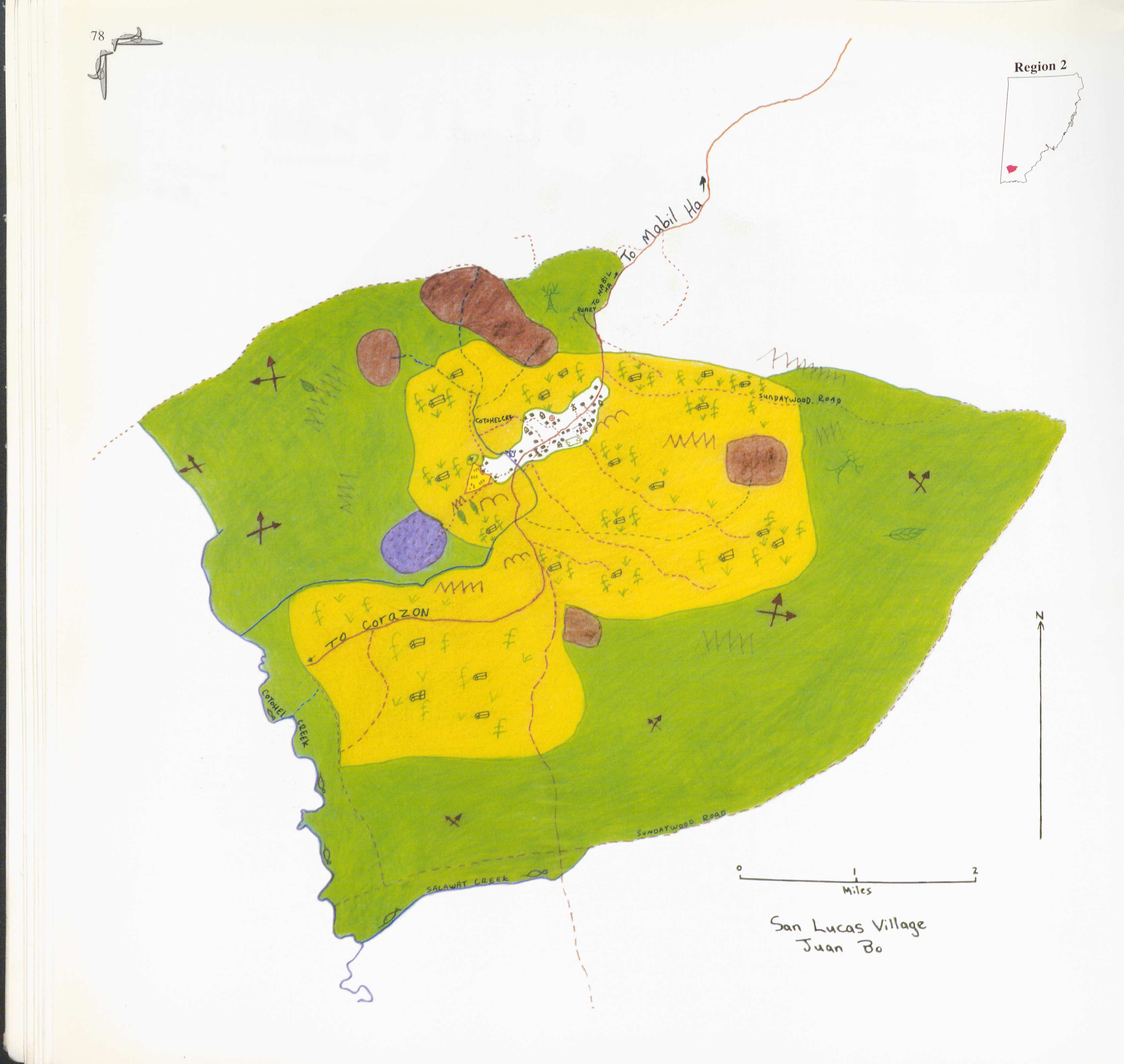
San Lucas
Mapa 1997