
Citação
Tanck de Estrada, Dorothy. Atlas Ilustrado de los Pueblos de Indios: Nueva España, 1800. México: El Colegio de México, 2005. N/A - NO DIGITAL ACCESS
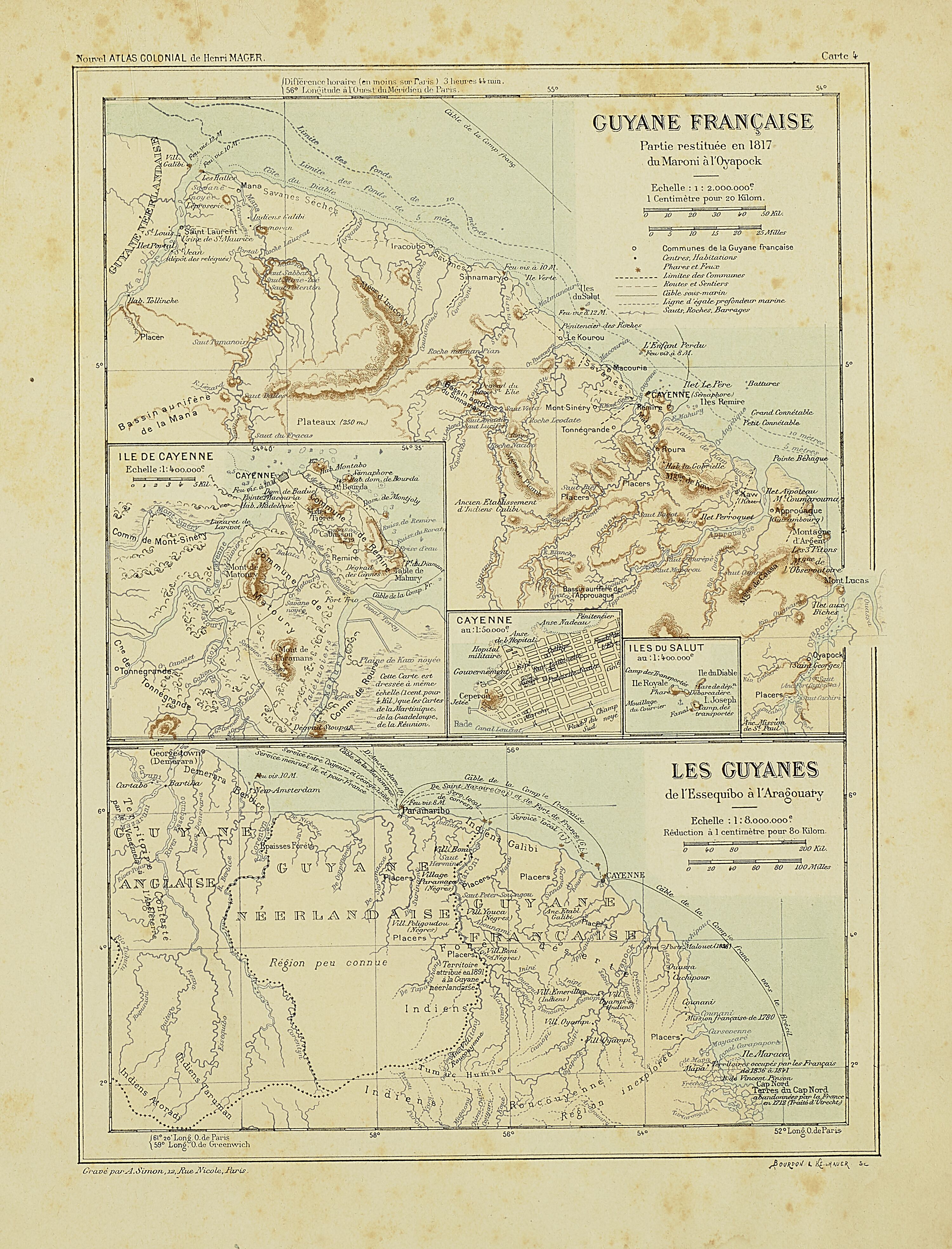
Carte IV: Guyane française.
Mapa 1899![Serie Fatherland / Padre Patria [Série Fatherland / Pai pátria]](https://dnet8ble6lm7w.cloudfront.net/art_sm/APER005.png)
Serie Fatherland / Padre Patria [Série Fatherland / Pai pátria]
Obra de arte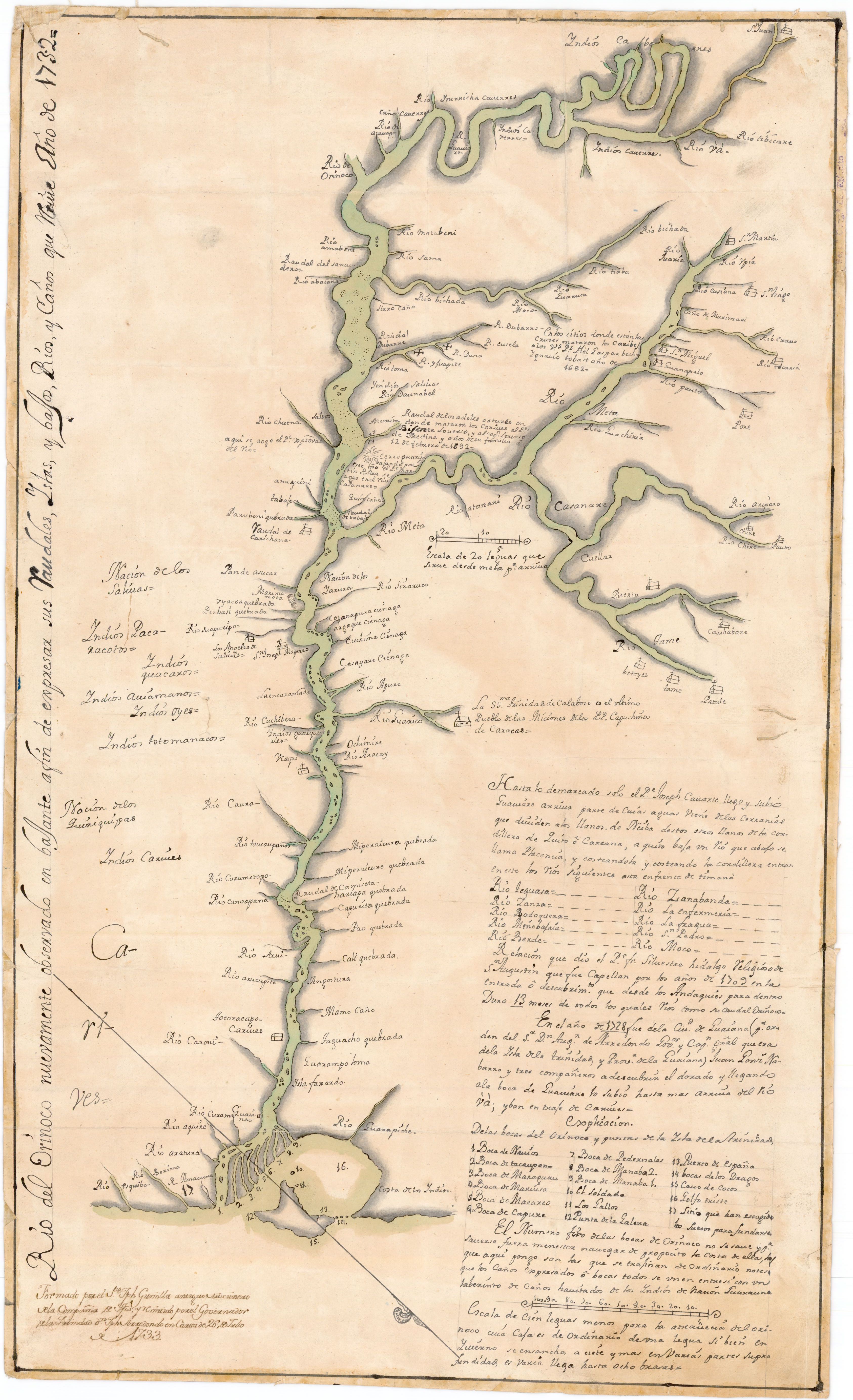
Río del Orinoco nuevamente observado en bajante a fin de expresar sus Caudales;Yslas y bajos;Rios y Caños que tiene
Mapa 1732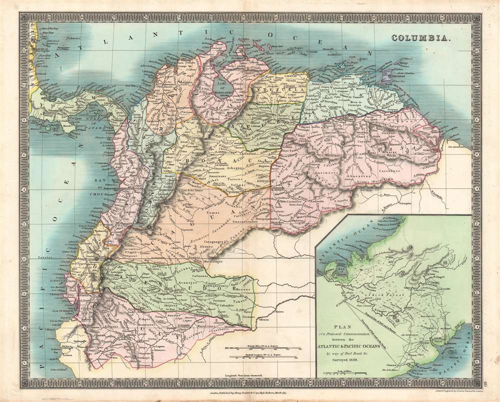
COLUMBIA
Mapa 1829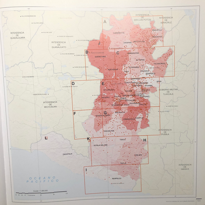
INTENDENCIA DE MÉXICO
Mapa 1800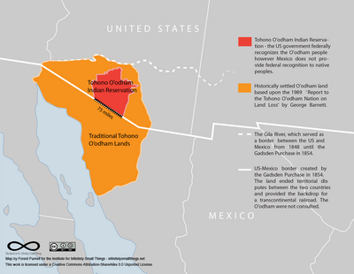
Tohono O’odham Nation Map
Mapa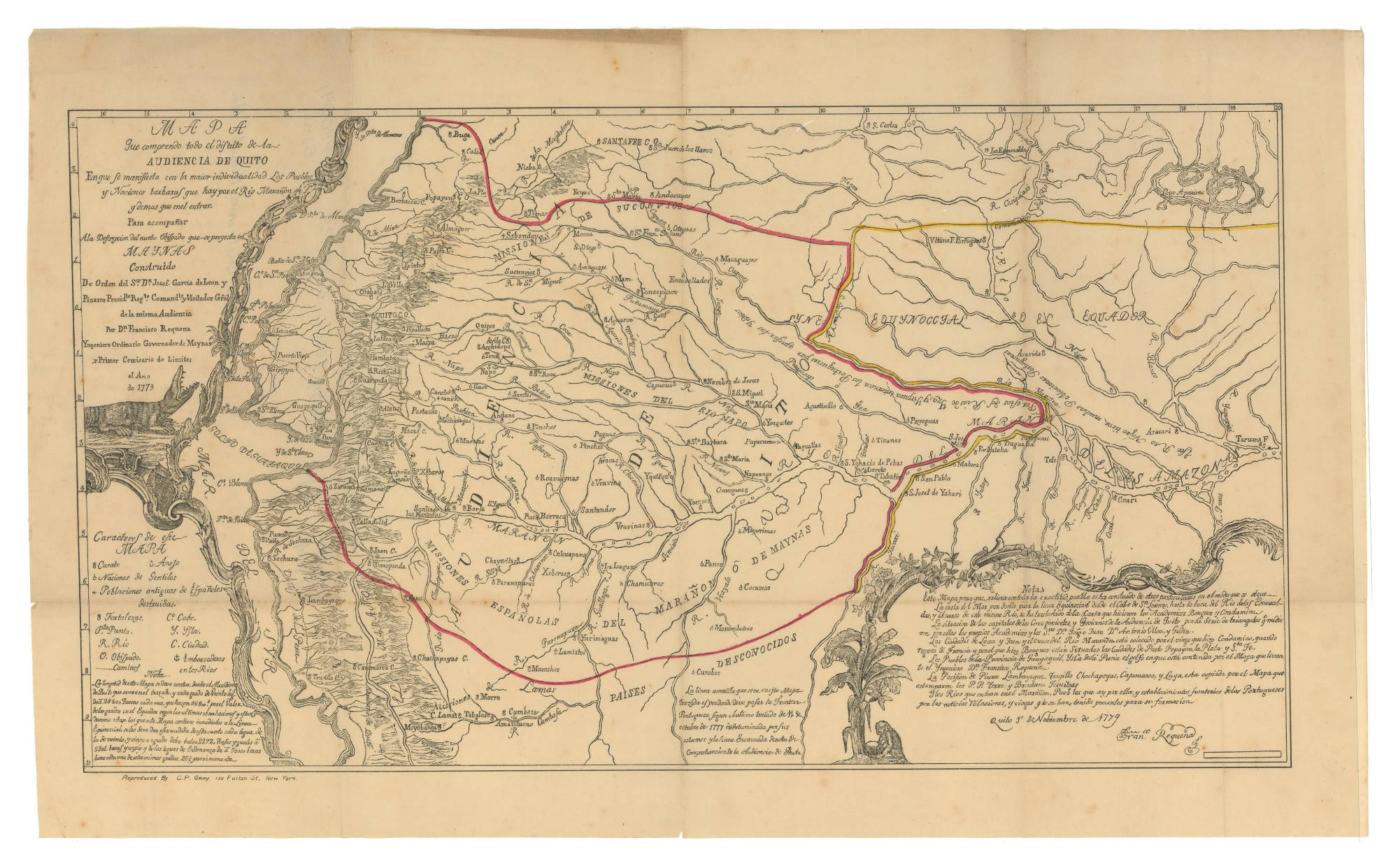
MAPA QUE COMPRENDE TODO EL DISTRITO DE LA AUDIENCIA DE QUITO
Mapa 1779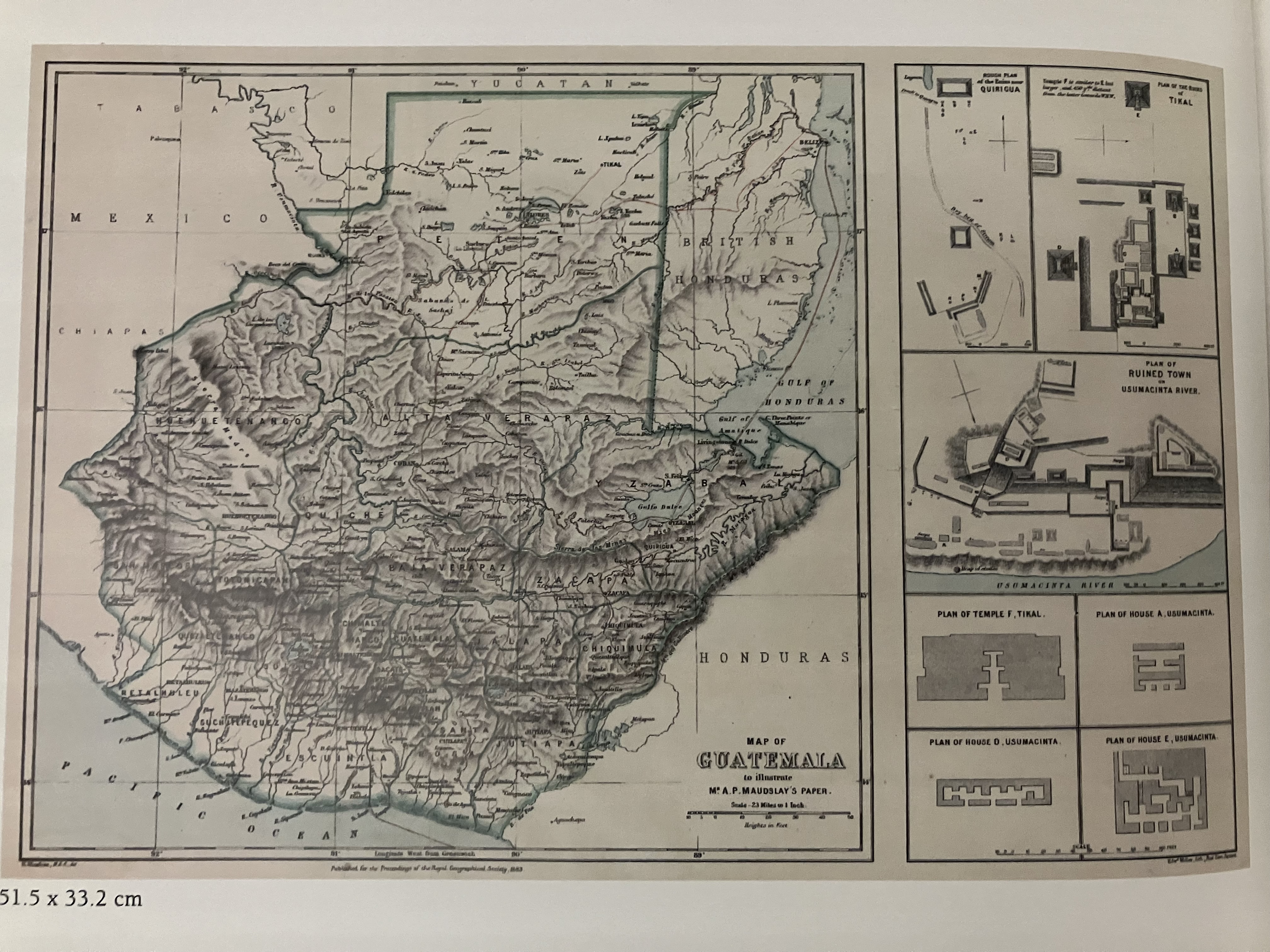
Map of Guatemala/to illustrate/Mr. A.P Maudslay's Paper
Mapa 1883