Citação
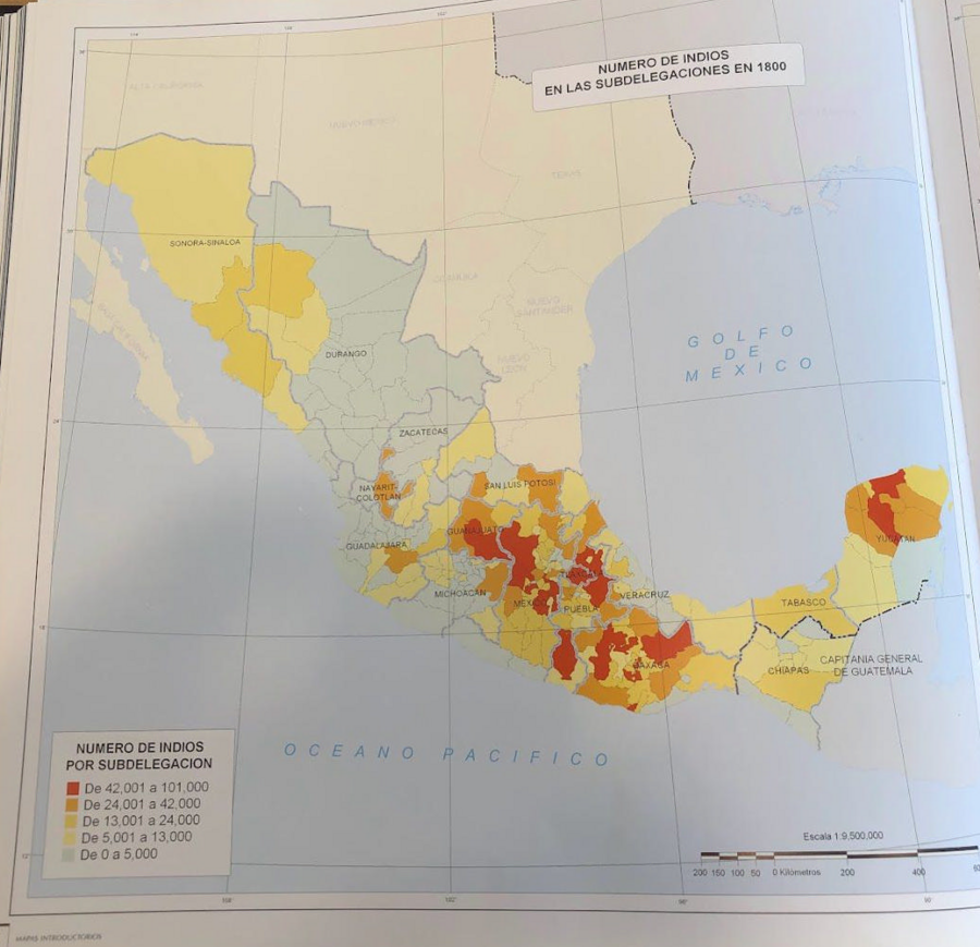
Tanck de Estrada, Dorothy. Atlas Ilustrado de los Pueblos de Indios: Nueva España, 1800. México: El Colegio de México, 2005. N/A - NO DIGITAL ACCESS
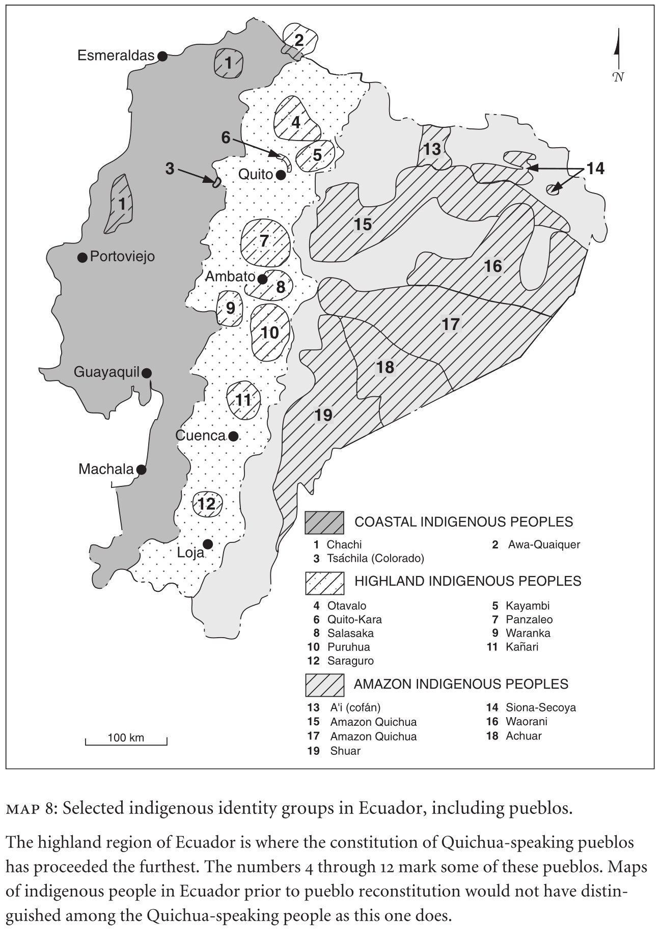
MAP 8: SELECTED INDIGENOUS IDENTITY GROUPS IN ECUADOR;INCLUDING PUEBLOS
Mapa 2009
Haush Indians of Tierra del Fuego
Mapa 1800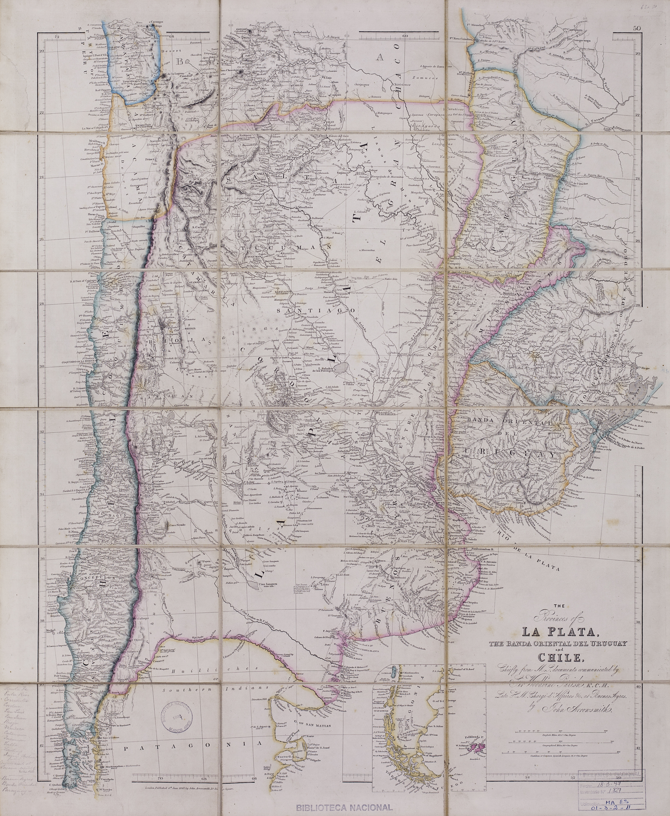
The provinces of La Plata, the Banda Oriental del Uruguay and Chile.
Mapa 1842
BRÉSIL: Carte Politique et Économique
Mapa 1906 - 1907
Indigenous Groups of the Caribbean
Mapa
Carta particolare dell'India Ocidentale;con la terra ferma dal' capo di Paria sin al' capo S. Romano
Mapa 1661![Virosis [Virose]](https://dnet8ble6lm7w.cloudfront.net/art_sm/ACOL003.png)
Virosis [Virose]
Obra de arte
Geographic Distribution of the Huastec
Mapa 1969