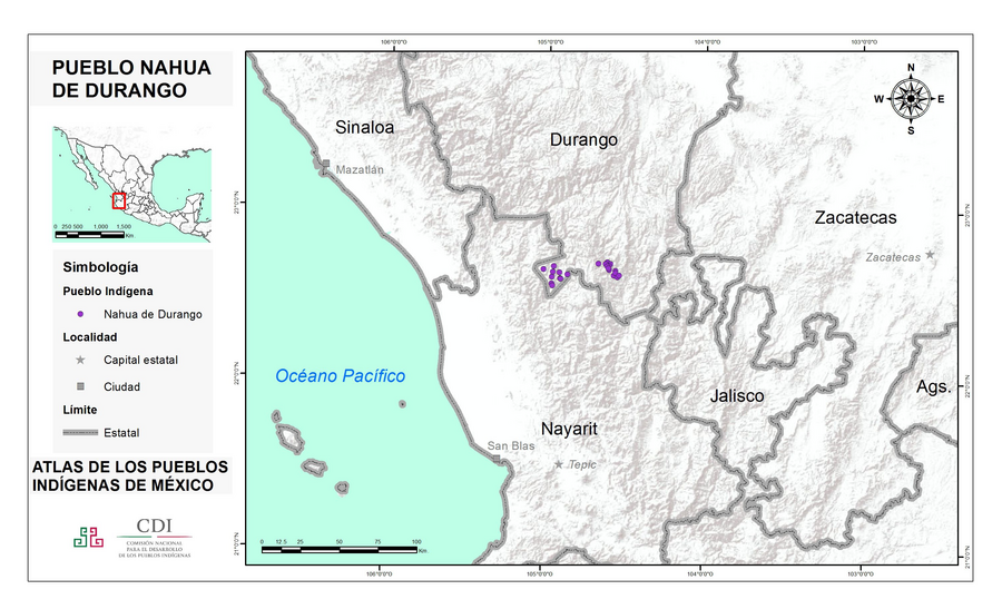
Povos
- MEXICANERO DE DURANGO
Citação
Instituto Nacional de los Pueblos Indígenas. "Mexicaneros de Durango – Ubicación." Atlas de los Pueblos Indígenas de México. http://atlas.inpi.gob.mx/mexicaneros-de-durango-ubicacion/.
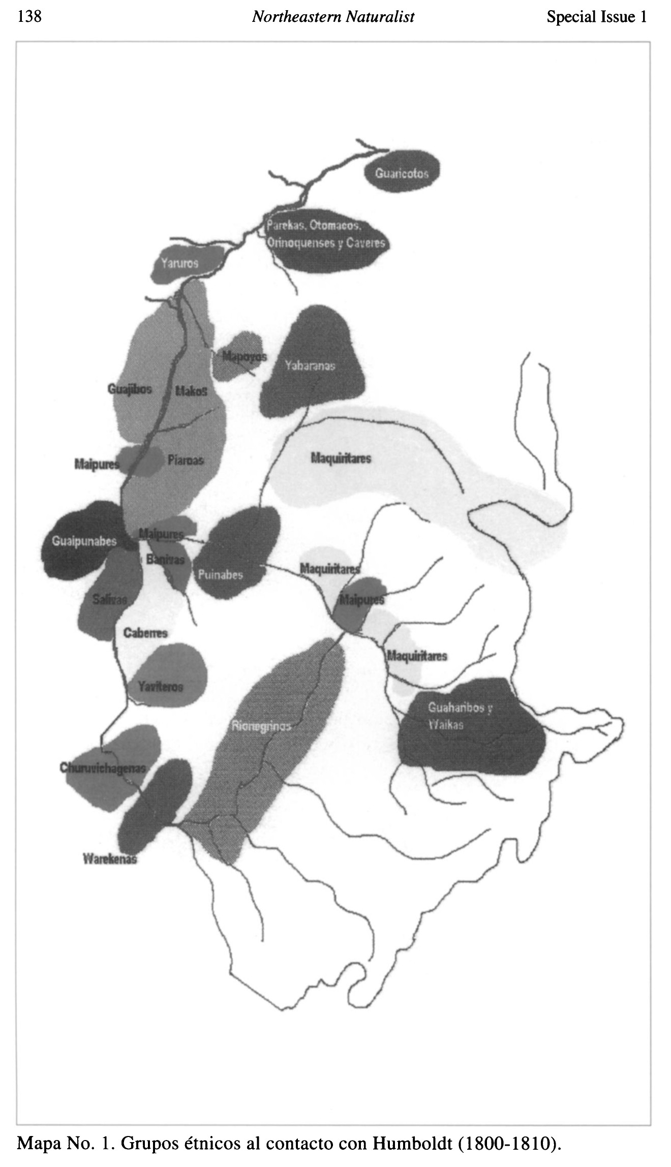
Grupos étnicos al contacto con Humboldt (1800-1810)
Mapa 1800 - 1810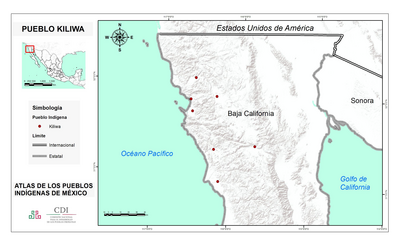
PUEBLO KILIWA
Mapa 2020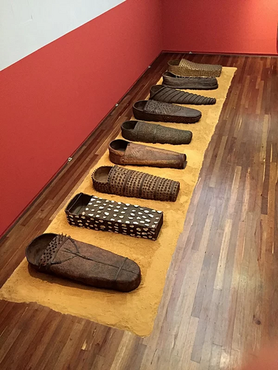
Sarcófago
Obra de arte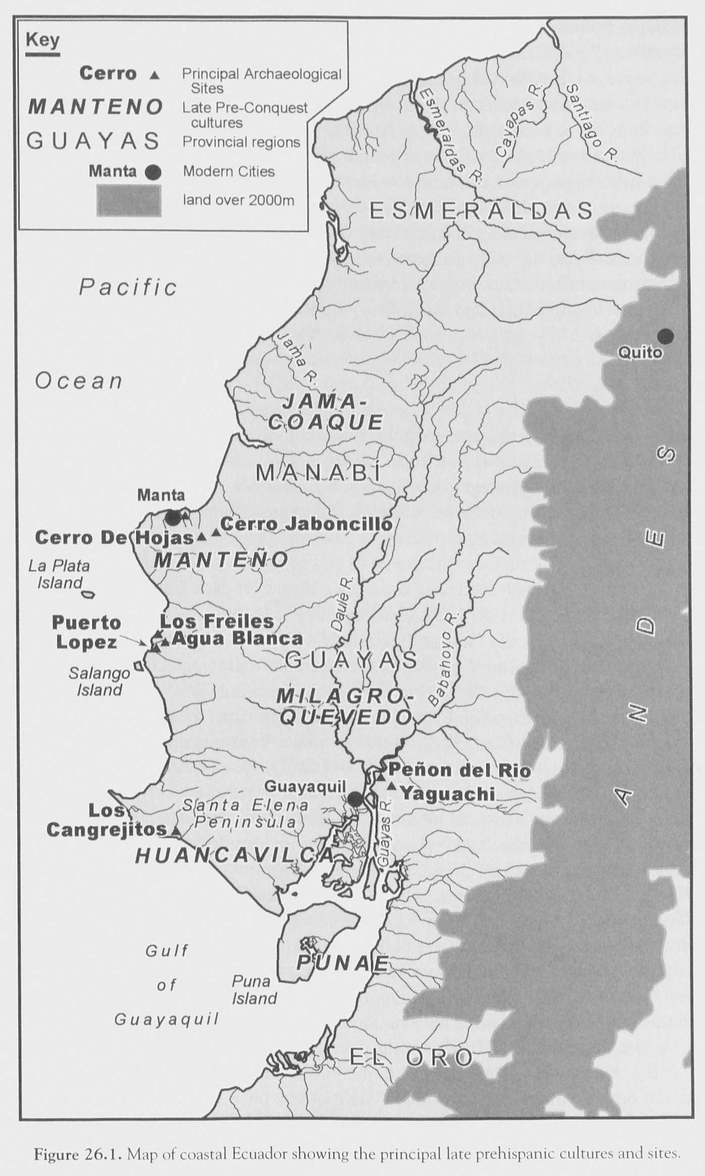
FIGURE 26.1. MAP OF COASTAL ECUADOR SHOWING THE PRINCIPAL COASTAL PREHISPANIC CULTURES AND SITES
Mapa 1500
CARTA GEOGRÁFICA DEL ECUADOR POR DR. TEODORO WOLF;PUBLICADA POR ORDEN DEL SUPREMO GOBIERNO DE LA REPÚBLICA Y TRABAJADA BAJO LAS PRESIDENCIAS DE LOS EE. SEÑORES DR. D.J.M. PLÁCIDO CAAMAÑO Y DR. D. ANTONIO FLORES. 1892 ... INSTITUTO GEOGRAFICO DE H. WAGNER & E. DEBES EN LEIPZIG. (WITH) LA REGION ORIENTAL DEL ECUADOR. (WITH) ARCHIPIÉLAGO DE GALÁPAGOS.
Mapa 1892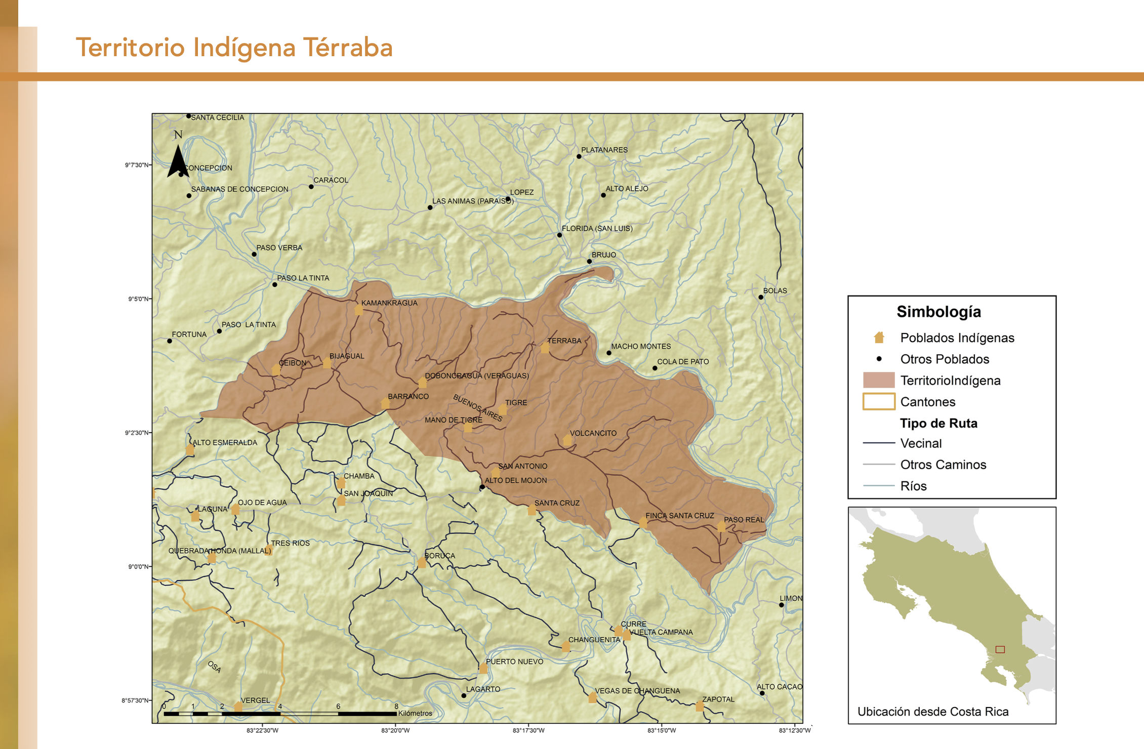
"Territorio Indígena Cabécar de Ujarrás"
Mapa 2010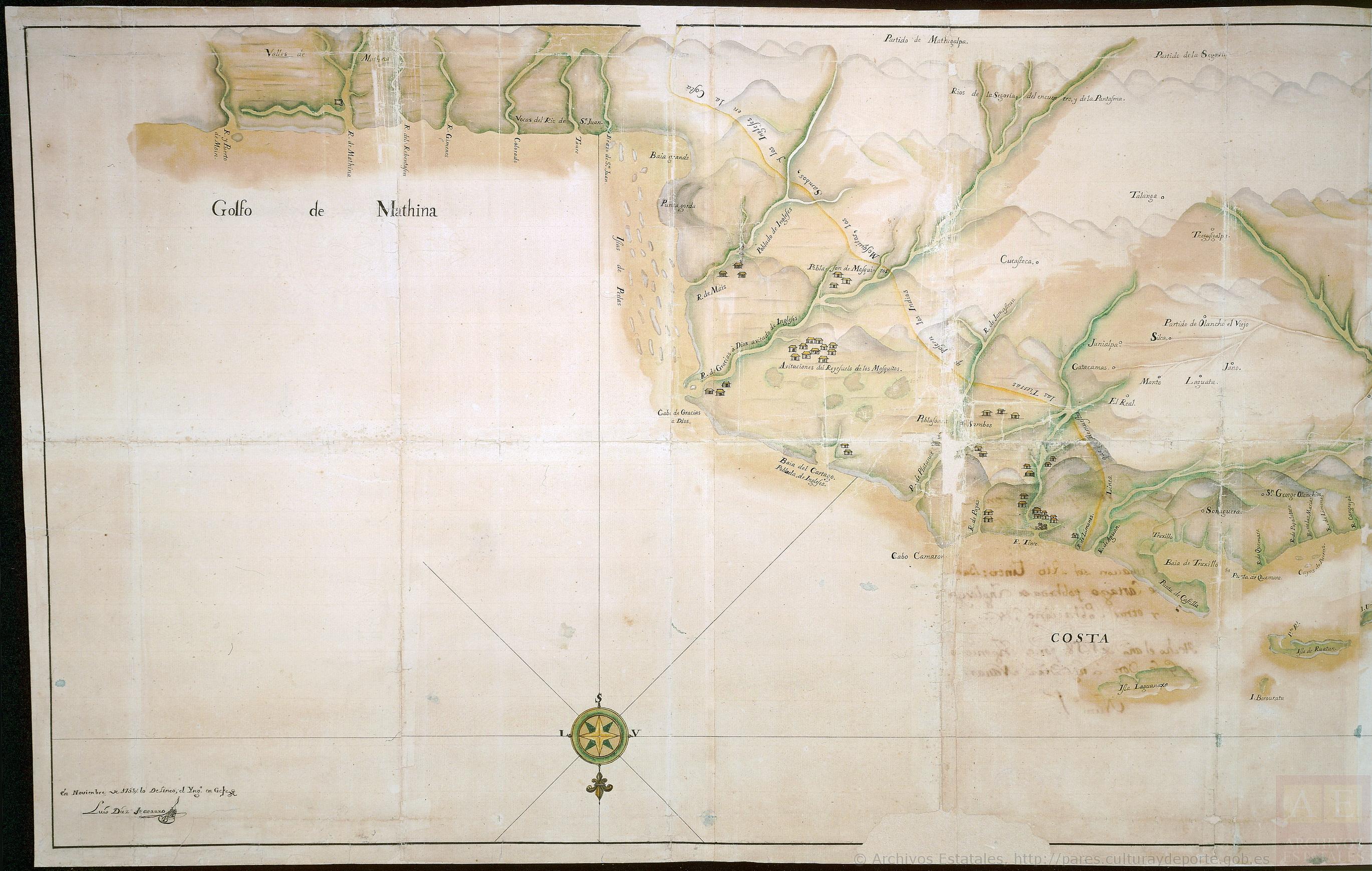
Mapa que comprende desde el Golfo de Matina hasta el de Santo Thomás
Mapa 1758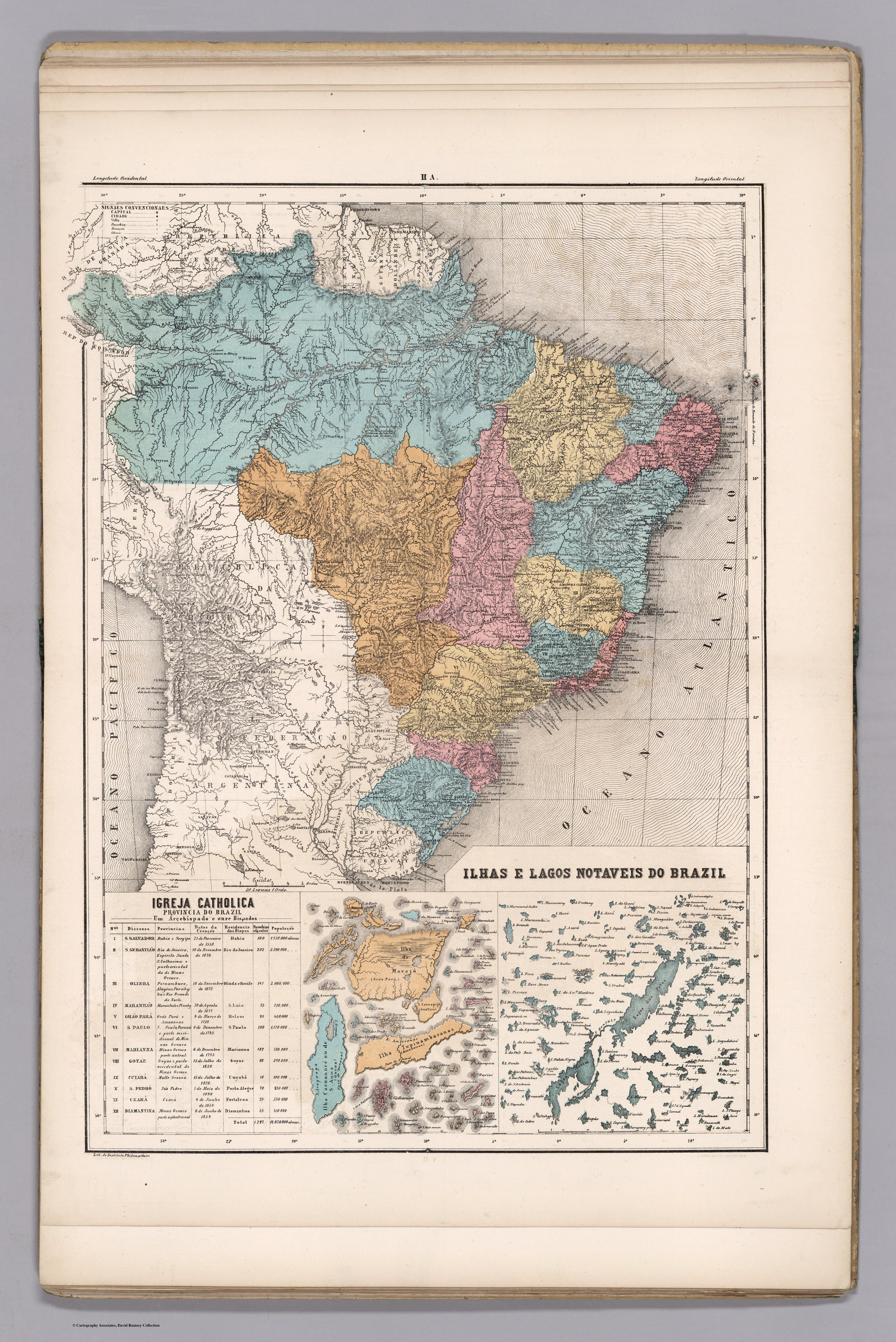
ILHAS E LAGOS NOTAVEIS DO BRAZIL
Mapa 1800 - 1899