
Povos
- TARAHUMARAS
Citação
University of Kansas. "Sierra Tarahumara Study Area - Online GIS." PRMapping. Last modified November 5, 2007. https://prmapping.ku.edu/Mexico_Indigena/SVG/Sierra_taramhumara_idiomas_zonas_procede/index.html
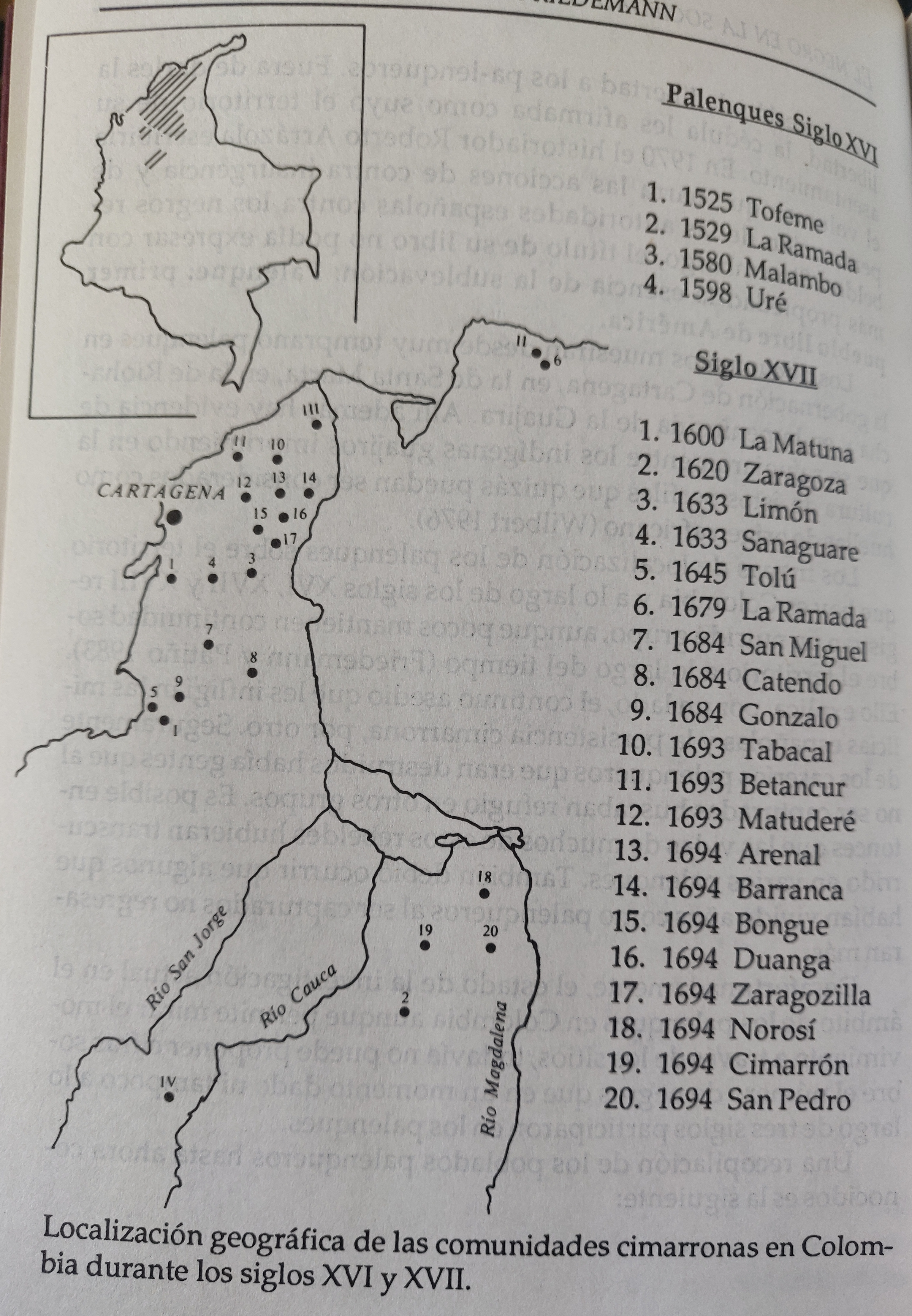
LOCALIZACION GEOGRAFICA DE LAS COMUNIDADES CIMARRONAS EN COLOMBIA DURANTE LOS SIGLOS XVI Y XVII
Mapa 1500 - 1699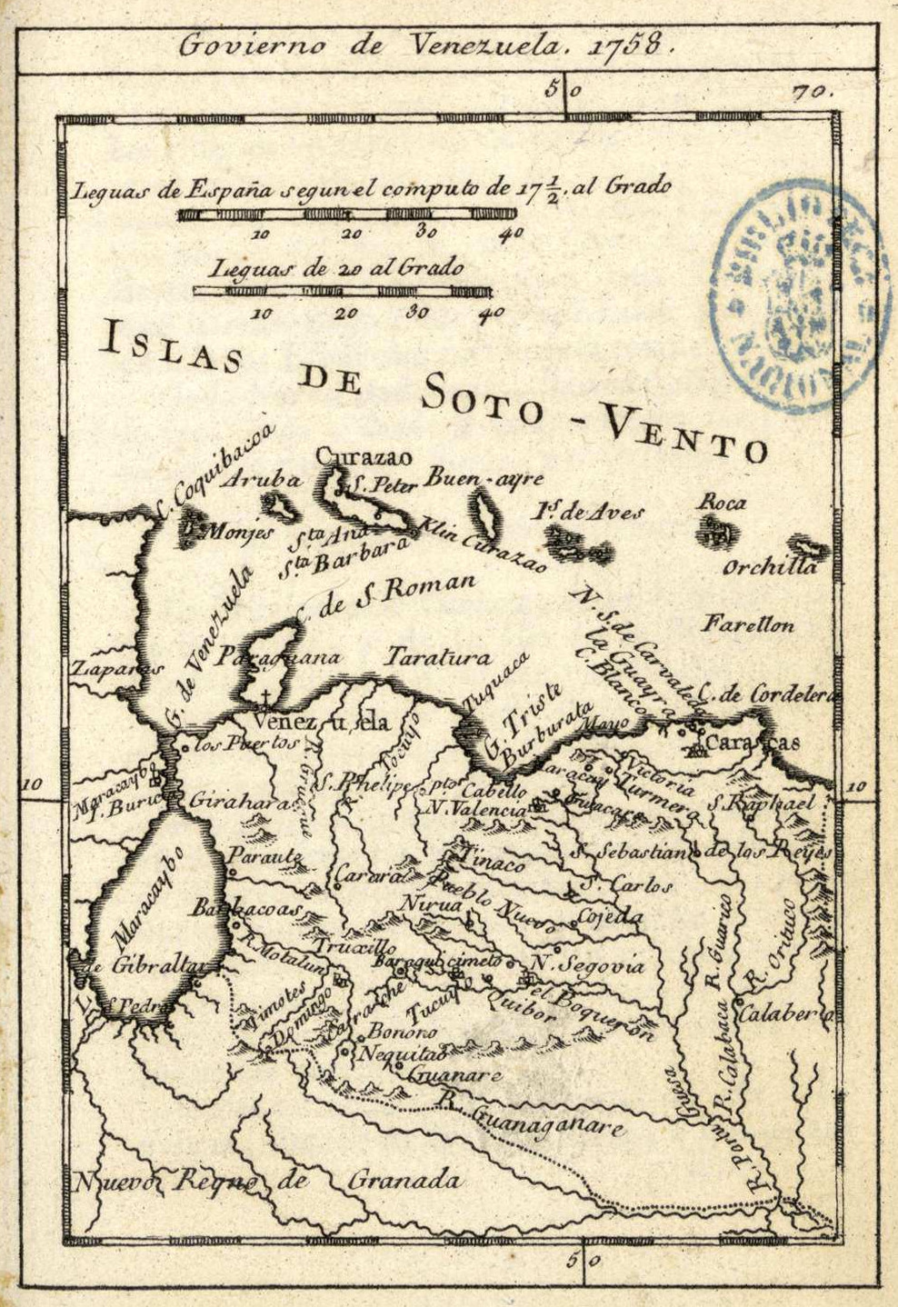
Govierno de Venezuela;1758.
Mapa 1758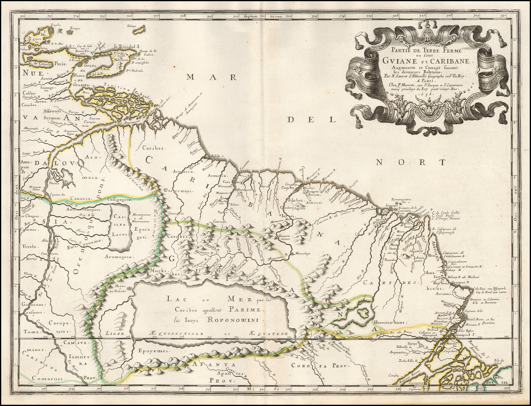
Partie de Terre Ferme ou sont Guiane et Caribane. Augmentée et Corrigée suivant les dernières Relations
Mapa 1594 - 1596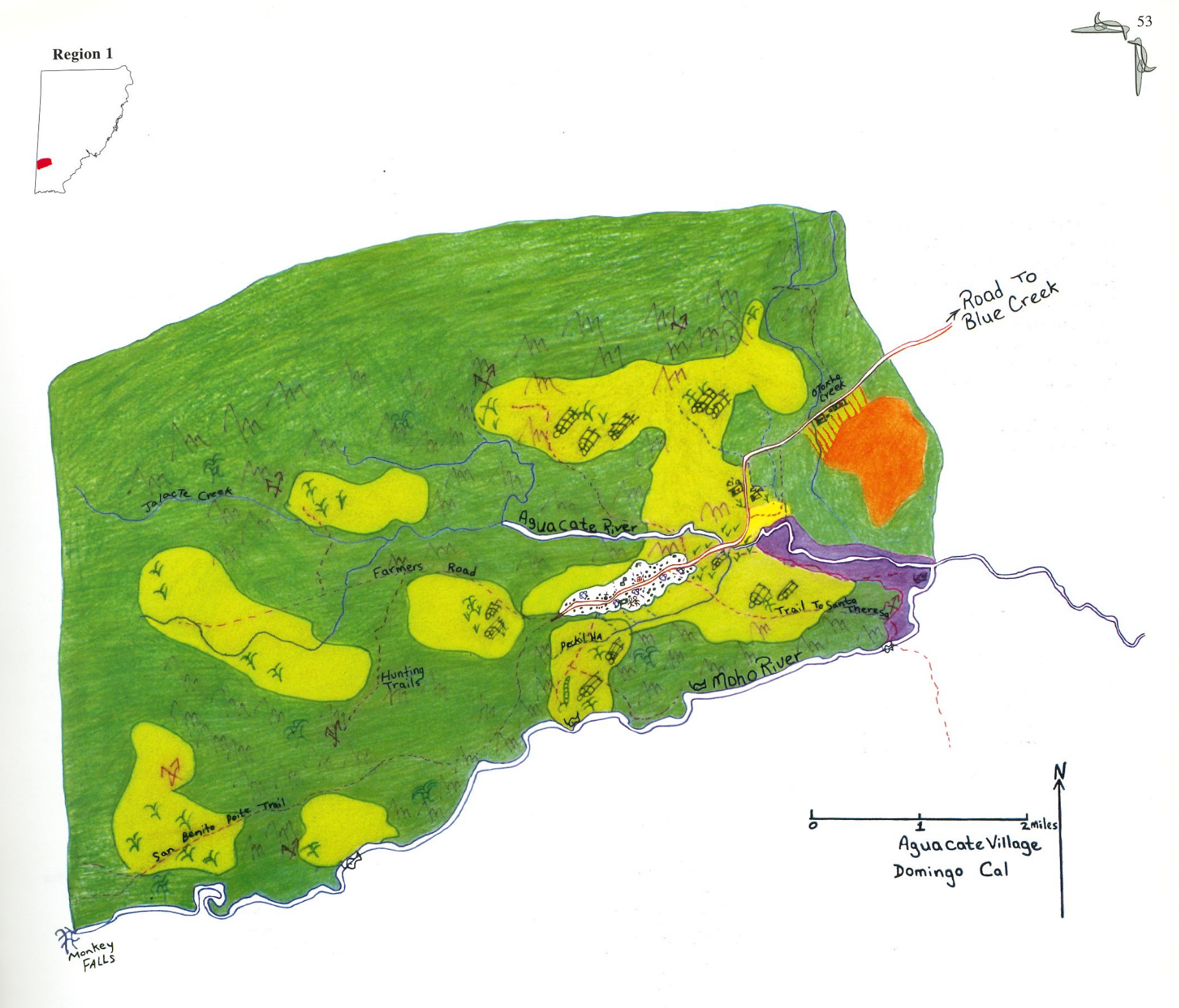
Aguacate
Mapa 1997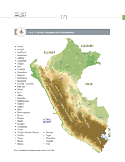
Pueblos indígenas en el Perú amazónico
Mapa 2009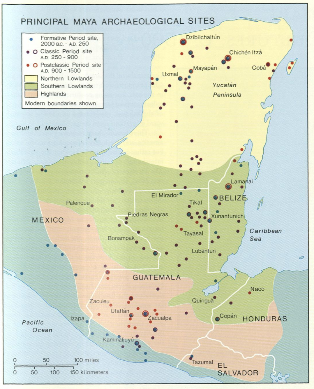
Principal Maya Archaeological Sites
Mapa 1490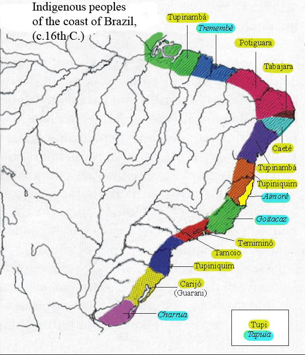
Indigenous peoples of the coast of Brazil, (c. 16th C.)
Mapa 1500 - 1599
PLANTA DA MARCHA DO 2º CORPO DO EXERCITO BRAZILEIRO DO RIO URUGUAY AO PARANÀ em 1866
Mapa 1866