Citação
Cotter, John, "Indian Riots and Rebellions in Guatemala, 1679-1825" IN Hall, Carolyn and Héctor Pérez Brignoli, Historical Atlas of Central America. Norman, University of California Press, 2003.
Sur de Mesamérica alrededor del siglo XVII con los grupos lingüísticos
Mapa 1800 - 1900
Sketch of the country from reduction to Buenos Ayres, shewing the movements of B. Genl. Beresford, when he captured that place June 1806. Drawn from memorandums furnished by Capt: Donnelly
Mapa 1806
Carte particulière de la colonie de Cayenne. Levée et présentée à Monseigneur le Comte de Pontchartrain, Ministre et secrétaire d'Etat ;Par son très humble serviteur et très obéissant serviteur De Créanton officier de la marine
Mapa 1701
GEOGRAPHICAL, STATISTICAL AND HISTORICAL MAP OF COLOMBIA
Mapa 1822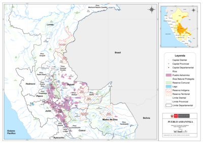
PUEBLO ASHANINKA
Mapa 2021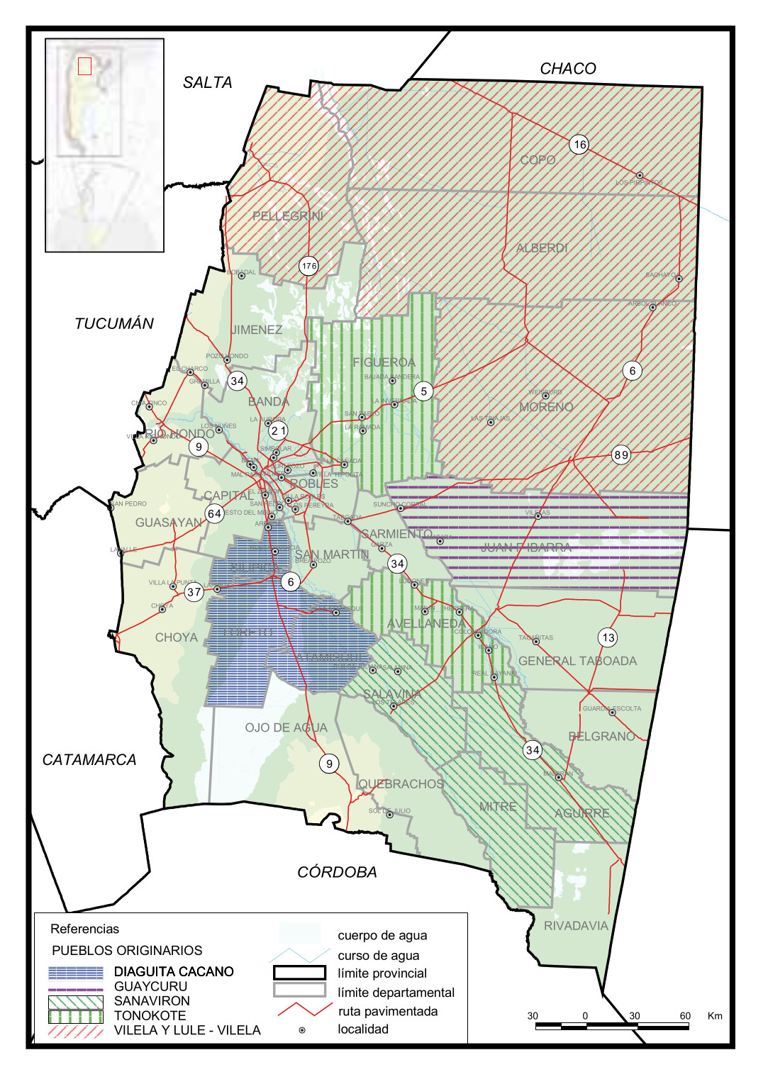
Pueblos Originarios, Santiago del Estero
Mapa 2016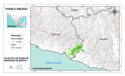
PUEBLO AMUZGO
Mapa 2020
PARTE DEL MAR DEL SUR DESDE C. DE S. FRANCISCO HASTA PAIJTA EN LA COSTA DE PERÚ
Mapa 1628