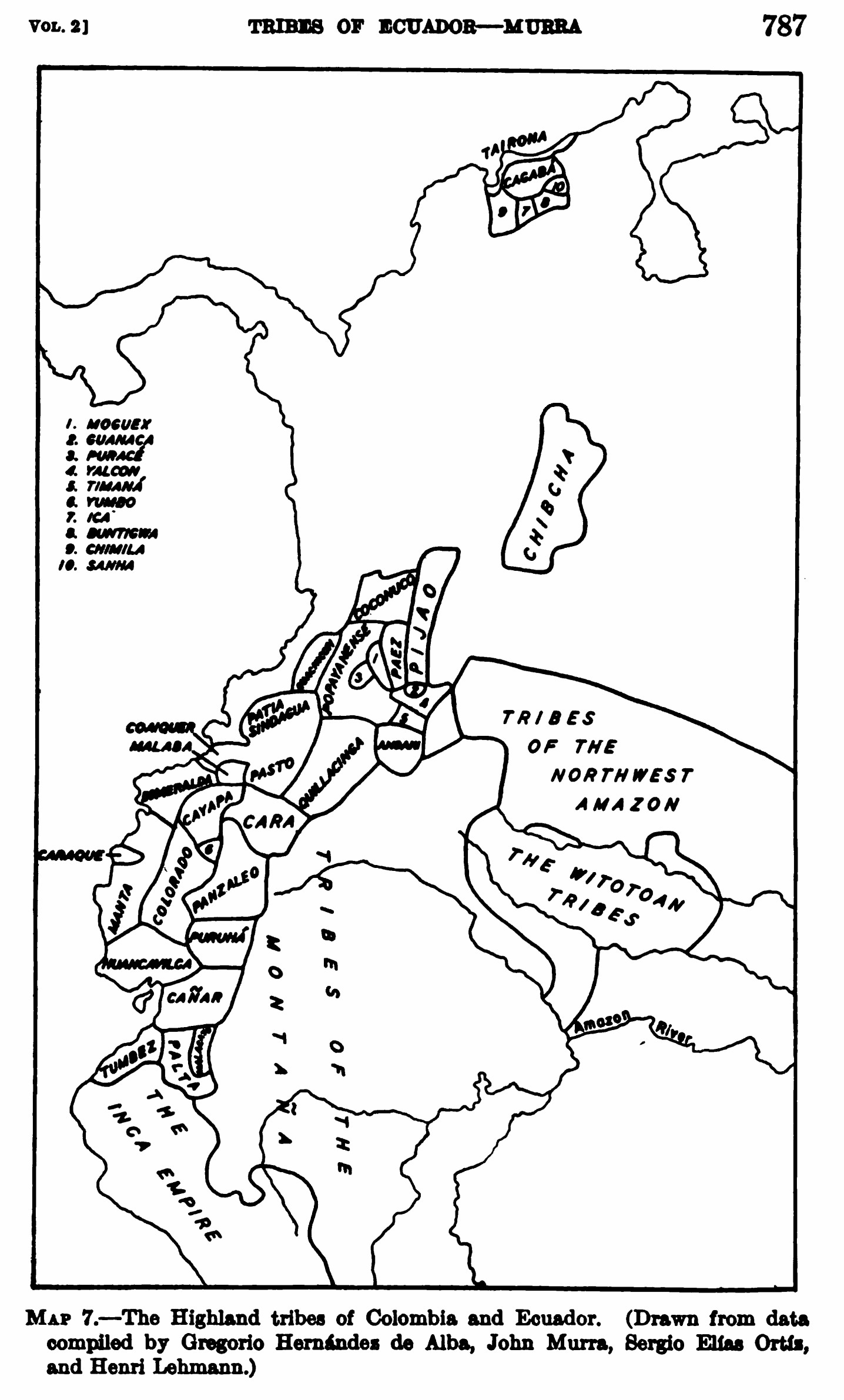
Povos
- KANARI
- TSACHILAS
- PURUHA
- PALTAS
Citação
Steward;Julian Haynes;Handbook of South American Indians: Volume 2. New York: Cooper Square Publishers;1963. pages 786-791 https://babel.hathitrust.org/cgi/pt?id=uva.x001436992&view=1up&seq=18&skin=2021
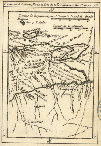
Provincias de Cumana;Paria;la Isla de la Trinidad;y el Rio Orinoco. 1758.
Mapa 1758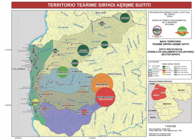
TERRITORIO TEÄRIME SIRI’KOI AERIME SUITITI
Mapa 2012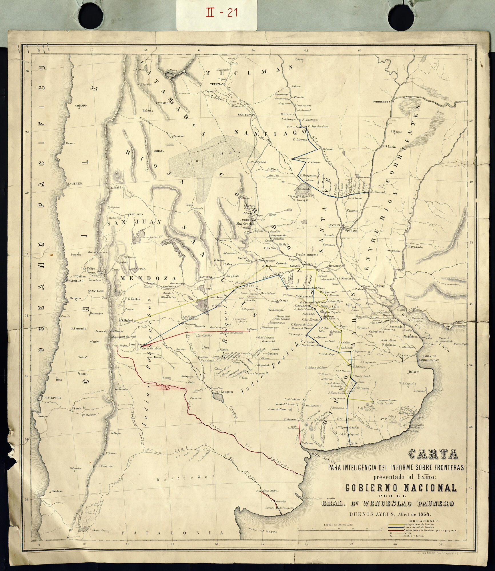
Carta para la inteligencia del informe sobre fronteras presentado al Excelentísimo Gobierno nacional por el General Don Wenceslao Paunero. Impreso
Mapa 1850 - 1880
A Sequel of the Seat of War in the West Indies containing… Sub-map title: A large & accurate MAP of part of the Isthmus of Panama, taken from a Spanish drought exhibiting the Country adjacent to that City and Puerto Bello, with the Roads and Course of the River CHAGRE, by which the Treasure of the South Sea is conveyed a cross the Isthmus
Mapa 1740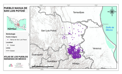
PUEBLO NAHUA DE SAN LUIS POTOSI
Mapa 2020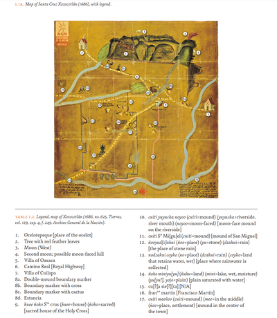
MAP OF SANTA CRUZ XOXOCOTLÁN
Mapa 1686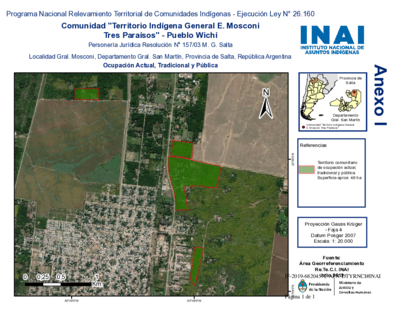
Comunidad "Territorio Indígena General E. Mosconi Tres Paraísos" - Pueblo Wichí
Mapa 2020![La viruela del mono [A varíola do macaco]](https://dnet8ble6lm7w.cloudfront.net/art/APER056.jpg)
La viruela del mono [A varíola do macaco]
Obra de arte