Povos
- SOMBRERILLO
Citação
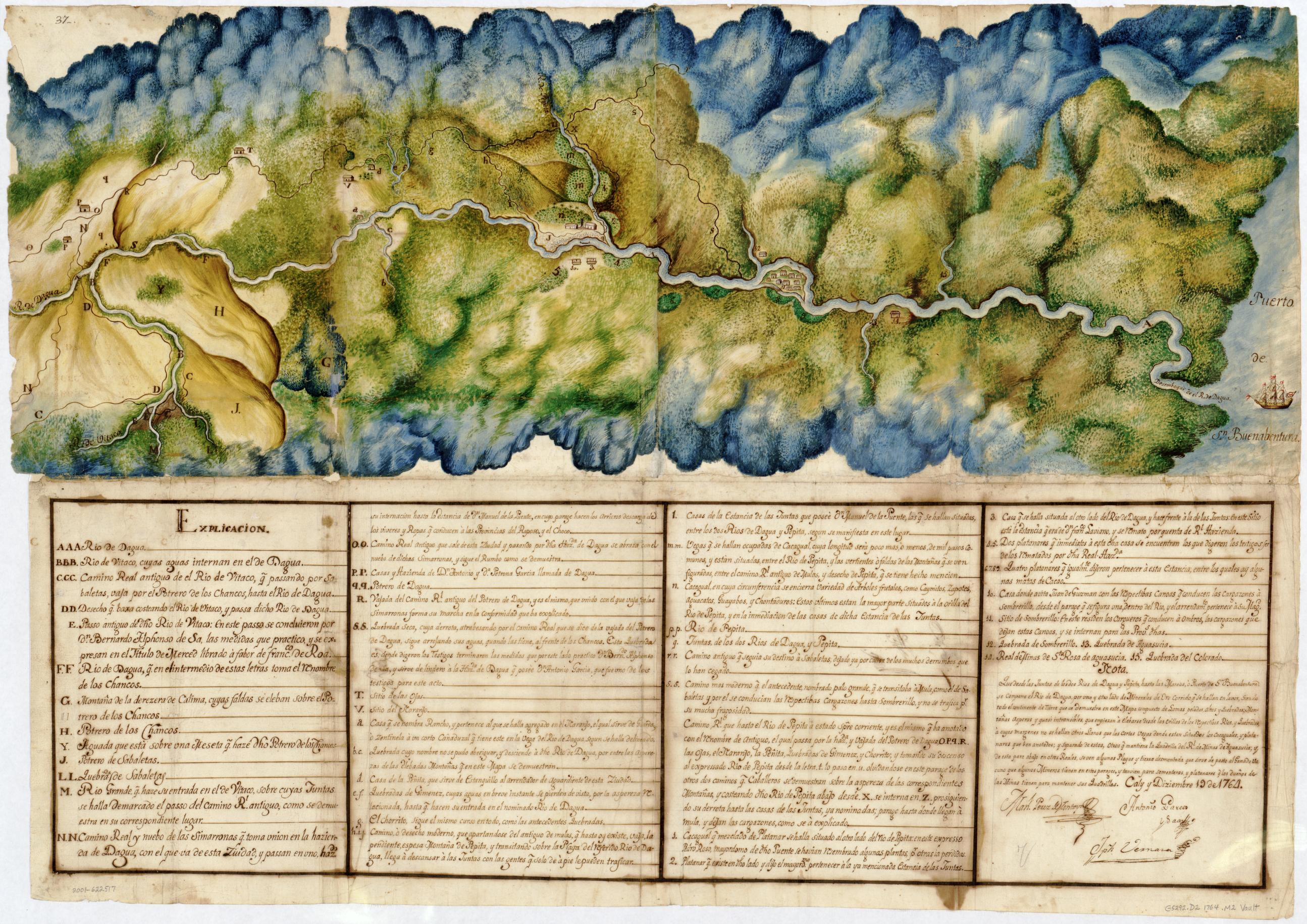
MANUEL PEREZ DE MONTOYA;ANTONIO GARCES Y SAAZ;JOSEPH VERNAZA. Manuscript Map of the Dagua River Region. Library of Congress Geography and Map Division Washington, D.C. 1764. - Call Number/Physical Location: G5292.D2 1764 .M2 https://www.loc.gov/resource/g5292d.ct001464/?st=image&r=0.23,0.154,0.492,0.193,0
![K. GUIANA. I. DAS BRITISCHE, II. [DAS] NIEDERLAENDISCHE, III. [DAS FRANZÖSISCHE.]](https://dnet8ble6lm7w.cloudfront.net/maps/CNT/CNT0147.jpg)
![[Carte de la Guyane, des bassins de l'Orénoque et de l'Amazone]](https://dnet8ble6lm7w.cloudfront.net/maps/CNT/CNT0174.jpeg)

![Haec pars Peruvianae, regiones Chicam & Chile[nsem]
complectitur, & Regionem](https://dnet8ble6lm7w.cloudfront.net/maps/ARG/ARG0063.jpg)