
Povos
- RAPA NUI
Citação
Hotus, Alberto. "Distribucion Territorial Tribal Ancestral del Pueblo Rapa Nui." Map. In Te mau hatu o te Rapa Nui. 2021. http://www.memoriachilena.gob.cl/602/articles-122901_recurso_3.pdf
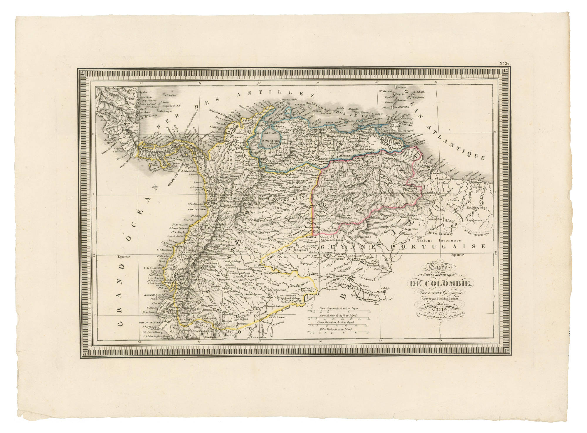
Carte DE LA RÉPUBLIQUE DE COLOMBIE;Par. L. VIVEN Géographe
Mapa 1826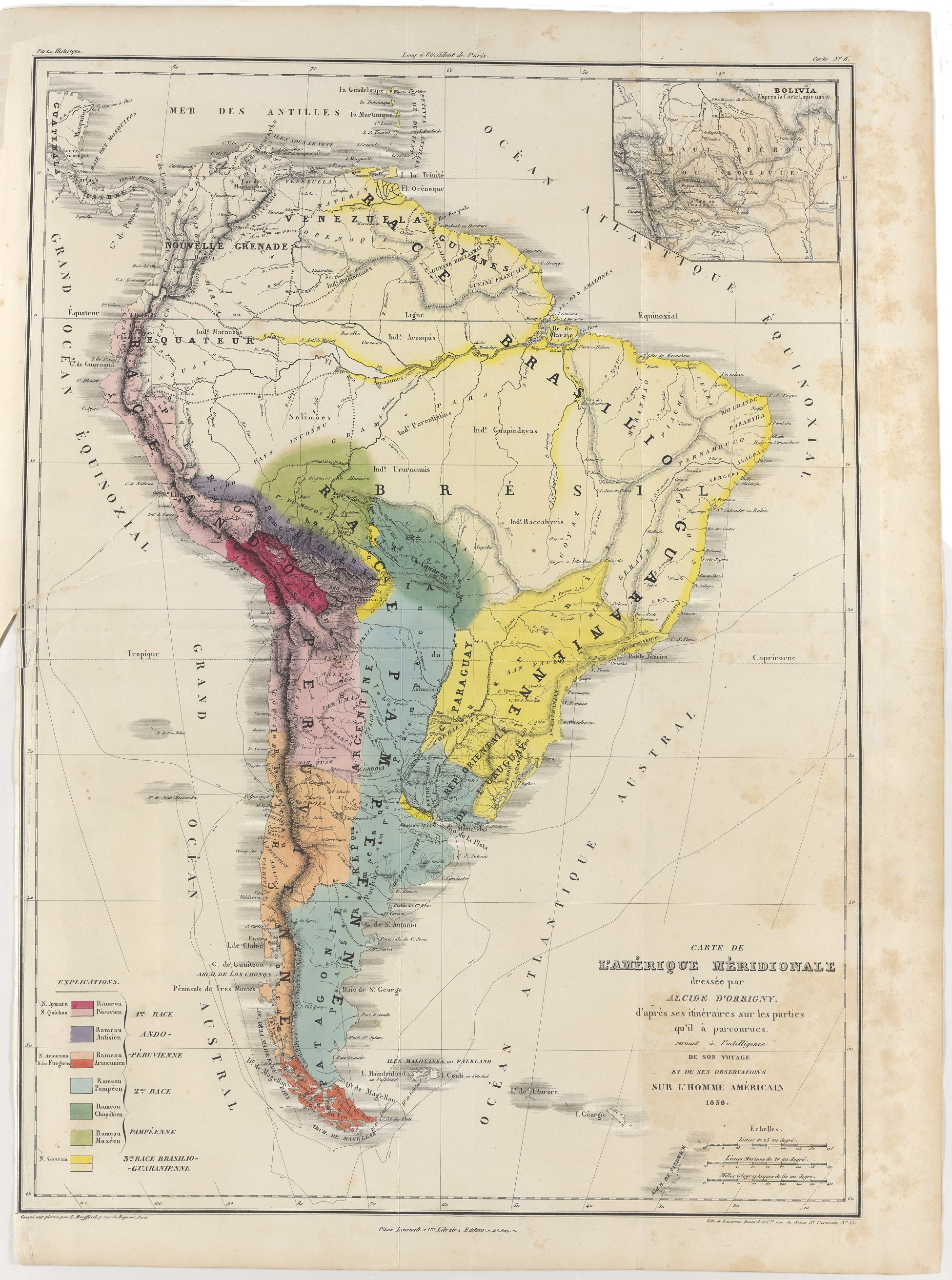
Carte de l'Amérique Méridionale dressée par Alcide d'Orbigny. d'aprés ses itinéraires sur les parties qu'il à parcourues servant à l'intelligence de son voyage et de ses observations sur l'homme américain
Mapa 1829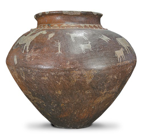
AM, Brasil - Pote, sem data
Obra de arte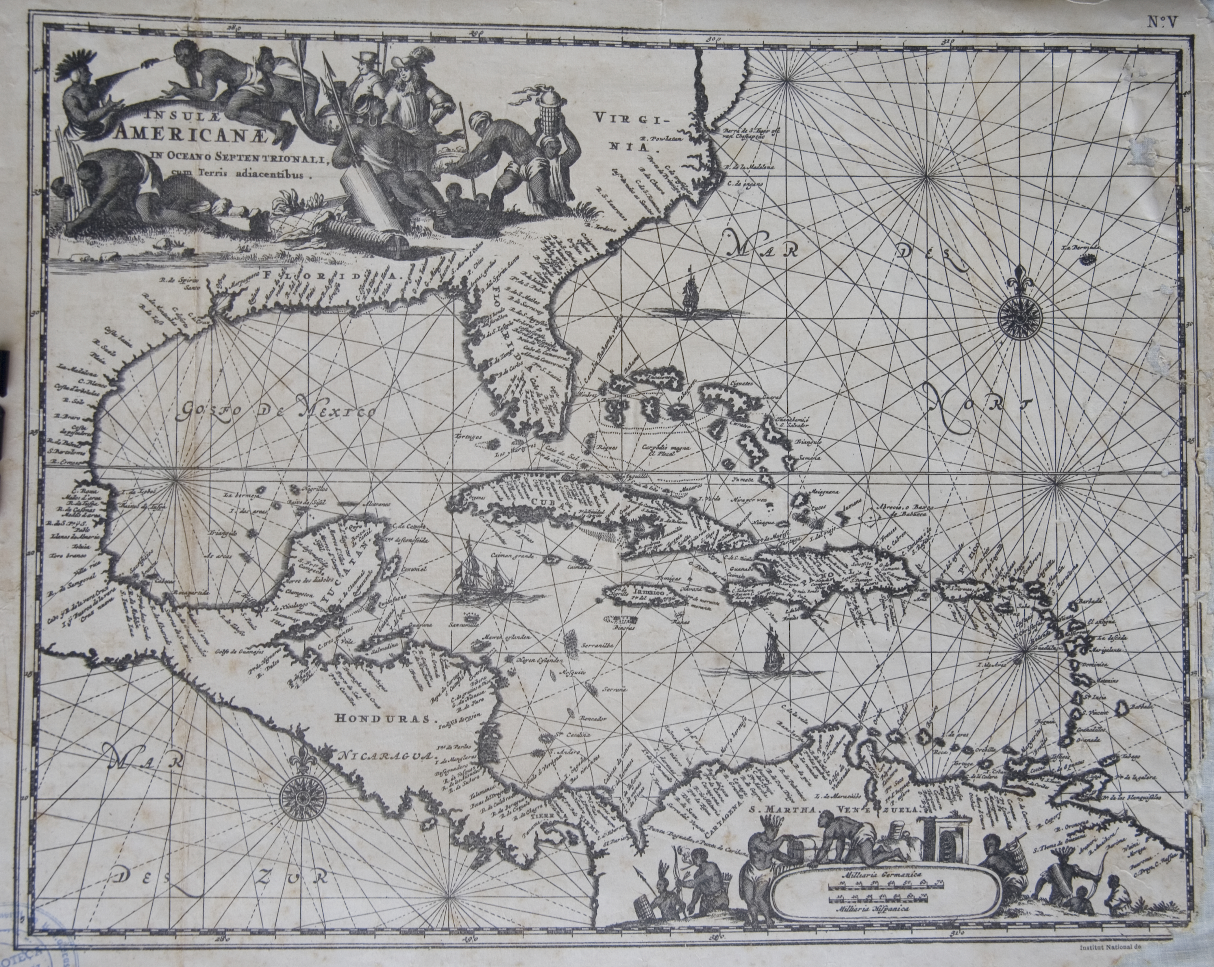
Islas Antillas y costas de tierra firme.
Mapa 1500 - 1599
Carte du Chili depuis le sud du Perou jusqu'au Cap Horn ... par Mr. Bonne, Ingr. Hydrographe de la Marine.
Mapa 1780
MAPA DE SAN DIEGO XOCOYUCAN
Mapa 1500 - 1599
CHART containing the greater part of the SOUTH SEA to the South of the LINE, with the ISLANDS dispersed thro' the same
Mapa 1794
NACIONALIDADES INDÍGENAS DEL ECUADOR
Mapa 1988