Povos
- INDEA
Citação
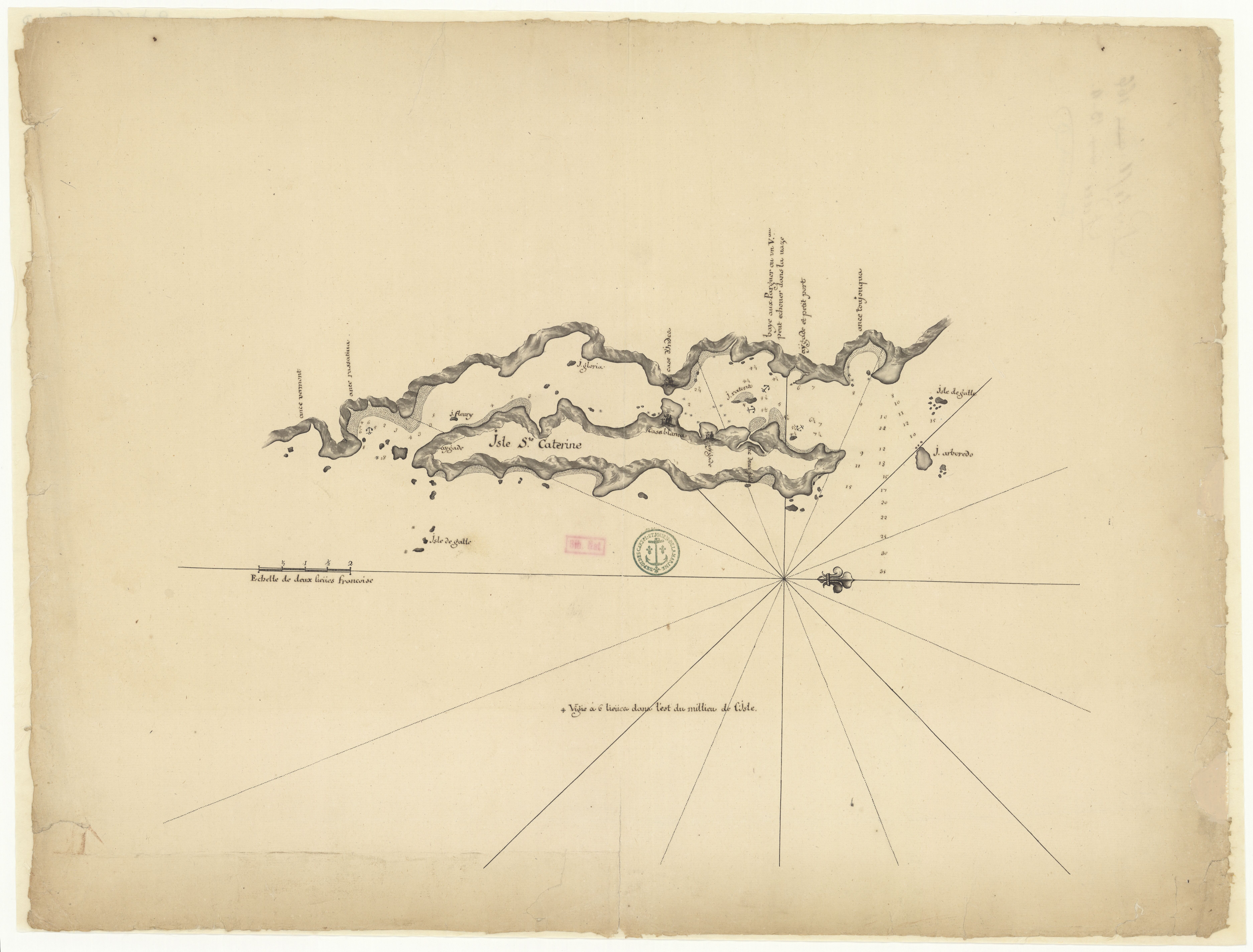
"Isle Ste. Catherine." Map. 1710. Accessed August 7, 2023. https://gallica.bnf.fr/ark:/12148/btv1b531221954/f1.item.
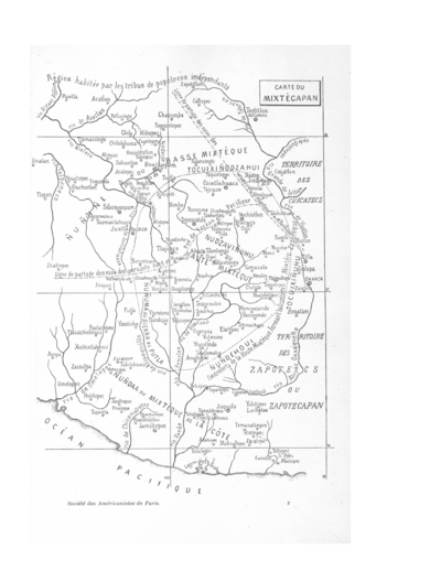
CARTE DU MIXTECAPAN
Mapa 1906!["Mapa de lo principal de la Provincia de Nicaragua;su Laguna;y desagüe de ella;por el Río de San Juan;Poblasones [sic] de los enemigos Zambos e yngleses en Puntagorda y Mosquitos;y las costas y parajes;adonde hazen daños y prezas".](https://dnet8ble6lm7w.cloudfront.net/maps/NIC/NIC0009.jpg)
"Mapa de lo principal de la Provincia de Nicaragua;su Laguna;y desagüe de ella;por el Río de San Juan;Poblasones [sic] de los enemigos Zambos e yngleses en Puntagorda y Mosquitos;y las costas y parajes;adonde hazen daños y prezas".
Mapa 1700 - 1716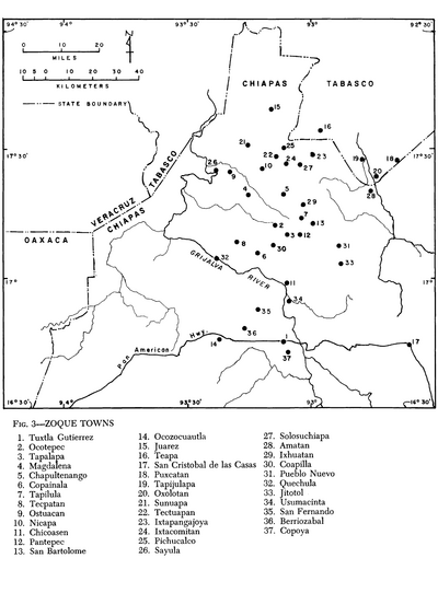
Zoque Towns
Mapa 1969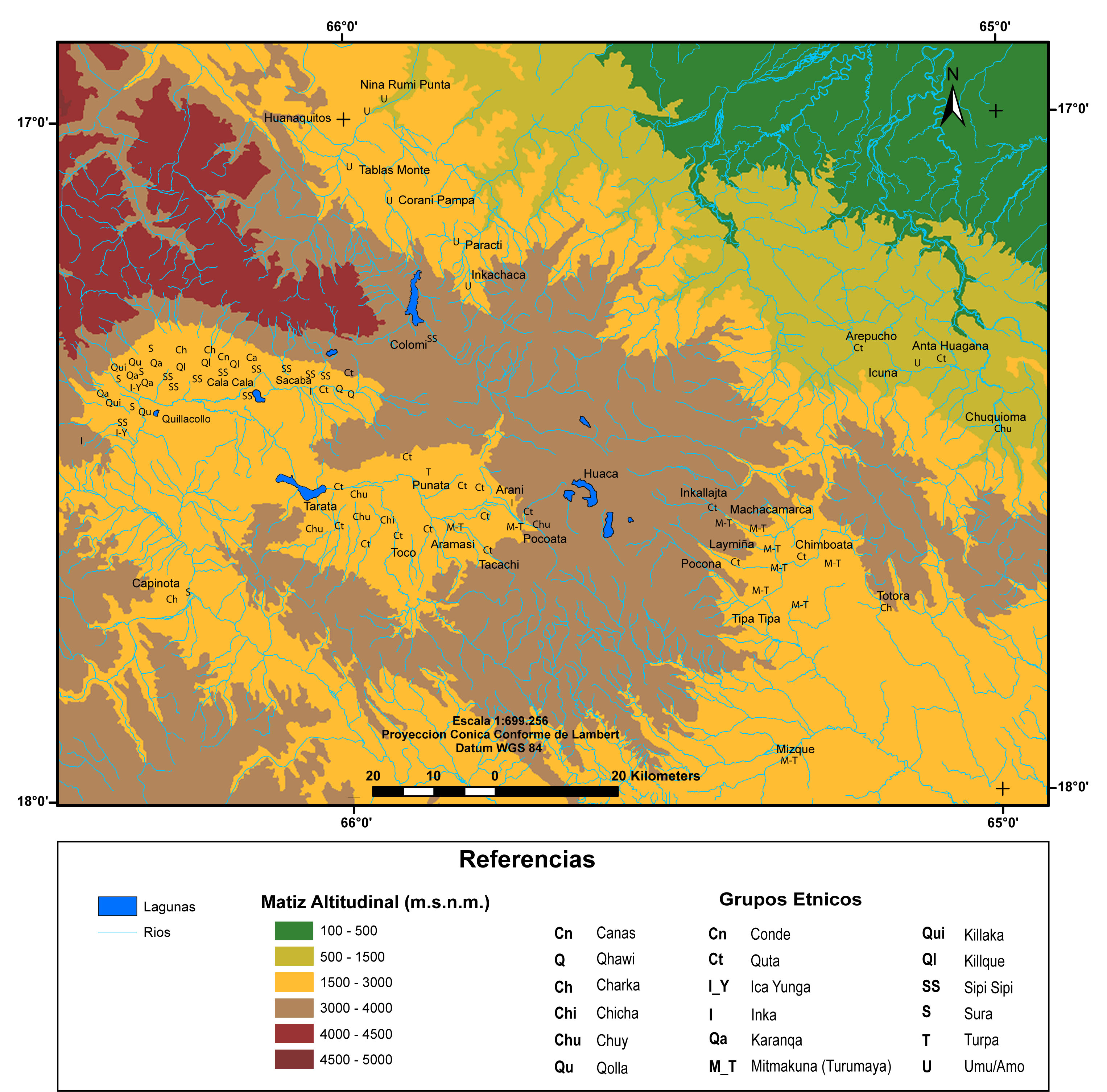
MULTI-ETHNIC TERRITORY under INCA DIRECT RULE: THE CENTRAL AND UPPER VALLEYS OF COCHABAMBA in the 1530s
Mapa 1520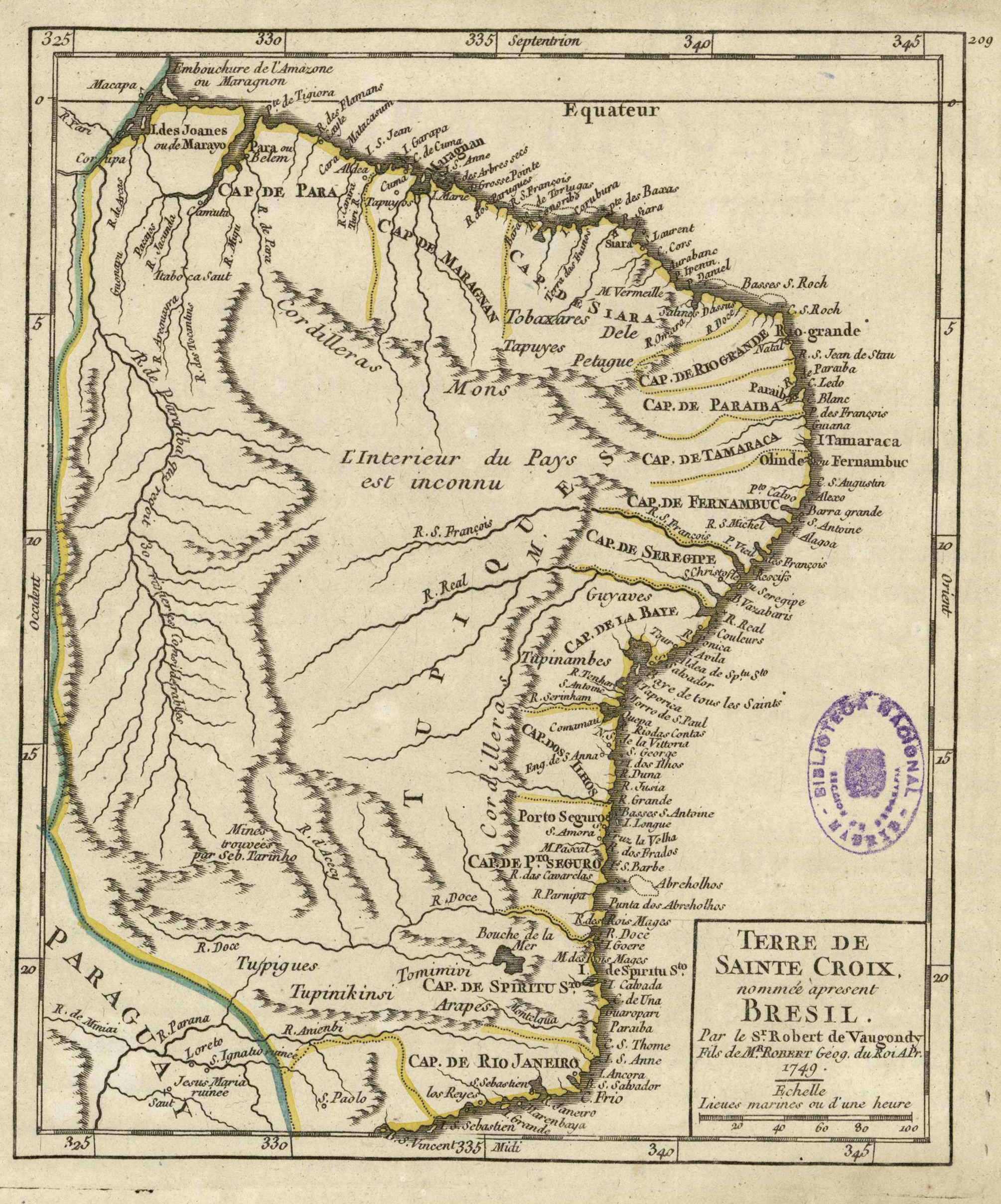
Terre de Sainte Croix, nommée apresent Bresil
Mapa 1749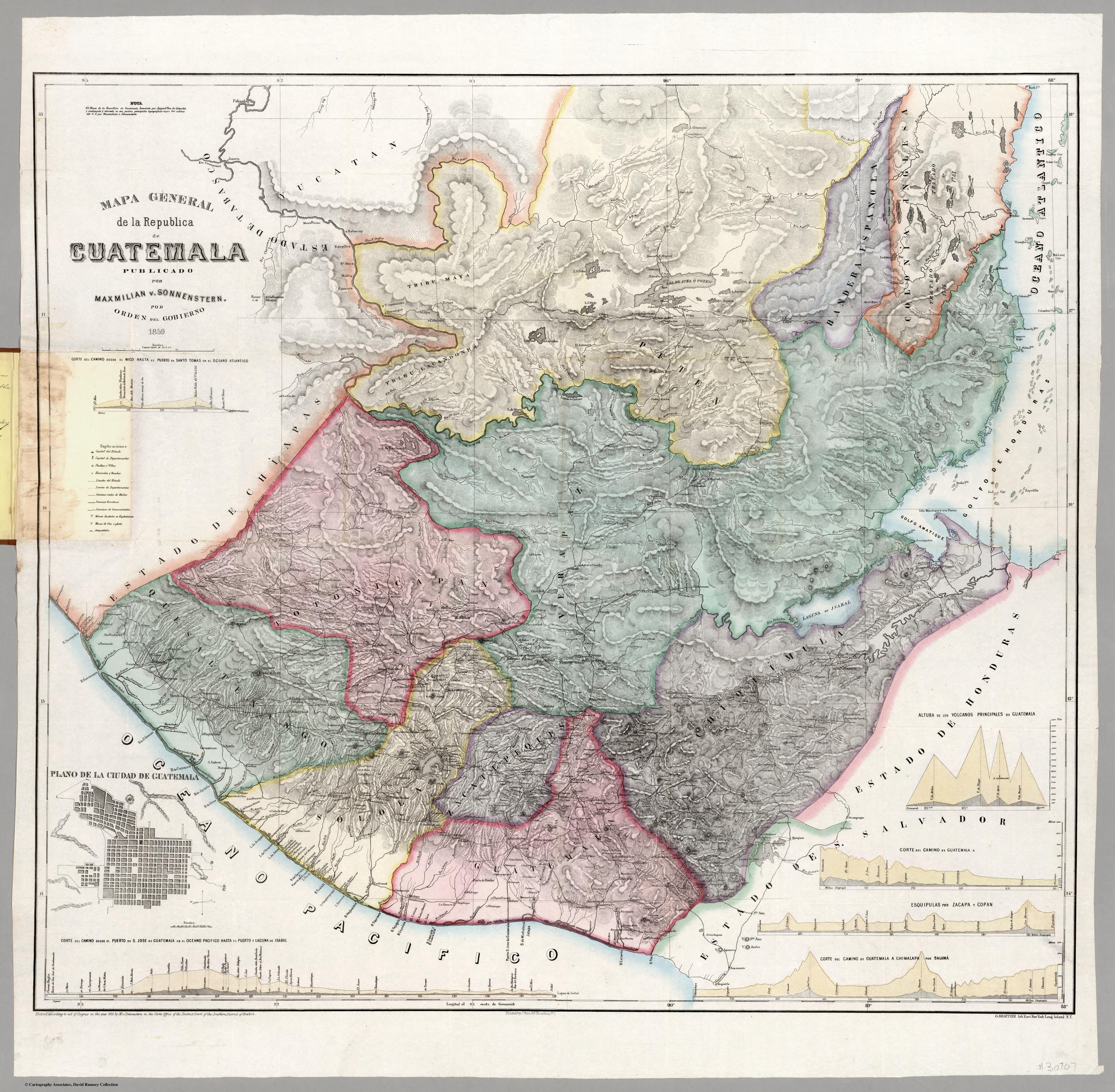
Mapa general de la Republica de Guatemala. Publicado por Maximilian v. Sonnenstern por orden del gobierno, 1859. Printed by J. Rau, 33 Broadway, NY. G Kraetzer lith, East New York Long Island, N.Y. "Entered according to act of Congress in the year 1859 by M.v Sonnenster...New York. (insets) Plando de la Ciudad de Guatemala;and 6 releif profiles.
Mapa 1800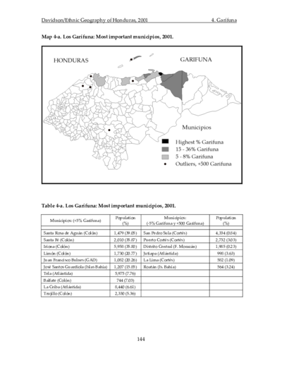
Los Garífuna: Most important municipios, 2001
Mapa 2001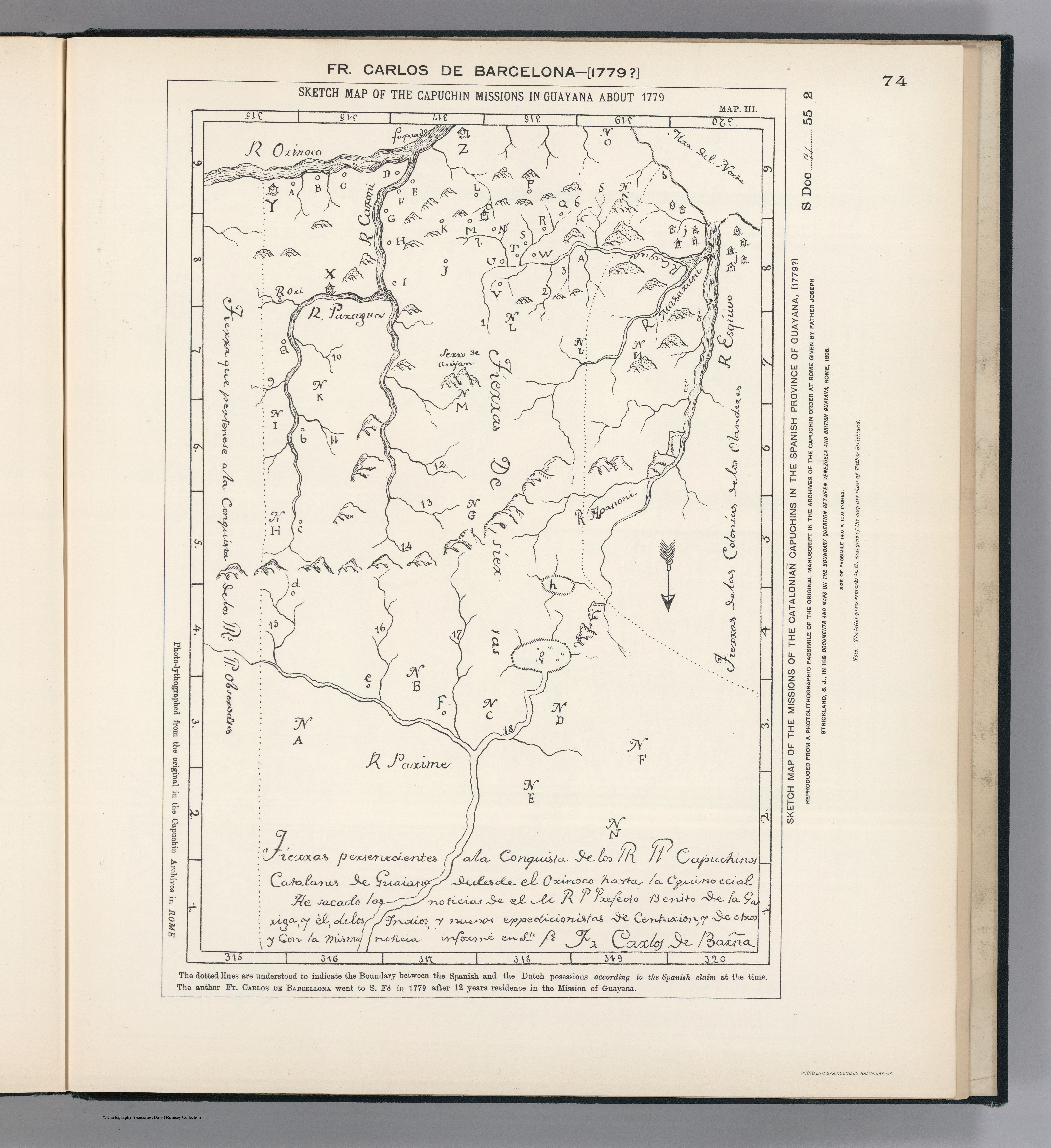
SKETCH MAP OF THE CAPUCHIN MISSIONS IN GUAYANA ABOUT 1779
Mapa 1779