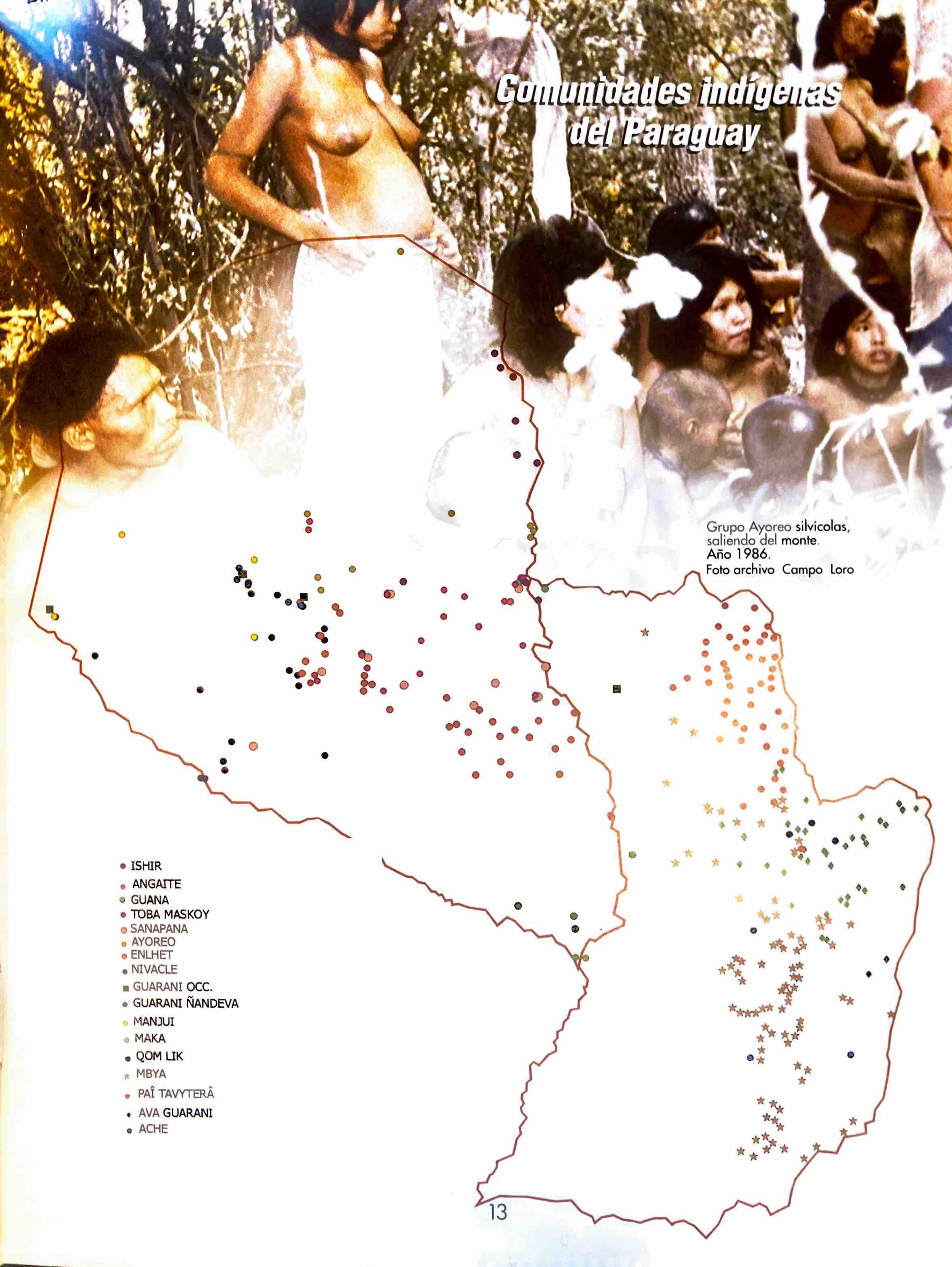
Dispossesions in the Americas

Dispossesions in the Americas

  • Lar
  • Explorar
  • Autores
  • Sobre
  • Arte
  • Corpos
  • Currículos
  • Patrimônio Cultural
  • Mapas
  • Territórios
Voltar à seção Explorar

Lendo em Inglês

Mapa 1794

A New Chart of the Coast of Brazil from the Banks of St. Roque, to the Island of St. Sebastian;with the Islands and Soundings in the Offing

  • WHITTLE, JAMES, ET AL.

Publicado: 1794

  • Baixar Imagem
  • Baixar Imagem

Lendo em Espanhol

Mapa 1794

A New Chart of the Coast of Brazil from the Banks of St. Roque, to the Island of St. Sebastian;with the Islands and Soundings in the Offing

  • WHITTLE, JAMES, ET AL.

Publicado: 1794

  • Baixar Imagem
  • Baixar Imagem
Mapa 1794

A New Chart of the Coast of Brazil from the Banks of St. Roque, to the Island of St. Sebastian;with the Islands and Soundings in the Offing

  • WHITTLE, JAMES, ET AL.

Publicado: 1794

  • Baixar Imagem

Povos

  • INDIAN VILLAGE

Citação

Whittle, James, and Robert Laurie. A New Chart of the Coast of Brazil from the Banks of St. Roque, to the Island of St. Sebastian;with the Islands and Soundings in the Offing. Map. London: Laurie & Whittle, 1794. Accessed July 26, 2023. https://gallica.bnf.fr/ark:/12148/btv1b53123069n/f1.item.

  • Baixar Imagem

Itens Relacionados

Aldeia Tekoha Mara’E Ey

Aldeia Tekoha Mara’E Ey

Mapa 1989 - 2001
CARTA DEL DEPARTAMENTO DEL ZULIA

CARTA DEL DEPARTAMENTO DEL ZULIA

Mapa 1827
El primer hombre no fue hombre, fue mujer [O primeiro homem não foi homem, foi mulher]

El primer hombre no fue hombre, fue mujer [O primeiro homem não foi homem, foi mulher]

Obra de arte
BRAZIL BOLIVIA & PERU

BRAZIL BOLIVIA & PERU

Mapa 1830
Carte DE LA RÉPUBLIQUE DE COLOMBIE;Par. L. VIVEN Géographe

Carte DE LA RÉPUBLIQUE DE COLOMBIE;Par. L. VIVEN Géographe

Mapa 1826
PAA. Pan American Flight Map. New York and Caribbean.

PAA. Pan American Flight Map. New York and Caribbean.

Mapa 1508 - 1783
Comunidades indígenas del Paraguay

Comunidades indígenas del Paraguay

Mapa 2001
"Territorio Indígena Brunka de Boruca"

"Territorio Indígena Brunka de Boruca"

Mapa 2010

Despossessões nas Américas

Um projeto de

University of Pennsylvania

Copyright 2024

Com o apoio de

Mellon Foundation

Projeto e desenvolvimento do site

Element 84

Créditos da arte

Whittle, James, and Robert Laurie. A New Chart of the Coast of Brazil from the Banks of St. Roque, to the Island of St. Sebastian;with the Islands and Soundings in the Offing. Map. London: Laurie & Whittle, 1794. Accessed July 26, 2023. https://gallica.bnf.fr/ark:/12148/btv1b53123069n/f1.item.

Páginas do site

  • Lar
  • Explorar
  • Autores
  • Sobre
  • Arte
  • Corpos
  • Currículos
  • Patrimônio Cultural
  • Mapas
  • Territórios