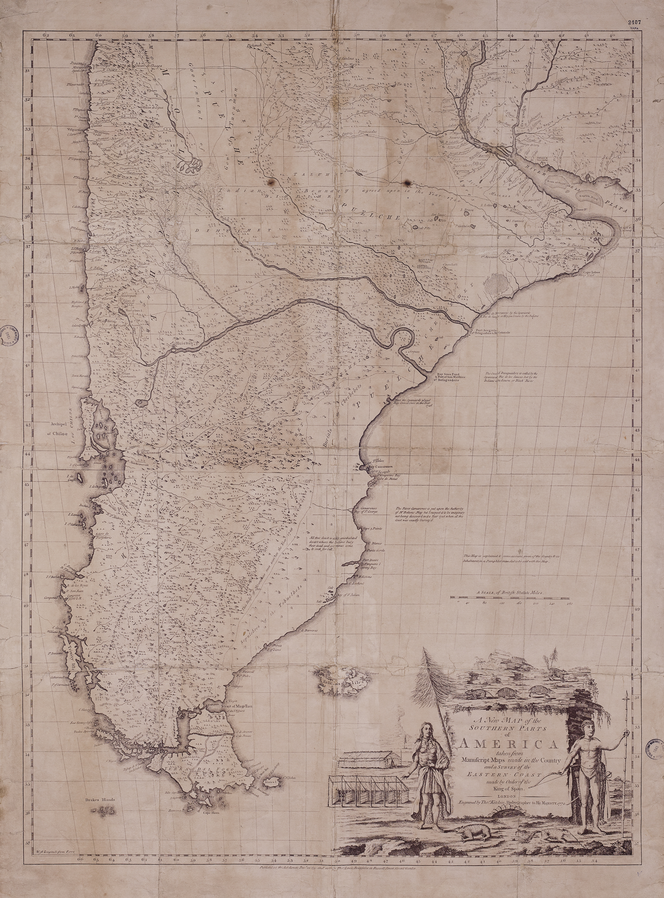
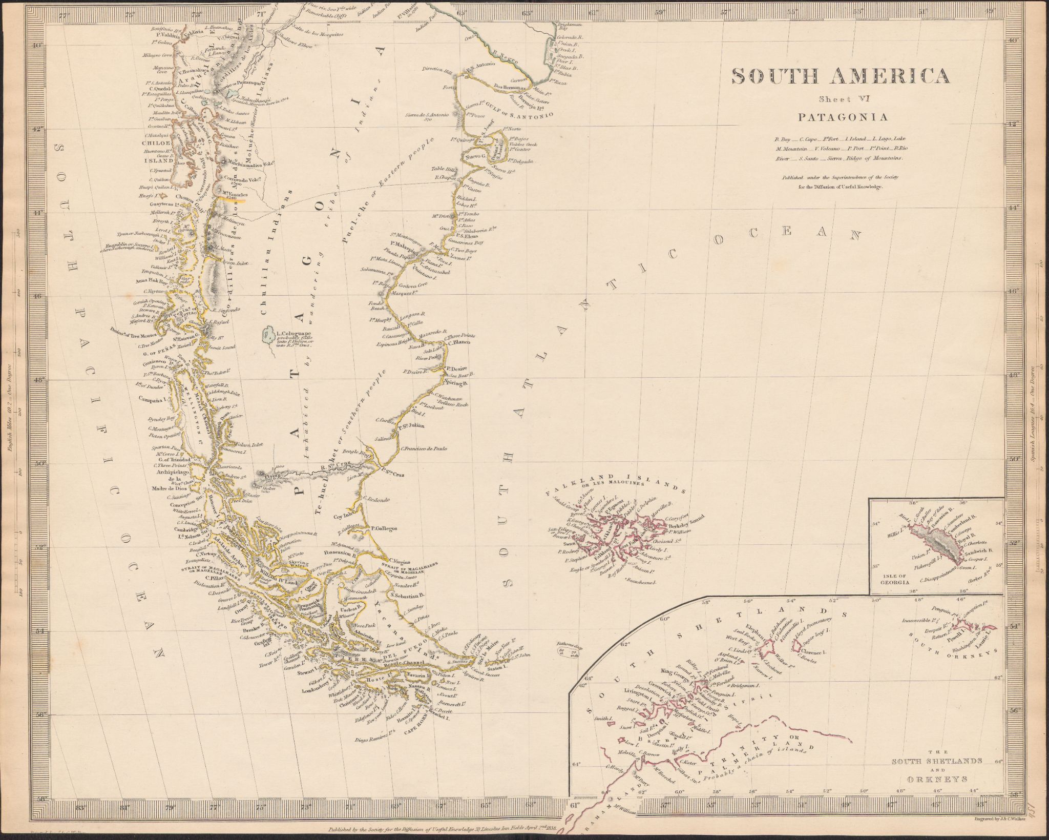
Dispossesions in the Americas

Dispossesions in the Americas

  • Lar
  • Explorar
  • Autores
  • Sobre
  • Arte
  • Corpos
  • Currículos
  • Patrimônio Cultural
  • Mapas
  • Territórios
Voltar à seção Explorar

Lendo em Inglês

Mapa 1800 - 1850

South America

  • WALKER, JONH

Publicado: 1838

  • Baixar Imagem
  • Baixar Imagem

Lendo em Espanhol

Mapa 1800 - 1850

South America

  • WALKER, JONH

Publicado: 1838

  • Baixar Imagem
  • Baixar Imagem
Mapa 1800 - 1850

South America

  • WALKER, JONH

Publicado: 1838

  • Baixar Imagem

Povos

  • PUEL-CHE OR EASTERN PEOPLE
  • TE-HUEL-SHET OR SOUTHERN PEOPLE
  • PUELCHES
  • TEHUELCHES
  • MOLUCHE
  • ARAUCANIAN INDIANS
  • ARAUCANOS
  • MOLUCHES
  • YACANA INDIANS
  • YACANAS

Citação

Walker, Jonh. South America. Map. London, United Kingdom: Society for the Diffusion of Useful Knowledge, 1838. Accessed July 9, 2023. https://digital.iai.spk-berlin.de/viewer/image/63010896X/1/LOG_0000/.

  • Baixar Imagem

Itens Relacionados

A New Map of the Southern Parts of America

A New Map of the Southern Parts of America

Mapa 1772
BRASILIA

BRASILIA

Mapa 1600 - 1699
Plan topográfico de las Provincias de Chocó, Antioquia y Popayán

Plan topográfico de las Provincias de Chocó, Antioquia y Popayán

Mapa 1700
Na Luum Caj

Na Luum Caj

Mapa 1997
Mazatec Area

Mazatec Area

Mapa 1969
Carte Generale De La Guiane Dressee d'apres les Observations les plus recentes Pour Servir aux Recherches a faire dans cette partie interessante et encore peu connue de l'Amerique et a l'intelligence des diverses Relations qui ont ete publiees jusqu'a ce jour. Par N. Buache;Membre de l'Institut National;l'An VI. de la Republique.

Carte Generale De La Guiane Dressee d'apres les Observations les plus recentes Pour Servir aux Recherches a faire dans cette partie interessante et encore peu connue de l'Amerique et a l'intelligence des diverses Relations qui ont ete publiees jusqu'a ce jour. Par N. Buache;Membre de l'Institut National;l'An VI. de la Republique.

Mapa 1700 - 1799
TERRITORIOS DE LOS PUEBLOS Y NACIONALIDADES;TERRITORIOS DE VIDA Y AREAS PROTEGIDAS EN EL ECUADOR CONTINENTAL

TERRITORIOS DE LOS PUEBLOS Y NACIONALIDADES;TERRITORIOS DE VIDA Y AREAS PROTEGIDAS EN EL ECUADOR CONTINENTAL

Mapa 2016 - 2018
Tribes of the Gran Chaco: Locations at the first European contact

Tribes of the Gran Chaco: Locations at the first European contact

Mapa 1524

Despossessões nas Américas

Um projeto de

University of Pennsylvania

Copyright 2024

Com o apoio de

Mellon Foundation

Projeto e desenvolvimento do site

Element 84

Créditos da arte

Walker, Jonh. South America. Map. London, United Kingdom: Society for the Diffusion of Useful Knowledge, 1838. Accessed July 9, 2023. https://digital.iai.spk-berlin.de/viewer/image/63010896X/1/LOG_0000/.

Páginas do site

  • Lar
  • Explorar
  • Autores
  • Sobre
  • Arte
  • Corpos
  • Currículos
  • Patrimônio Cultural
  • Mapas
  • Territórios