
Povos
- DIAGUITA CACANO
Citação
Biblioteca del Congreso de la Nación. Legislación oficial actualizada. September 1, 2020. Accessed June 8, 2024 https://bcn.gob.ar/uploads/SEPARATA-2-PUEBLOS-ORIGINARIOS-BORA-01-09-2020.pdf
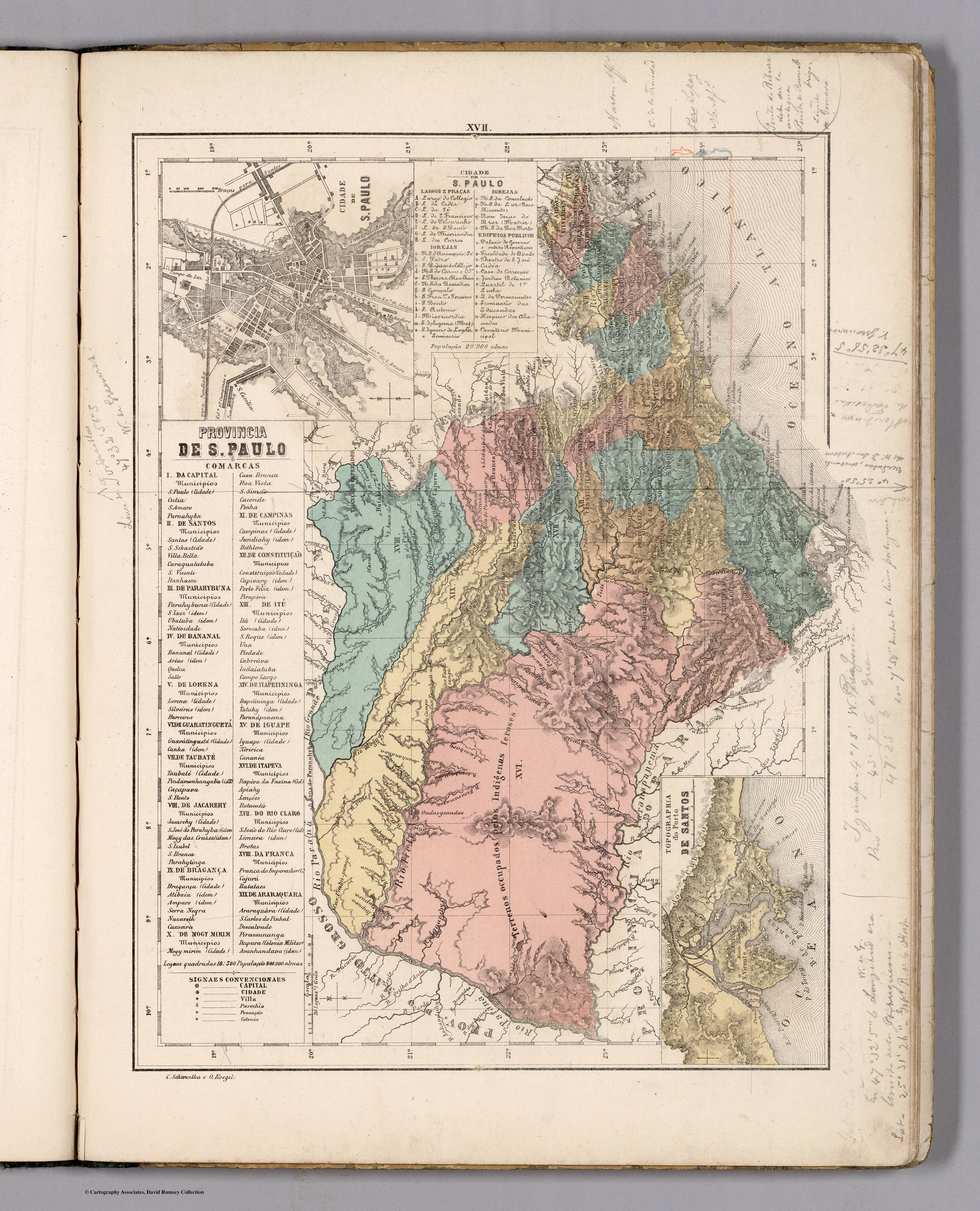
PROVINCIA DE SAO PAULO
Mapa 1800 - 1850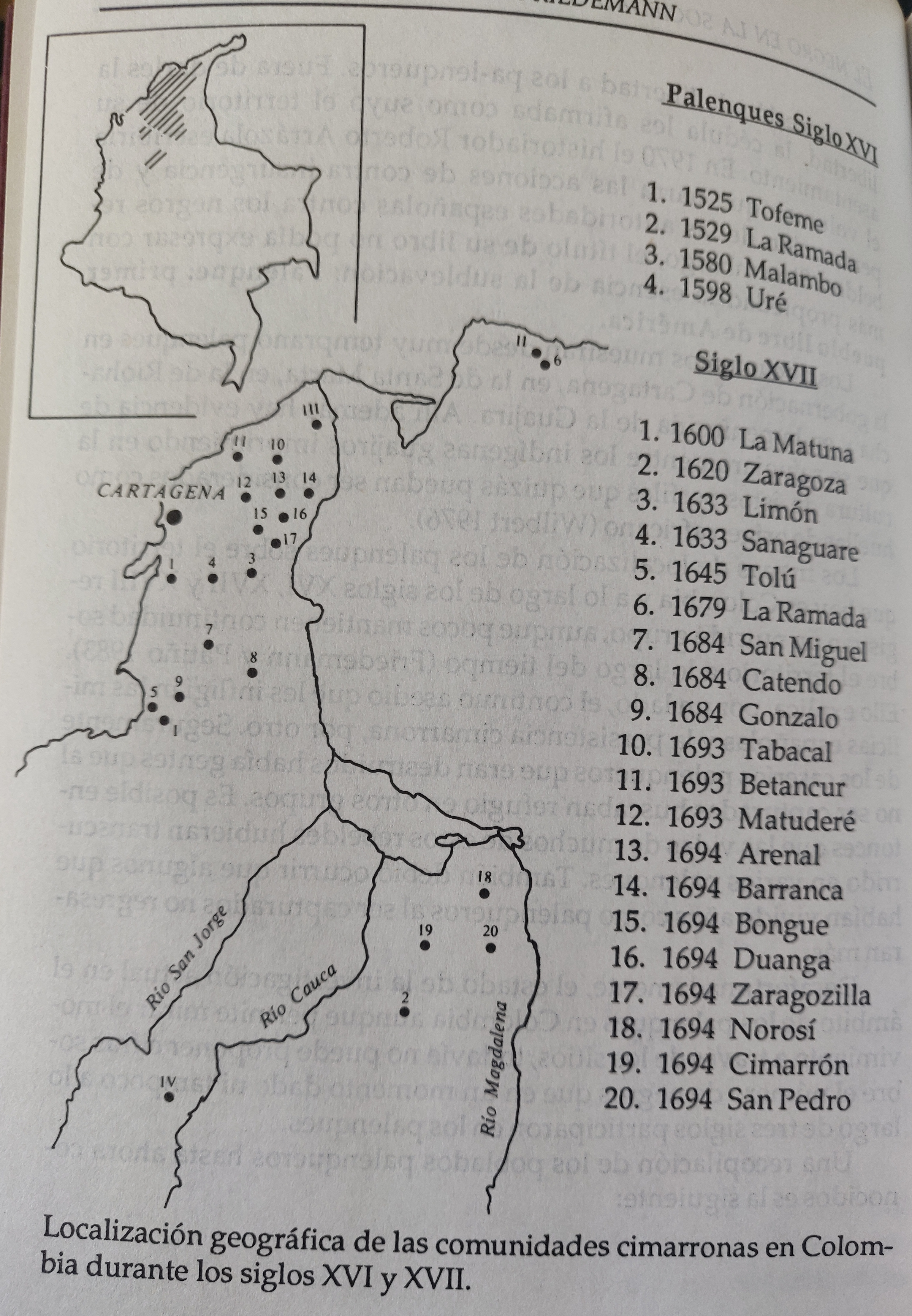
LOCALIZACION GEOGRAFICA DE LAS COMUNIDADES CIMARRONAS EN COLOMBIA DURANTE LOS SIGLOS XVI Y XVII
Mapa 1500 - 1699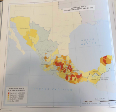
NÚMERO DE INDIOS EN LAS SUBDELEGACIONES EN 1800
Mapa 1800
PUEBLO POPOLUCA DE LA SIERRA
Mapa 2020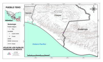
PUEBLO TEKO
Mapa 2020![What did they actually see? [O que é que eles viram realmente?] “Out of control” Pag-127 / “Deviant” Pag-128 / “Possessed” Pag-129 2018](https://dnet8ble6lm7w.cloudfront.net/art_sm/AECU020.png)
What did they actually see? [O que é que eles viram realmente?] “Out of control” Pag-127 / “Deviant” Pag-128 / “Possessed” Pag-129 2018
Obra de arte
Terre de Sainte Croix, nommée apresent Bresil
Mapa 1749
The Caribee Islands and Guyana.
Mapa 1700 - 1799