Pueblos
- ZAPARA
- JIRAJARA
- TIMOTE
Cita
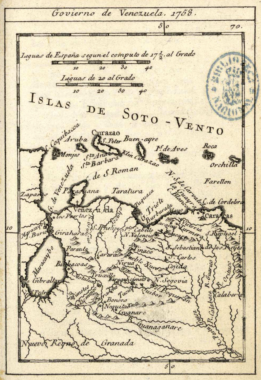
"Govierno de Venezuela." Map. In Atlas Geographico de la América Septentrional y Meridional;by Tomás Lopéz;70. Paris;1758. Accessed December 30;2022. http://bdh.bne.es/bnesearch/detalle/bdh0000001391.
Partie du Mexique ou De La Nouvelle Espagne ou se trouxe L Audience de Guatimala.
Mapa 1748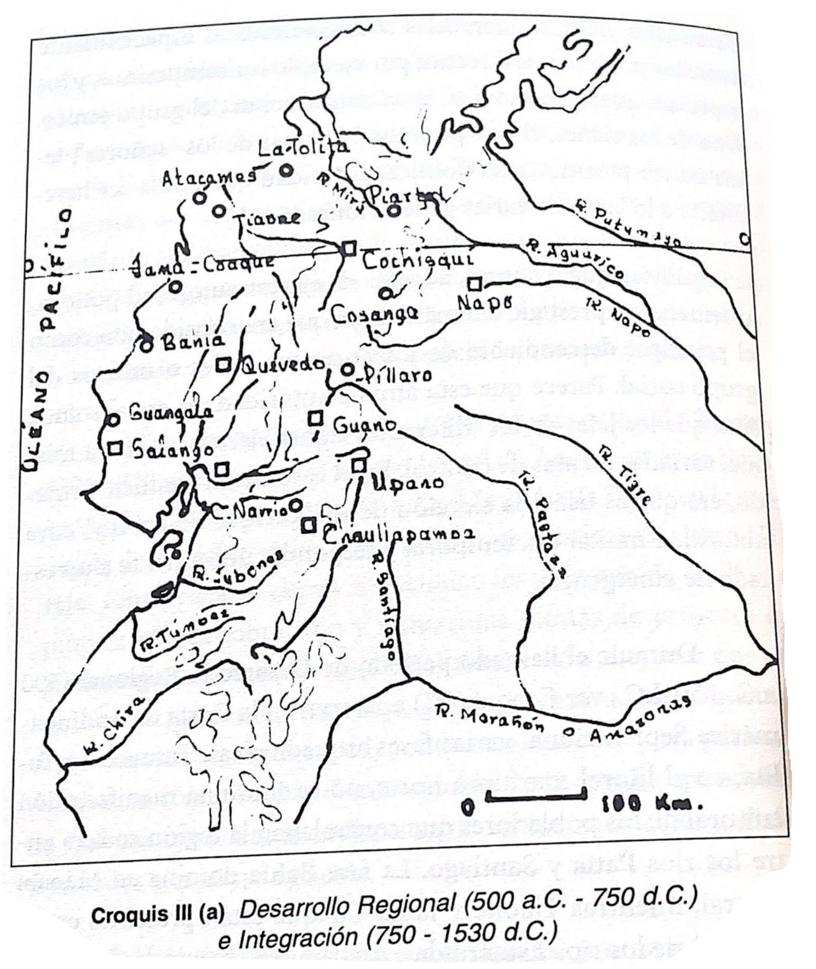
Croquis III. (a) Desarrollo Regional (500 a.C -750 d.C) e Integración (750-1530 a.C.)
Mapa -500 - 1530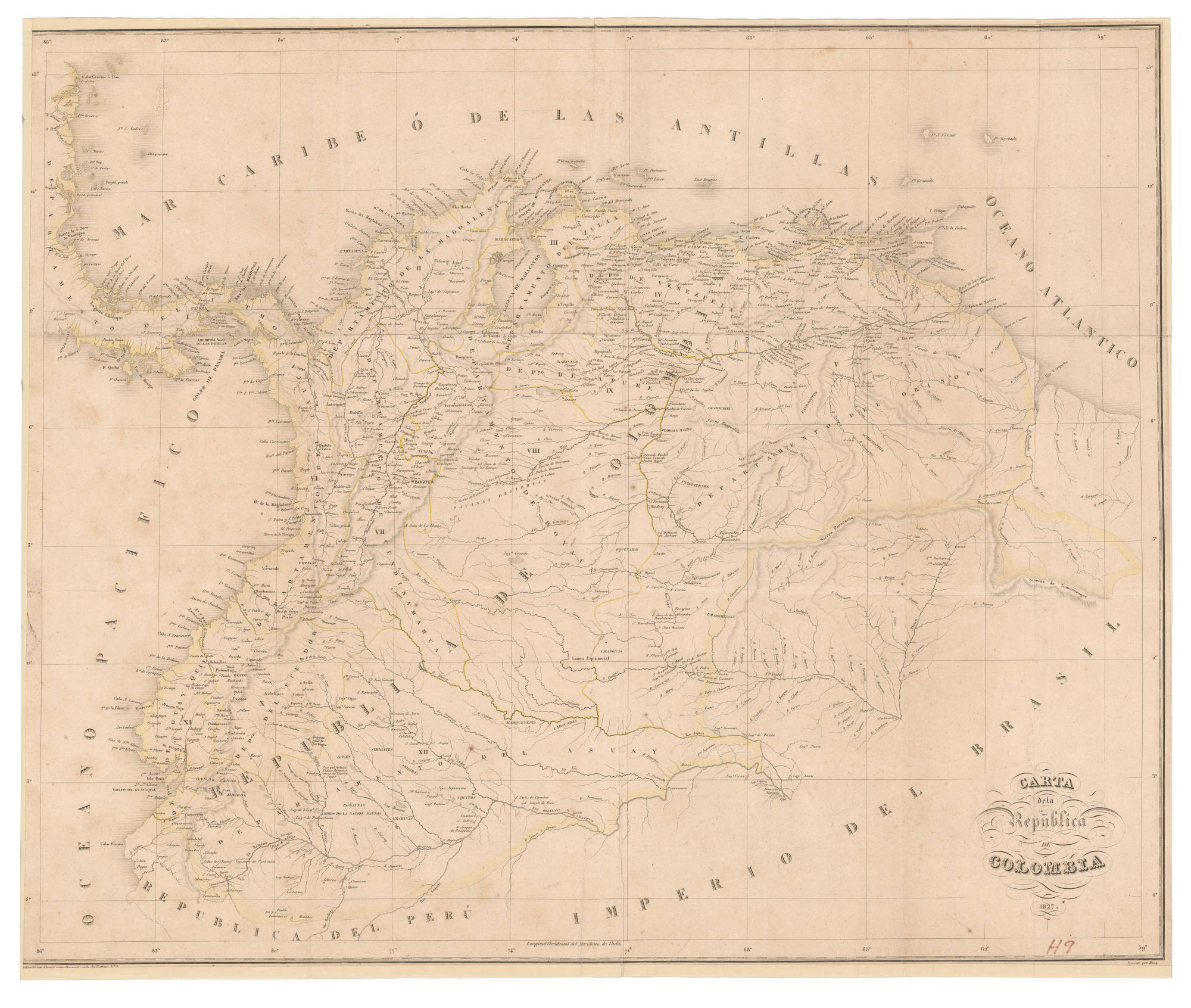
CARTA de la República DE COLOMBIA
Mapa 1827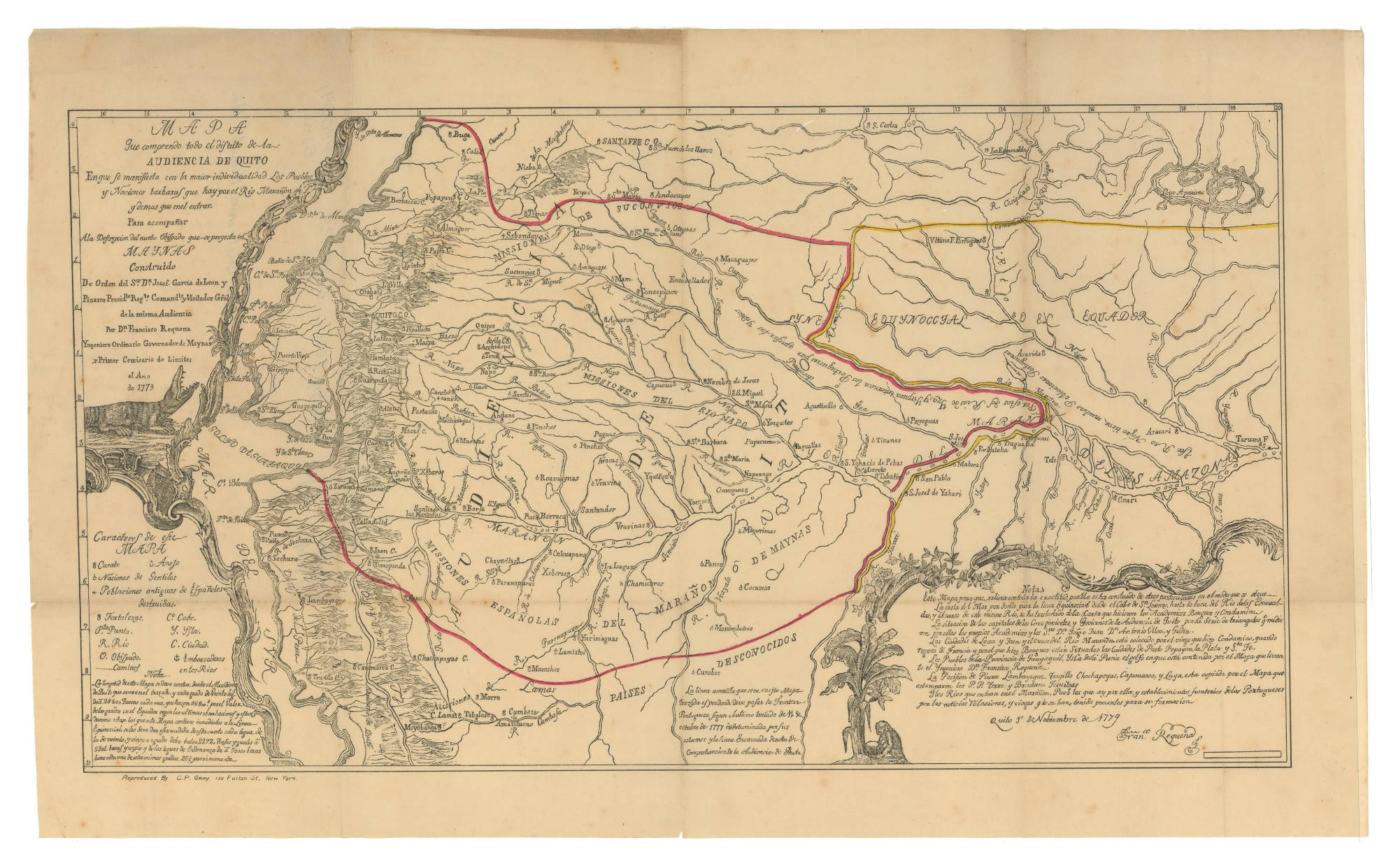
MAPA QUE COMPRENDE TODO EL DISTRITO DE LA AUDIENCIA DE QUITO
Mapa 1779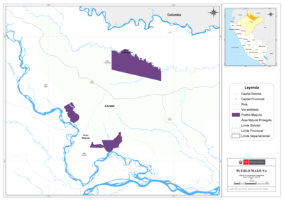
PUEBLO MAIJUNA
Mapa 2021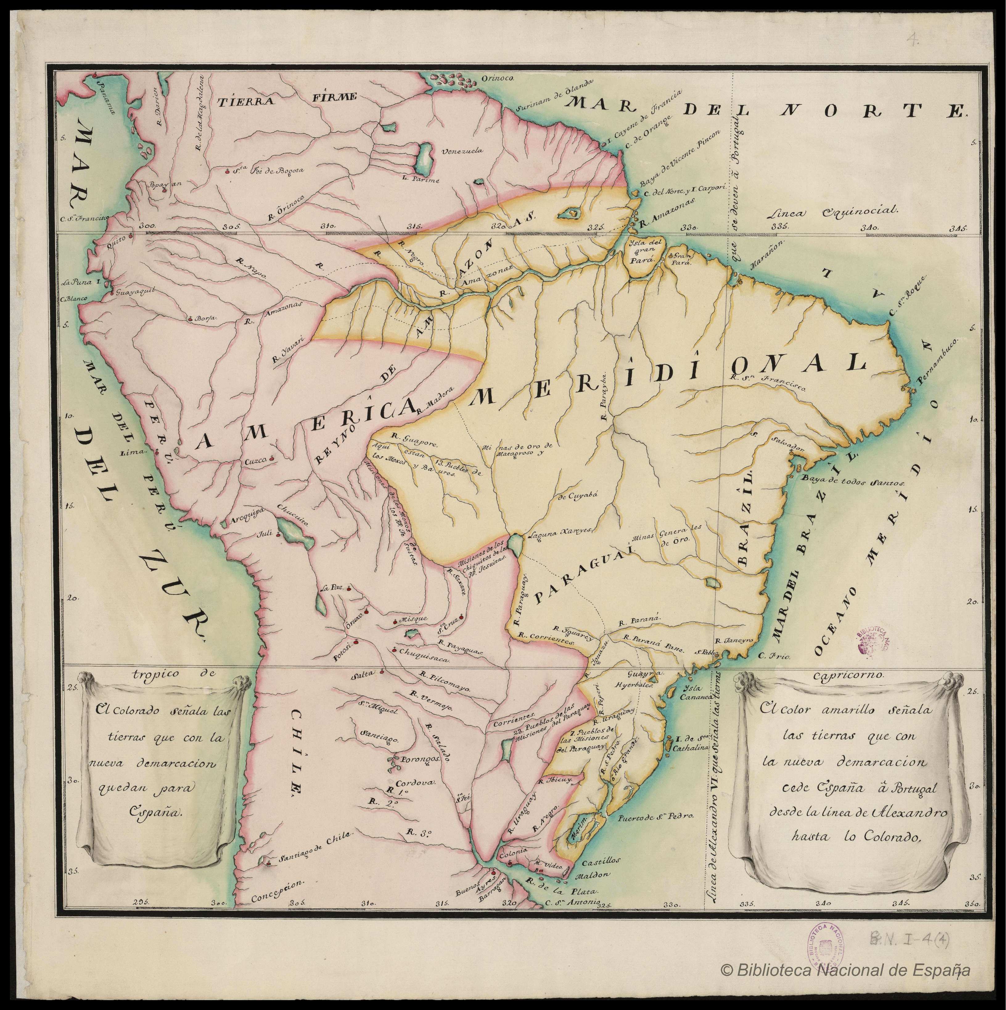
AMÉRICA MERIDIONAL : BIBLIOTECA ESPAÑA
Mapa 1662 - 1791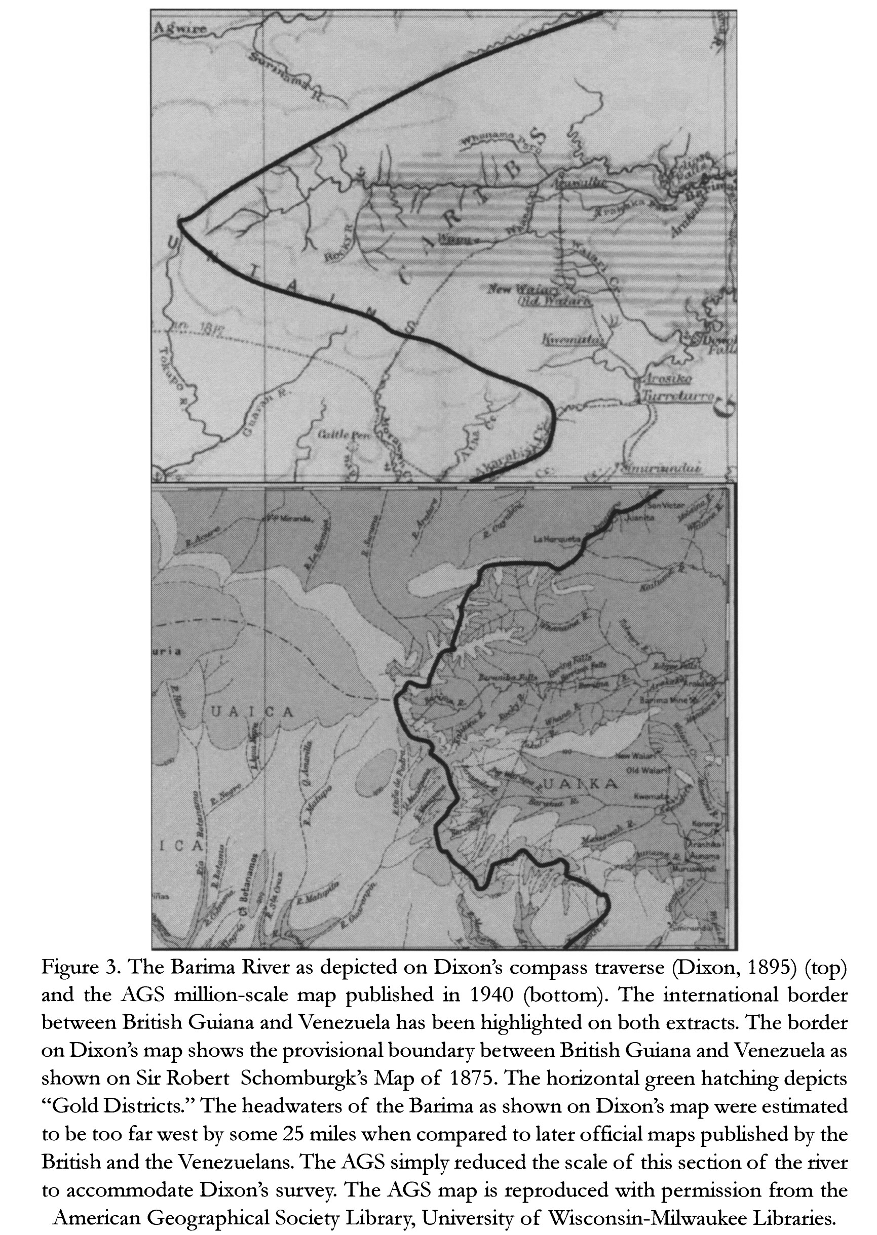
The Barima River as depicted on Dixon's compass traverse and the AGS million-scale map published in 1940 (bottom)
Mapa 1895
SOUTHERN STATES OF SOUTH AMERICA. LA PLATA;CHILI;PARAGUAY;URUGUAY & PATAGONIA
Mapa 1863