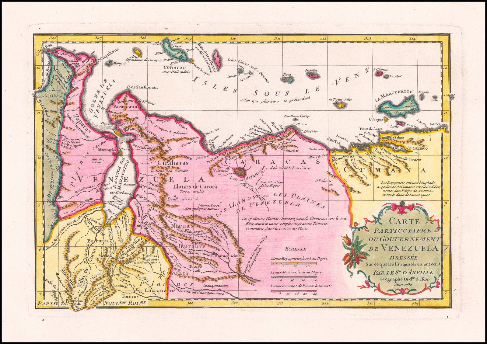
Dispossesions in the Americas

Dispossesions in the Americas

  • Inicio
  • Explorar
  • Autores
  • Sobre
  • Arte
  • Cuerpos
  • Planes de Estudio
  • Herencia Cultural
  • Mapas
  • Territorios
Volver a Explorar

Leyendo en Inglés

Mapa 1730

Carte particulière du gouvernement de Venezuela / dressée sur ce que les Espagnols en ont écrit par le Sr D'Anville

  • D'ANVILLE;JEAN-BAPTISTE BOURGUIGNON

Publicado: 1730

  • Descargar Imágen
  • Descargar Imágen
Mapa 1730

Carte particulière du gouvernement de Venezuela / dressée sur ce que les Espagnols en ont écrit par le Sr D'Anville

  • D'ANVILLE;JEAN-BAPTISTE BOURGUIGNON

Publicado: 1730

  • Descargar Imágen

Pueblos

  • WAYUU
  • ZAPARA
  • QUIRIQUIRES
  • TIMOTE
  • YUKPA
  • TOROROS
  • KAKETIO
  • KUMANAGOTO
  • JIRAJARA
  • COYONES
  • BURAURE
  • NIRUAS
  • CUICA

Citas

d'Anville;Jean-Baptiste Bourguignon. Carte Particuliere du Gouvernement de Venezuela. Map. Paris;1730. Accessed August 28;2022. https://www.raremaps.com/gallery/detail/60631op/carte-particuliere-du-gouvernement-de-venezuela-danville.

  • Descargar Imágen

Artículos Relacionados

Mapa de una parte del Rio Yapurá : comprehendida desde la boca del Caño de Avatiparána immediata al pueblo de Maripi hasta la boca del Rio Apaporis proxima al Salto de Cupati

Mapa de una parte del Rio Yapurá : comprehendida desde la boca del Caño de Avatiparána immediata al pueblo de Maripi hasta la boca del Rio Apaporis proxima al Salto de Cupati

Mapa 1788
Mexico at the time of the conquest (1519), showing the extent of the Culhua Mexica (Aztec Empire) and of the Maya holdings

Mexico at the time of the conquest (1519), showing the extent of the Culhua Mexica (Aztec Empire) and of the Maya holdings

Mapa 1519
PUEBLO MIXTECO

PUEBLO MIXTECO

Mapa 2020
Guiana siue Amazonum Regio.

Guiana siue Amazonum Regio.

Mapa 1600 - 1699
A Description of the Plantations in the Valley of Paneca

A Description of the Plantations in the Valley of Paneca

Mapa
MAPA ETNOGRÁFICO

MAPA ETNOGRÁFICO

Mapa 1500 - 1900
Pueblos y territorios indígenas de Honduras (2000)

Pueblos y territorios indígenas de Honduras (2000)

Mapa 2000
"Territorio Indígena Cabécar de Tayní"

"Territorio Indígena Cabécar de Tayní"

Mapa 2010

Despojos en las Américas

Un Proyecto de

University of Pennsylvania

Copyright 2024

Con el apoyo de

Mellon Foundation

Diseño y Desarrollo del Sitio

Element 84

Créditos Artísticos

d’Anville;Jean-Baptiste Bourguignon. Carte Particuliere du Gouvernement de Venezuela. Map. Paris;1730. Accessed August 28;2022. https://www.raremaps.com/gallery/detail/60631op/carte-particuliere-du-gouvernement-de-venezuela-danville.

Páginas del Sitio

  • Inicio
  • Explorar
  • Autores
  • Sobre
  • Arte
  • Cuerpos
  • Planes de Estudio
  • Herencia Cultural
  • Mapas
  • Territorios