Pueblos
- PARIAGOTOS
- GUYANOS
Cita
"Mapa de la desembocadura del río Orinoco." Map. 1720. Accessed August 21;2022. http://pares.mcu.es/ParesBusquedas20/catalogo/show/25990.
Colombia Prima or South America drawn from the large map in eight sheets by Louis Stanislas D'Arcy Delarochette
Mapa 1811
De gris a positHIVo
Obra de Arte
Carte générale de Colombie, de la Guyane Française, Hollandaise et Anglaise.
Mapa 1800 - 1899
SANAPANÁ
Mapa 2015
A Map of part of Yucatan or of that Part of the Eastern Shore Within the Bay of Honduras Alloted to Great Britain for the Cutting of Logwood, in consequence of the Convention Signed with Spain on the 14th July 1786.
Mapa 1700![Cover-up of the Christopher Columbus statue behind the Bayfront Park Amphitheater in Miami, Florida [Encubrimiento de la estatua de Cristóbal Colón detrás del Anfiteatro Bayfront Park en Miami, Florida]](https://dnet8ble6lm7w.cloudfront.net/art_sm/AECU017.png)
Cover-up of the Christopher Columbus statue behind the Bayfront Park Amphitheater in Miami, Florida [Encubrimiento de la estatua de Cristóbal Colón detrás del Anfiteatro Bayfront Park en Miami, Florida]
Obra de Arte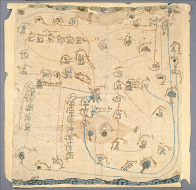
MAPA DE COATLINCHAN/ MAP OF COALINCHAN
Mapa 1500 - 1599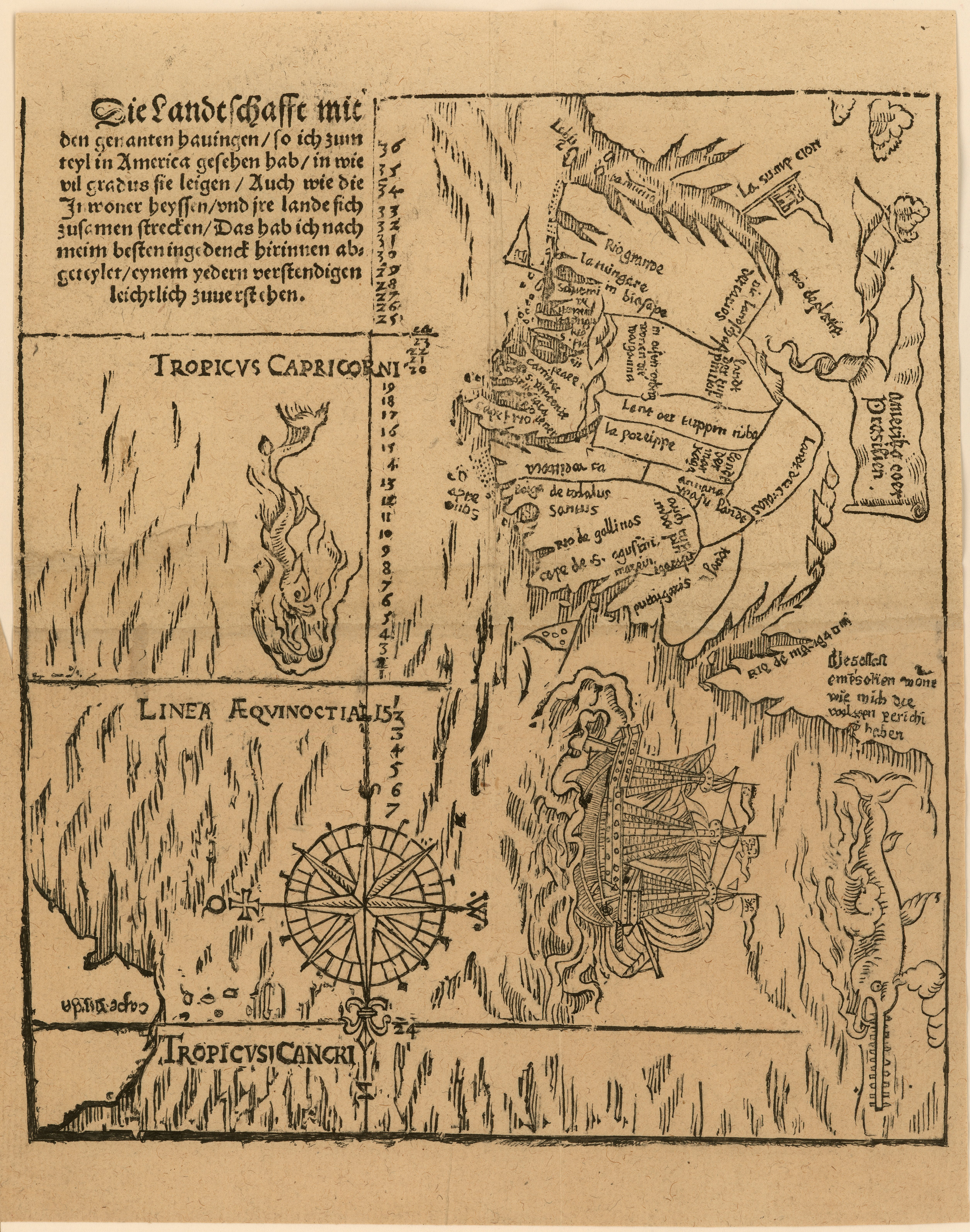
Die landtschafft mit den genanten hauingen so ich zum teyl in America gesehen hab...
Mapa 1500 - 1550