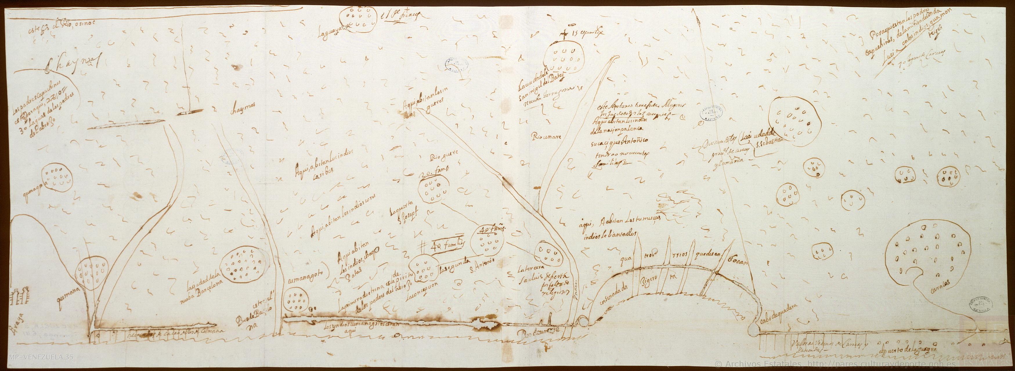
Pueblos
- KUMANAGOTO
- CHORES
- CARIBE
- CHACOPATAS
- GUERES
- TOMUZAS
- GUAMONTEYES
- PALENQUES
Cita
de Caravantes;José. "Diseño de las misiones de Nueva Andalucía." Map. 1660. Accessed August 21;2022. http://pares.mcu.es/ParesBusquedas20/catalogo/show/25945.
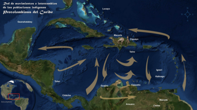
Red de movimientos e intercambios de las poblaciones indígenas Precolombinas del Caribe
Mapa 1492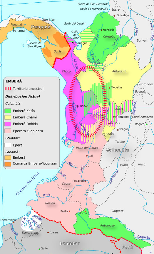
Grupo aborigen Emberá
Mapa![Ombre des Amazonies [Sombra de las Amazonías]](https://dnet8ble6lm7w.cloudfront.net/art/APER055.JPG)
Ombre des Amazonies [Sombra de las Amazonías]
Obra de Arte
A Map of part of Yucatan or of that Part of the Eastern Shore Within the Bay of Honduras Alloted to Great Britain for the Cutting of Logwood, in consequence of the Convention Signed with Spain on the 14th July 1786.
Mapa 1700![O Vendedor de frutas [El vendedor de frutas]](https://dnet8ble6lm7w.cloudfront.net/art/ABRA045.jpeg)
O Vendedor de frutas [El vendedor de frutas]
Obra de Arte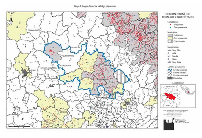
REGIÓN OTOMI DE HIDALGO Y QUERETARO
Mapa 2000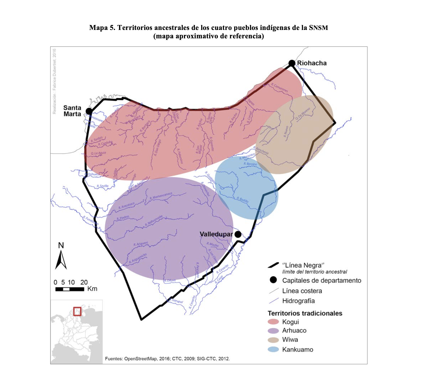
TERRITORIOS ANCESTRALES DE LOS CUATRO PUEBLOS INDIGENAS DE LA SSNM (MAPA APROXIMATIVO DE REFERENCIA)
Mapa 2009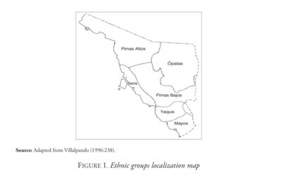
Ethnic Groups Localization Map
Mapa 2014