
Pueblos
- TAINO
- GARIFUNA
- WAYUU
- LOKONO
- KALINAGO
Cita
Taíno: Herencia e identidad indígena en el Caribe. Smithsonian. https://americanindian.si.edu/nk360/pdf/Taino-Gallery-Guide-Spanish.pdf
Côtes de la Guyane brésilienne de l'Oyapoc à Para
Mapa 1600 - 1750
Map representing the linguistic diversity that existed in Central America and the Gulf of Fonseca at the time of contact with the Spanish
Mapa 1522
Empire du BRÉSIL
Mapa 1835
Cocris o Diseño que da una Ydea de la Rebentazón deel Bolcán de Pacaia, su figura, distancias y proporción de los terrenos adiacentes
Mapa 1700
Mapa Etno-Histórico do Brasil e Regiões Adjacentes - Adaptado do Mapa de Curt Nimuendajú 1944.
Mapa 1400 - 1944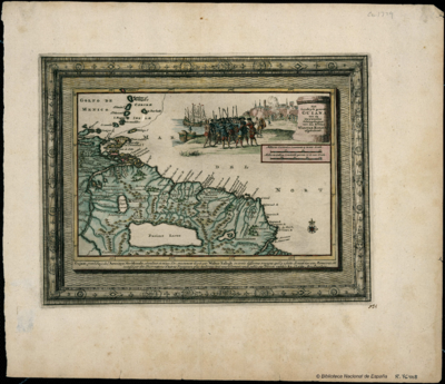
Het Goudryk gewest Guiana tot de Drywerfze Scheepstogten.
Mapa 1700 - 1799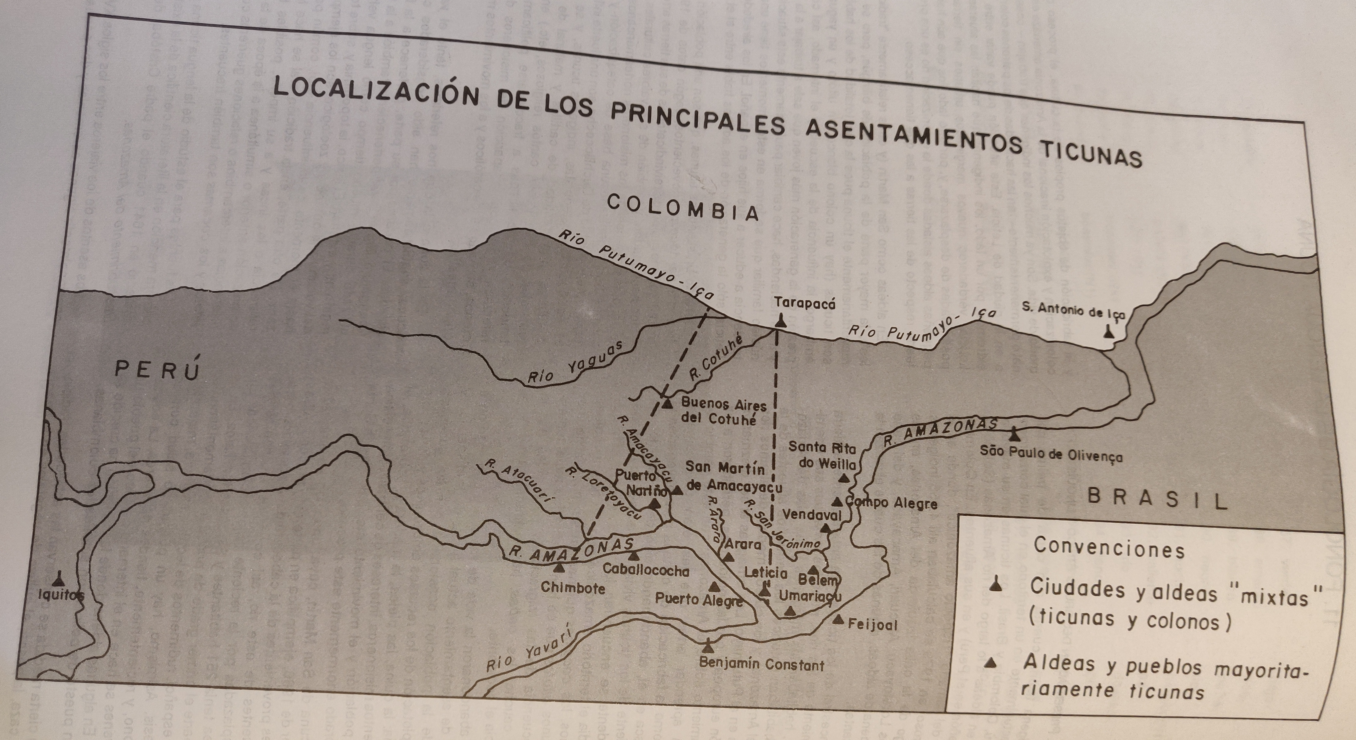
LOCALIZACIÓN DE LOS PRINCIPALES ASENTAMIENTOS TICUNAS
Mapa 2000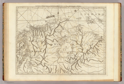
The coast of Tierra Firma from Cartagena to Golfo Triste
Mapa 1775