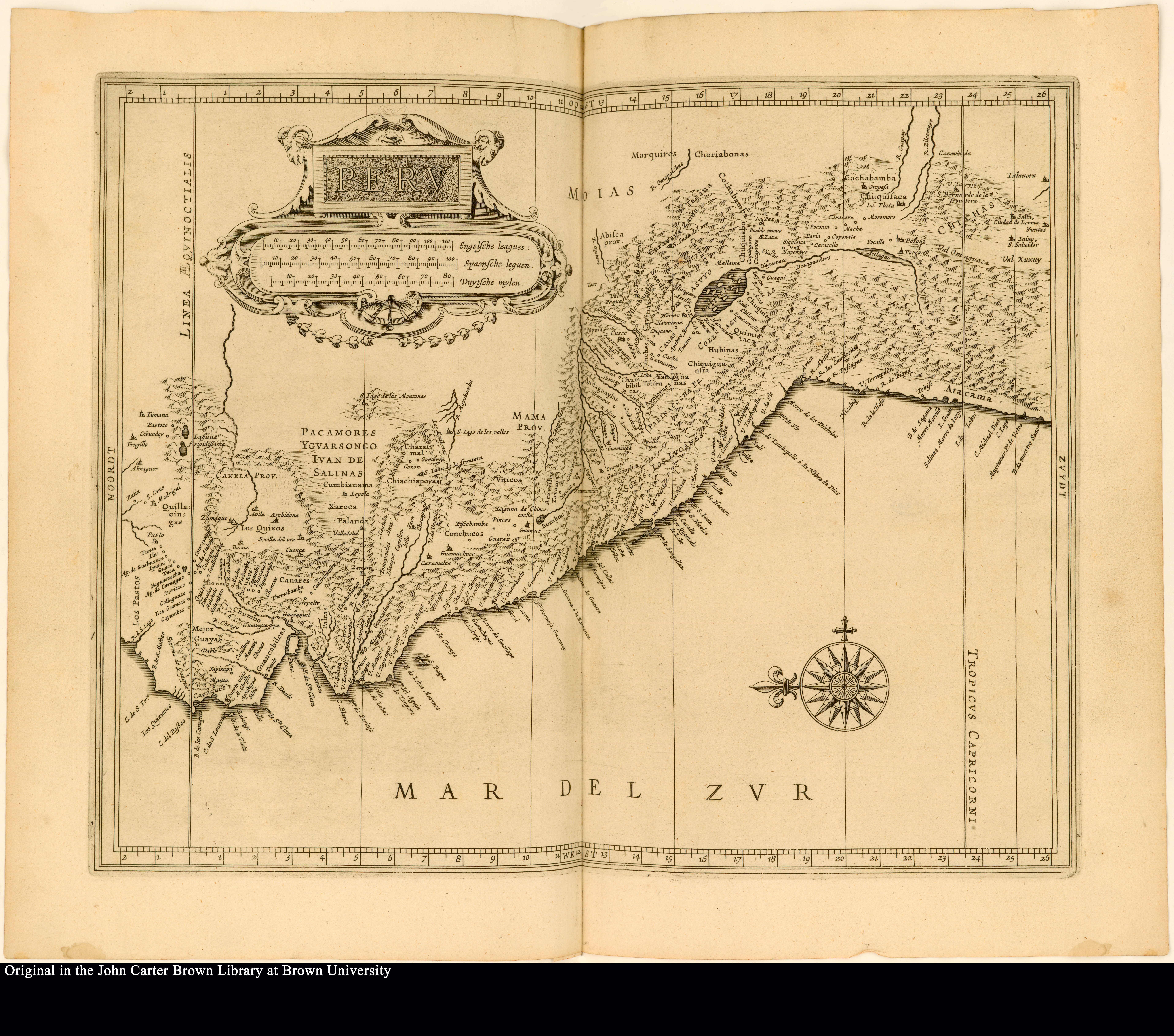
Pueblos
- QUICINGAS
- LOS PASTOS
- LOS QUIXOS
- CANARES
- GUANCABELICAS
- PACAMORES
- CHIACHIAPOYAS
- VITICOS
- CONCHUCOS
- LOS SORAS
- LOS LVCANES
- MARQUIRES
- CHERIABONAS
- AYMERAES
- CANAS
- CANCHES
- COLLAS
Cita
de Laet, J. (Cartographer). (1625). Peru [Map]. In de druckerye van Isaack Elzevier. John Carter Brown Library. https://jcb.lunaimaging.com/luna/servlet/detail/JCBMAPS~1~1~4568~102653:Peru?sort=normalized_date%2Cfile_name%2Csource_author%2Csource_title
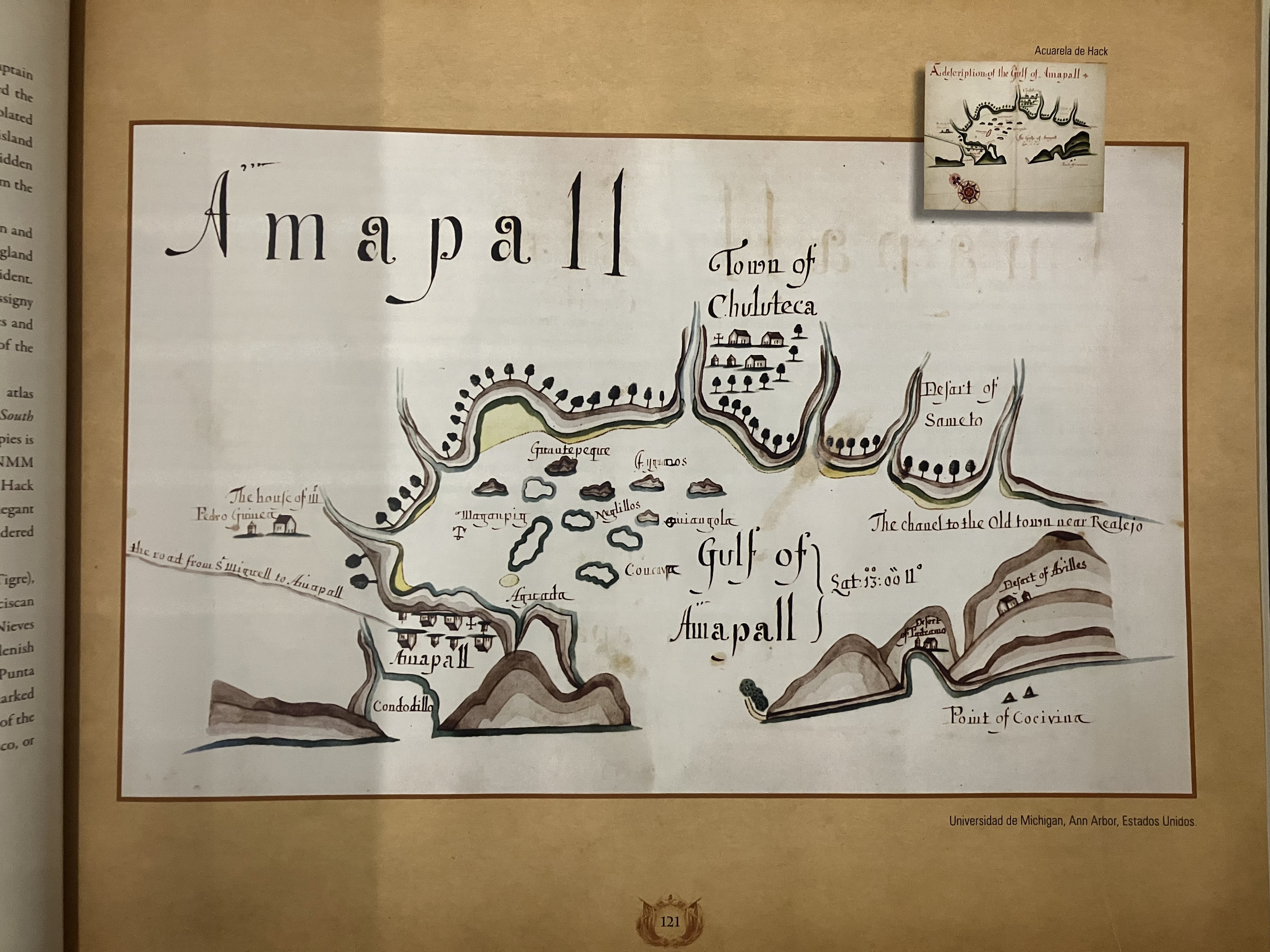
![Numero 6⁰. Plano que de muestra la porcion de costades de la Punta de Marabiq[u]e [sic] por la parte del oeste, has[t]as la detirbes por el leste, puertos, cauos yslas &c](https://dnet8ble6lm7w.cloudfront.net/maps/HON/HON0020.jpg)