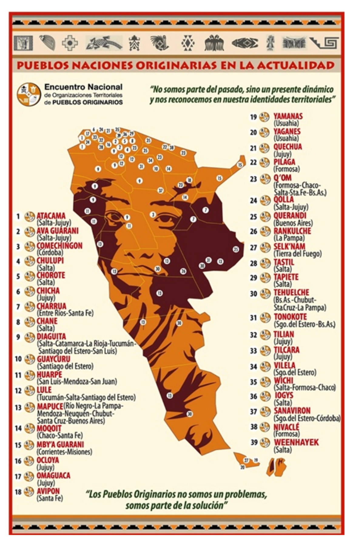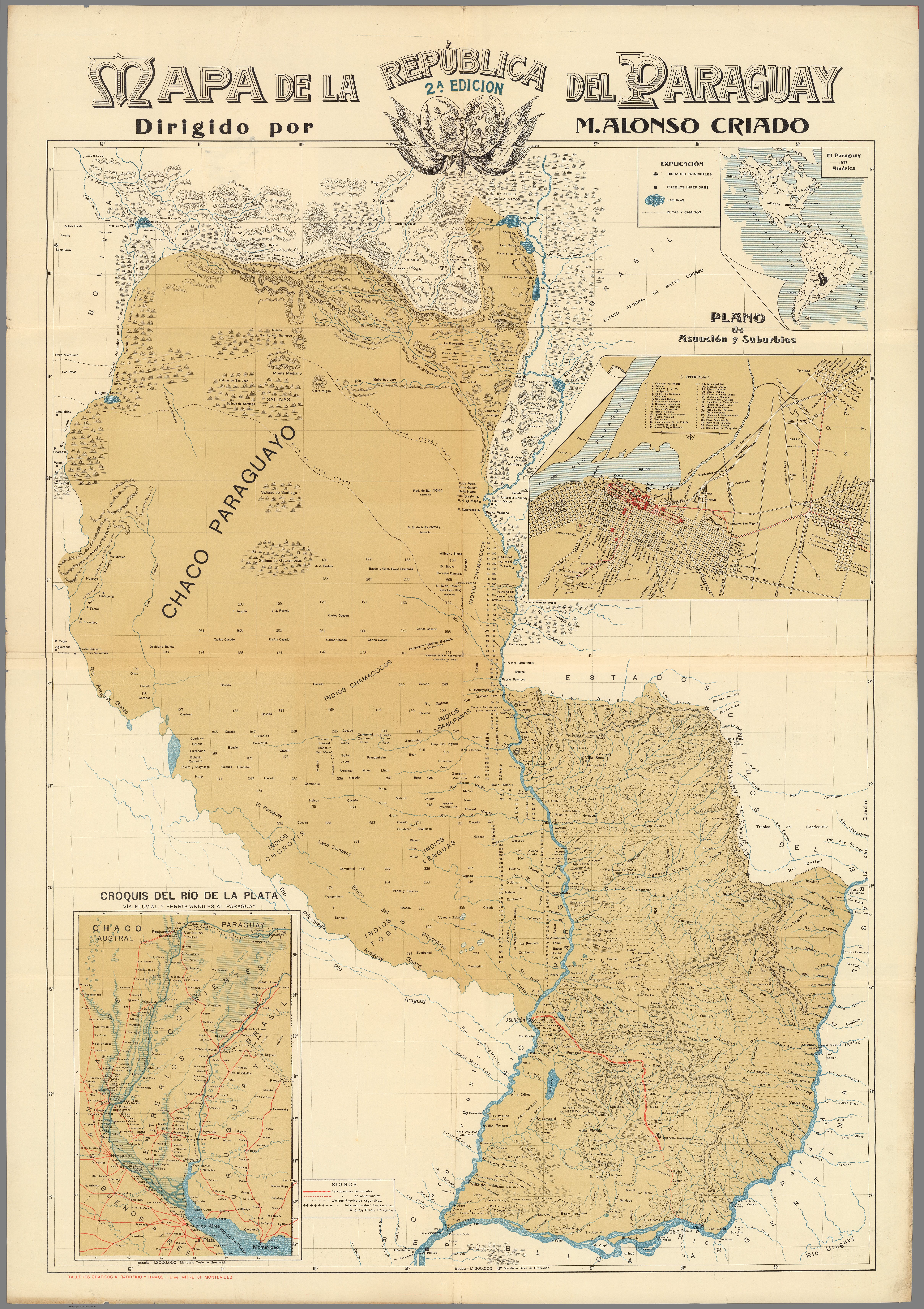
Pueblos- CHAMACOCOS
- SANAPANA
- LENGUA
- CHOROTE
- TOBA
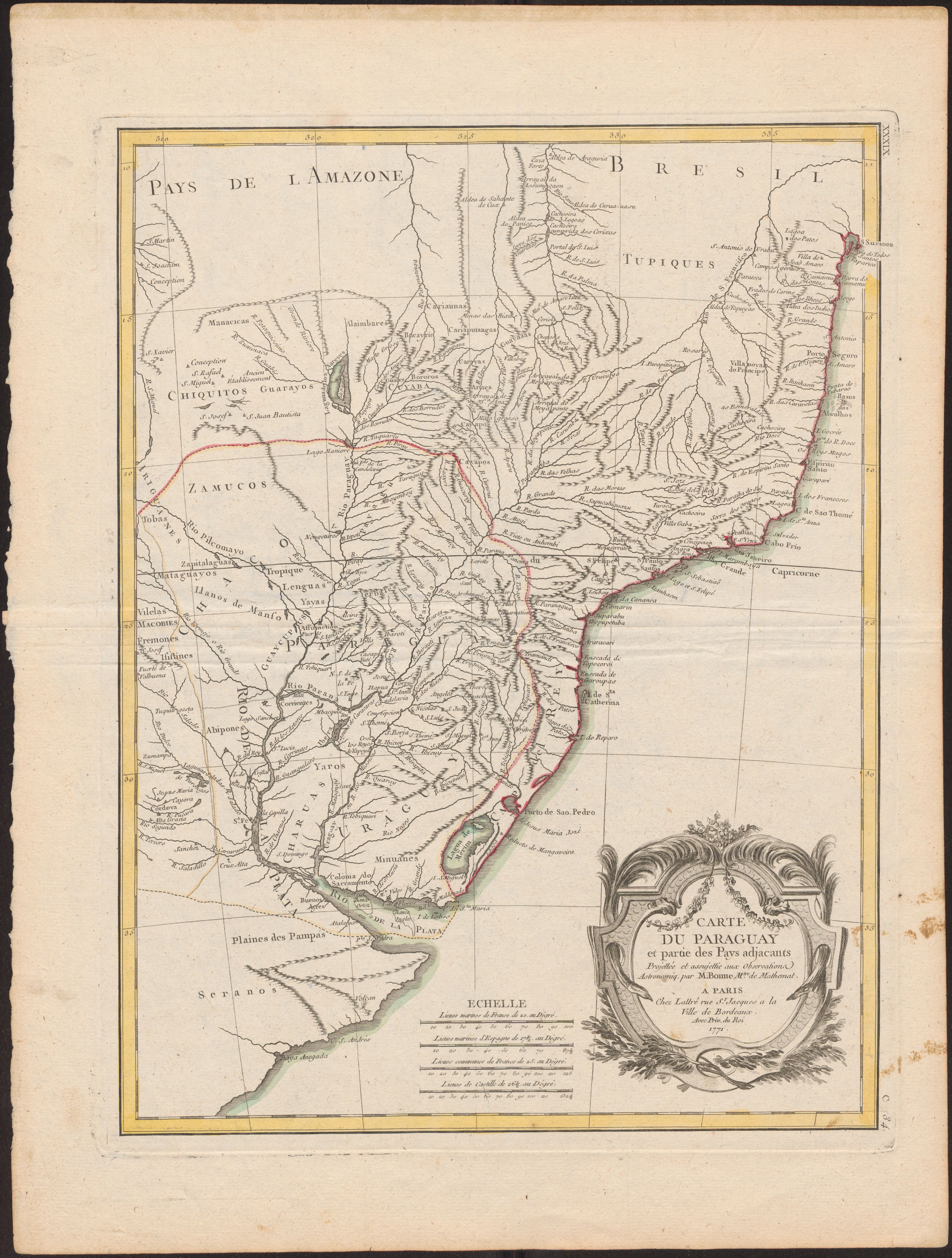
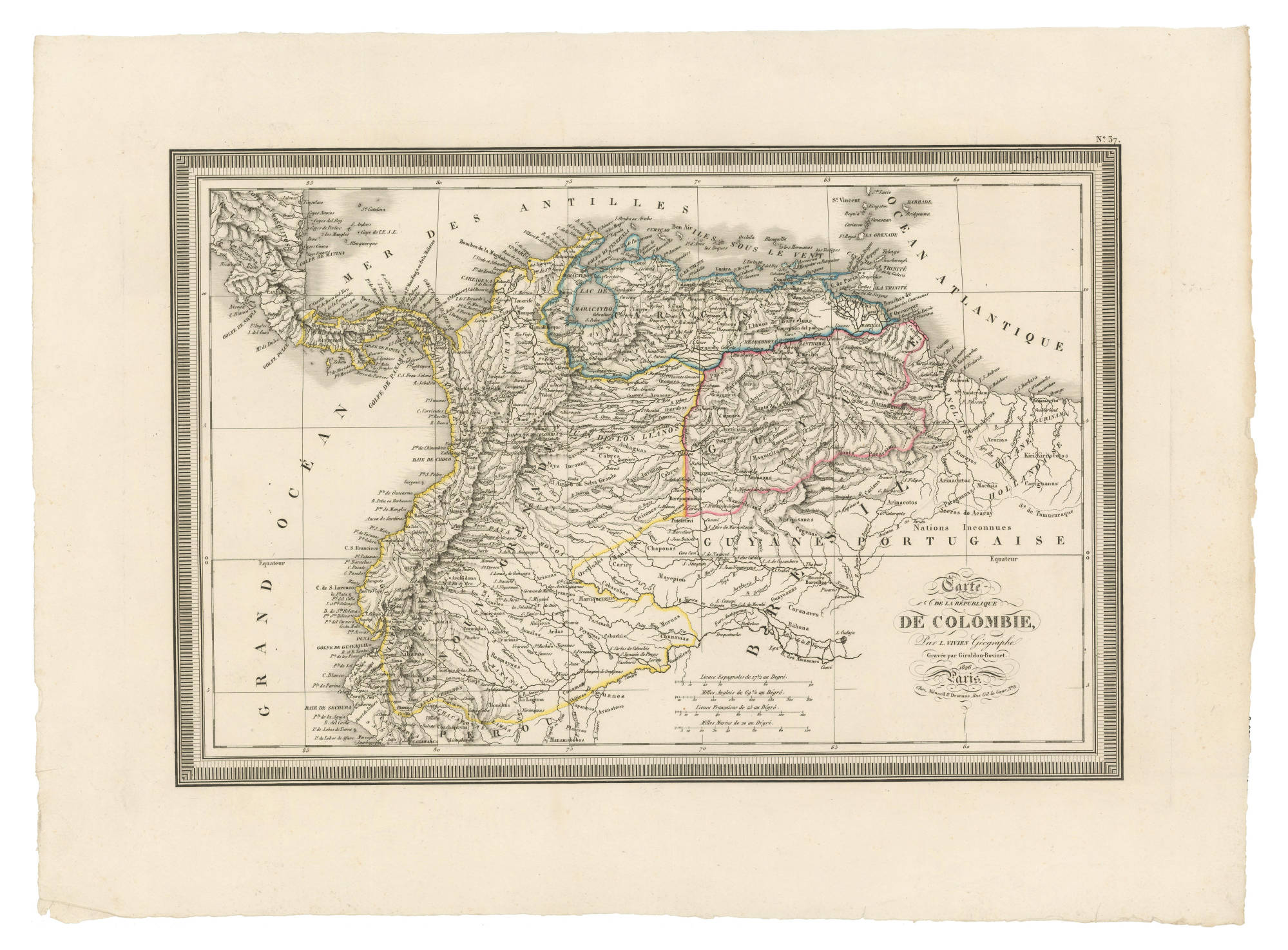
CitasCriado, Alonso M. Mapa de la Republica del Paraguay. Map. Montevideo: Talleres
Graficos A. Barreiro y Ramos, 1908. Accessed April 20, 2023. https://www.davidrumsey.com/luna/servlet/detail/RUMSEY~8~1~292074~90063927:Mapa-de-la-Republica-del-Paraguay?sort=pub_list_no_initialsort%2Cpub_date%2Cpub_list_no%2Cseries_no#.
Criado, Alonso M. Mapa de la Republica del Paraguay. Map. Montevideo: Talleres Graficos A. Barreiro y Ramos, 1908. Accessed April 20, 2023. https://www.davidrumsey.com/luna/servlet/detail/RUMSEY~8~1~292074~90063927:Mapa-de-la-Republica-del-Paraguay?sort=pub_list_no_initialsort%2Cpub_date%2Cpub_list_no%2Cseries_no#.