Cita
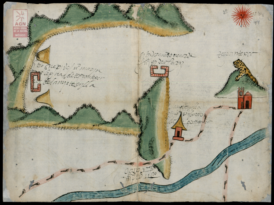
Mystequilla y Tegoantepec. Oaxaca, 1573. AGN, Tierras, vol. 3343, exp. 4, ff. 43v. y 44 http://bdmx.mx/documento/galeria/mapas-indigenas-novohispanos-agn/fo_06
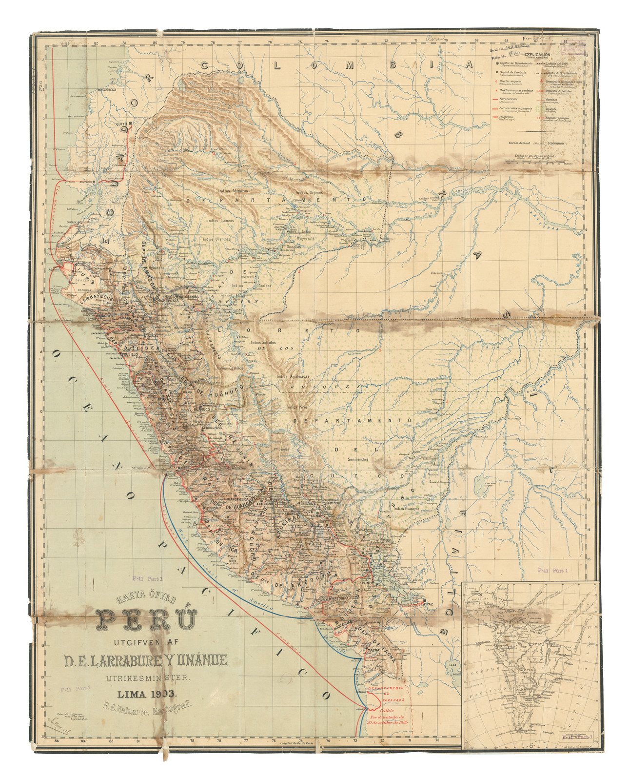
Karte Ofver Peru Utgifven D.E. Larrabure y Unnanue Utrikesminister
Mapa 1903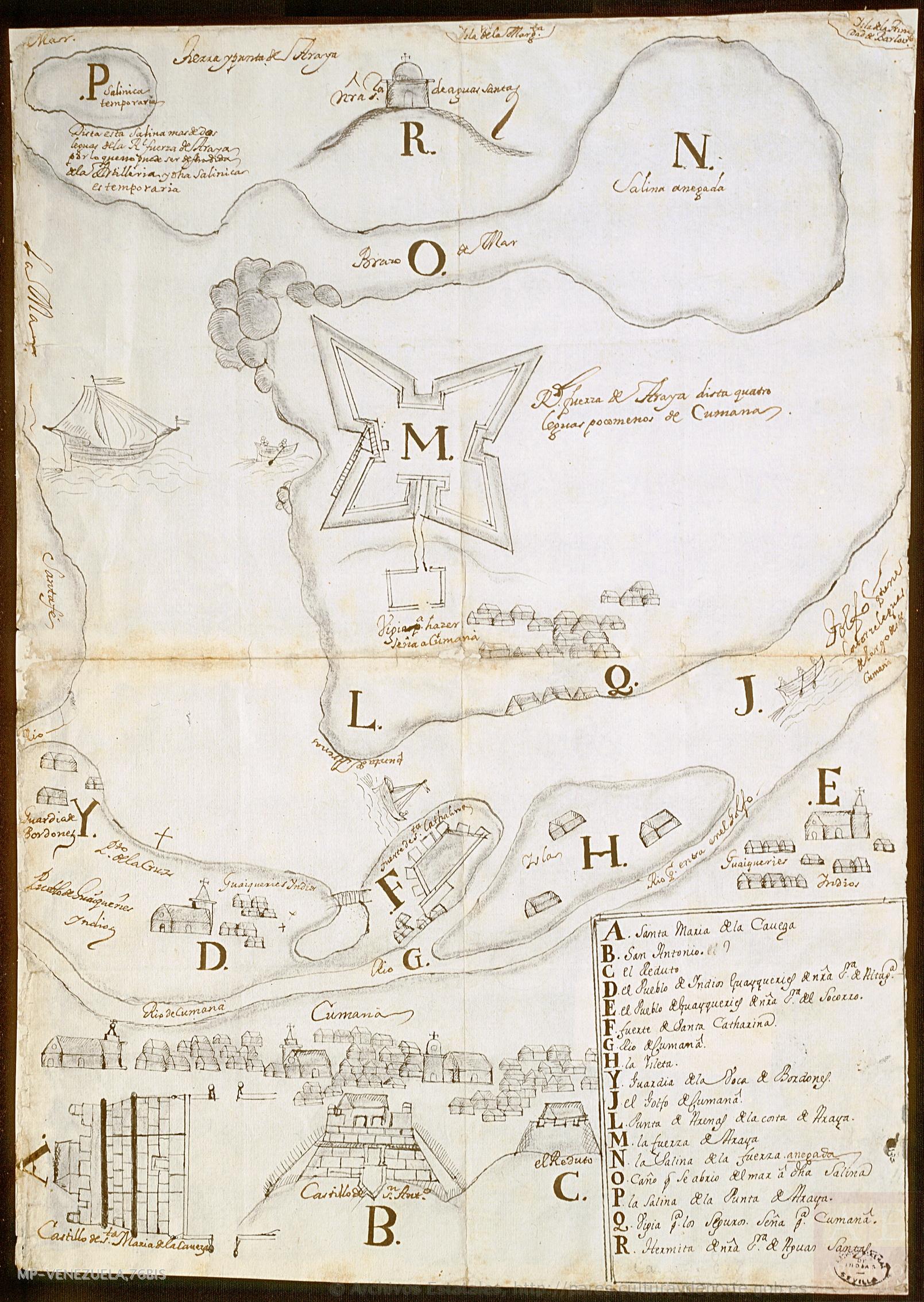
No Title
Mapa 1725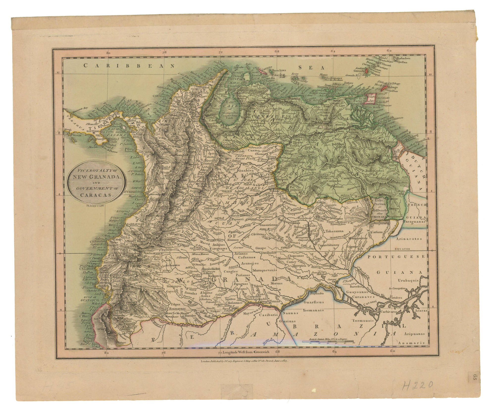
VICEROYALTY OF NEW GRANADA AND GOVERNMENT OF CARACAS
Mapa 1813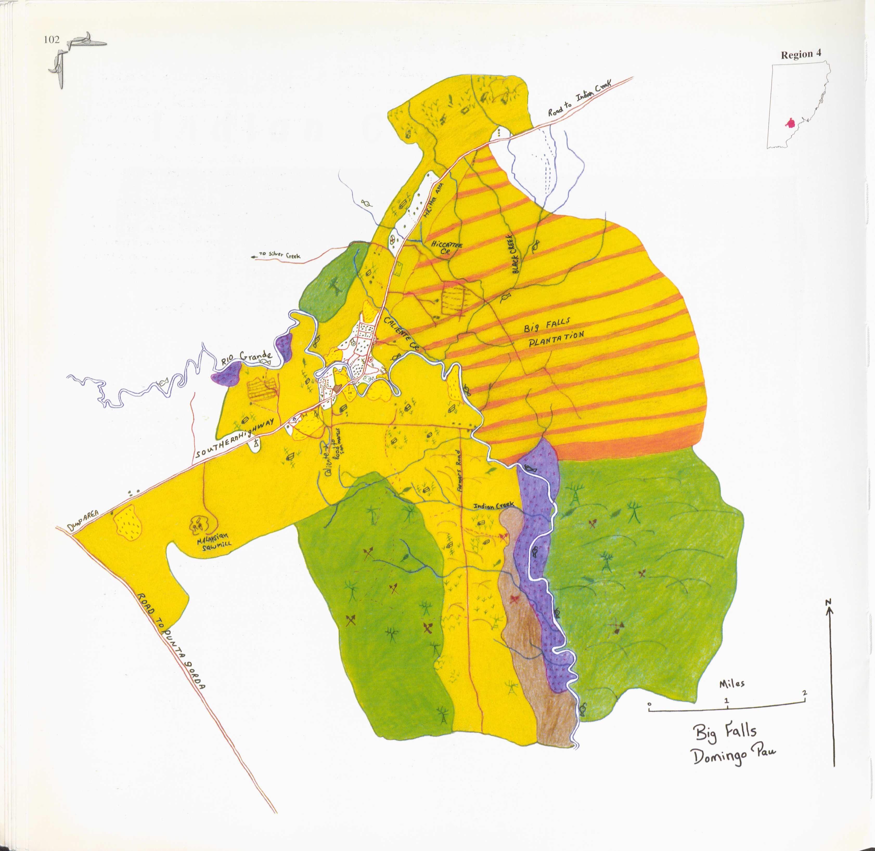
Big Falls
Mapa 1997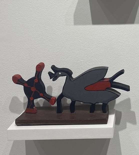
El diablo del dengue
Obra de Arte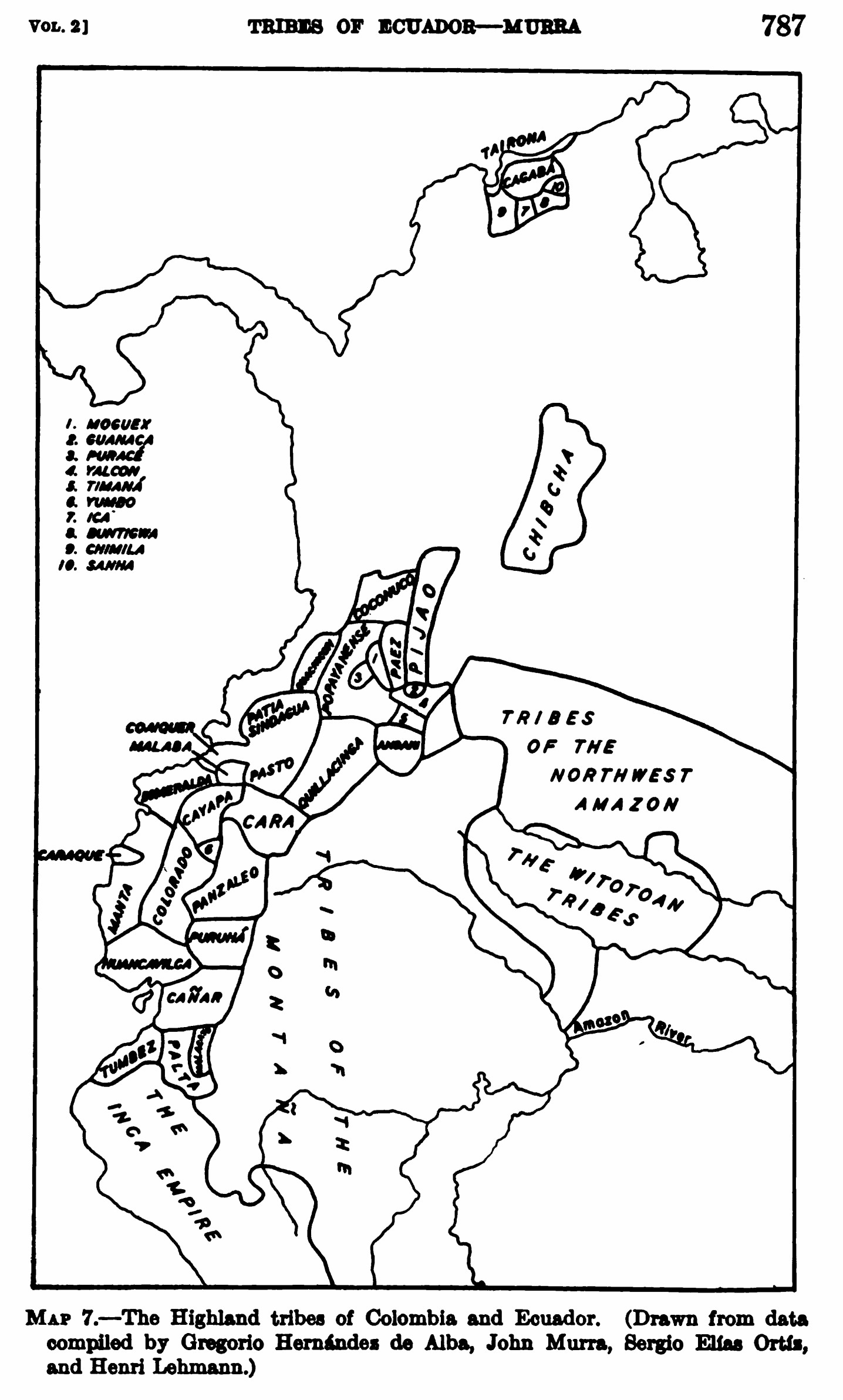
MAP 7.—The Highland tribes of Colombia and Ecuador. (Drawn from data compiled by Gregorio Hernández de Alba;John Murra;Sergio Elías Ortíz;and Henri Lehmann.)
Mapa 1400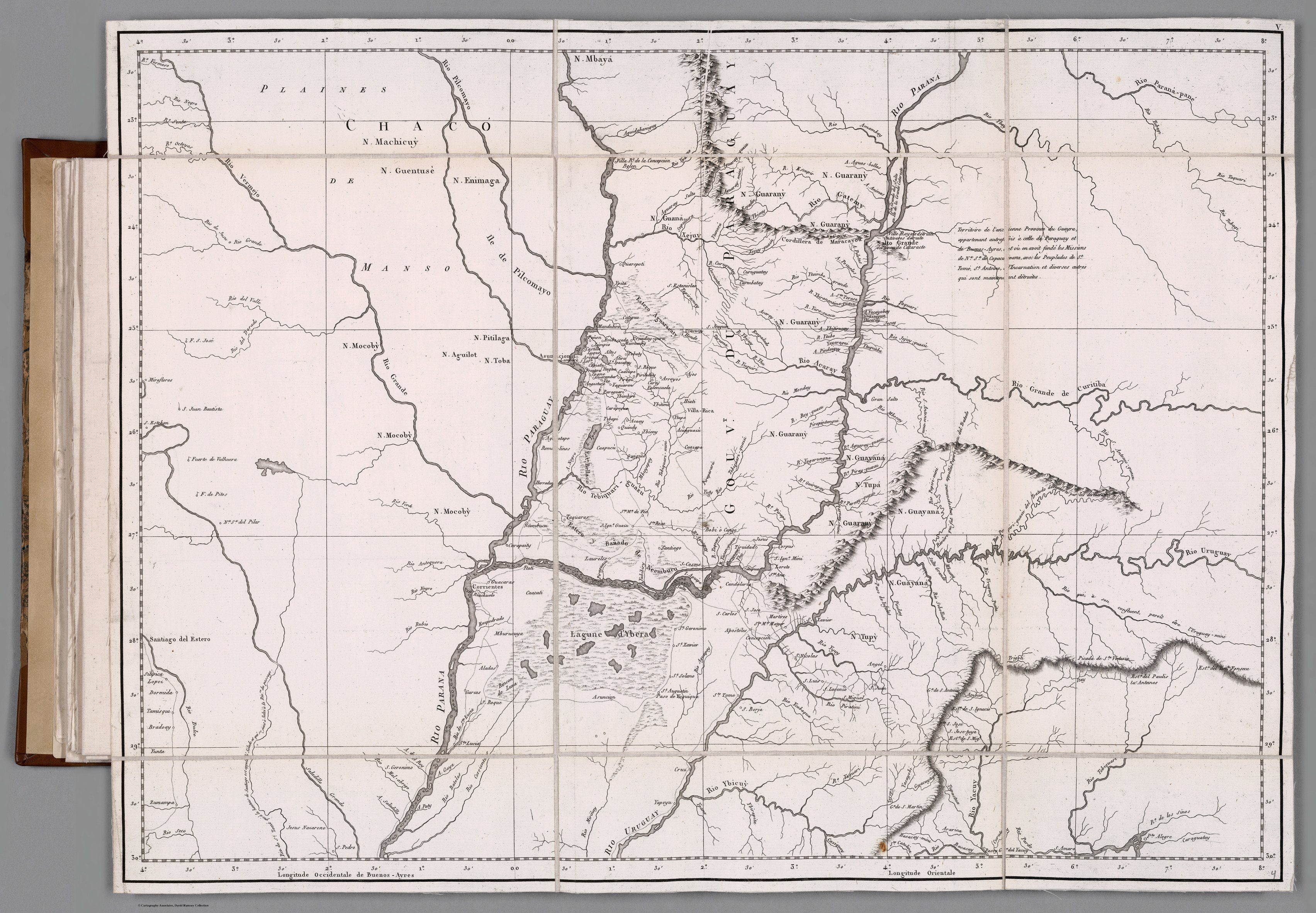
GOUVERNEMENT DU PARAGUAY ET PARTIE DU CHACO
Mapa 1781![Dibujo de las tierras de los padres regulares espulsos y litixio con los indios, Pulares, Palogastas y Cachis. 1782-1783 [1790]](https://dnet8ble6lm7w.cloudfront.net/maps/ARG/ARG0092.jpeg)
Dibujo de las tierras de los padres regulares espulsos y litixio con los indios, Pulares, Palogastas y Cachis. 1782-1783 [1790]
Mapa 1782