
Cita
Comisión Nacional para el Desarrollo de los Pueblos Indígenas. Regiones indígenas de México. Publication no. 330.972. 2006. https://www.gob.mx/cms/uploads/attachment/file/35735/cdi-regiones-indigenas-mexico.pdf.
The tribes of southern South America, at the first European contact period
Mapa 1600 - 1799
The Marañon or Amazon River with the Mission of the Society of Jesus
Mapa 1686 - 1707
Plano general de las montañas orientales del Reino del Peru
Mapa 1795
An exact draught of the river of Bellese as high as the Barcadares. A new draught of the bay of Honduras by Capt. Nathaniel Uring
Mapa 1726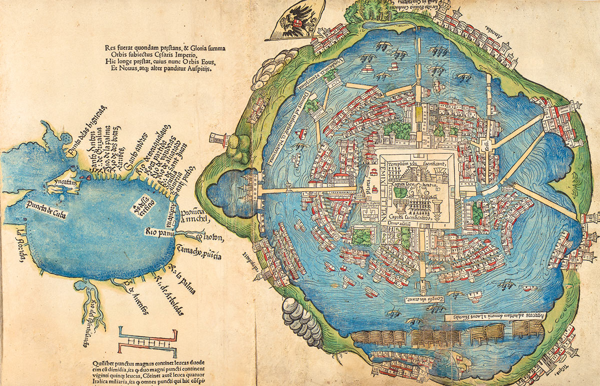
Nuremberg Map of Tenochititlan and the Gulf Coast, 1524
Mapa 1524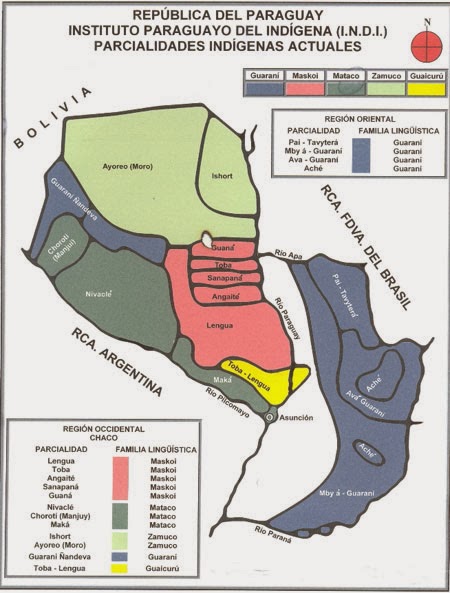
REPÚBLICA DEL PARAGUAY INSTITUTO PARAGUAYO DEL INDÍGENA (I.N.D.I.) PARCIALIDADES INDÍGENAS ACTUALES
Mapa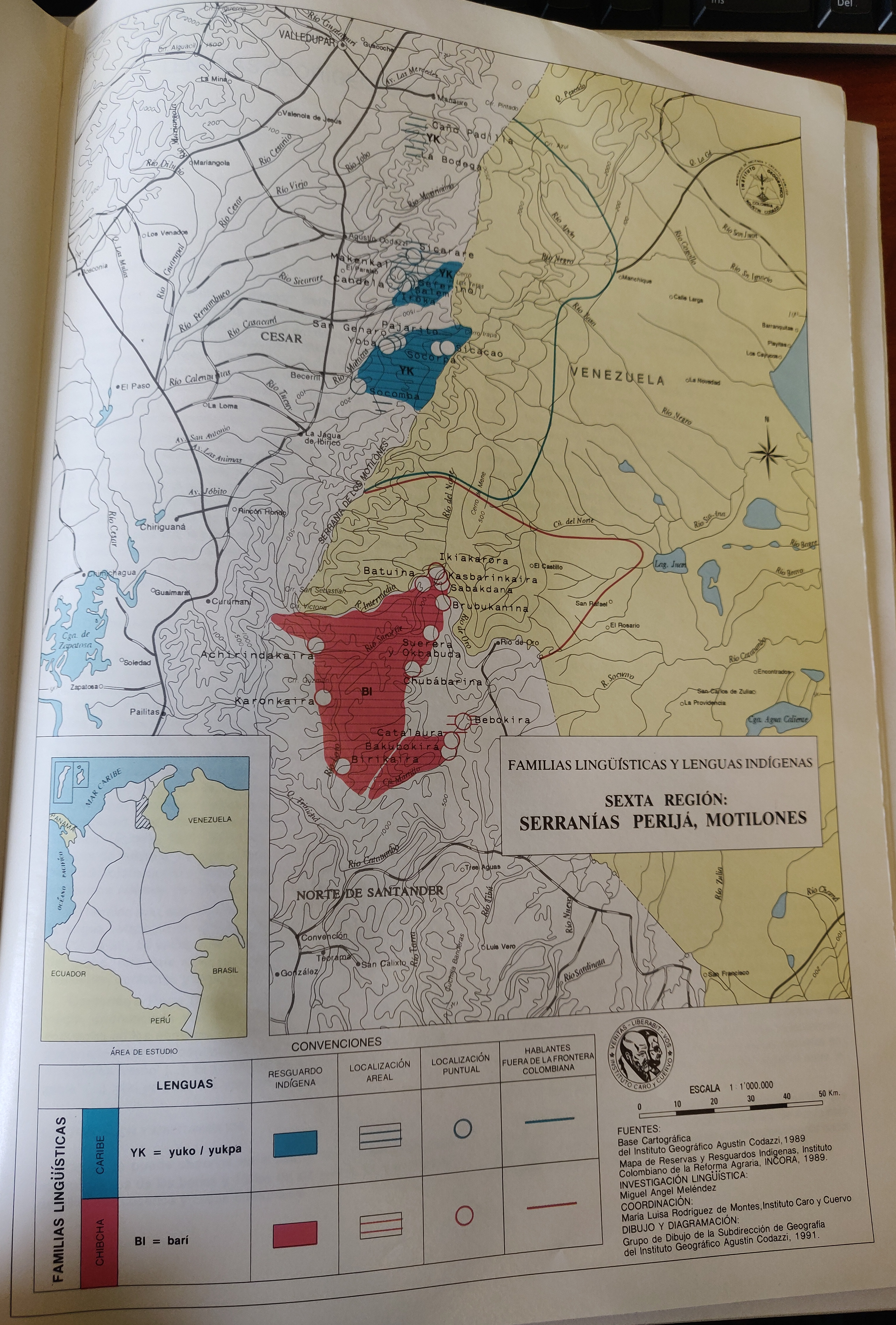
FAMILIAS LINGUÍSTICAS Y LENGUAS INDÍGENAS. SEXTA REGION: SERRANÍAS PERIJA, MOTILONES
Mapa 1989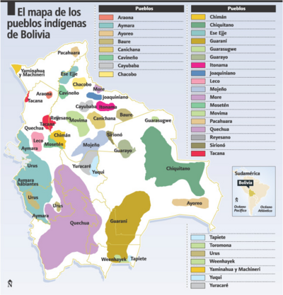
El mapa de los pueblos indígenas de Bolivia
Mapa 2007