
Pueblos
- AMUZGO
- MIXTECO
- NAHUA
- TLAPANECO
Cita
Instituto Nacional de los Pueblos Indígenas. "Distribución por Entidad Federativa." Atlas de los pueblos indígenas de México. http://atlas.inpi.gob.mx/distribucion-por-entidad-federativa/.
![[O ateliê], sem data [El taller, sin fecha]](https://dnet8ble6lm7w.cloudfront.net/art_sm/ABRA021.png)
[O ateliê], sem data [El taller, sin fecha]
Obra de Arte
PUEBLO PAME
Mapa 2020
Colombia Prima or South America drawn from the large map in eight sheets by Louis Stanislas D'Arcy Delarochette
Mapa 1811
Carte DE LA RÉPUBLIQUE DE COLOMBIE;Par. L. VIVEN Géographe
Mapa 1826
Terra Indígena Vale do Javarí
Mapa 2000 - 2099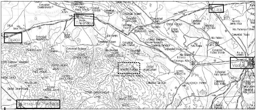
‘INDIAN ROYAL TOWNS’ (REDUCCIONES) AND SACRED SPACES UNDER SPANISH COLONIAL RULE IN THE TERRITORY OF THE PRE-COLONIAL AYMARA POLITY OF THE PAKAXA IN THE LATE 16TH CENTURY
Mapa 1570 - 1650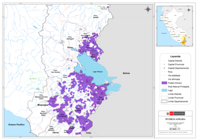
PUEBLO AIMARA
Mapa 2021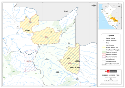
PUEBLO MASHCO PIRO
Mapa 2021