Cita
Tanck de Estrada, Dorothy. Atlas Ilustrado de los Pueblos de Indios: Nueva España, 1800. México: El Colegio de México, 2005. N/A - NO DIGITAL ACCESS

Detail from the 1770 copy of Francisco Álvarez Barreiro’s 1728 map of northern New Spain illustrating Spanish mapping of Indian domains in southern Texas and along the Gulf Coast, especially through the repetition of labels: “tierra de los Pampopas,” “tierra de los Carrizos,” “tierra de los Cujanes,” etc.
Mapa 1728
Subdelegaciones de la Nueva España en 1800
Mapa 1800
Partie de la coste de la Guyane depuis la Rivière de Mahury jusqu'à celle de Macouria ou se trouve comprise la Rade de Cayenne
Mapa 1765
Carta/del/Estado/de Guatemala/en Centro-Americ
Mapa 1832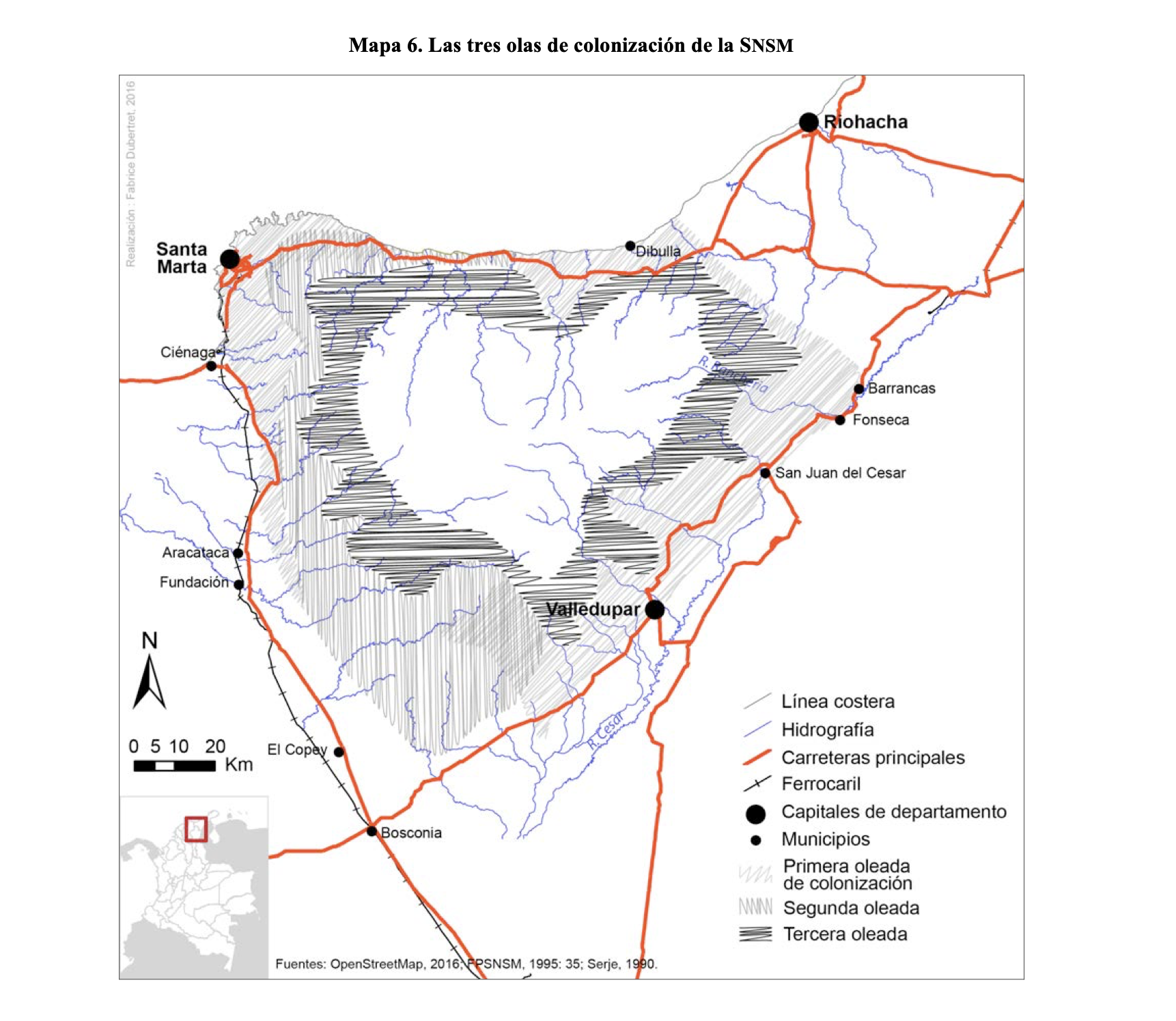
LAS TRES OLAS DE COLONIZACION DE LA SNSM
Mapa 1900 - 1999
"Territorio Indígena Kekoldi (Bribri)"
Mapa 2010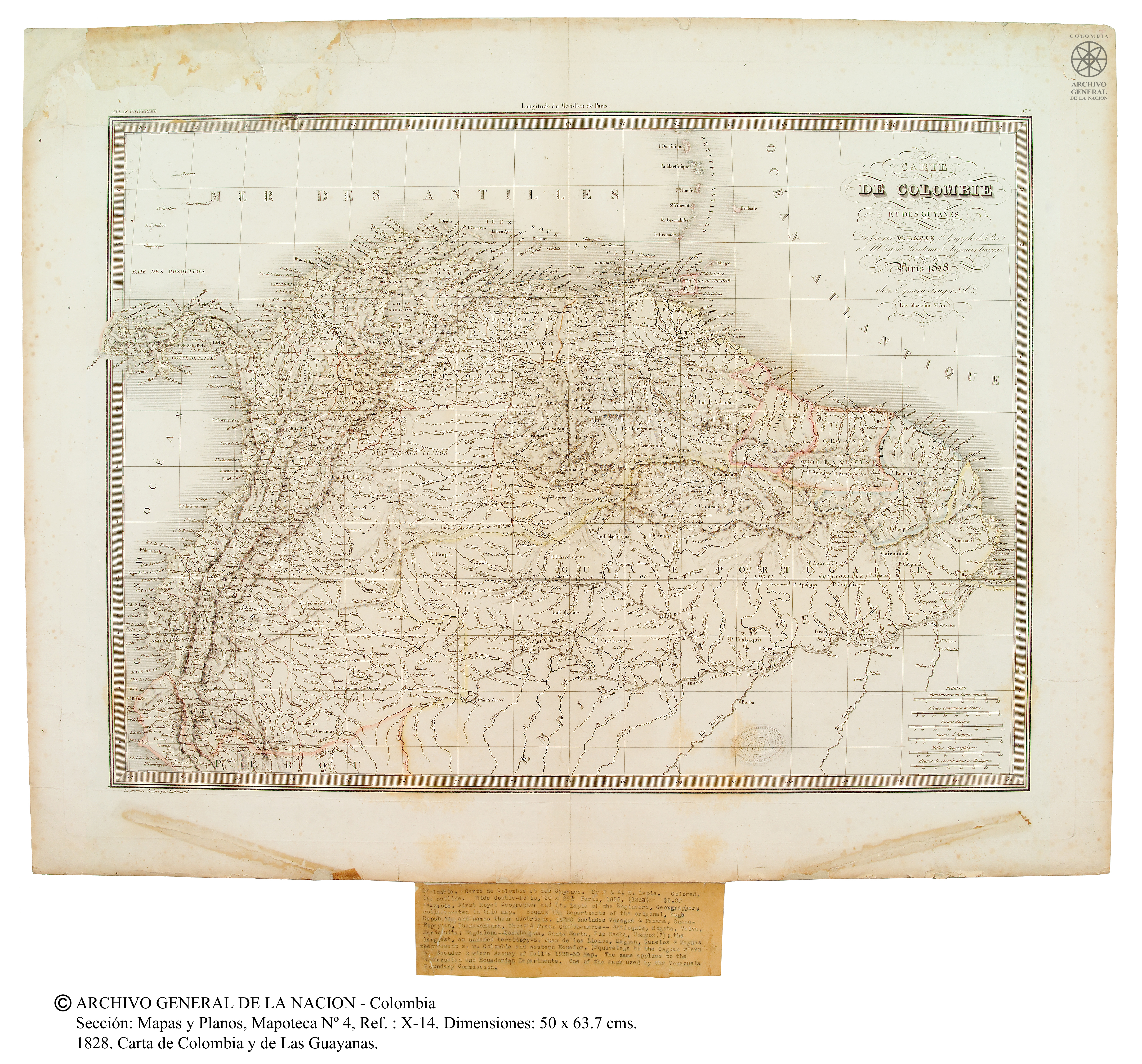
Carte de Colombie et des Guyanes
Mapa 1800 - 1899
Noa Night
Obra de Arte