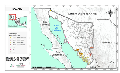
Dispossesions in the Americas

Dispossesions in the Americas

  • Inicio
  • Explorar
  • Autores
  • Sobre
  • Arte
  • Cuerpos
  • Planes de Estudio
  • Herencia Cultural
  • Mapas
  • Territorios
Volver a Explorar

Leyendo en Inglés

Mapa 1810

A New Map of Mexico and Adjacent Provinces Compiled From Original Documents

  • AARON ARROWSMITH

Publicado: 1810

  • Descargar Imágen
  • Descargar Imágen
Mapa 1810

A New Map of Mexico and Adjacent Provinces Compiled From Original Documents

  • AARON ARROWSMITH

Publicado: 1810

  • Descargar Imágen

Pueblos

  • PIMA BAJO
  • PAPAGO
  • CUCAPA
  • CAJUENCHE
  • JUMAS
  • COCOMARICOPA
  • APACHES TONTOS
  • SERIS
  • TARAHUMARA

Citas

Arrowsmith, Aaron. A Map of Mexico and Adjacent Provinces Compiled from Original Documents. Map. London: A Arrowsmith, 1810. http://pares.mcu.es/ParesBusquedas20/catalogo/show/21443?nm.

  • Descargar Imágen

Artículos Relacionados

Fig. 1 Map of the Guianas with schematic locations of the
indigenous groups relevant to our study, based on the linguistic
map of South America (http://www.muturzikin.com/cartesamerique/
7.htm). Carib-speaking groups are indicated in yellow, Arawak-speaking
groups in blue, Tupi-speaking Wayãpi in pink and the Warao-speaking
group in green

Fig. 1 Map of the Guianas with schematic locations of the indigenous groups relevant to our study, based on the linguistic map of South America (http://www.muturzikin.com/cartesamerique/ 7.htm). Carib-speaking groups are indicated in yellow, Arawak-speaking groups in blue, Tupi-speaking Wayãpi in pink and the Warao-speaking group in green

Mapa 2000 - 2024
Chili

Chili

Mapa 1663
Specialkarte von A. v. HUMBOLDT’S REISEN in VENEZUELA und am ORINOKO-STROM

Specialkarte von A. v. HUMBOLDT’S REISEN in VENEZUELA und am ORINOKO-STROM

Mapa 1799 - 1800
MAPA DE OZTOTÍCPAC

MAPA DE OZTOTÍCPAC

Mapa 1500 - 1599
PUEBLO ASHENINKA

PUEBLO ASHENINKA

Mapa 2021
PUEBLO YINE

PUEBLO YINE

Mapa 2021
REGIÓN MONTANA DE GUERRERO

REGIÓN MONTANA DE GUERRERO

Mapa 2000
Territorio ancestral y territorio agrario 2015

Territorio ancestral y territorio agrario 2015

Mapa 2015

Despojos en las Américas

Un Proyecto de

University of Pennsylvania

Copyright 2024

Con el apoyo de

Mellon Foundation

Diseño y Desarrollo del Sitio

Element 84

Créditos Artísticos

Arrowsmith, Aaron. A Map of Mexico and Adjacent Provinces Compiled from Original Documents. Map. London: A Arrowsmith, 1810. http://pares.mcu.es/ParesBusquedas20/catalogo/show/21443?nm.

Páginas del Sitio

  • Inicio
  • Explorar
  • Autores
  • Sobre
  • Arte
  • Cuerpos
  • Planes de Estudio
  • Herencia Cultural
  • Mapas
  • Territorios