Cita
Gruzinski, Serge. Painting the Conquest: the Mexican Indians and the European Renaissance. Paris: Unesco-Flammarion, 1992. NO ONLINE ACCESS TO SOURCE
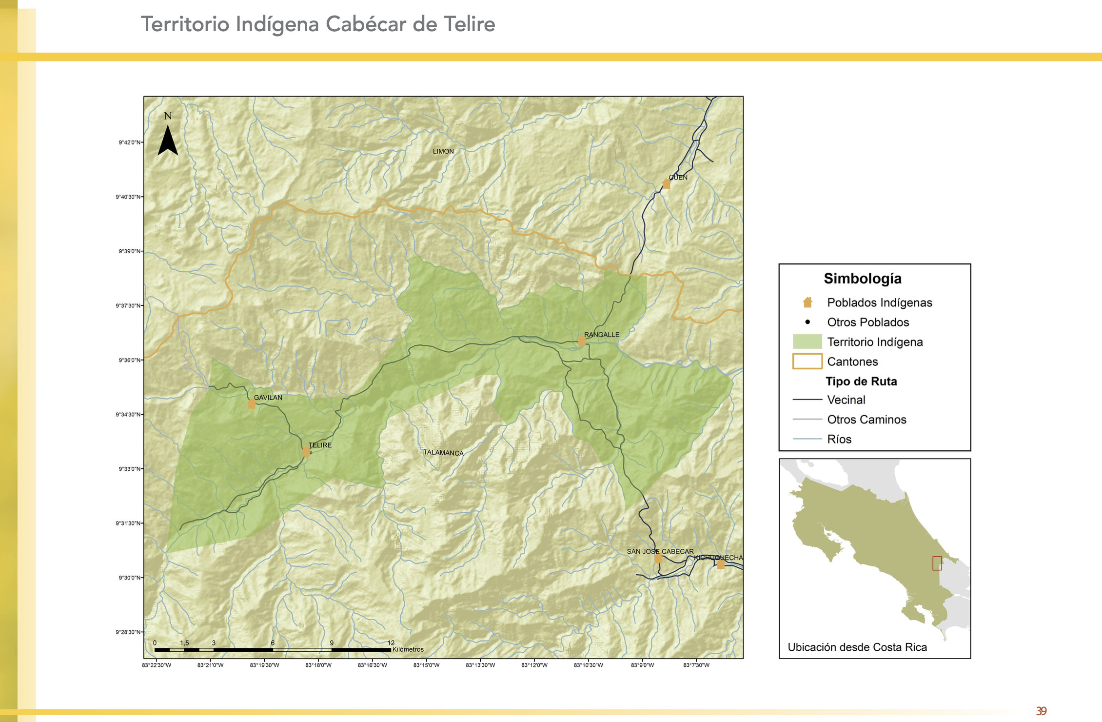
"Territorio Indígena Cabécar de Telire"
Mapa 2010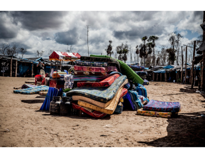
Serie Esclavas de la fiebre de oro
Obra de Arte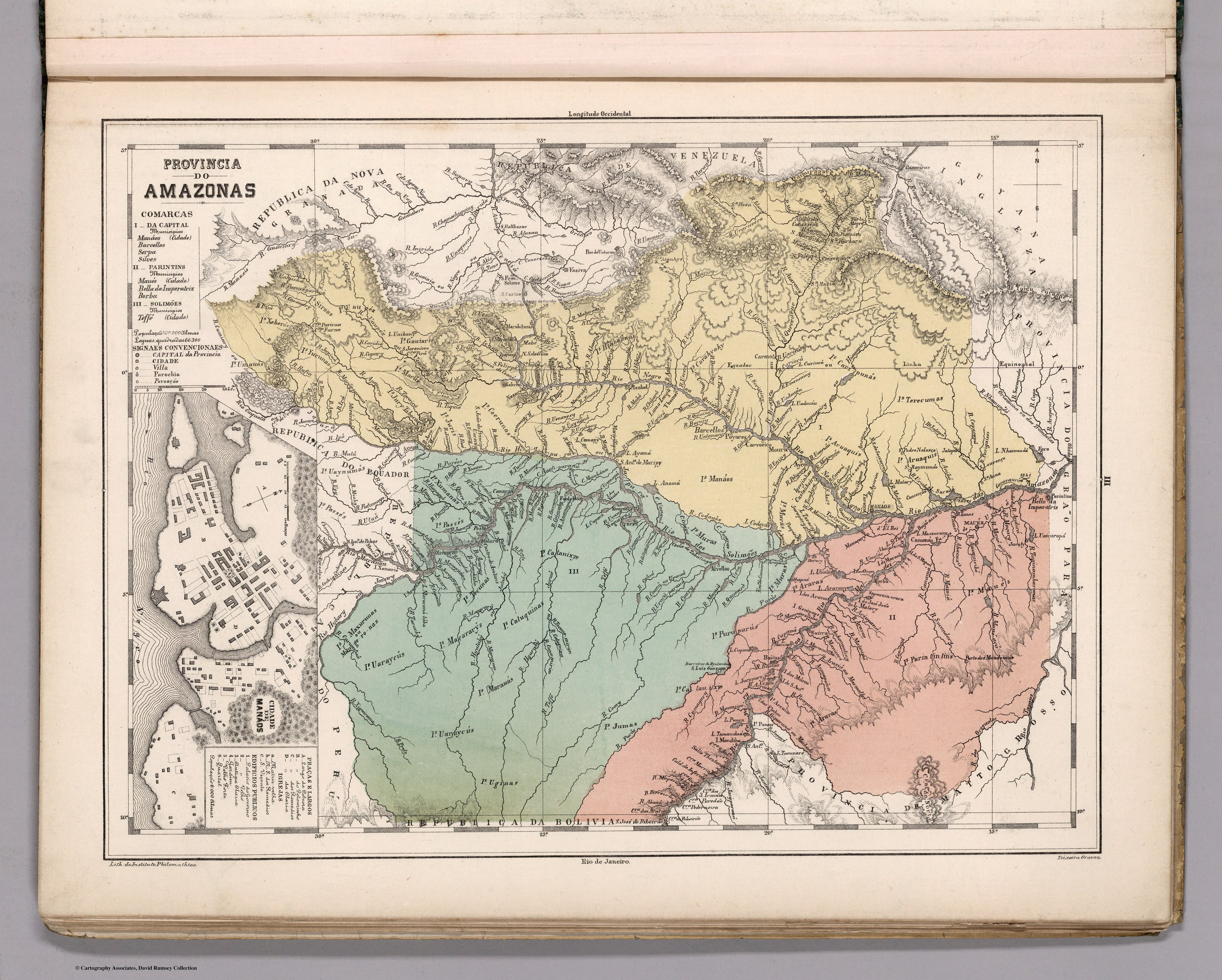
Provincia do AMAZONAS
Mapa 1800 - 1850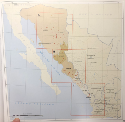
INTENDENCIA DE SONORA-SINOLOA
Mapa 1800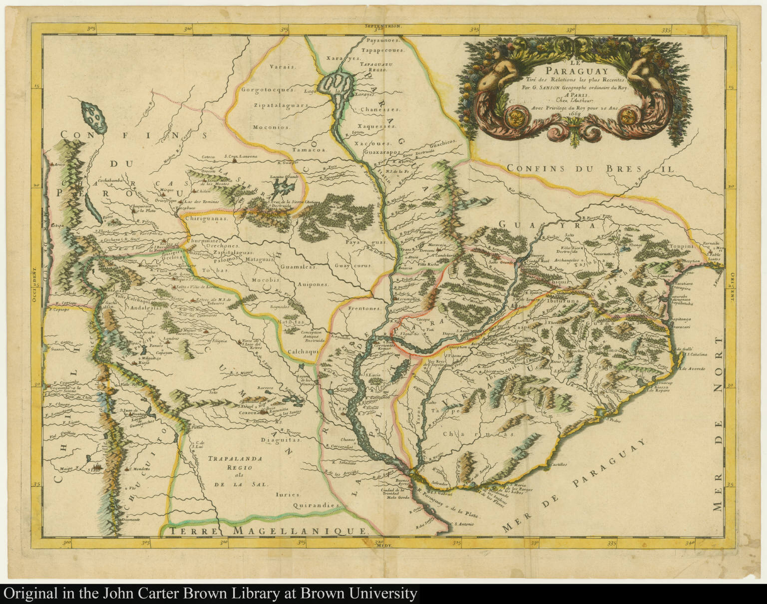
Le Paraguay Tiré des Relations les plus Recentes
Mapa 1668
The modern departments of Ahuachapán, La Libertad, Santa Ana, and Sonsonate (highlighted in red) now contain the highest concentration of Indigenous communities in El Salvador.
Mapa 2010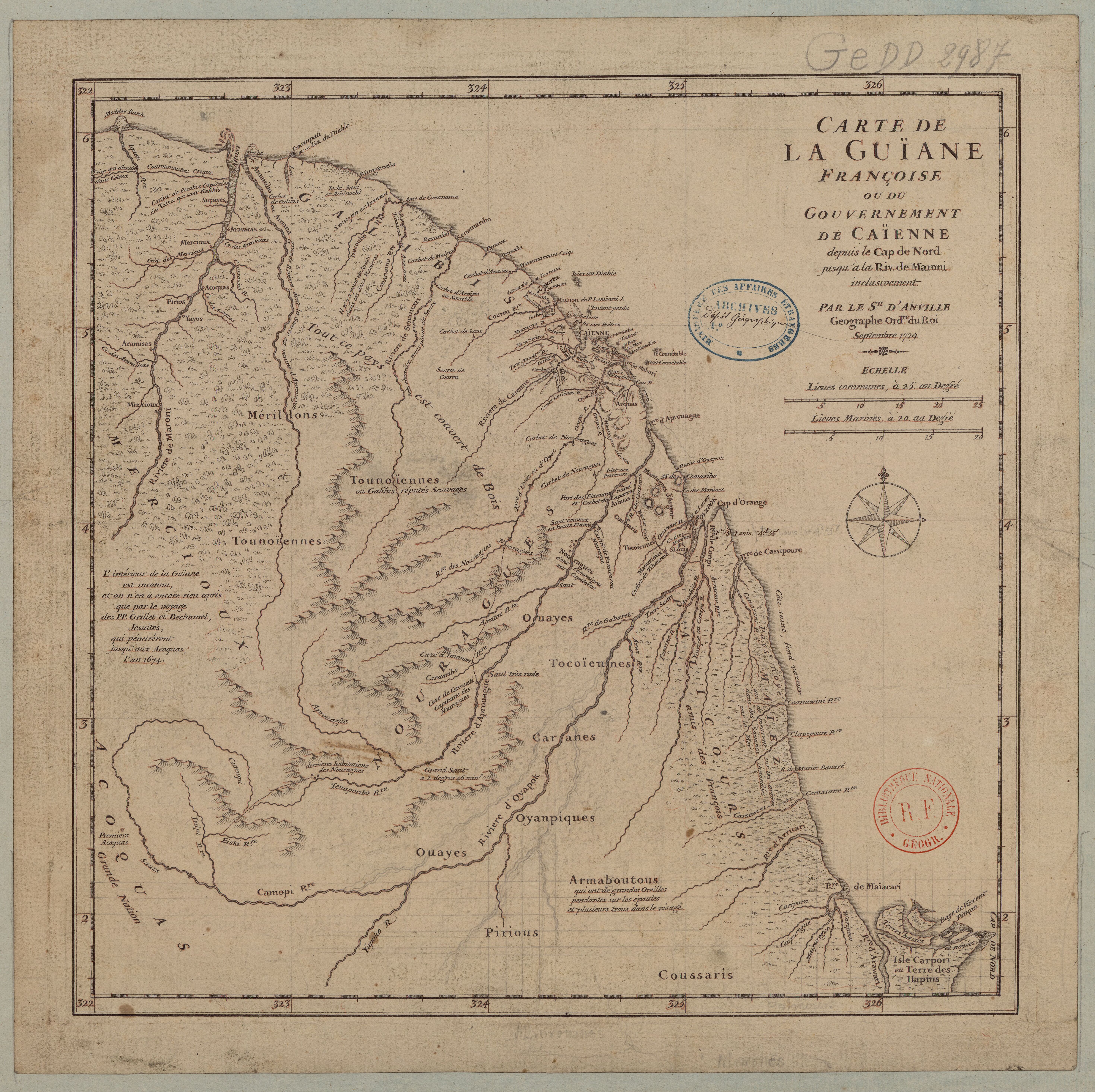
Carte de la Guïane françoise ou du gouvernement de Caïenne depuis le Cap de Nord jusqu'àla rivière de Maroni inclusivement.
Mapa 1729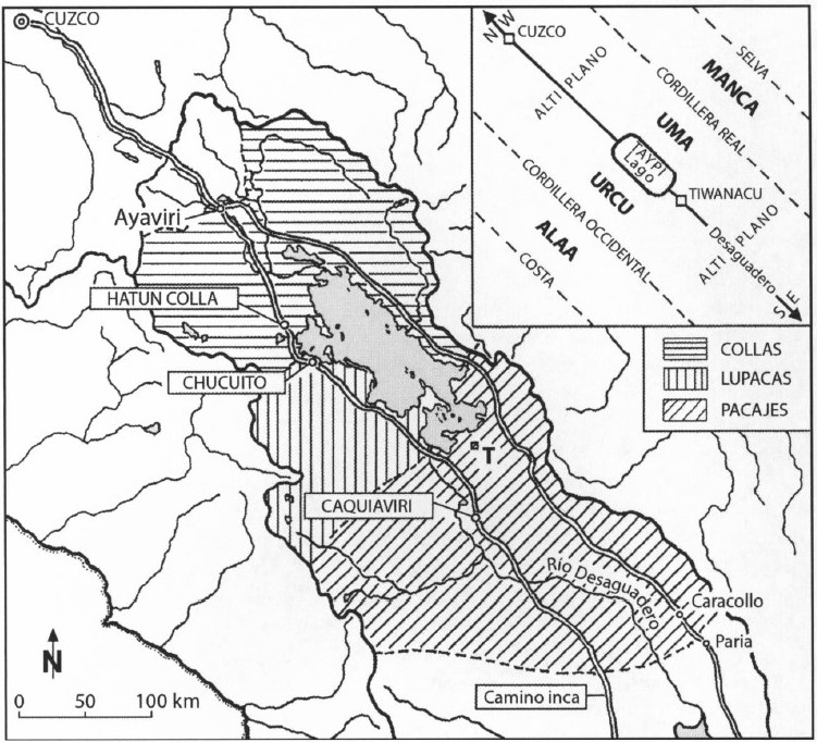
AYMARA POLITIES AROUND THE TITICACA LAKE IN THE 15TH AND 16TH CENTURIES
Mapa 1548 - 1610