Dispossesions in the Americas

Dispossesions in the Americas

  • Inicio
  • Explorar
  • Autores
  • Sobre
  • Arte
  • Cuerpos
  • Planes de Estudio
  • Herencia Cultural
  • Mapas
  • Territorios
Volver a Explorar

Leyendo en Inglés

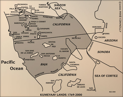
Mapa 1915

Tequistlatec and Tlapanec Areas, Mexico

  • DL OLMSTED

Publicado: 1915

  • Descargar Imágen
  • Descargar Imágen
Mapa 1915

Tequistlatec and Tlapanec Areas, Mexico

  • DL OLMSTED

Publicado: 1915

  • Descargar Imágen

Pueblos

  • TEXISTLATEC
  • TLAPANEC

Citas

Olmsted, D. L. "The Tequistlatec and Tlapanec." In Ethnology, edited by Robert Wauchope and Evon Z. Vogt, 553. Vols. 7-8 of Handbook of Middle American Indians. Austin: University of Texas Press, 1969. https://ebookcentral-proquest-com.proxy.library.upenn.edu/lib/upenn-ebooks/reader.action?docID=4826335&ppg=573.

  • Descargar Imágen

Artículos Relacionados

DESCRIPCIÓN GEOGRAPHICA E HIDORGRÁPHICA DEL GOVIERNO DE VENEZUELA I SUS PROVINCIAS

DESCRIPCIÓN GEOGRAPHICA E HIDORGRÁPHICA DEL GOVIERNO DE VENEZUELA I SUS PROVINCIAS

Mapa 1634
Presencia indígena en Argentina

Presencia indígena en Argentina

Mapa 2015
ANGAITÉ

ANGAITÉ

Mapa 2015
Mapa histórico-geográfico de Perú, Chile y Buenos Aires

Mapa histórico-geográfico de Perú, Chile y Buenos Aires

Mapa 1830
FRAGMENTO HUMBOLDT 2

FRAGMENTO HUMBOLDT 2

Mapa 1500 - 1599
Carte de la Guiane française dressée à Cayenne par ordre du Gouvernement, dans la construction de laquelle, employant tous les matériaux géographiques qui se troucent actuellement au dépôt des Cartes et Plans de la Colonie, après les avoir assujétis à plusieurs observations astronomiques.

Carte de la Guiane française dressée à Cayenne par ordre du Gouvernement, dans la construction de laquelle, employant tous les matériaux géographiques qui se troucent actuellement au dépôt des Cartes et Plans de la Colonie, après les avoir assujétis à plusieurs observations astronomiques.

Mapa 1782
Distribution of Nahuatl Population, Mexico

Distribution of Nahuatl Population, Mexico

Mapa 1969
The Spanish and Musketor shore and the bay of Honduras and the islands adjacent

The Spanish and Musketor shore and the bay of Honduras and the islands adjacent

Mapa 1735

Despojos en las Américas

Un Proyecto de

University of Pennsylvania

Copyright 2024

Con el apoyo de

Mellon Foundation

Diseño y Desarrollo del Sitio

Element 84

Créditos Artísticos

Olmsted, D. L. “The Tequistlatec and Tlapanec.” In Ethnology, edited by Robert Wauchope and Evon Z. Vogt, 553. Vols. 7-8 of Handbook of Middle American Indians. Austin: University of Texas Press, 1969. https://ebookcentral-proquest-com.proxy.library.upenn.edu/lib/upenn-ebooks/reader.action?docID=4826335&ppg=573.
Páginas del Sitio

  • Inicio
  • Explorar
  • Autores
  • Sobre
  • Arte
  • Cuerpos
  • Planes de Estudio
  • Herencia Cultural
  • Mapas
  • Territorios