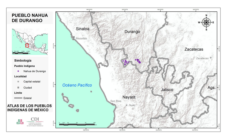
Pueblos
- MEXICANERO DE DURANGO
Cita
Instituto Nacional de los Pueblos Indígenas. "Mexicaneros de Durango – Ubicación." Atlas de los Pueblos Indígenas de México. http://atlas.inpi.gob.mx/mexicaneros-de-durango-ubicacion/.
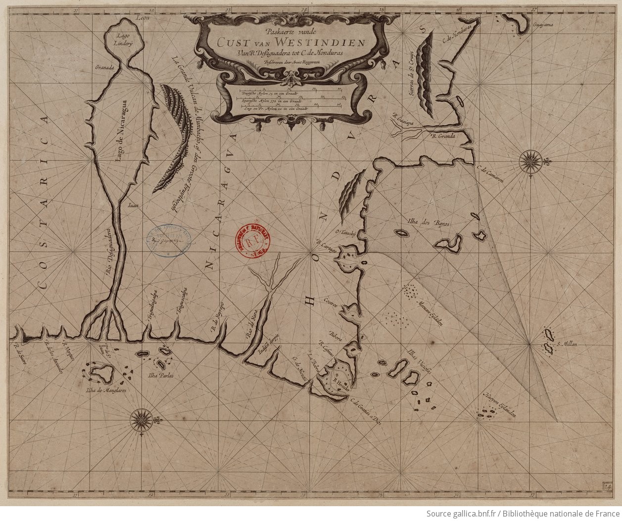
Paskaerte vande cust van Westindien van R. Desaguadera tot C. de Honduras / beschreven door Arent Roggeveen
Mapa 1675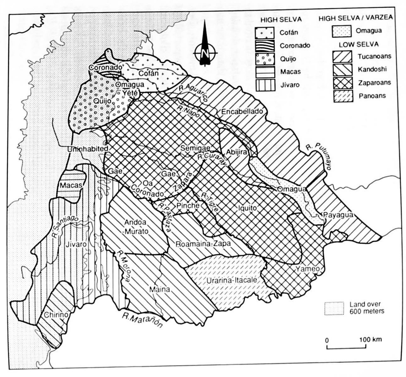
MAP 4. DISTRIBUTION OF ETHNIC GROUPS IN THE ORIENTE ON THE EVE OF SPANISH CONQUEST
Mapa 1535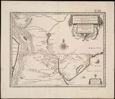
Paraguay;ó prov. de Rio de la Plata cum regionibus adiacentibus Tucuman et Sta. Cruz de la Sierra
Mapa 1600 - 1699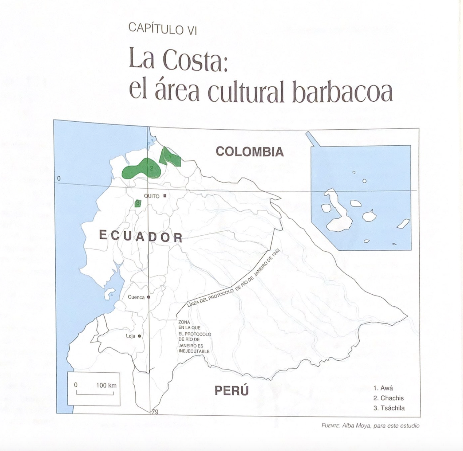
La Costa: el área cultural barbacoa.
Mapa 1997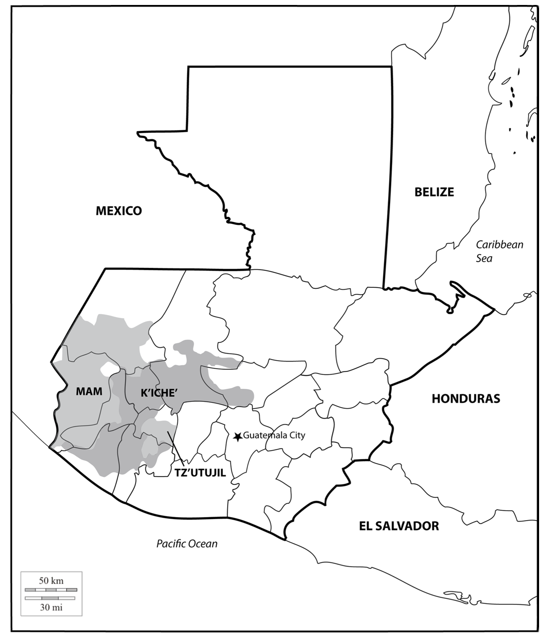
Location of three ethno-linguistic groups in the highlands of Guatemala in which joint InHerit-Riecken community-participant mapping took place. Adapted from http://d-maps. com/carte.php?num_car=1717&lang=en)
Mapa 2000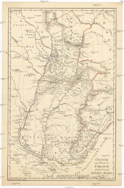
CHARTE eines Theils von PARAGUAY und der Provinz BUENOS-AYRES
Mapa 1809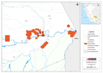
PUEBLO ESE EJA
Mapa 2021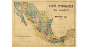
CARTA ETNOGRÁFICA DE MEXICO
Mapa 1864