
Cita
Burley, David V., Robyn P. Woodward, Shea Henry, and Ivor C. Conolley. "Jamaican Taíno Settlement Configuration at the Time of Christopher Columbus." Latin American Antiquity 28, no. 3 .2017. : 337-52. https://doi.org/10.1017/laq.2017.14.
Mapa histórico-geográfico de Perú, Chile y Buenos Aires
Mapa 1830
Carte du gouvernement de Cayenne avec le Nombre des habitations, le lieu ou elles sont situées et le nom de ceux a qui elles appartiennent
Mapa 1600 - 1699
PUEBLO POPOLOCA
Mapa 2020
Ishir (Chamacoco)
Mapa 2001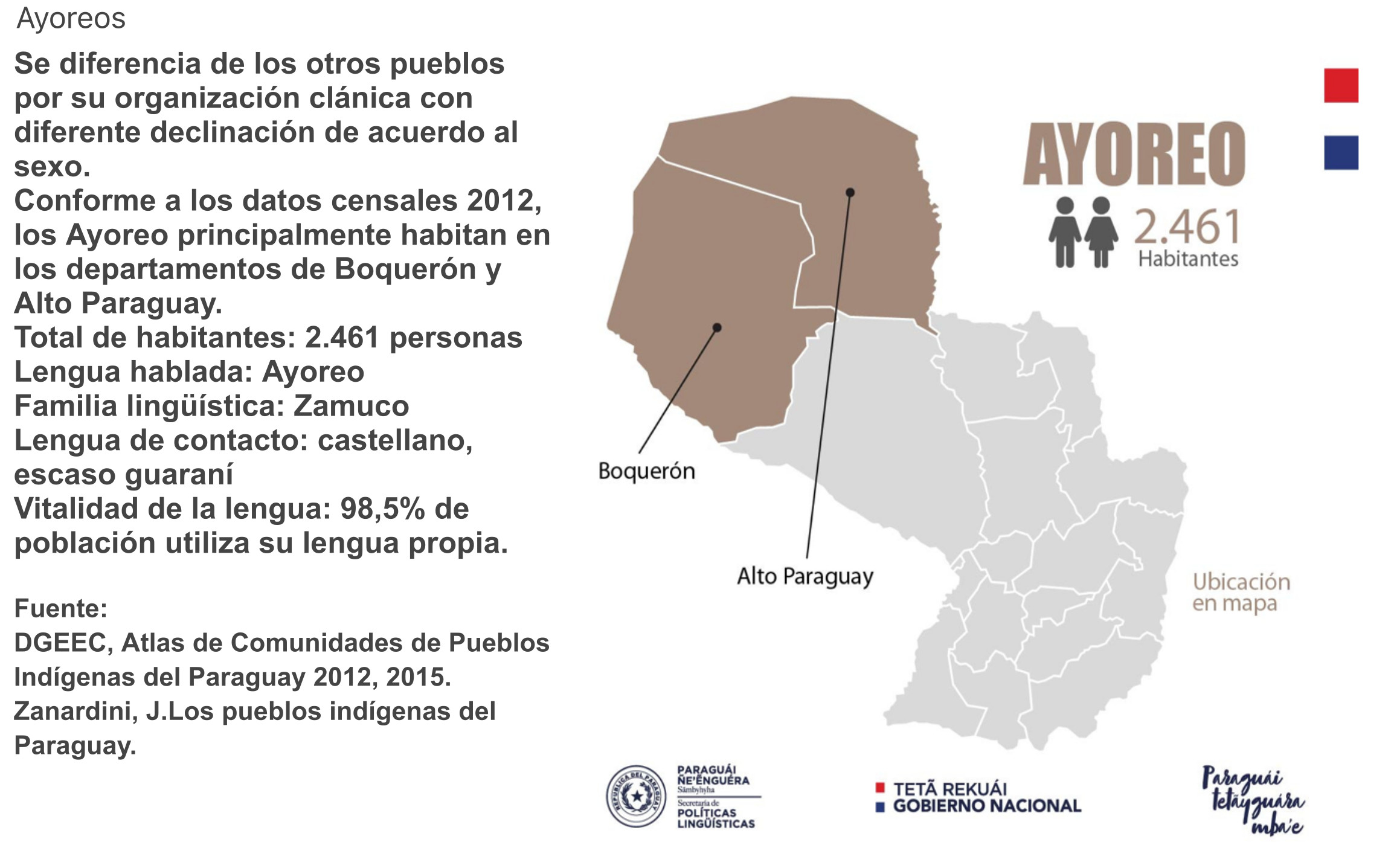
AYOREO
Mapa 2015![Paisagem de Brodowski [Paisaje de Brodowski]](https://dnet8ble6lm7w.cloudfront.net/art_sm/ABRA008.png)
Paisagem de Brodowski [Paisaje de Brodowski]
Obra de Arte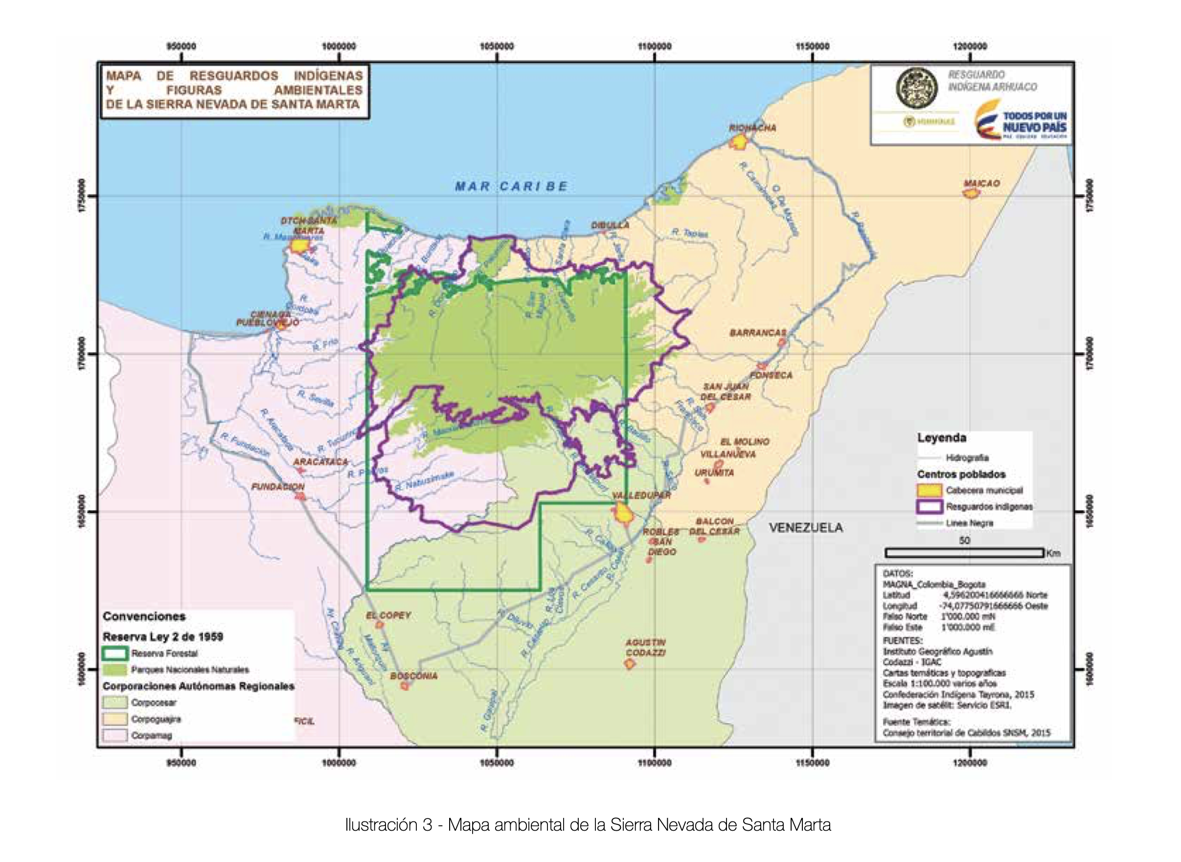
MAPA DE RESGUARDOS INDIGENAS Y FIGURAS AMBIENTALES DE LA SIERRA NEVADA DE SANTA MARTA
Mapa 2015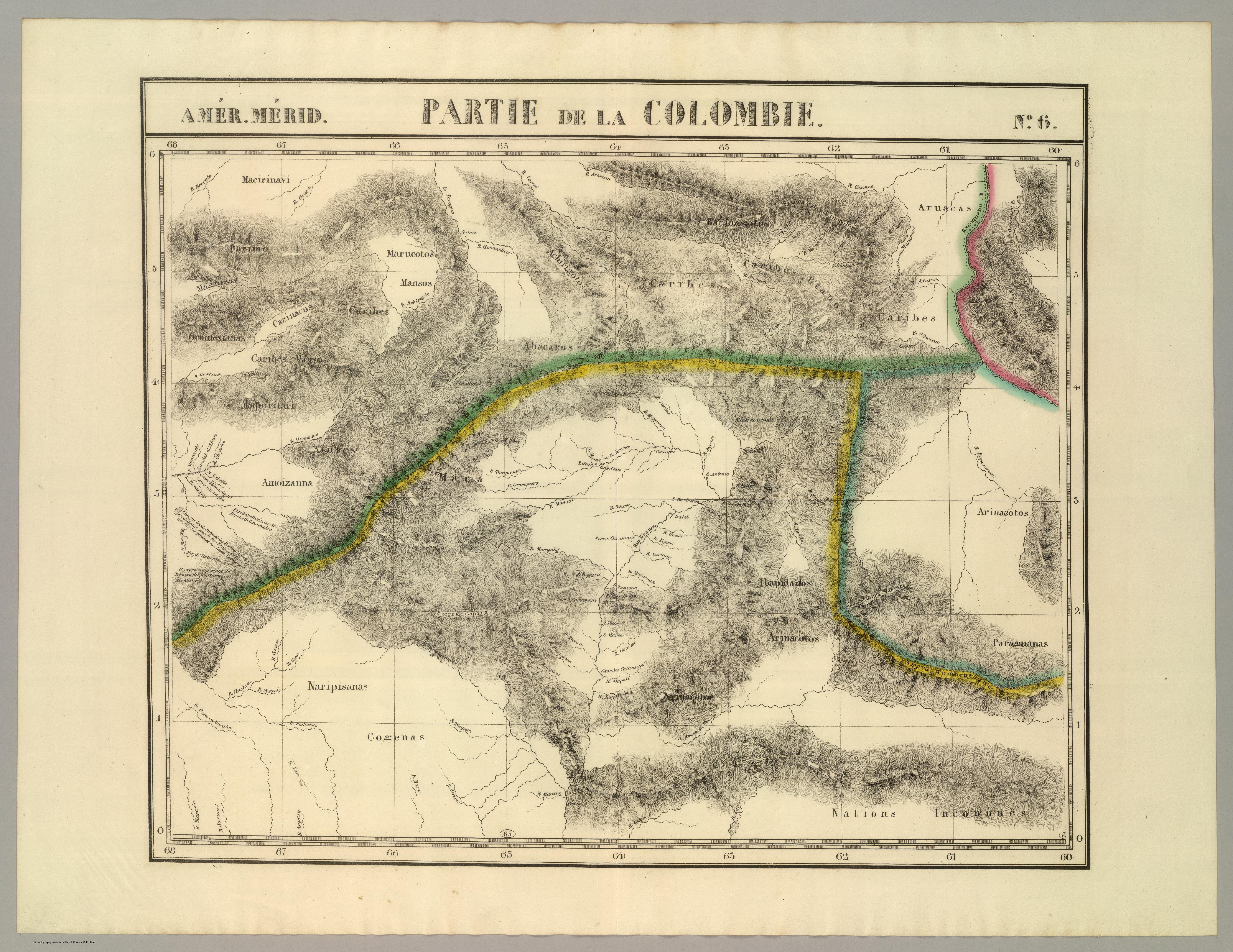
PARTIE DE LA COLOMBIE
Mapa 1827