Cita
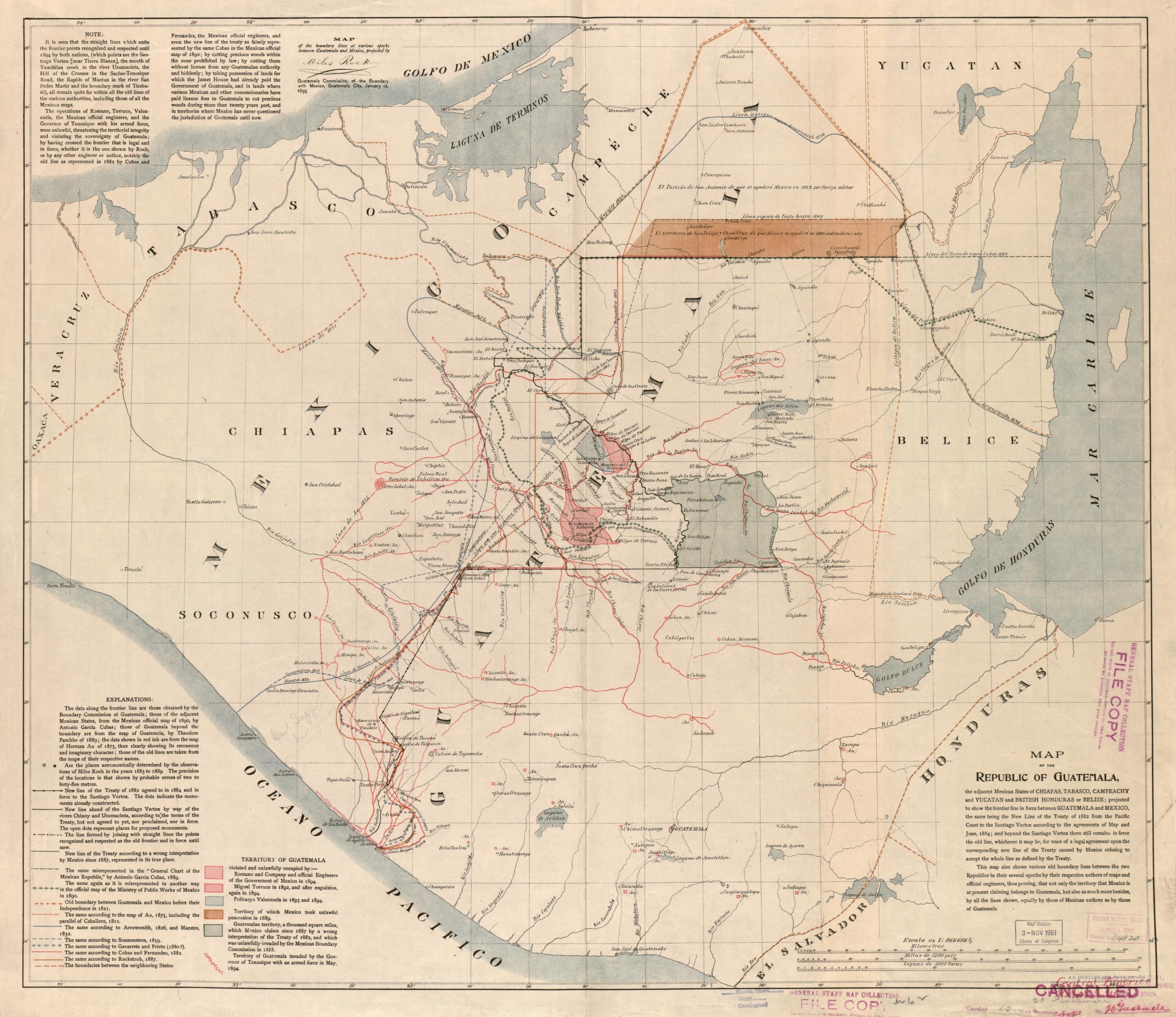
Map of the Republic of Guatemala. Mueller, A.H. Philadelphia, 1895. Library of Congress Geography and Map Division Washington, DC. G4811.F2 1895 .M8 . http://hdl.loc.gov/loc.gmd/g4811f.ct002031
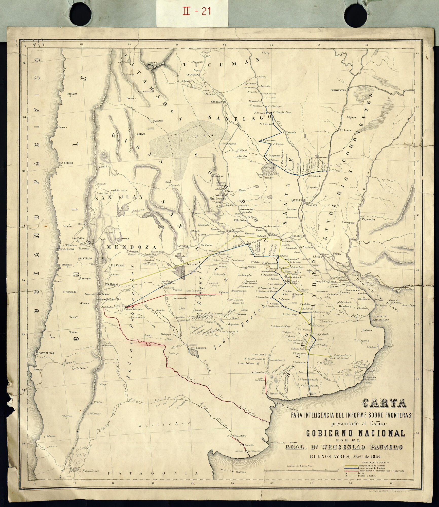
Carta para la inteligencia del informe sobre fronteras presentado al Excelentísimo Gobierno nacional por el General Don Wenceslao Paunero. Impreso
Mapa 1850 - 1880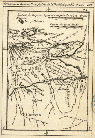
Provincias de Cumana;Paria;la Isla de la Trinidad;y el Rio Orinoco. 1758.
Mapa 1758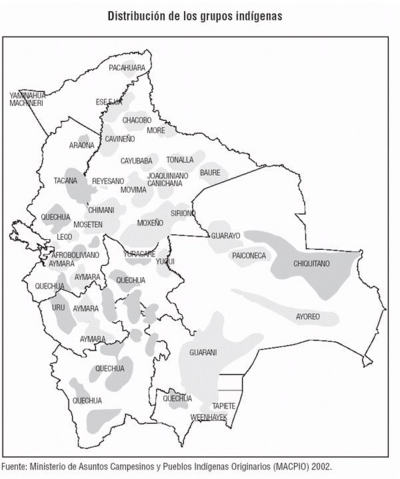
Distribución de los Grupos Indígenas de Bolivia
Mapa 2000 - 2010
CARTE particuliere du cours de la RIVIERE DES AMAZONES ou de MARAGNON Depuis l'entrée du Para en remontant jusqu'au Confluent de la Rivière Noire.
Mapa 1729
PUEBLO WAMPIS
Mapa 2021
Tribes of the Gran Chaco: Locations at the first European contact
Mapa 1524
O. DIE REP: ARGENTINA. P. DAS DICTATORAT PARAGUAY.
Mapa 1830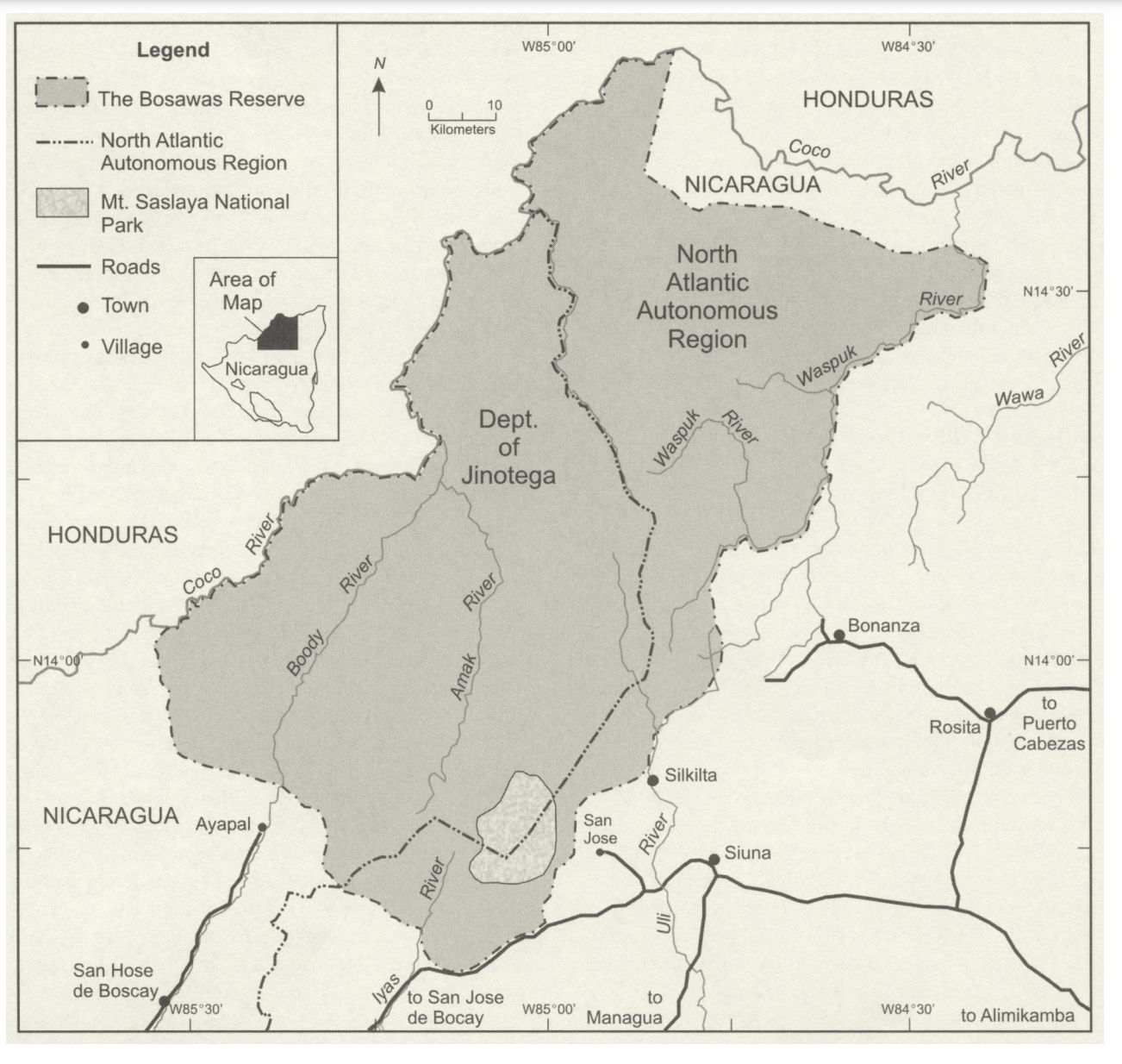
The Bosawas Reserve;North-Central Nicaragua
Mapa 2000 - 2003