
Pueblos
- COLAMBO
Cita
Archivo Nacional del Ecuador. "Plano que se adjunta al proceso que siguen los indígenas de la comunidad de Colambo". Loja;Ecuador. 1761. ANH.MP.03.11.25.IND.0324
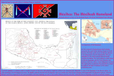
Mexico at the time of the conquest (1519), showing the extent of the Culhua Mexica (Aztec Empire) and of the Maya holdings
Mapa 1519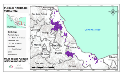
PUEBLO NAHUA DE VERACRUZ
Mapa 2020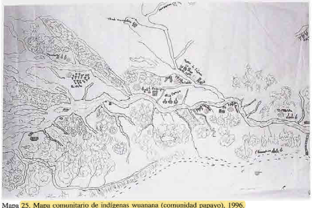
MAPA COMUNITARIA DE INDIGENAS WUANANA
Mapa 1996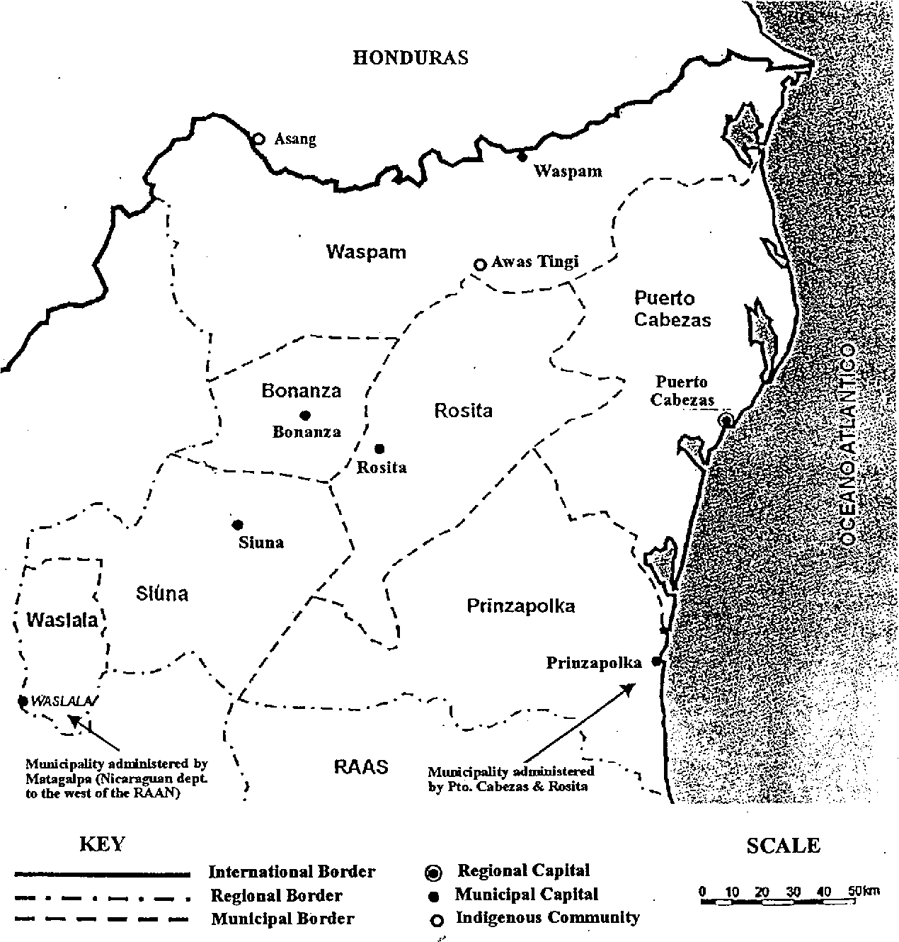
Map of the North Atlantic Autonomous Region (RAAN);Northeastern Nicaragua.
Mapa 1900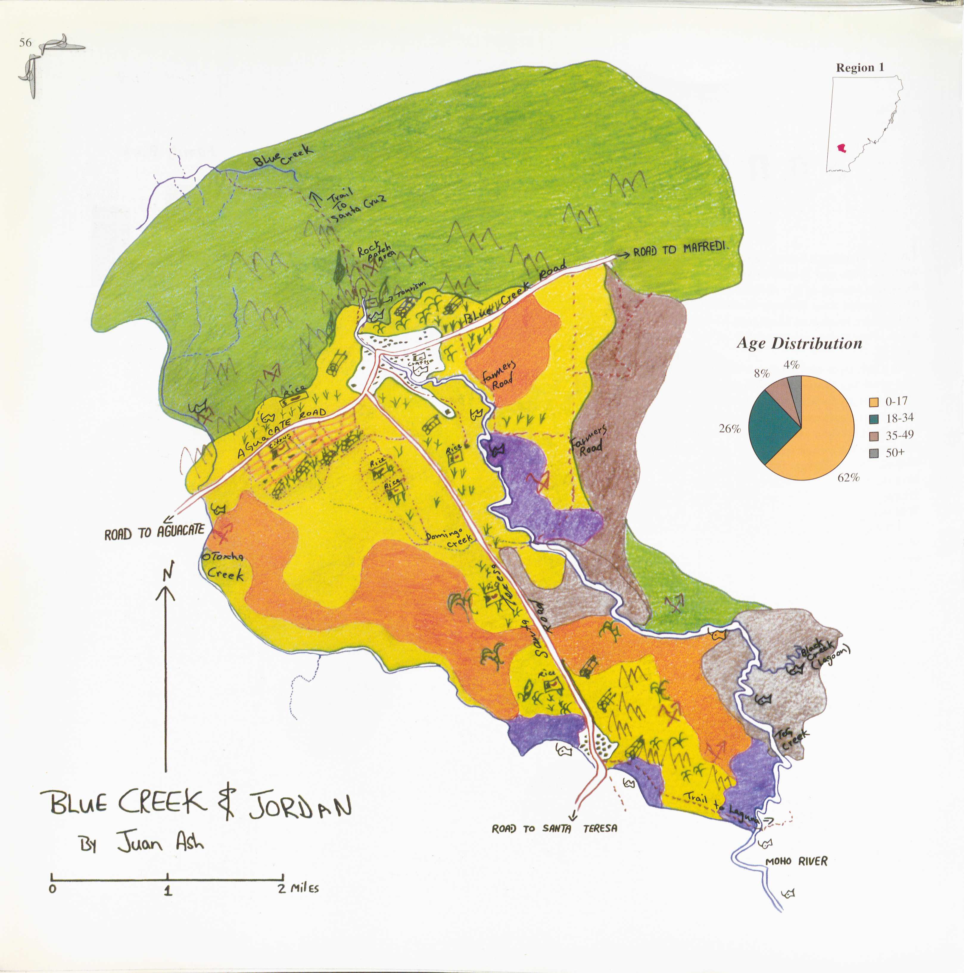
Blue Creek
Mapa 1997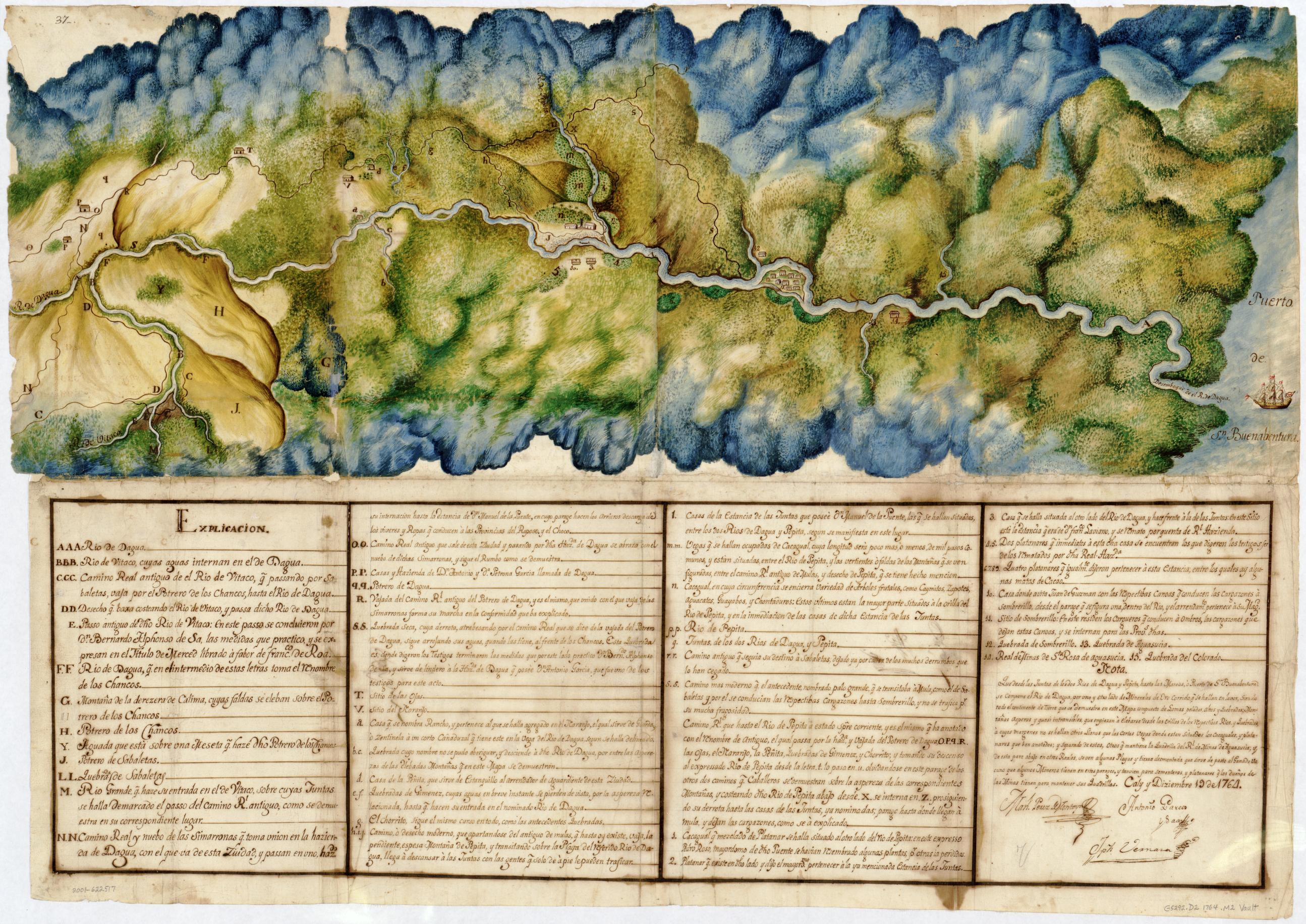
Manuscript Map of the Dagua River Region
Mapa 1764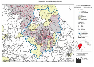
REGIÓN SIERRA NORTE DE PUEBLA Y TOTONACAPAN
Mapa 2000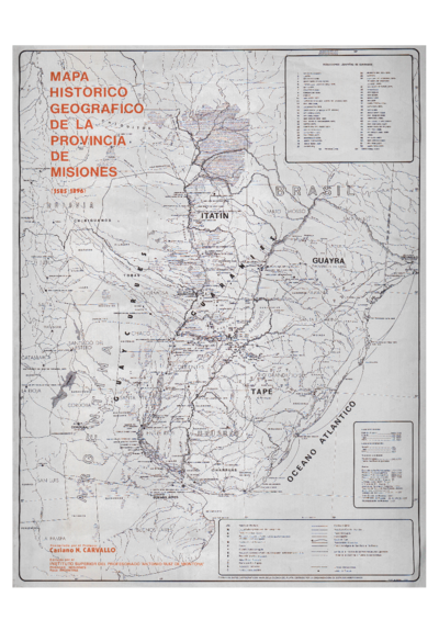
Mapa histórico geográfico de la provincia de Misiones (1585-1896)
Mapa 1585 - 1896