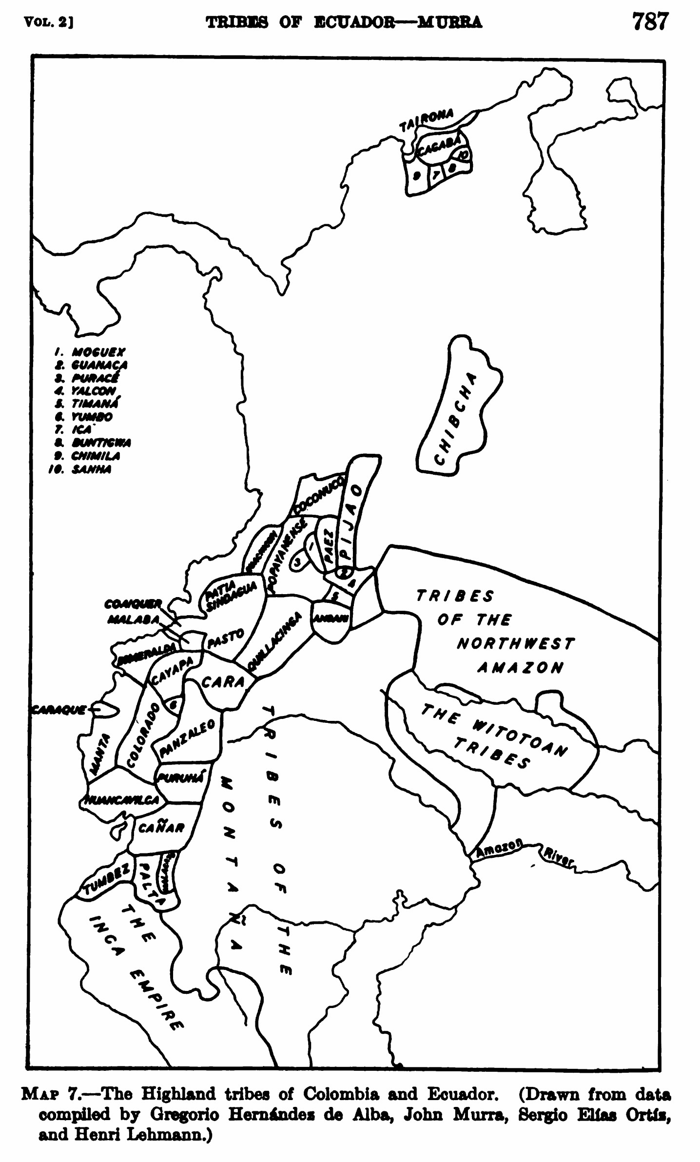
Pueblos
- KANARI
- TSACHILAS
- PURUHA
- PALTAS
Cita
Steward;Julian Haynes;Handbook of South American Indians: Volume 2. New York: Cooper Square Publishers;1963. pages 786-791 https://babel.hathitrust.org/cgi/pt?id=uva.x001436992&view=1up&seq=18&skin=2021
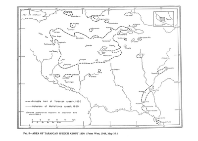
Area of Tarascan Speech about 1850
Mapa 1850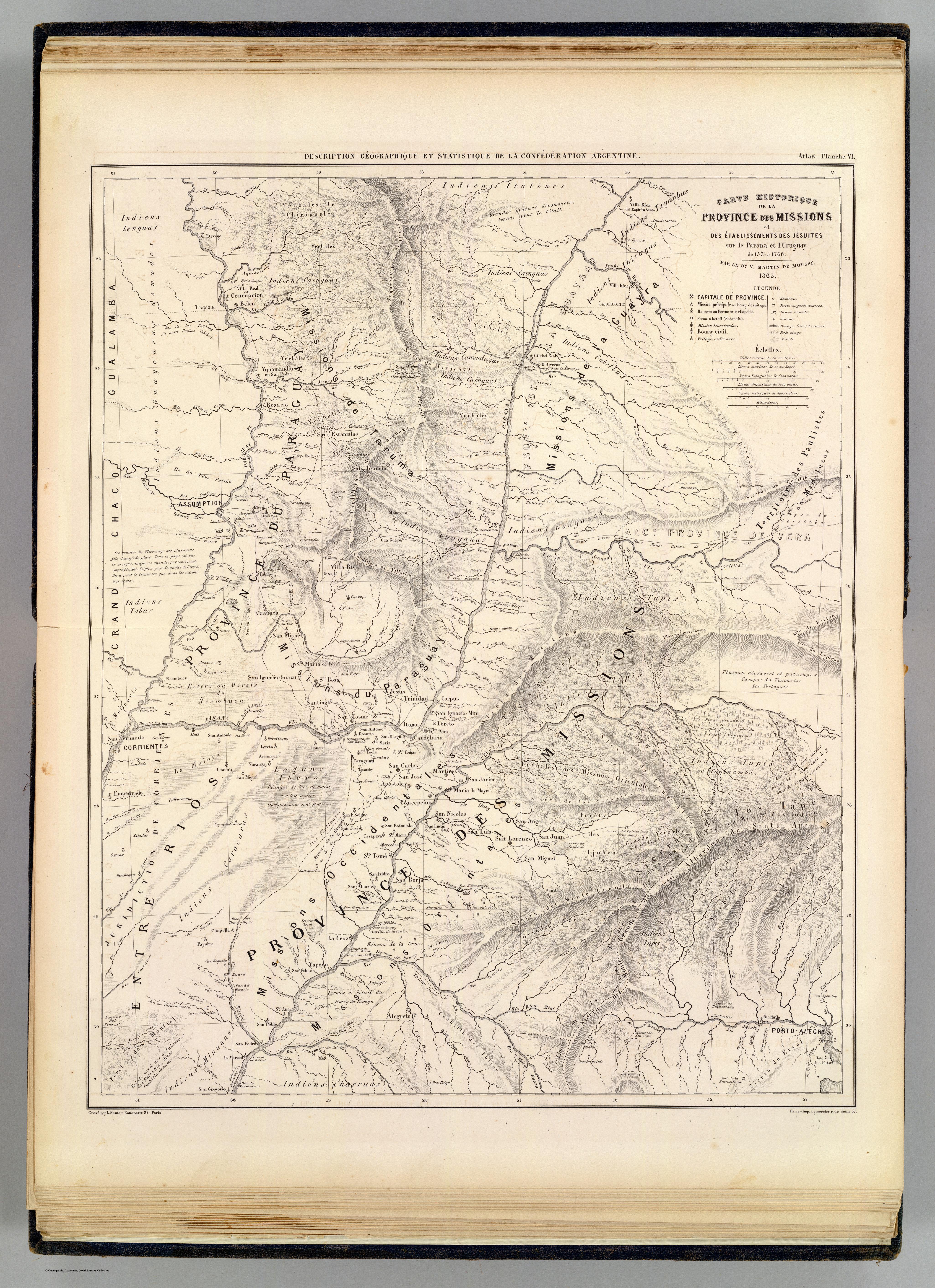
Carte hist.;Prov. des Missions;etabl. Jesuites;Parana et l'Uruguay;1575- 1768
Mapa 1575 - 1768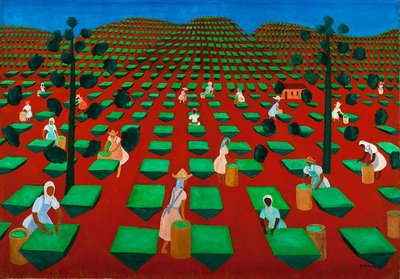
Hacienda de té en Itacolomi
Obra de Arte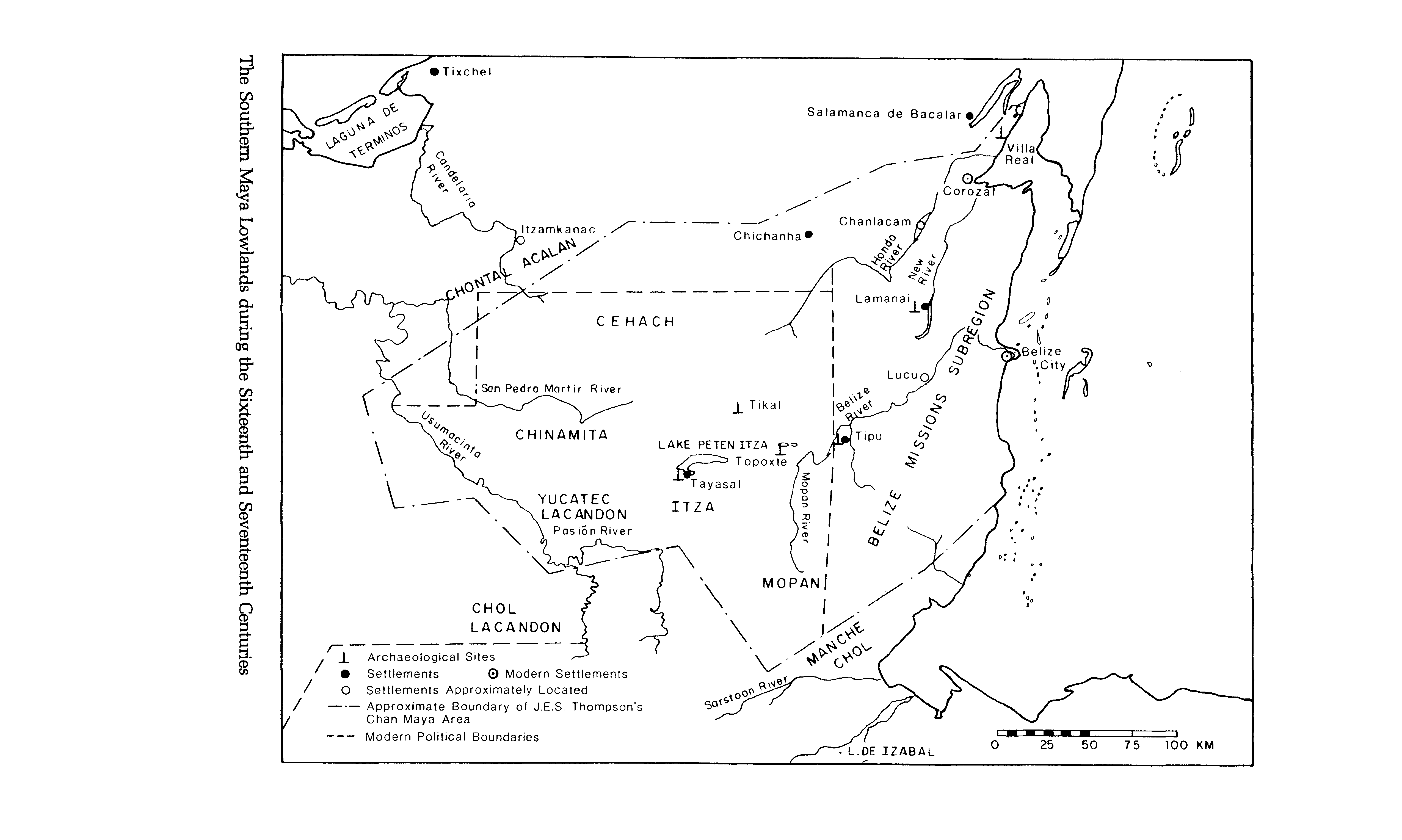
The Southern Maya Lowlands during the Sixteenth and Seventeenth Centuries
Mapa 1500 - 1700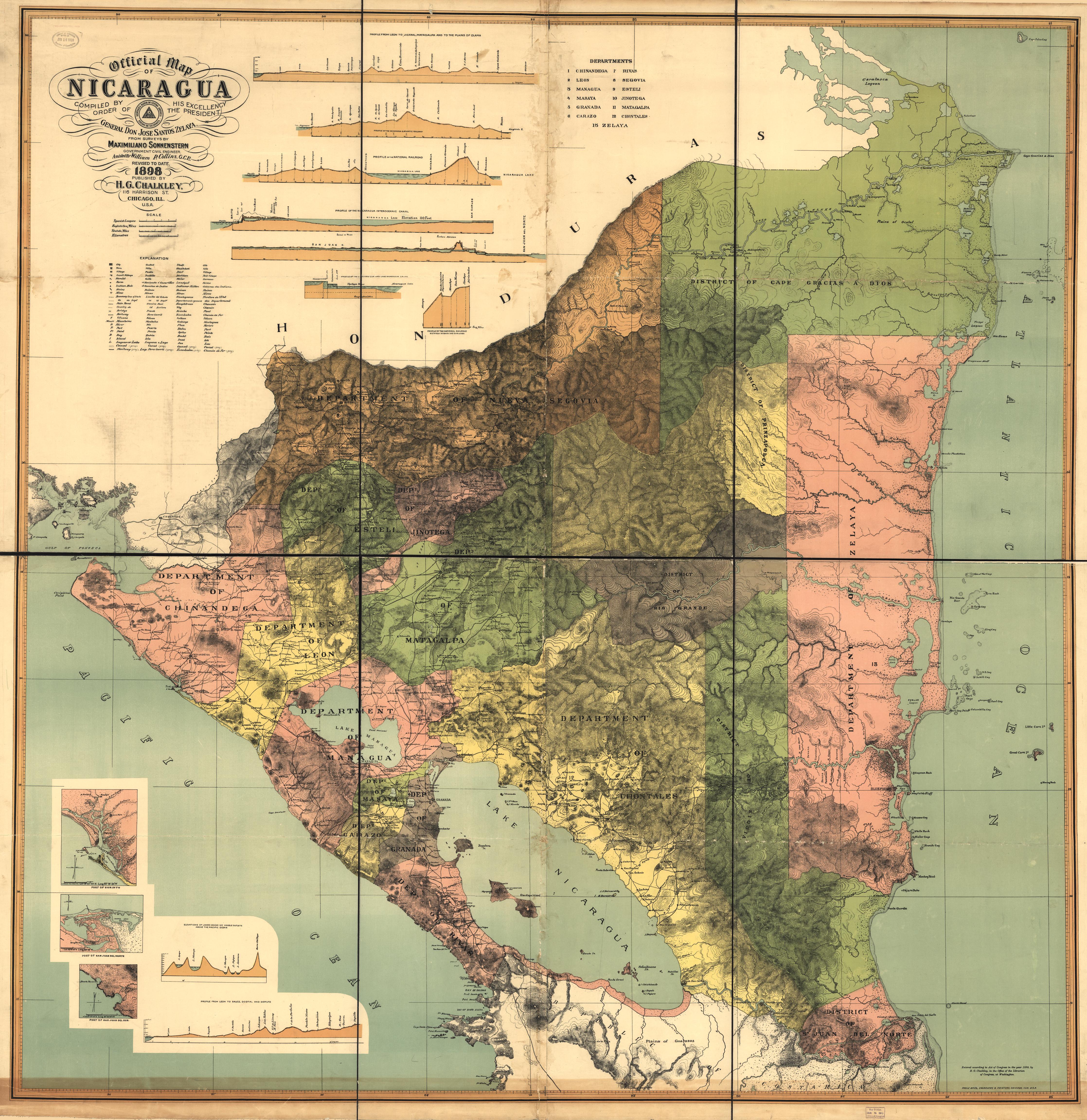
Official Map of Nicaragua.
Mapa 1898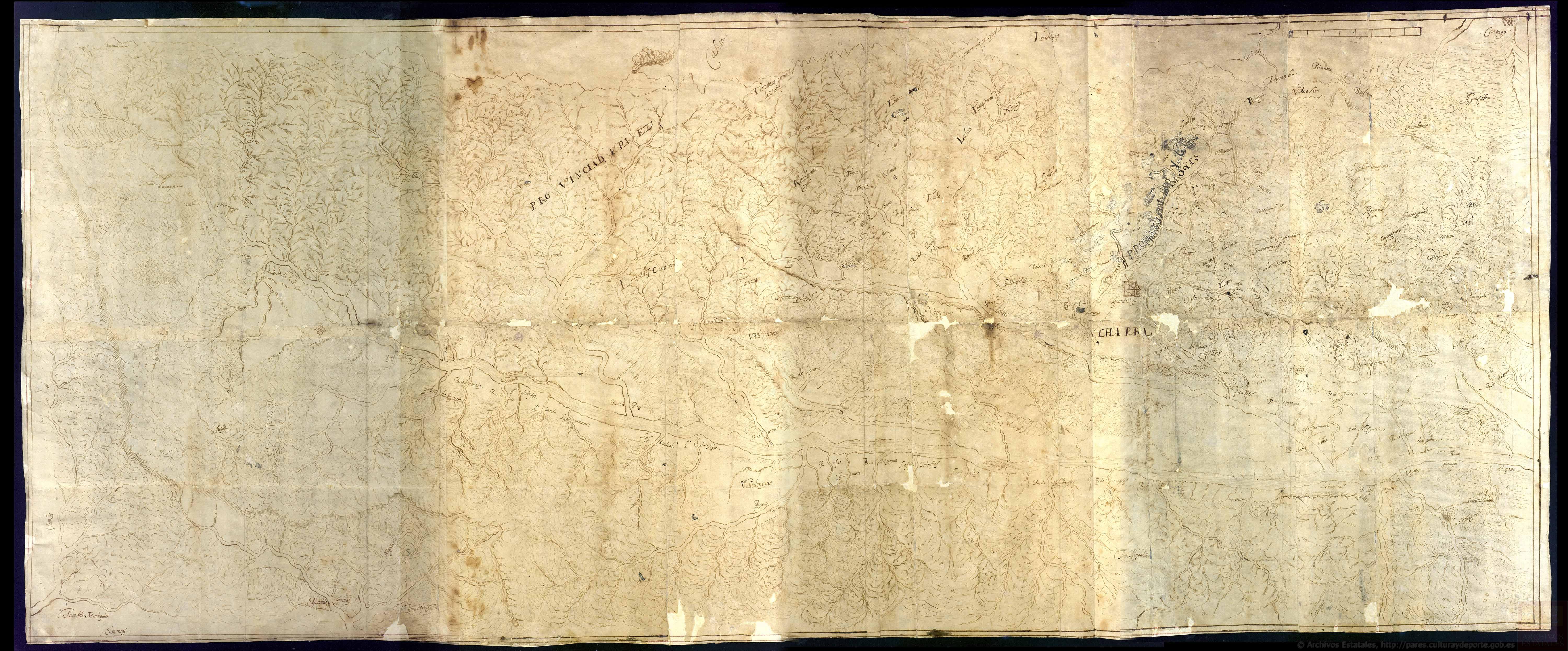
Discrepçion y mapa del territorio que ocupan los indios pijaos
Mapa 1608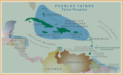
Pueblos Taínos
Mapa 2000 - 2015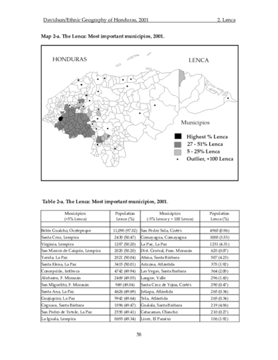
The Lenca: Most important municipios, 2001
Mapa 2001