Dispossesions in the Americas

Dispossesions in the Americas

  • Inicio
  • Explorar
  • Autores
  • Sobre
  • Arte
  • Cuerpos
  • Planes de Estudio
  • Herencia Cultural
  • Mapas
  • Territorios
Volver a Explorar

Leyendo en Inglés

Mapa 1799 - 1804

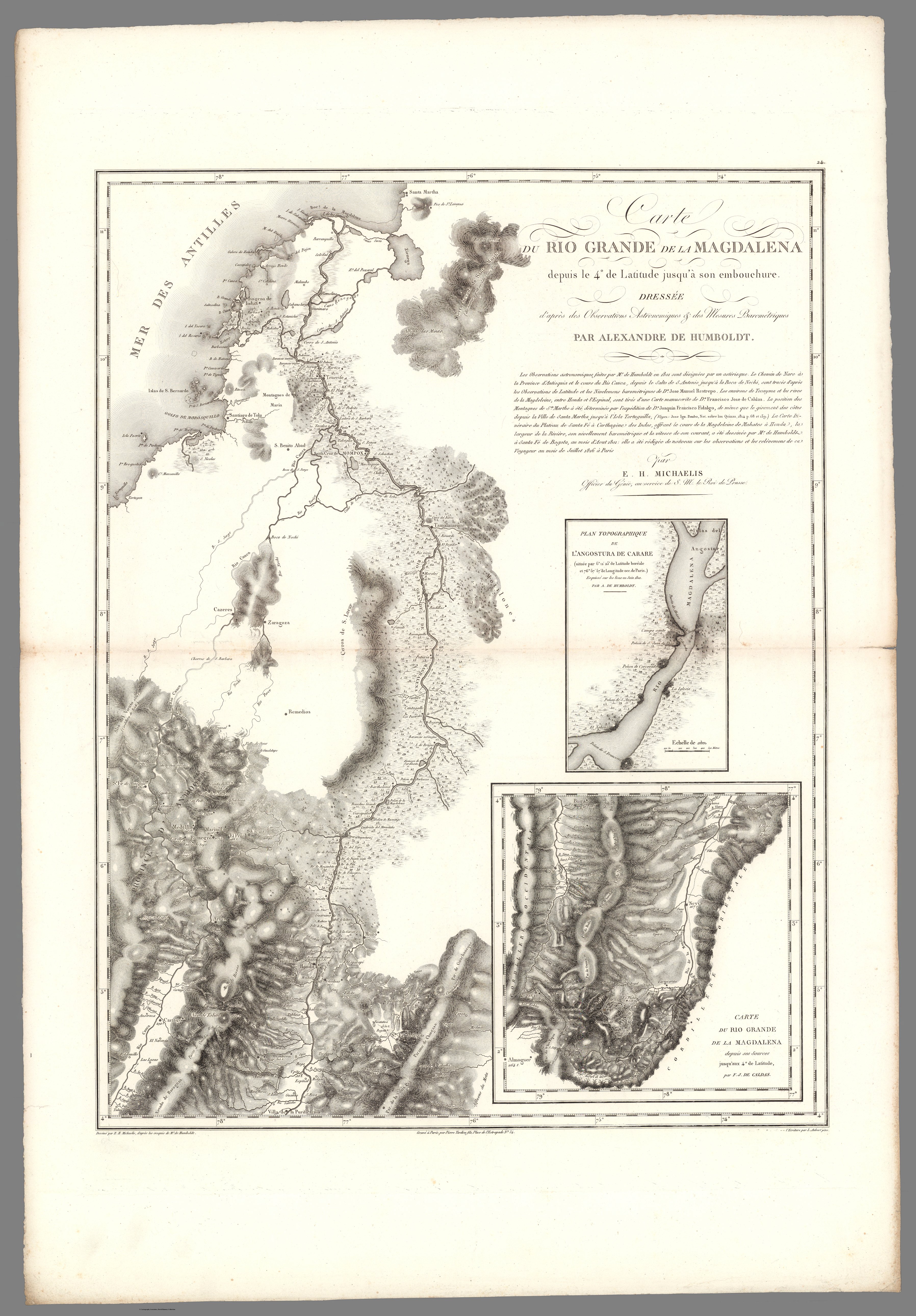
XXIV. Carte du Rio Grande de la Magdalena, depuis ses sources jusqu'a son embouchure.

  • Alexandre de Humboldt;Aime Bonpland

Publicado: 1831

  • Descargar Imágen
  • Descargar Imágen
Mapa 1799 - 1804

XXIV. Carte du Rio Grande de la Magdalena, depuis ses sources jusqu'a son embouchure.

  • Alexandre de Humboldt;Aime Bonpland

Publicado: 1831

  • Descargar Imágen

Pueblos

  • MOTILONES

Citas

Voyage de MM. Alexandre de Humboldt et Aime Bonpland. Atlas Geographique et Physique, pour Accompagner la Relation Historique. Sixieme livraison. Paris, J. Smith, Rue Montmorency, No. 16;Londres, Dulau et Compie., Soho-Square. 1831. Imprimerie de J. Smith. https://www.davidrumsey.com/luna/servlet/detail/RUMSEY~8~1~292872~90064417:XXIV--Carte-du-Rio-Grande-de-la-Mag?sort=Pub_List_No_InitialSort&qvq=q:colombia;sort:Pub_List_No_InitialSort;lc:RUMSEY~8~1&mi=207&trs=457#
  • Descargar Imágen

Artículos Relacionados

PART OF BRAZIL

PART OF BRAZIL

Mapa 1904
Geographisch-statistische und historische Charte von Guyana.

Geographisch-statistische und historische Charte von Guyana.

Mapa 1800 - 1899
Mapa 1. Ubicación geográfica del territorio Waorani

Mapa 1. Ubicación geográfica del territorio Waorani

Mapa 2018
The Fort Yuma Reservation and Places Mentioned in the Text

The Fort Yuma Reservation and Places Mentioned in the Text

Mapa 2016
TRIBUS QUE HABITARON URUGUAY

TRIBUS QUE HABITARON URUGUAY

Mapa 1500 - 1700
South America and West Indies. 1818

South America and West Indies. 1818

Mapa 1818
Kiñe Lafken Ngelay Afpun [Un Océano Sin Frontera]

Kiñe Lafken Ngelay Afpun [Un Océano Sin Frontera]

Obra de Arte
Maká

Maká

Mapa 2001

Despojos en las Américas

Un Proyecto de

University of Pennsylvania

Copyright 2024

Con el apoyo de

Mellon Foundation

Diseño y Desarrollo del Sitio

Element 84

Créditos Artísticos

Voyage de MM. Alexandre de Humboldt et Aime Bonpland. Atlas Geographique et Physique, pour Accompagner la Relation Historique. Sixieme livraison. Paris, J. Smith, Rue Montmorency, No. 16;Londres, Dulau et Compie., Soho-Square. 1831. Imprimerie de J. Smith. https://www.davidrumsey.com/luna/servlet/detail/RUMSEY~8~1~292872~90064417:XXIV--Carte-du-Rio-Grande-de-la-Mag?sort=Pub_List_No_InitialSort&qvq=q:colombia;sort:Pub_List_No_InitialSort;lc:RUMSEY~8~1&mi=207&trs=457#
Páginas del Sitio

  • Inicio
  • Explorar
  • Autores
  • Sobre
  • Arte
  • Cuerpos
  • Planes de Estudio
  • Herencia Cultural
  • Mapas
  • Territorios