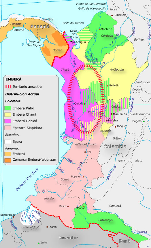
Pueblos
- EMBERA KATIO
- EMBERA CHAMI
- EMBERA DOBIDA
- EMBERA SIAPIDARA
- EPERA
- EMBERA
- COMARCA EMBERA-WOUNAAN
Cita
"Grupo aborigen Emberá." Pueblos Originarios. Accessed June 18, 2021. https://pueblosoriginarios.com/sur/caribe/embera/embera.html.
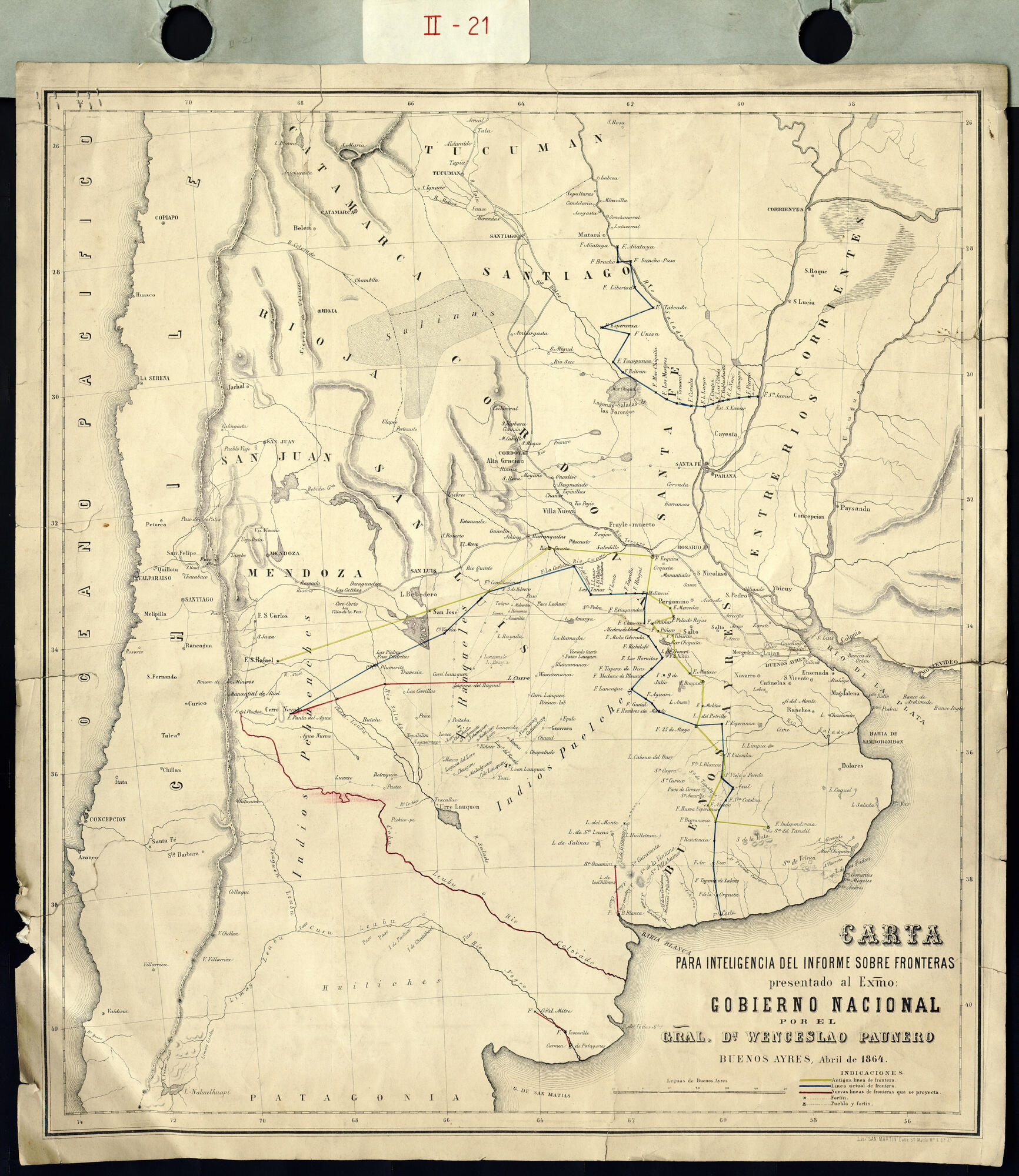
Carta para la inteligencia del informe sobre fronteras presentado al Excelentísimo Gobierno nacional por el General Don Wenceslao Paunero. Impreso
Mapa 1850 - 1880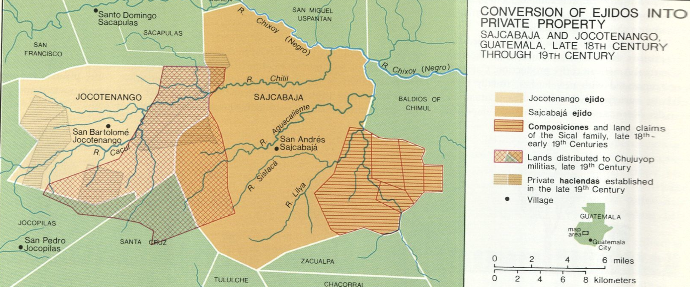
Conversion of Ejidos into Private Property, Sajcabaja and Jocotenango, Guatemala, Late 18th Century through 19th Century
Mapa 1700 - 1800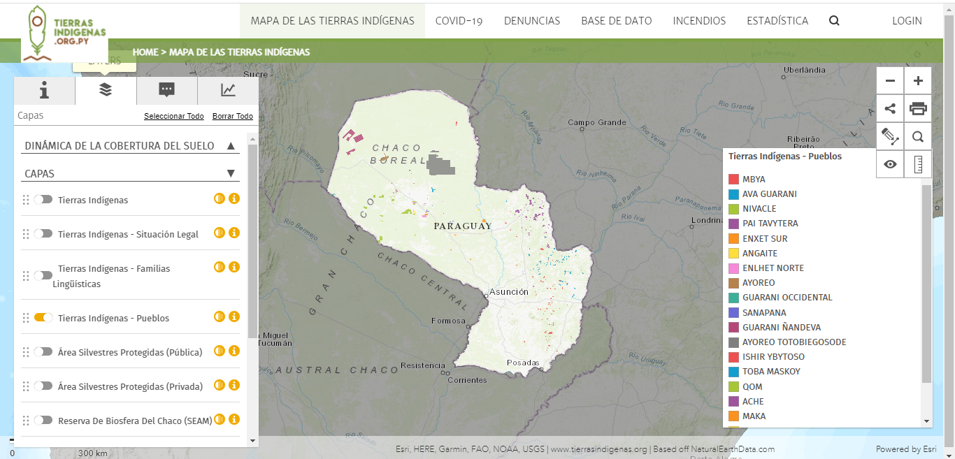
Mapa de las tierras indígenas - Pueblos
Mapa 2017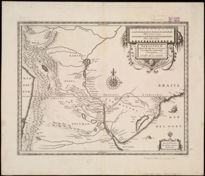
Paraguay;ó prov. de Rio de la Plata cum regionibus adiacentibus Tucuman et Sta. Cruz de la Sierra
Mapa 1600 - 1699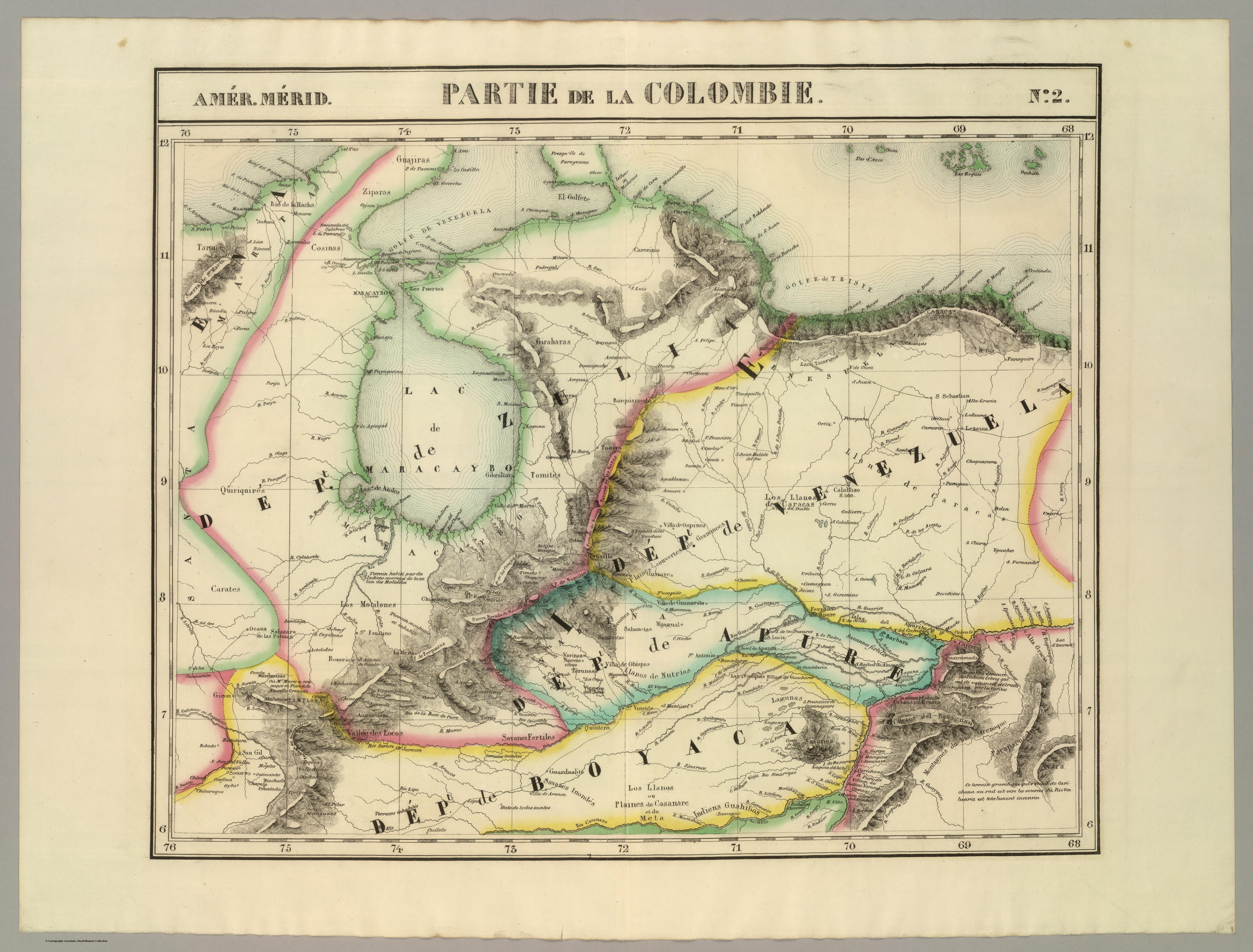
PARTIE DE LA COLOMBIE
Mapa 1827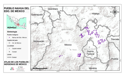
PUEBLO NAHUA DEL EDO DE MEXICO
Mapa 2020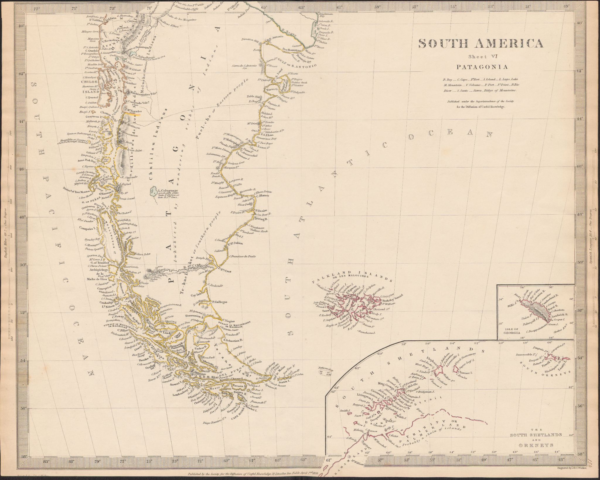
South America
Mapa 1800 - 1850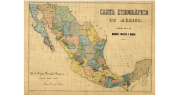
CARTA ETNOGRÁFICA DE MEXICO
Mapa 1864