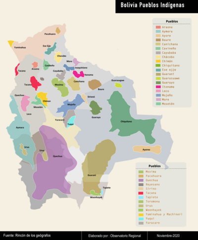
Pueblos
- ACOQUAS
- AMICOUANES
- GALIBIS
- GUARAUNAS
- MAYEZ
- NORAGUES
- PALICOURS
- PIRIOUS
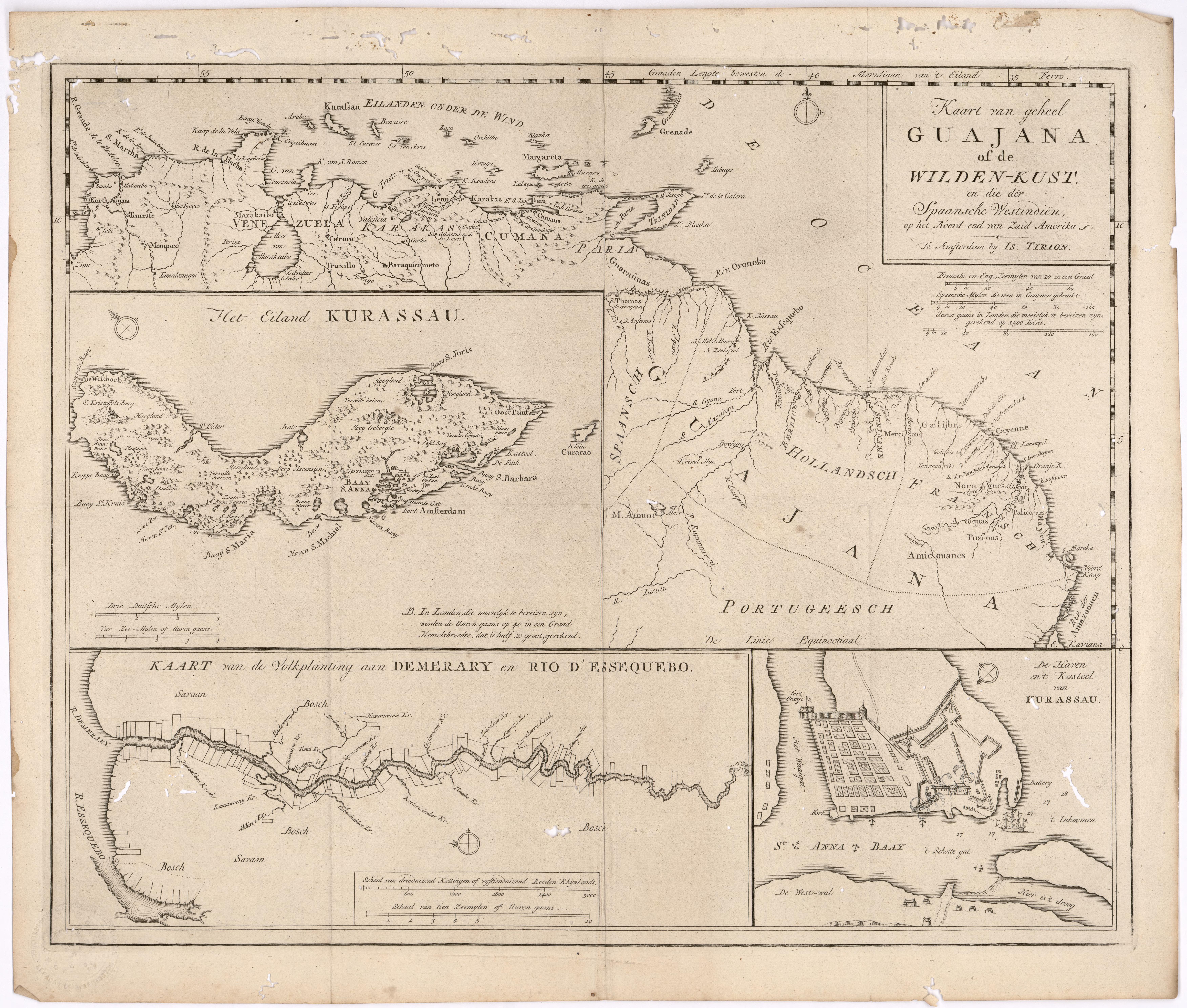
Cita
Tirion, Isaak. Map of the Whole of Guiana or the Savage Coast, and the Spanish West Indies at the Northern End of South America. Library of Congress. Accessed, August 3, 2023. https://www.loc.gov/resource/gdcwdl.wdl_11339/?r=0.213,0.044,0.861,0.453,0
![O Parque Municipal [El Parque Municipal]](https://dnet8ble6lm7w.cloudfront.net/art/ABRA001.jpg)
![Ombre des Amazonies [Sombra de las Amazonías]](https://dnet8ble6lm7w.cloudfront.net/art/APER055.JPG)