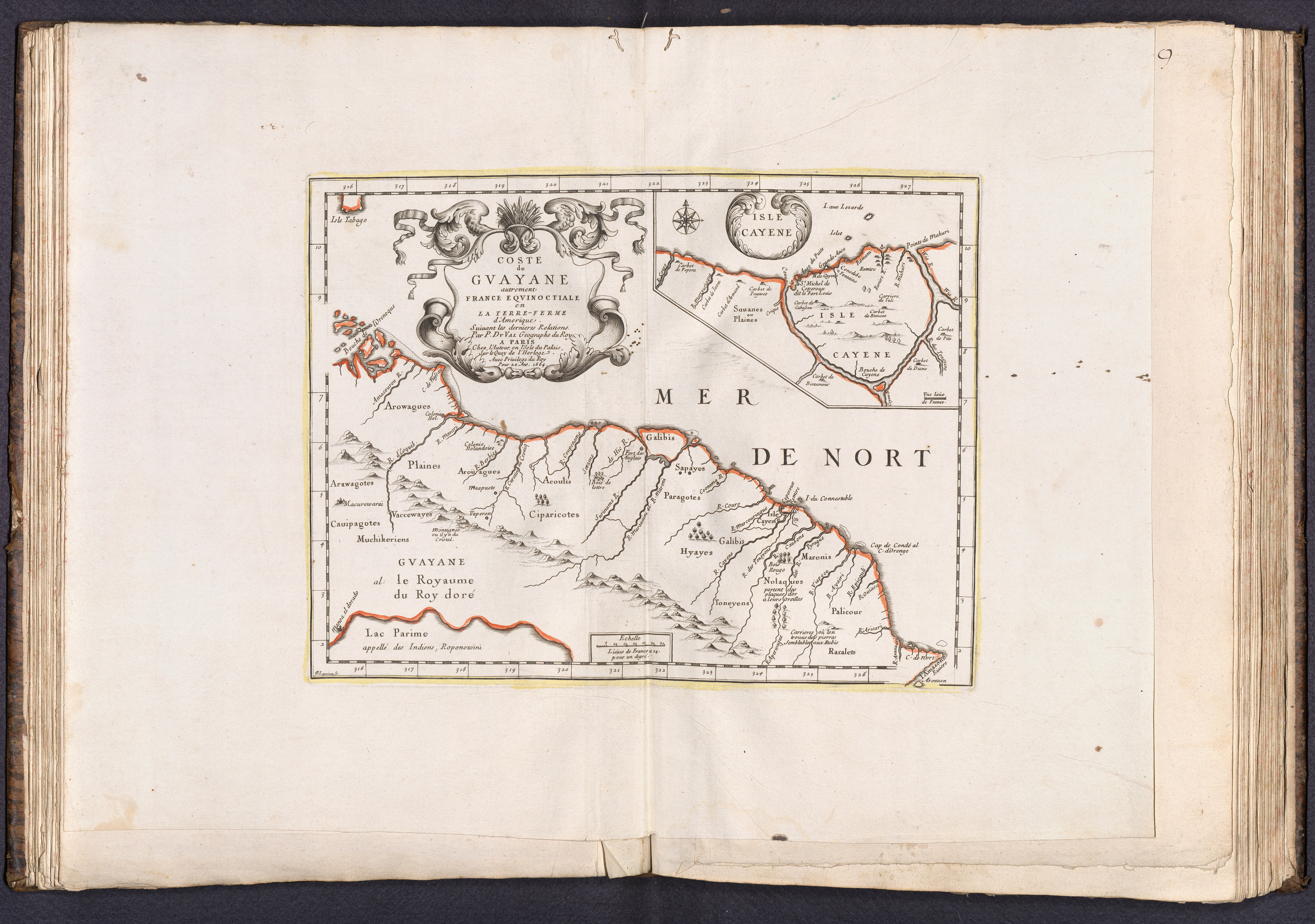
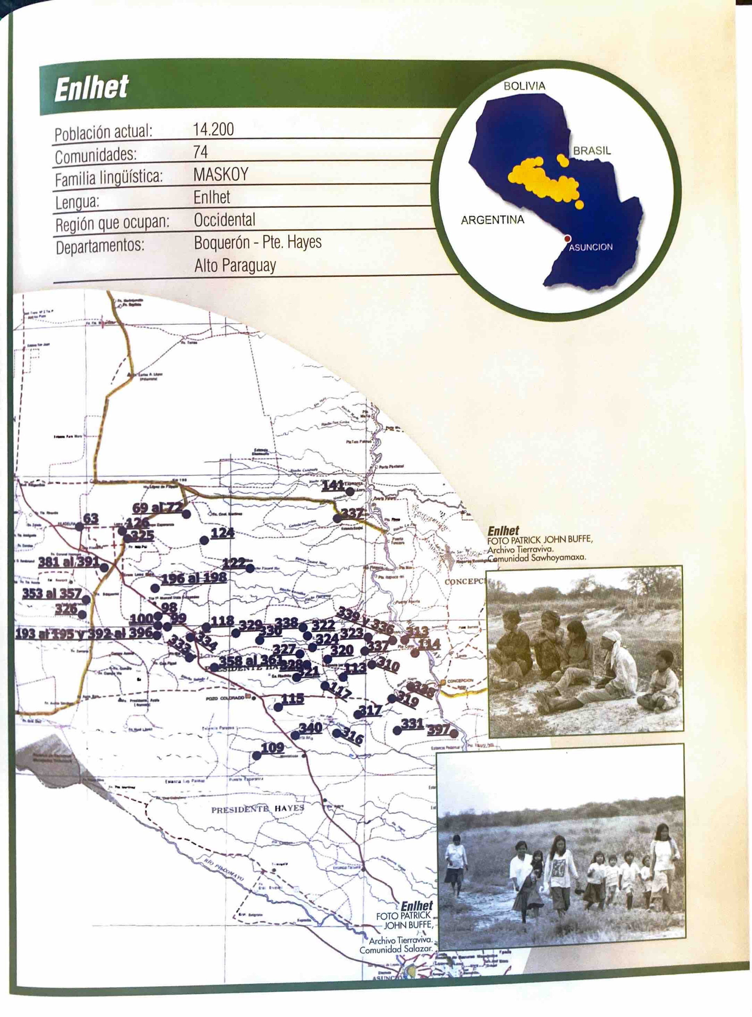
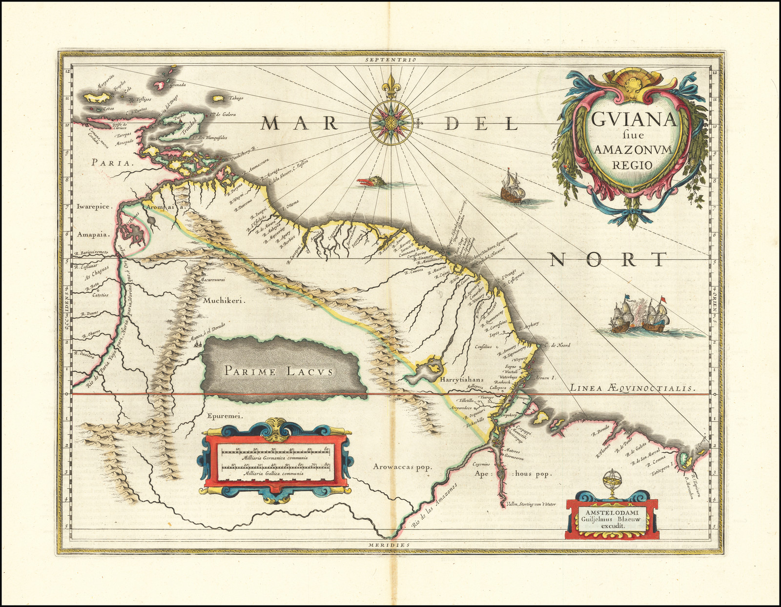
Dispossesions in the Americas

Dispossesions in the Americas

  • Inicio
  • Explorar
  • Autores
  • Sobre
  • Arte
  • Cuerpos
  • Planes de Estudio
  • Herencia Cultural
  • Mapas
  • Territorios
Volver a Explorar

Leyendo en Inglés

Mapa 1600 - 1699

GUIANA sive AMAZONUM REGIO

  • BLAEU;WILLEM JANSZOON

Publicado: CIRCA 1640

  • Descargar Imágen
  • Descargar Imágen
Mapa 1600 - 1699

GUIANA sive AMAZONUM REGIO

  • BLAEU;WILLEM JANSZOON

Publicado: CIRCA 1640

  • Descargar Imágen

Pueblos

  • APEHOUS
  • ARAWAK
  • EPUREMEI
  • HARRYTIAHANS
  • MUCHIKERI
  • IWAREPICE
  • AROMAIA

Cita

Blaeu, Willem Janszoon. Guiana Sive Amazonum Regio. Map. Amsterdam: Jan Jansson, 1640. Accessed August 23, 2022. https://www.raremaps.com/gallery/detail/66161/lake-parime-and-el-dorado-guiana-sive-amazonum-regio-blaeu.

  • Descargar Imágen

Leyendo en Portugués

Mapa 1600 - 1699

GUIANA sive AMAZONUM REGIO

  • BLAEU;WILLEM JANSZOON

Publicado: CIRCA 1640

  • Descargar Imágen

Pueblos

  • APEHOUS
  • ARAWAK
  • EPUREMEI
  • HARRYTIAHANS
  • MUCHIKERI
  • IWAREPICE
  • AROMAIA

Cita

Blaeu, Willem Janszoon. Guiana Sive Amazonum Regio. Map. Amsterdam: Jan Jansson, 1640. Accessed August 23, 2022. https://www.raremaps.com/gallery/detail/66161/lake-parime-and-el-dorado-guiana-sive-amazonum-regio-blaeu.

  • Descargar Imágen

Artículos Relacionados

Coste de Gvayane autrement France Eqvinoctiale en Terre-Ferme d'Amerique. Suivant les dernieres Relations.

Coste de Gvayane autrement France Eqvinoctiale en Terre-Ferme d'Amerique. Suivant les dernieres Relations.

Mapa 1664
Desde adentro. Las comunidades originarias de la Argentina

Desde adentro. Las comunidades originarias de la Argentina

Mapa 1600
A Map of the United and Independant Provinces of Venezuela and New Grenada.

A Map of the United and Independant Provinces of Venezuela and New Grenada.

Mapa 1800 - 1899
Mapa general de la Republica de Guatemala. Publicado por Maximilian v. Sonnenstern por orden del gobierno, 1859. Printed by J. Rau, 33 Broadway, NY. G Kraetzer lith, East New York Long Island, N.Y. "Entered according to act of Congress in the year 1859 by M.v Sonnenster...New York. (insets) Plando de la Ciudad de Guatemala;and 6 releif profiles.

Mapa general de la Republica de Guatemala. Publicado por Maximilian v. Sonnenstern por orden del gobierno, 1859. Printed by J. Rau, 33 Broadway, NY. G Kraetzer lith, East New York Long Island, N.Y. "Entered according to act of Congress in the year 1859 by M.v Sonnenster...New York. (insets) Plando de la Ciudad de Guatemala;and 6 releif profiles.

Mapa 1800
Enlhet

Enlhet

Mapa 2001
MAPPA PARAQUARIAE

MAPPA PARAQUARIAE

Mapa 1700 - 1770
Serie Fatherland / Padre Patria

Serie Fatherland / Padre Patria

Obra de Arte
Map representing the linguistic diversity that existed in Central America and the Gulf of Fonseca at the time of contact with the Spanish

Map representing the linguistic diversity that existed in Central America and the Gulf of Fonseca at the time of contact with the Spanish

Mapa 1522

Despojos en las Américas

Un Proyecto de

University of Pennsylvania

Copyright 2024

Con el apoyo de

Mellon Foundation

Diseño y Desarrollo del Sitio

Element 84

Créditos Artísticos

Blaeu, Willem Janszoon. Guiana Sive Amazonum Regio. Map. Amsterdam: Jan Jansson, 1640. Accessed August 23, 2022. https://www.raremaps.com/gallery/detail/66161/lake-parime-and-el-dorado-guiana-sive-amazonum-regio-blaeu.

Páginas del Sitio

  • Inicio
  • Explorar
  • Autores
  • Sobre
  • Arte
  • Cuerpos
  • Planes de Estudio
  • Herencia Cultural
  • Mapas
  • Territorios