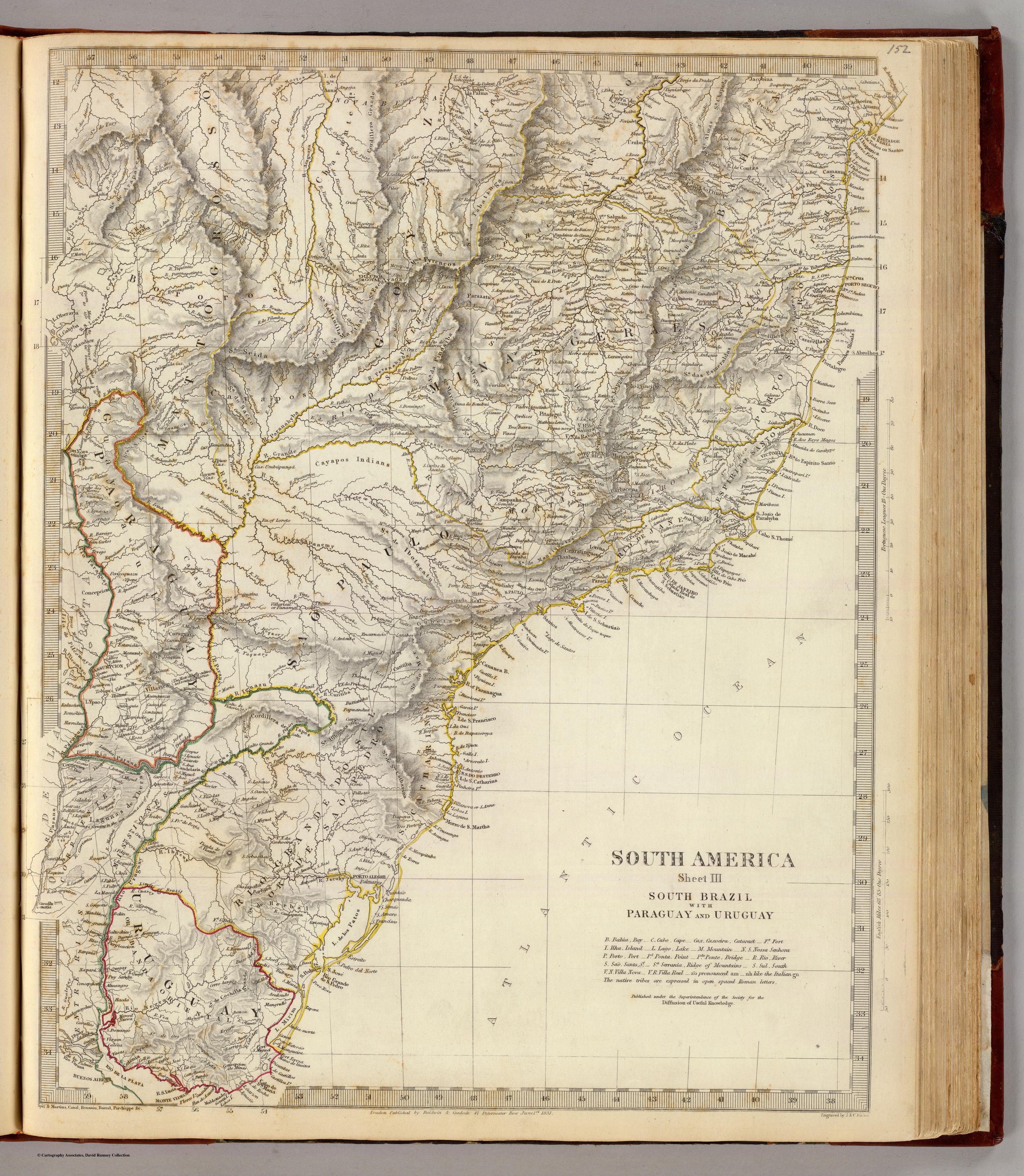
Dispossesions in the Americas

Dispossesions in the Americas

  • Inicio
  • Explorar
  • Autores
  • Sobre
  • Arte
  • Cuerpos
  • Planes de Estudio
  • Herencia Cultural
  • Mapas
  • Territorios
Volver a Explorar

Leyendo en Inglés

Mapa 1837

SOUTH AMERICA SHEET III. SOUTH BRAZIL WITH PARAGUAY AND URUGUAY

  • SOCIETY FOR THE DIFFUSION OF USEFUL KNOWLEDGE

Publicado: 1837

  • Descargar Imágen
  • Descargar Imágen
Mapa 1837

SOUTH AMERICA SHEET III. SOUTH BRAZIL WITH PARAGUAY AND URUGUAY

  • SOCIETY FOR THE DIFFUSION OF USEFUL KNOWLEDGE

Publicado: 1837

  • Descargar Imágen

Pueblos

  • CHAVANTE
  • BOROROS
  • CAYAPOS
  • GUAYOAU
  • CAHAN

Citas

Society for the Diffusion of Useful Knowledge. South America sheet III. South Brazil with Paraguay and Uruguay. Map. London: Chapman and Hall, 1837. Accessed July 27, 2023. https://www.davidrumsey.com/luna/servlet/detail/RUMSEY~8~1~20988~530080.

  • Descargar Imágen

Artículos Relacionados

Mapa Esférico De las Provincias Septentrionales del Río de la Plata

Mapa Esférico De las Provincias Septentrionales del Río de la Plata

Mapa 1796
Mapa de los pueblos indigenas Bolivia

Mapa de los pueblos indigenas Bolivia

Mapa 2010
Government map of Nicaragua : from the latest surveys ordered by President Patricio Rivas and Genl. William Walker ;executed under the supervision of the Señor Fermín Ferrer;Governor of the Western Department;1856

Government map of Nicaragua : from the latest surveys ordered by President Patricio Rivas and Genl. William Walker ;executed under the supervision of the Señor Fermín Ferrer;Governor of the Western Department;1856

Mapa 1800 - 1856
REGIÓN SIERRA NORTE DE PUEBLA Y TOTONACAPAN

REGIÓN SIERRA NORTE DE PUEBLA Y TOTONACAPAN

Mapa 2000
Mayan Access to Biomass Resources (Guatemala 2018).

Mayan Access to Biomass Resources (Guatemala 2018).

Mapa 2000
ARCHEOLOGICAL MAP OF MIDDLE AMERICA

ARCHEOLOGICAL MAP OF MIDDLE AMERICA

Mapa 1968
Carte du Pérou, ou se trouvent les Audiences de Quito, Lima et la Plata projettée et assujettie aux observations astronomiques

Carte du Pérou, ou se trouvent les Audiences de Quito, Lima et la Plata projettée et assujettie aux observations astronomiques

Mapa 1771
Karte von dem Eylande Caienne und Umliegenden Orten Zur allgemeinen Histoire der Reisen

Karte von dem Eylande Caienne und Umliegenden Orten Zur allgemeinen Histoire der Reisen

Mapa 1757

Despojos en las Américas

Un Proyecto de

University of Pennsylvania

Copyright 2024

Con el apoyo de

Mellon Foundation

Diseño y Desarrollo del Sitio

Element 84

Créditos Artísticos

Society for the Diffusion of Useful Knowledge. South America sheet III. South Brazil with Paraguay and Uruguay. Map. London: Chapman and Hall, 1837. Accessed July 27, 2023. https://www.davidrumsey.com/luna/servlet/detail/RUMSEY~8~1~20988~530080.

Páginas del Sitio

  • Inicio
  • Explorar
  • Autores
  • Sobre
  • Arte
  • Cuerpos
  • Planes de Estudio
  • Herencia Cultural
  • Mapas
  • Territorios