Pueblos
- INDIAN HABITATIONS
Cita
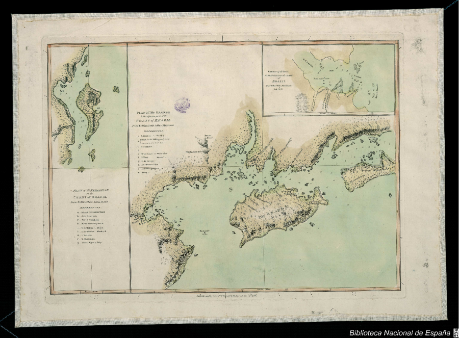
Bellin, Jacques Nicolas. Plan of the Isle Grande & the adjacent parts of the Coast of Brazil. Map. London: Alexander Dalrymple, 1786. Accessed July 18, 2023. http://bdh.bne.es/bnesearch/detalle/bdh0000033697.
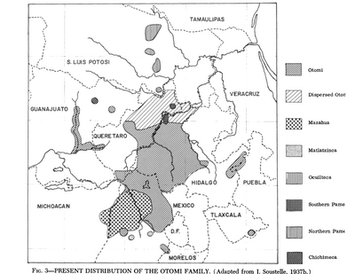
Present Distribution of the Otomi Family
Mapa 1969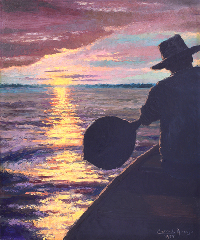
Bogando
Obra de Arte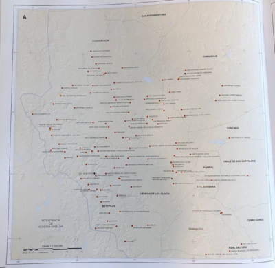
INTENDENCIA DE DURANGO
Mapa 1800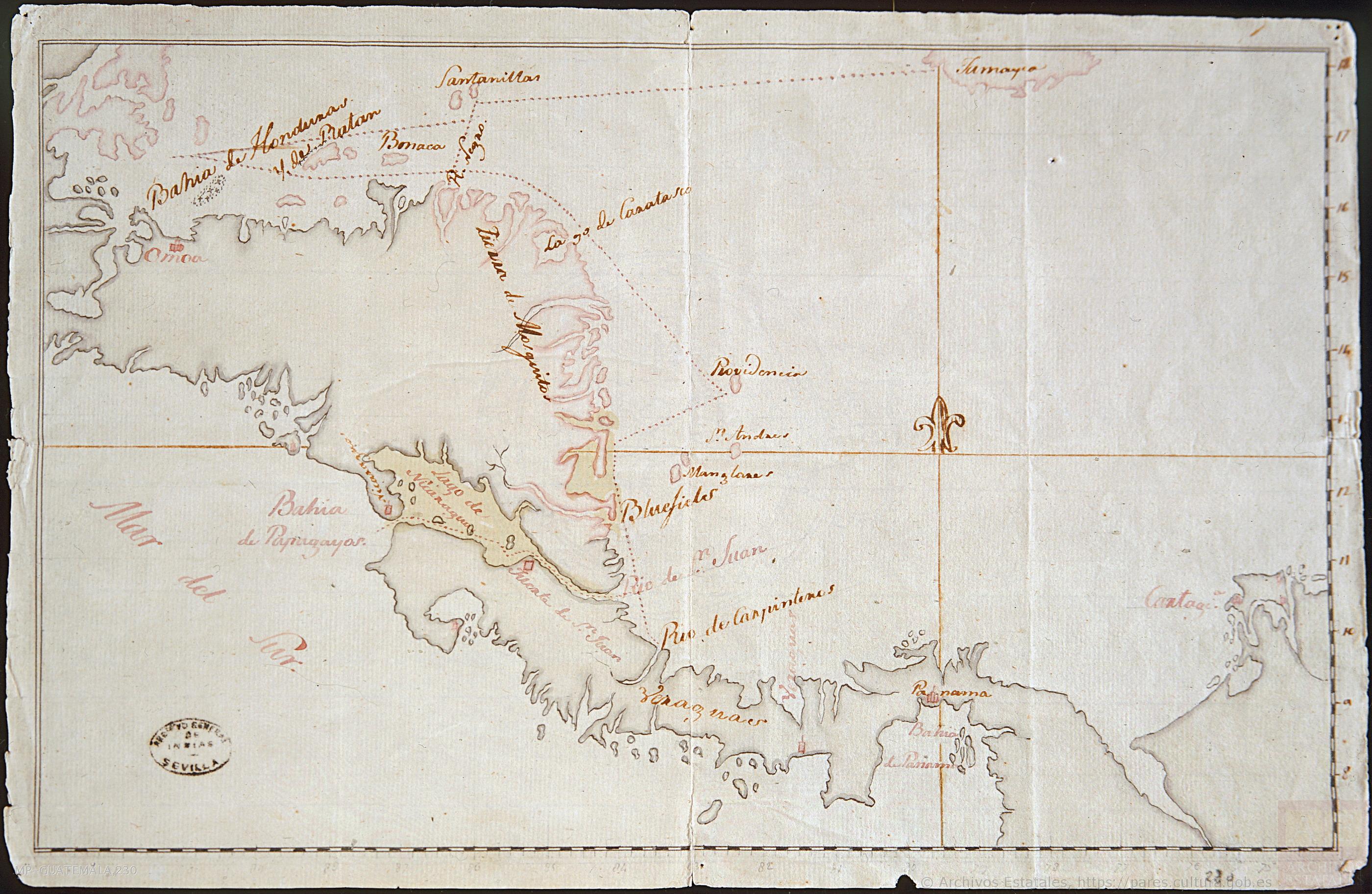
Mapa de la América Central comprendida entre el Golfo Dulce y Cartagena de Indias;por el Norte y entre la Bahía de Fonseca de Panamá por el Sur.
Mapa 1777
Mapa de la America meridional, desde la equinoccial hasta la Tierra del Fuego
Mapa 1596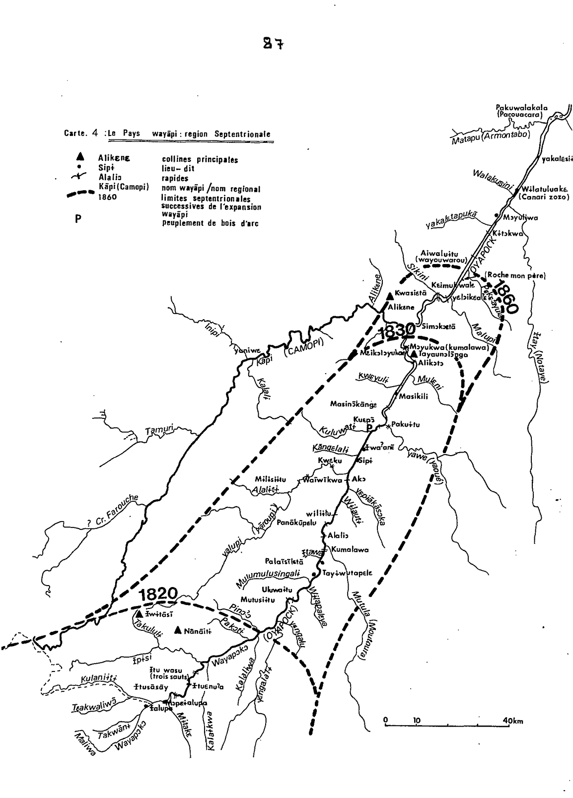
Carte 4: Le Pays Wayãpi : region Septentrionale
Mapa 1820 - 1860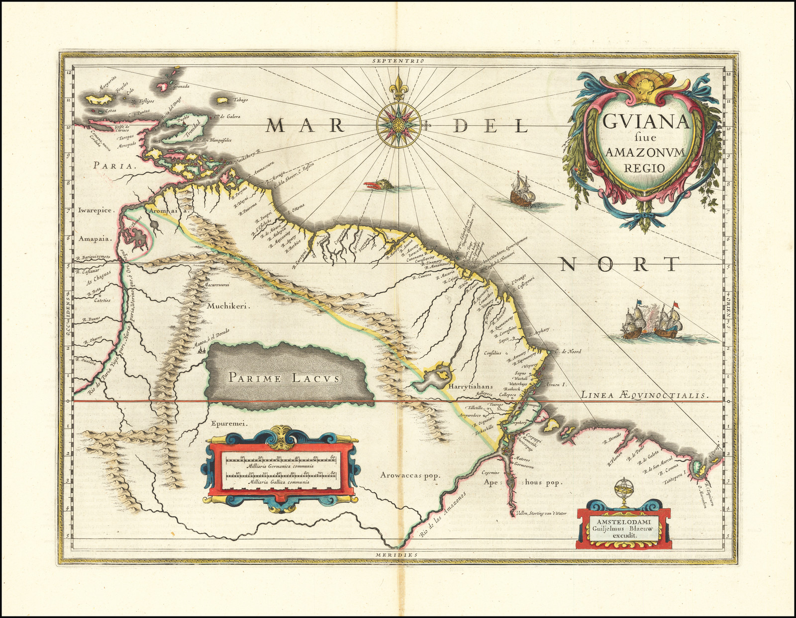
GUIANA sive AMAZONUM REGIO
Mapa 1600 - 1699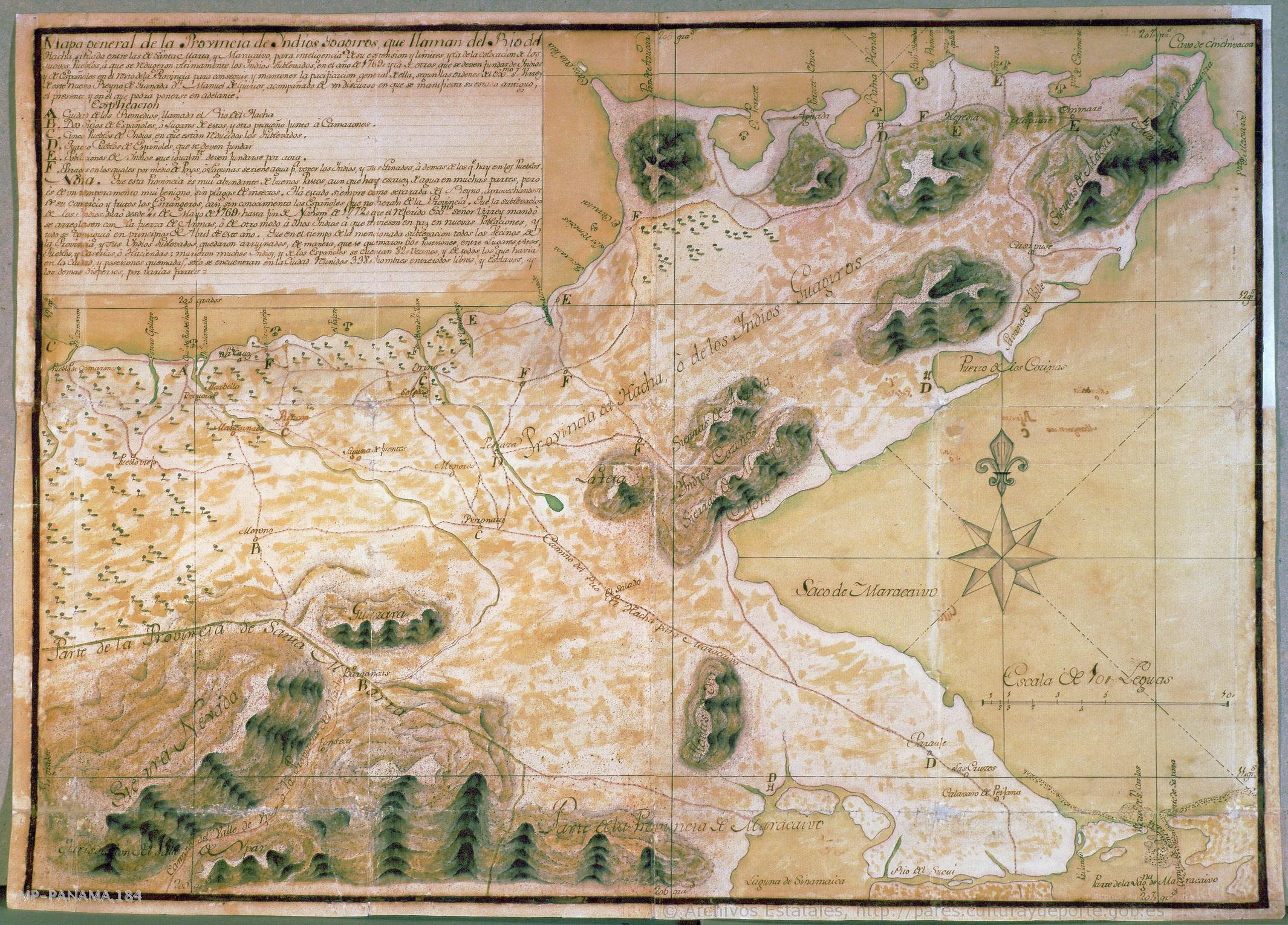
Mapa general de la Provincia de yndios Goagiros que llaman del Río del Hacha
Mapa 1773