Dispossesions in the Americas

Dispossesions in the Americas

  • Inicio
  • Explorar
  • Autores
  • Sobre
  • Arte
  • Cuerpos
  • Planes de Estudio
  • Herencia Cultural
  • Mapas
  • Territorios
Volver a Explorar

Leyendo en Inglés

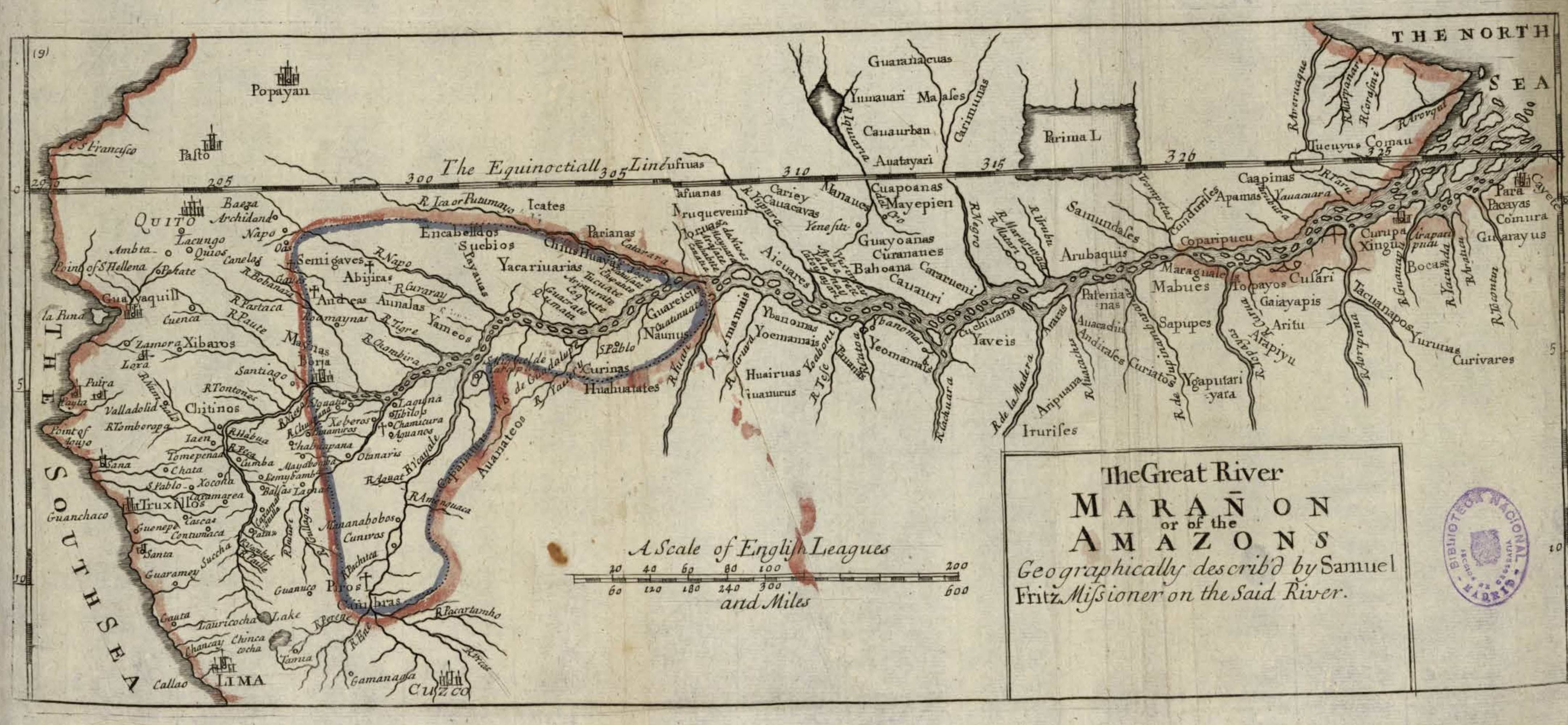
Mapa 1717

The Great River Marañon or of the Amazons

  • FRITZ, SAMUEL

Publicado: 1717

  • Descargar Imágen
  • Descargar Imágen
Mapa 1717

The Great River Marañon or of the Amazons

  • FRITZ, SAMUEL

Publicado: 1717

  • Descargar Imágen

Pueblos

  • GUARANACUAS
  • TUMAUARI
  • MAASES
  • CAUAURBAN
  • AUATAYARI
  • CARIMUNAS
  • TUCUYUS
  • COMAU
  • GUAYARUS
  • COMURA
  • PACAYAS
  • CURIVARES
  • YURUNAS
  • BOCAS
  • XINGU
  • TACUANAPOS
  • CUSARI
  • TOPAYOS
  • GAIAYAPIS
  • ARITU
  • ARAPIYU
  • MARAGUALES
  • MABUES
  • SAPUPES
  • YGAPUTARIYARA
  • PATENIANAS
  • AUACADUS
  • ANDIRASES
  • ARARAS
  • ARIPUANA
  • IRURISES
  • YAVEIS
  • CUCHIUARAS
  • YEOMAMAIS
  • PAUANAS
  • YBANOMAS
  • YOEMAMAIS
  • HUAIRUAS
  • IUANURUS
  • YEMAMAIS
  • HUAHUATATES
  • AUANATEOS
  • CAAPINAS
  • APAMAS
  • COPARIPUCU
  • CUNDURISES
  • SAMUNDASES
  • ARUBAQUIS
  • CUAPOANAS
  • MAYEPIEN
  • GUAYOANAS
  • CURANATIES
  • BAHOANA
  • CARARUENI
  • CAUAURI
  • MANAUES
  • CARIEY
  • CAUACAVAS
  • AICUARES
  • MORUAS
  • CASUANAS
  • PARIANAS
  • ICATES
  • GUAREICUS
  • NAUNUS
  • CURINAS
  • YACARIUARIAS
  • CHIUS
  • HUAYAS
  • SUCBIOS
  • ENCABELLDOS
  • PAYAUAS
  • SEMIGAVES
  • ABIJIRAS
  • ANDEAS
  • AUNALAS
  • YAMEOS
  • MAYNAS
  • CAPANATUAS
  • CAMBRAS
  • PIROS
  • CHITINOS

Citas

Fritz, Samuel. "The Great River Marañon or of the Amazons." Map. In America, by Herman Moll, 389. Vol. 5 of Atlas Geographus or, a compleat System of Geography, ancient and modern. London: John Nutt, 1717. Accessed July 14, 2023. http://bdh.bne.es/bnesearch/detalle/bdh0000163462.
  • Descargar Imágen

Artículos Relacionados

L'Amerique Meridionale divisée en ses principaux Etats

L'Amerique Meridionale divisée en ses principaux Etats

Mapa 1700 - 1800
PART OF A MAP OF GUIIANA BY J.J. HARTSINCK

PART OF A MAP OF GUIIANA BY J.J. HARTSINCK

Mapa 1770
Plan pour ouvrir une communication de la mer du Nord á la mer du Sud par la riviére San Juan;le lac de Nicaragua et la baie del Papagaye.

Plan pour ouvrir une communication de la mer du Nord á la mer du Sud par la riviére San Juan;le lac de Nicaragua et la baie del Papagaye.

Mapa 1700
TAMÁRÃHO

TAMÁRÃHO

Mapa 2015
Rio Para

Rio Para

Mapa 1700 - 1750
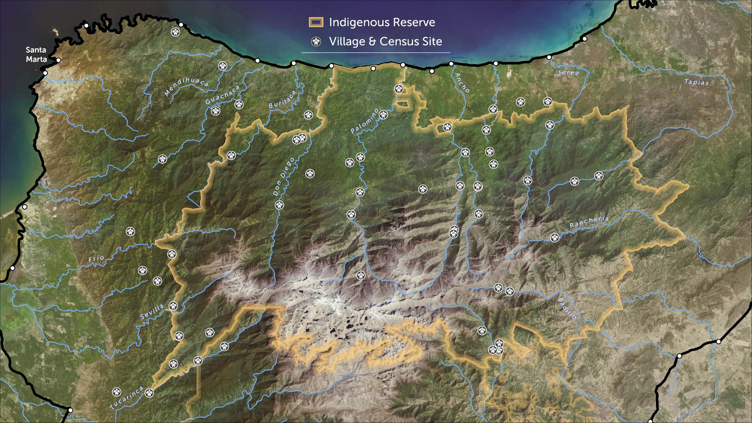
FIGURAS DE ORDENAMIENTO TERRITORIAL EN LA SNSM

FIGURAS DE ORDENAMIENTO TERRITORIAL EN LA SNSM

Mapa 2009
Matrimonios Duitama

Matrimonios Duitama

Mapa 1500 - 1600
Detail from the 1770 copy of Francisco Álvarez Barreiro’s 1728 map of northern New Spain illustrating Spanish mapping of Indian domains in southern Texas and along the Gulf Coast, especially through the repetition of labels: “tierra de los Pampopas,” “tierra de los Carrizos,” “tierra de los Cujanes,” etc.

Detail from the 1770 copy of Francisco Álvarez Barreiro’s 1728 map of northern New Spain illustrating Spanish mapping of Indian domains in southern Texas and along the Gulf Coast, especially through the repetition of labels: “tierra de los Pampopas,” “tierra de los Carrizos,” “tierra de los Cujanes,” etc.

Mapa 1728

Despojos en las Américas

Un Proyecto de

University of Pennsylvania

Copyright 2024

Con el apoyo de

Mellon Foundation

Diseño y Desarrollo del Sitio

Element 84

Créditos Artísticos

Fritz, Samuel. “The Great River Marañon or of the Amazons.” Map. In America, by Herman Moll, 389. Vol. 5 of Atlas Geographus or, a compleat System of Geography, ancient and modern. London: John Nutt, 1717. Accessed July 14, 2023. http://bdh.bne.es/bnesearch/detalle/bdh0000163462.
Páginas del Sitio

  • Inicio
  • Explorar
  • Autores
  • Sobre
  • Arte
  • Cuerpos
  • Planes de Estudio
  • Herencia Cultural
  • Mapas
  • Territorios