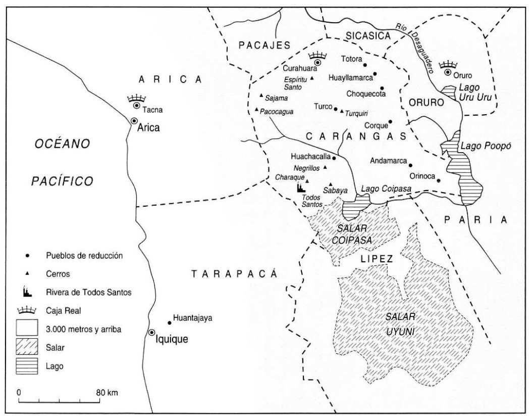
Pueblos
- CARANGAS
Cita
Gavira-Marquez, M. C. (2008). Población indígena, minería y sublevación en Carangas: La caja real de Carangas y el mineral de Huantajaya, 1750-1804. Instituto Francés de Estudios Andinos - CIHDE.
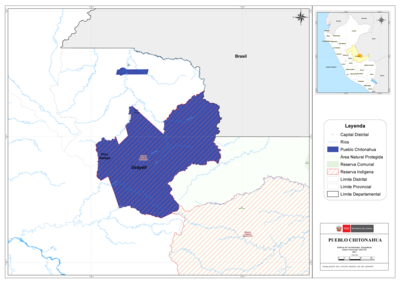
PUEBLO CHITONAHUA
Mapa 2021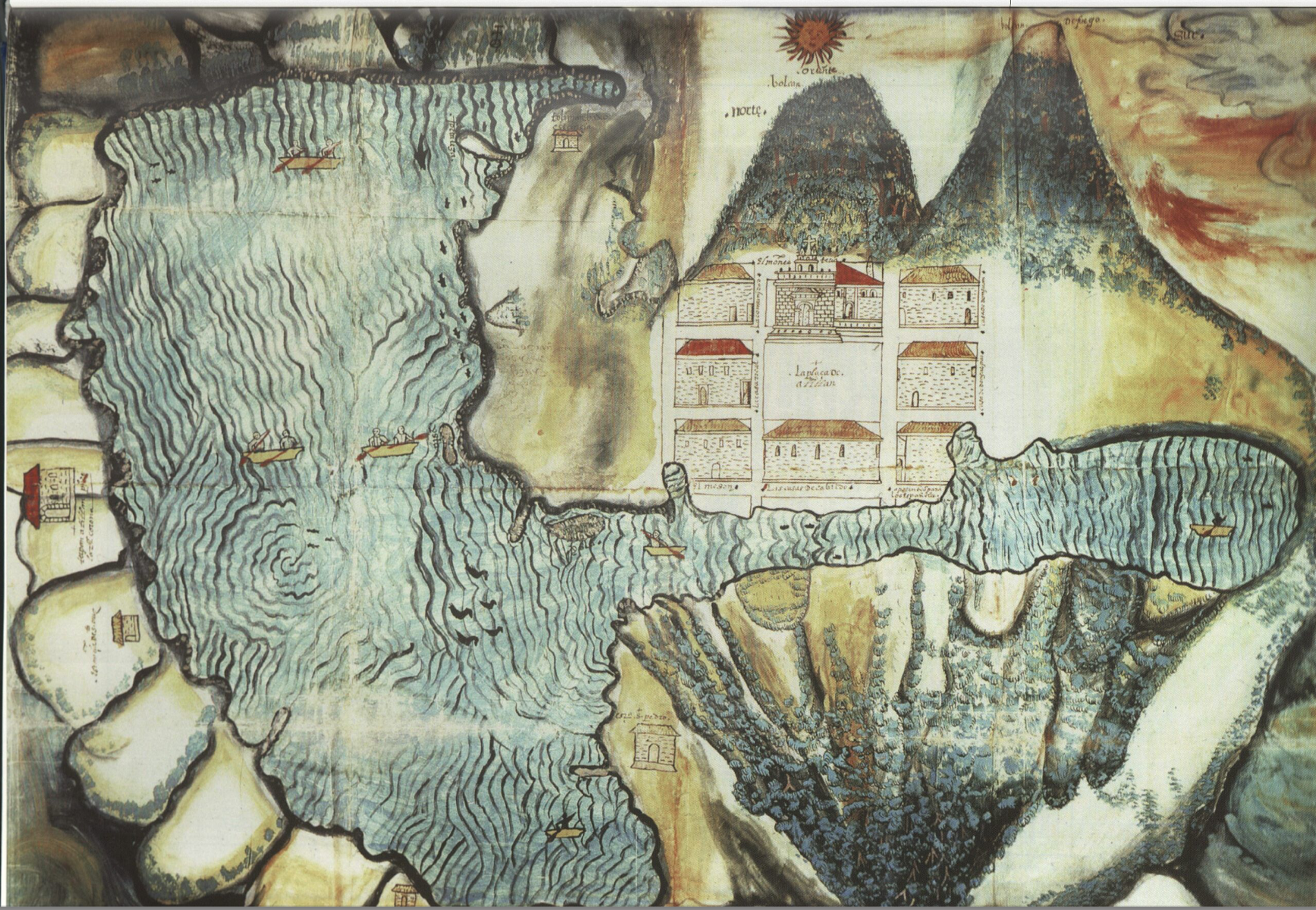
Asiento del pueblo de Santiago Atitlán c 1585.
Mapa 1585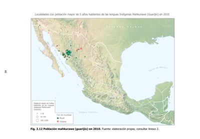
Población mahkurawe (guarijío) en 2010
Mapa 2010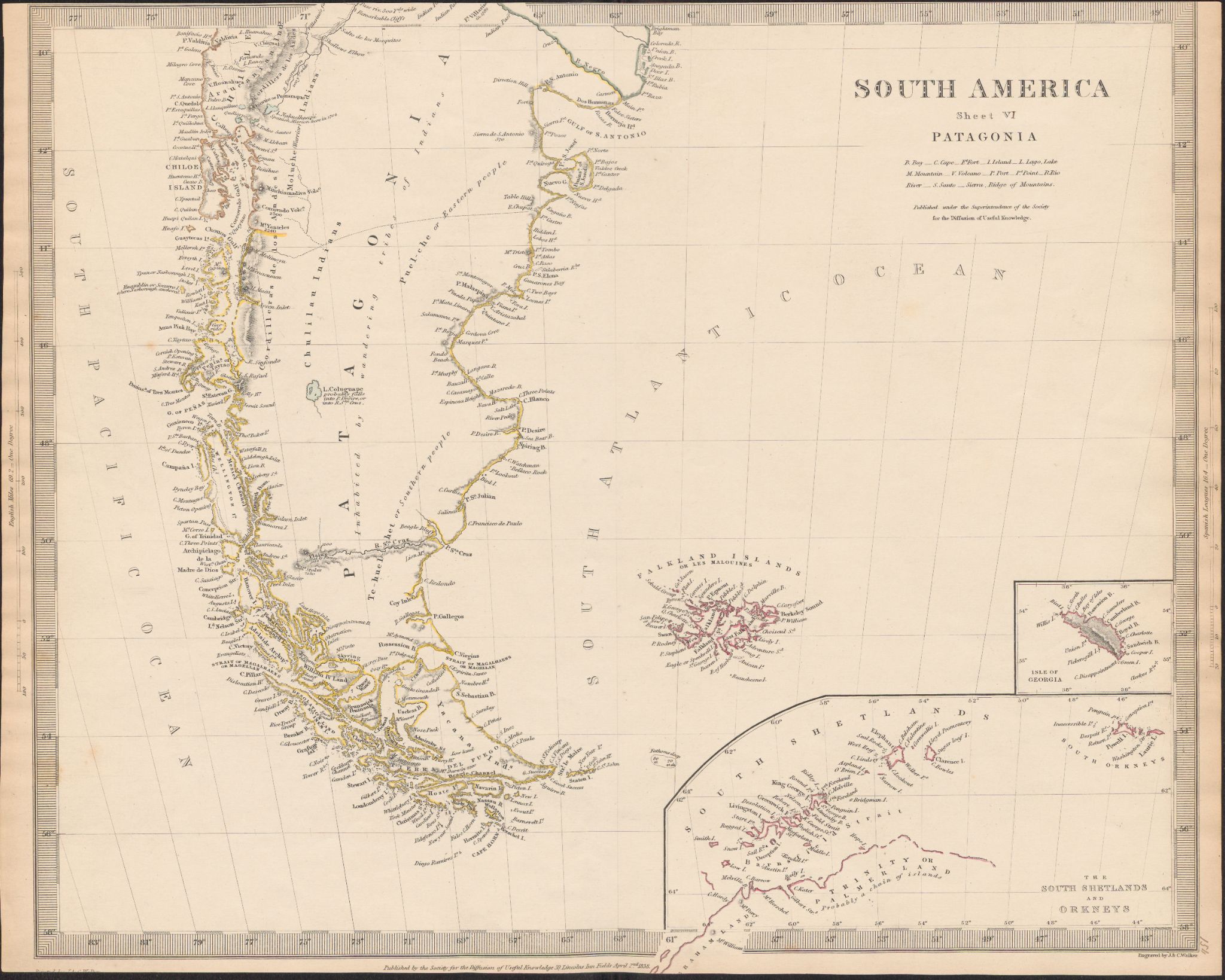
South America
Mapa 1800 - 1850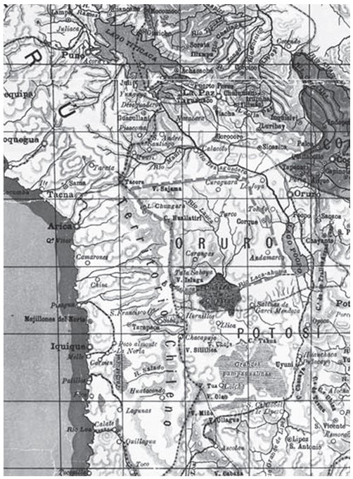
APPROXIMATE BORDERS OF TERRITORY OF THE AYMARA POLITY KARANQAS (OR CARANGAS) IN THE 19TH CENTURY
Mapa 1894
Detail from the 1770 copy of Francisco Álvarez Barreiro’s 1728 map of northern New Spain illustrating Spanish mapping of Indian domains in southern Texas and along the Gulf Coast, especially through the repetition of labels: “tierra de los Pampopas,” “tierra de los Carrizos,” “tierra de los Cujanes,” etc.
Mapa 1728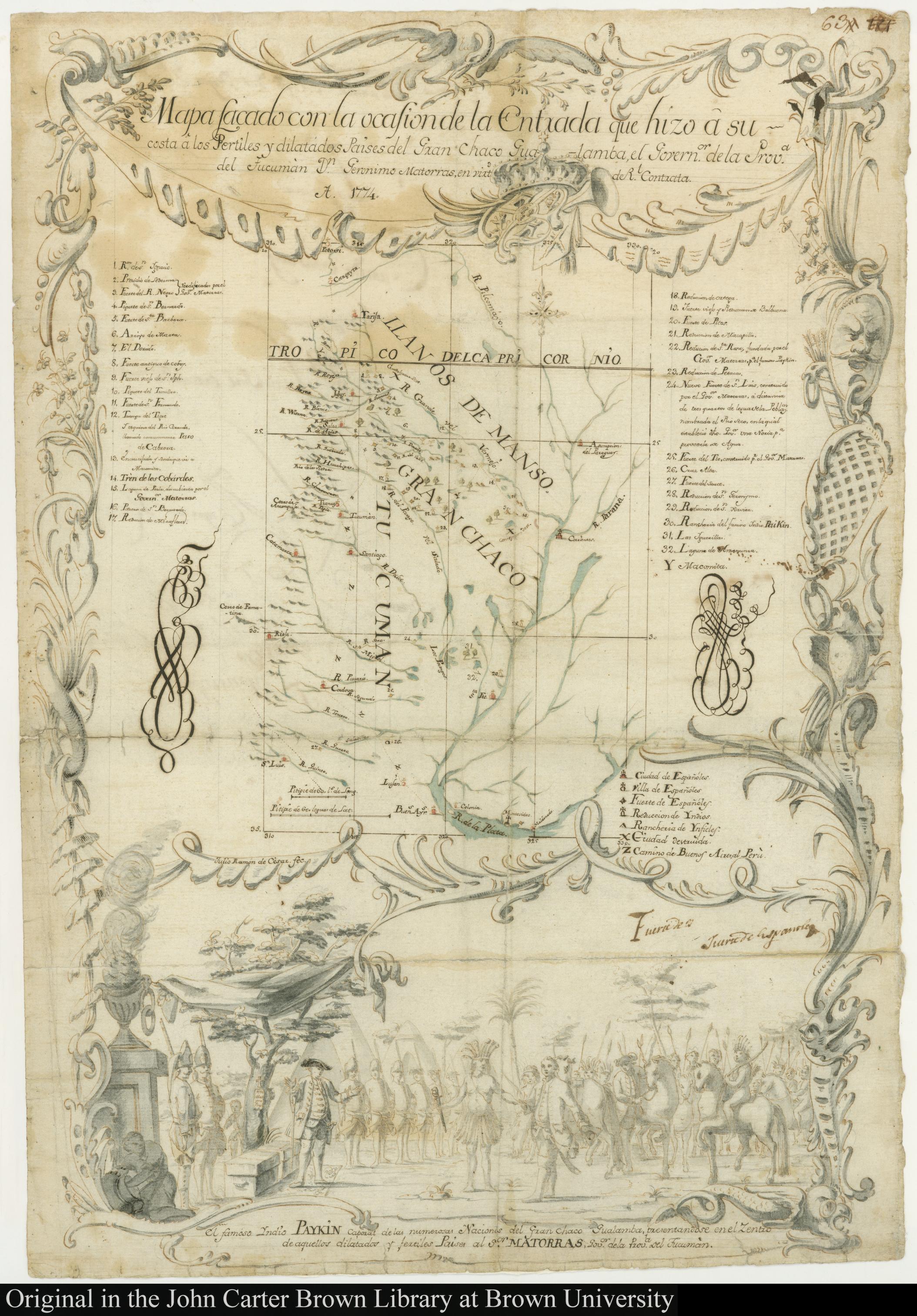
MAPA SACADO CON LA OCASION DE LA ENTRADA QUI HIZO Â SU COSTA Â LOS FERTILES Y DILATADOS PAISES DEL GRAN CHACO GUALAMBA
Mapa 1774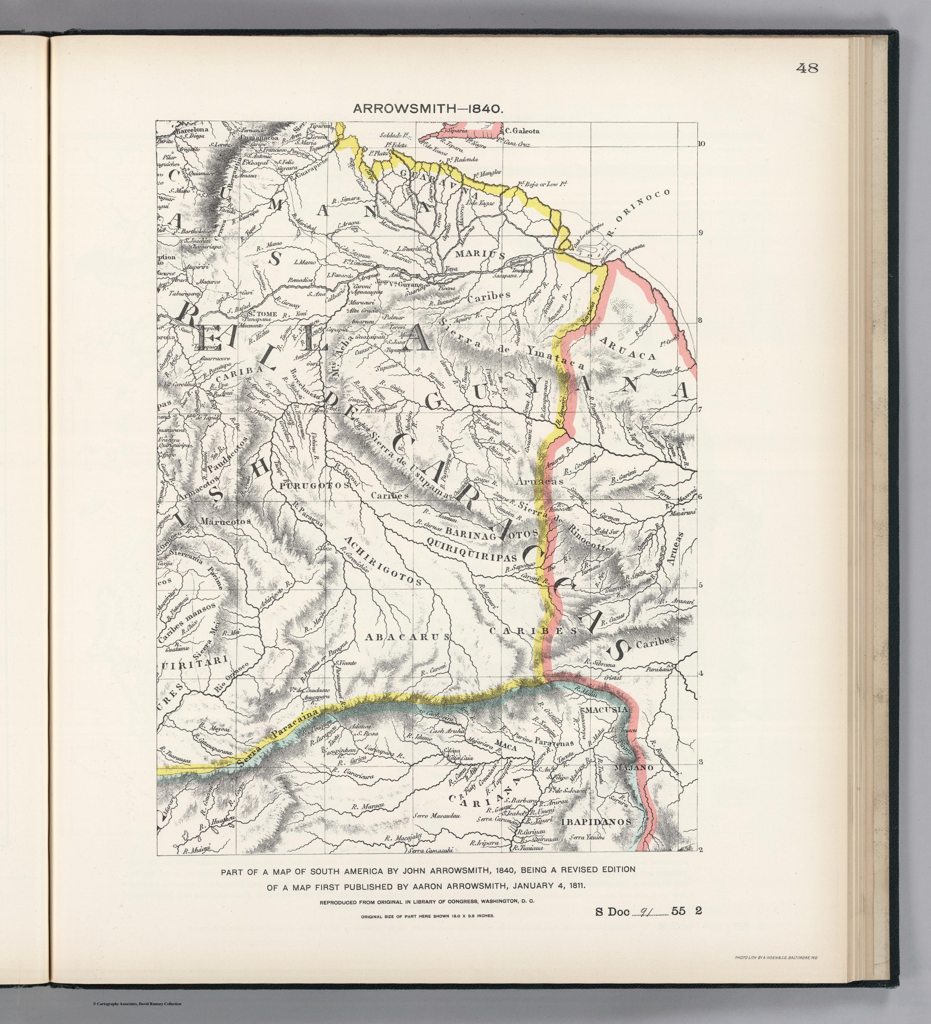
PART OF A MAP OF SOUTH AMERICA BY JOHN ARROWSMITH;1840;BEING A REVISED EDITION OF A MAP FIRST PUBLISHED BY AARON ARROWSMITH
Mapa 1840