Pueblos- MAYA
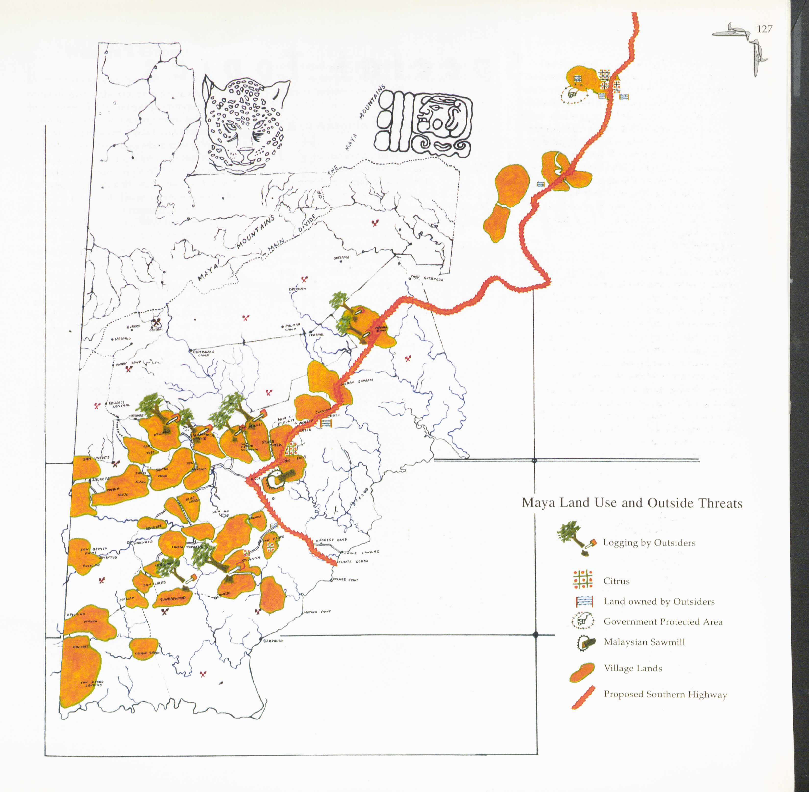
CitasMaya Land use and Outside Threats. 1977 BOOK
Maya Land use and Outside Threats. 1977 BOOK
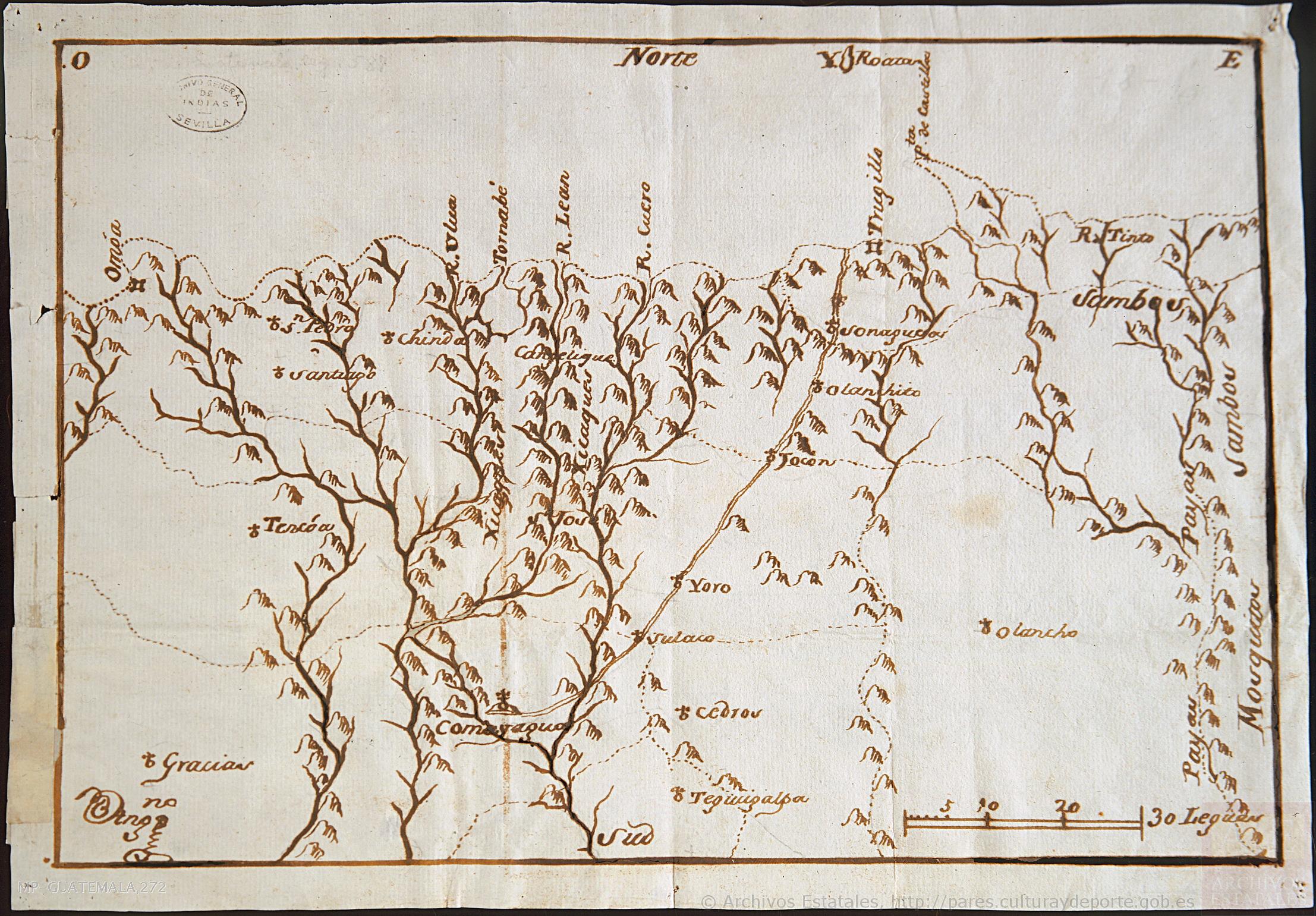
Mapa de la parte de la Provincia de Comayagua ú Honduras en que habitan los indios Xicaques.
Mapa 1798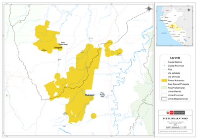
PUEBLO KAKATAIBO
Mapa 2021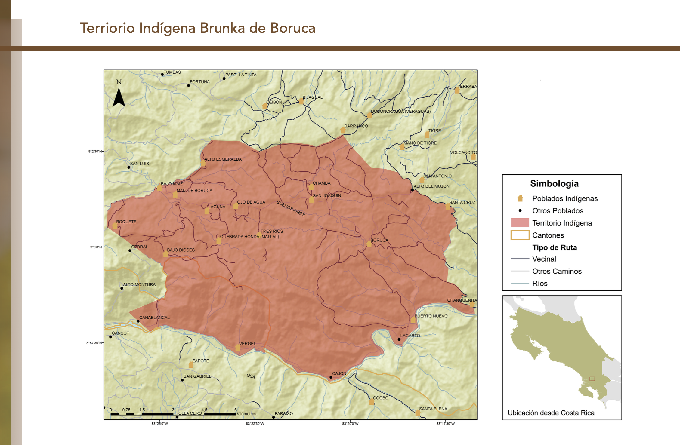
"Territorio Indígena Brunka de Boruca"
Mapa 2010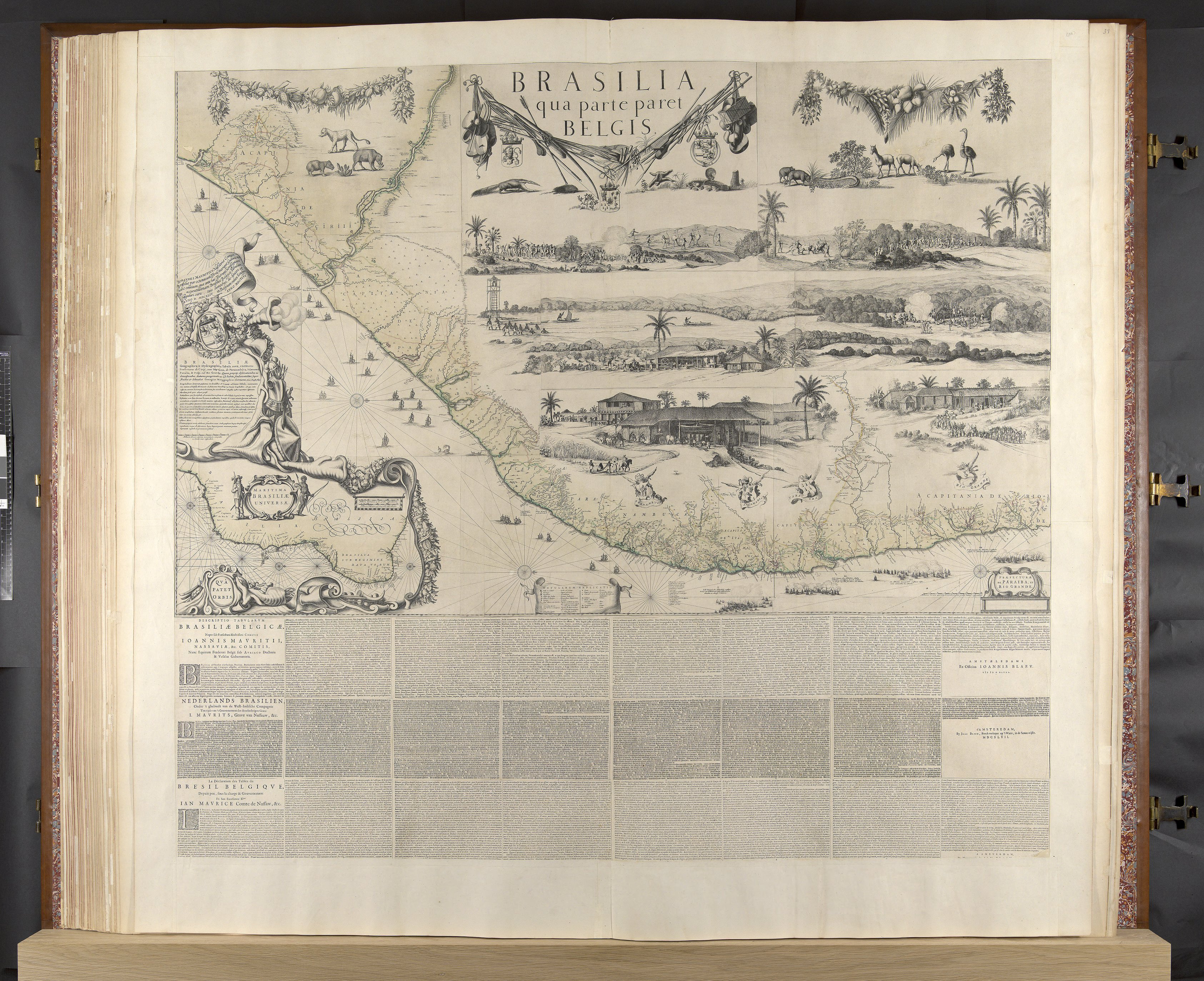
BRASILIA qua parte paret BELGIS
Mapa 1644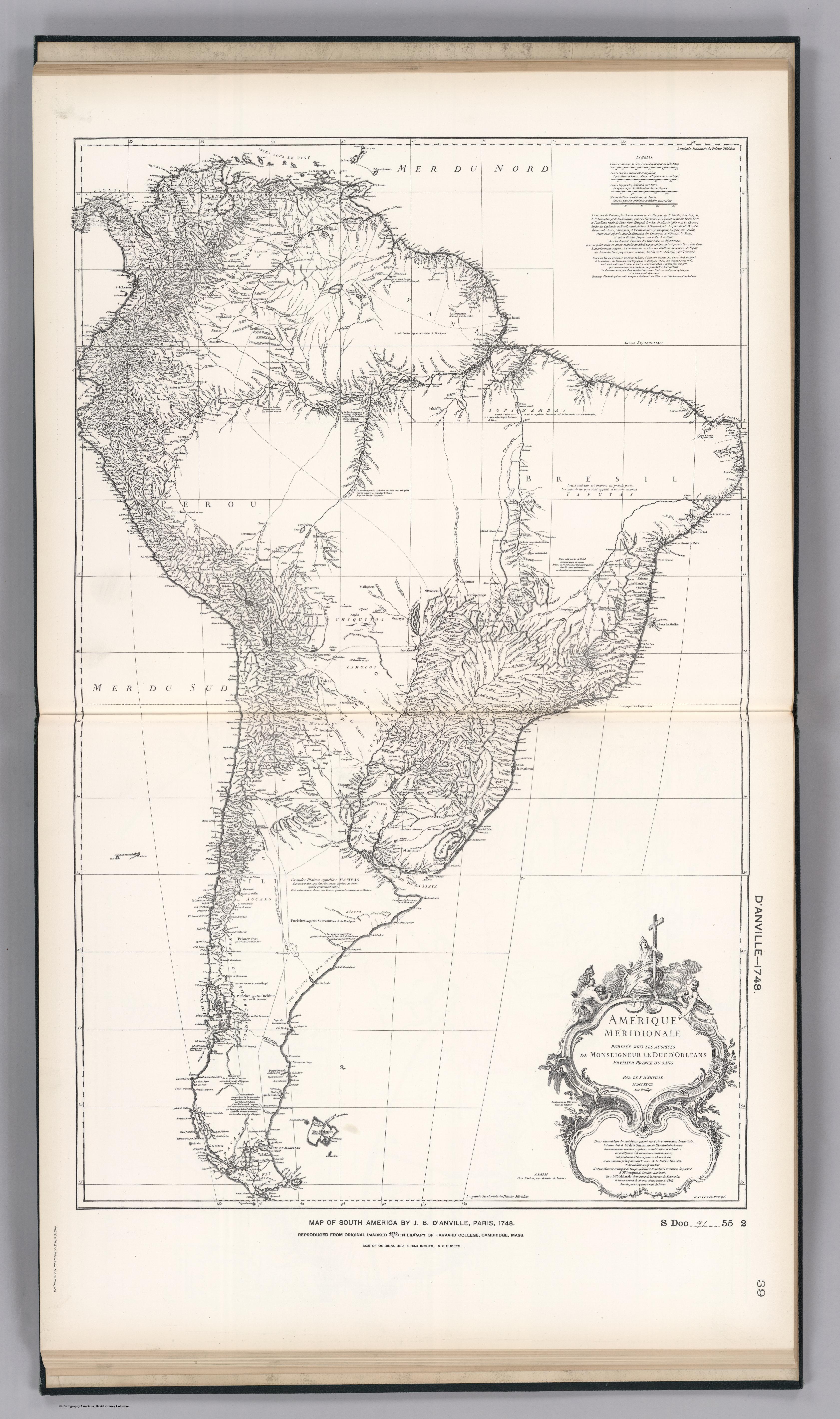
FACSIMILE: SOUTH AMERICA BY D'ANVILL
Mapa 1748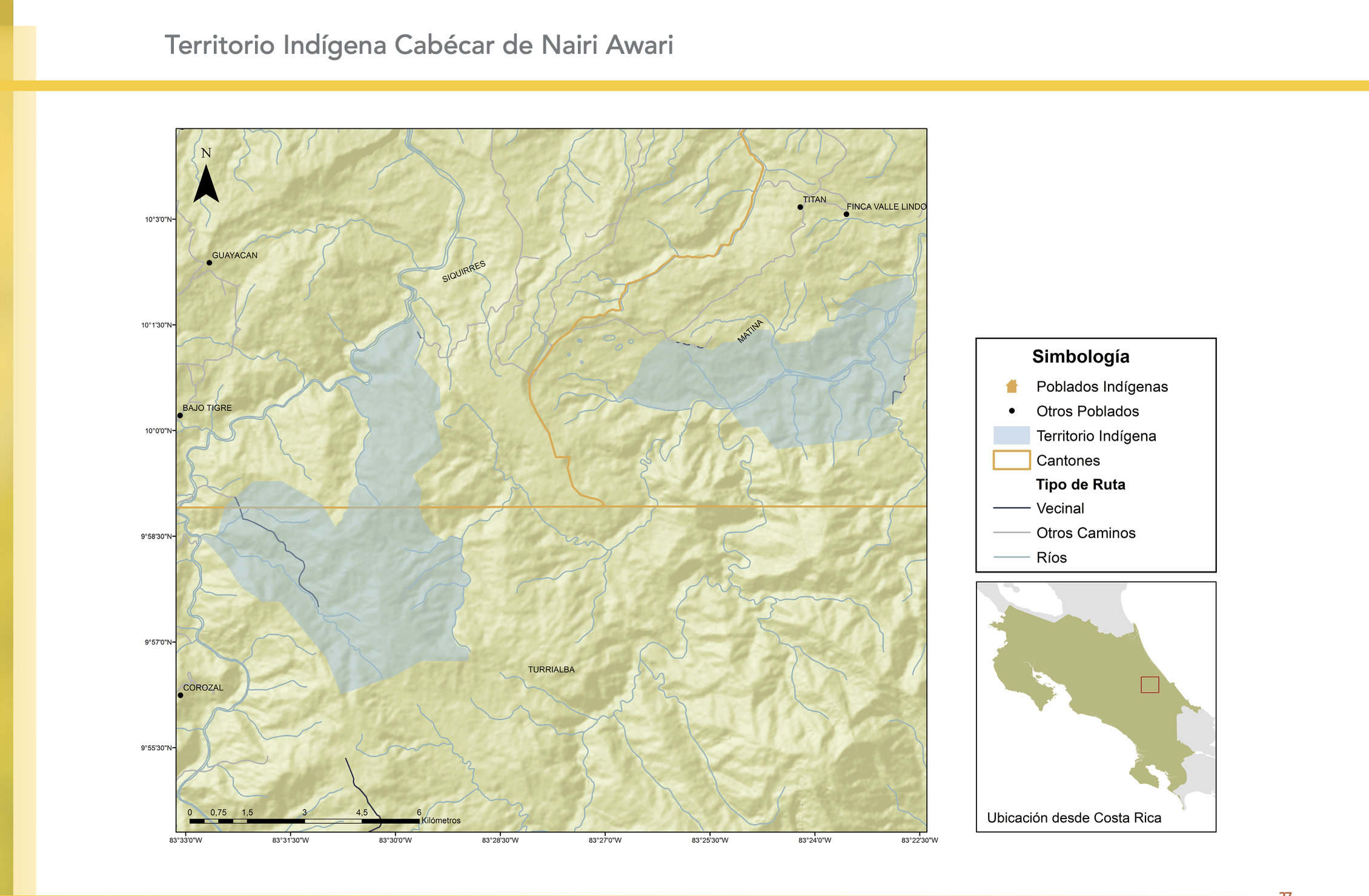
"Territorio Indígena Cabécar de Nairi Awari"
Mapa 2010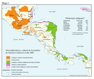
Diversidad étnica y cultural de los pueblos de América Central en el año 2000
Mapa 2000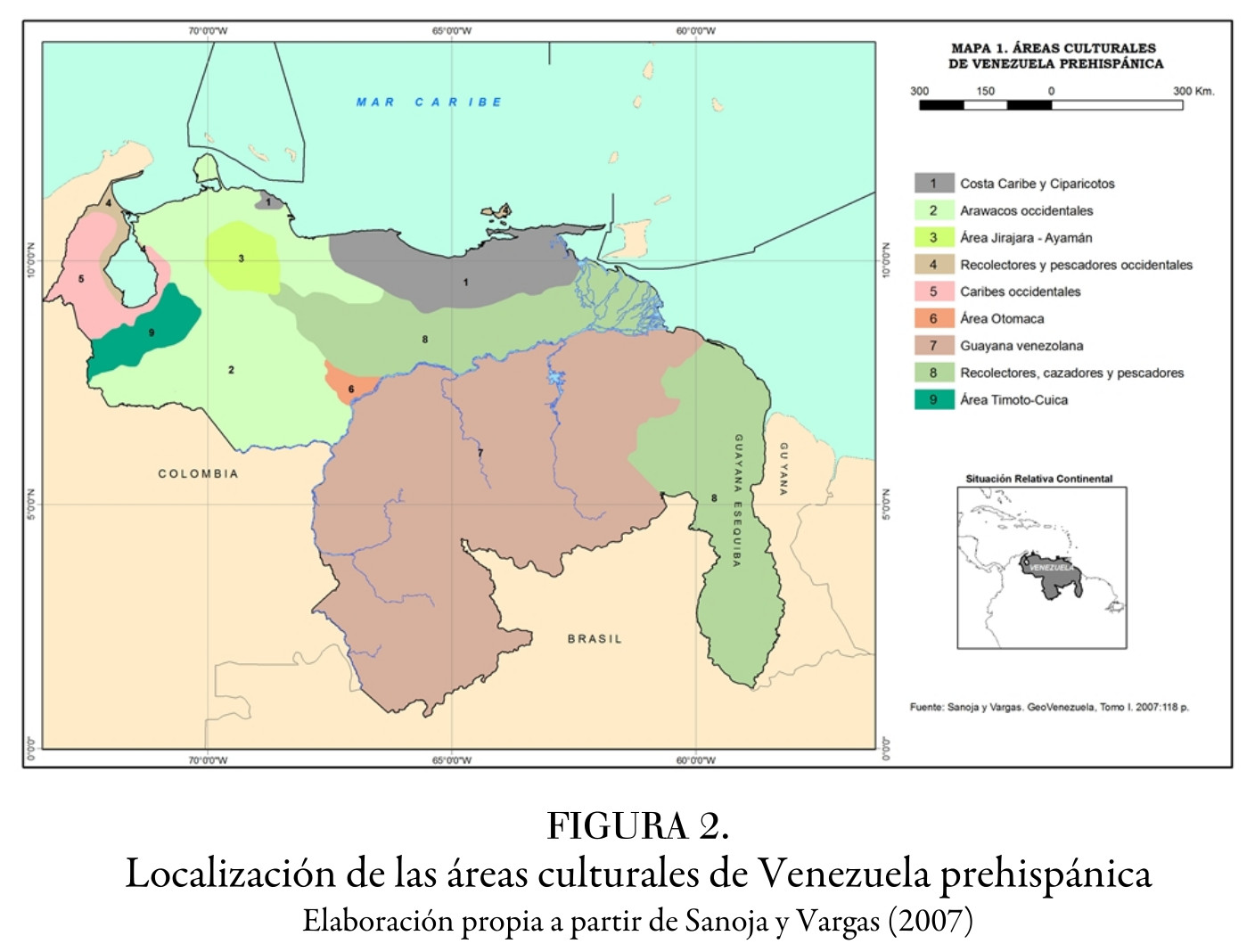
Localización de las áreas culturales de Venezuela prehispánica
Mapa 1490