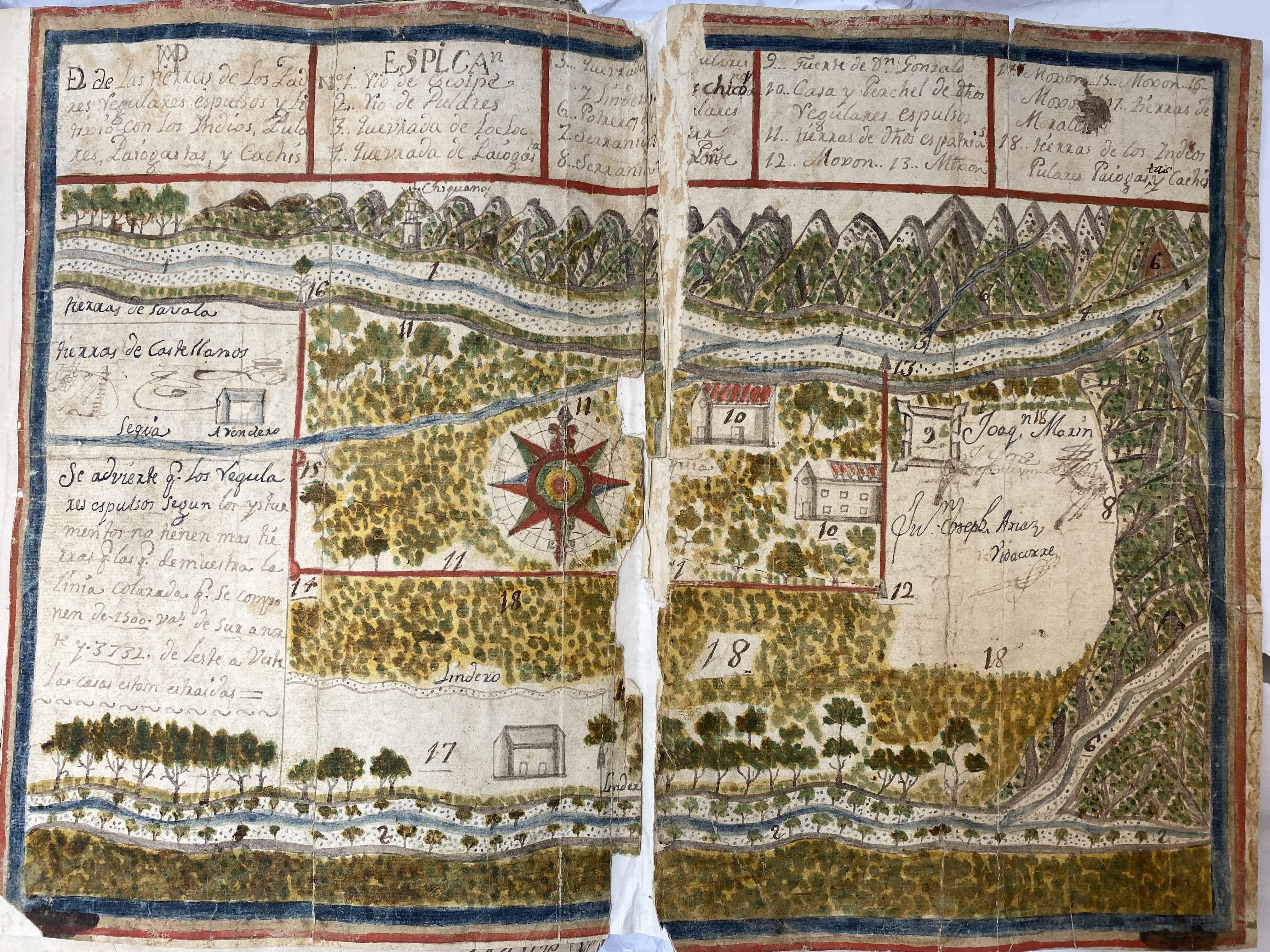
Pueblos
- PULARES
- PALOGASTAS
- CACHIS
Cita
Argentina. Archivo General de la Nación. Sala 9 (9-35-7-6 (1) o 9/3033). "Dibujo de las tierras de los padres regulares espulsos y litixio con los indios, Pulares, Palogastas y Cachis. 1790"
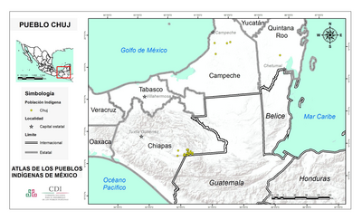
PUEBLO CHUJ
Mapa 2020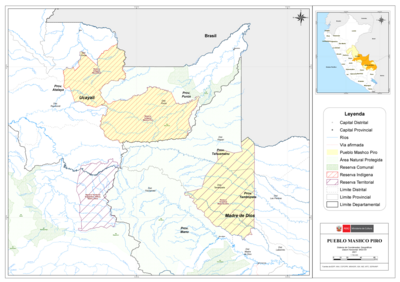
PUEBLO MASHCO PIRO
Mapa 2021
Mosquitia or The Mosquito Shore with The Eastern Part of Yucatán as far as the 20th Degree of North Latitude
Mapa 1787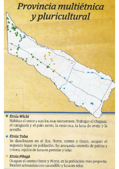
Provincia multiétnica y cultural
Mapa 2005
Sketch of the country from reduction to Buenos Ayres, shewing the movements of B. Genl. Beresford, when he captured that place June 1806. Drawn from memorandums furnished by Capt: Donnelly
Mapa 1806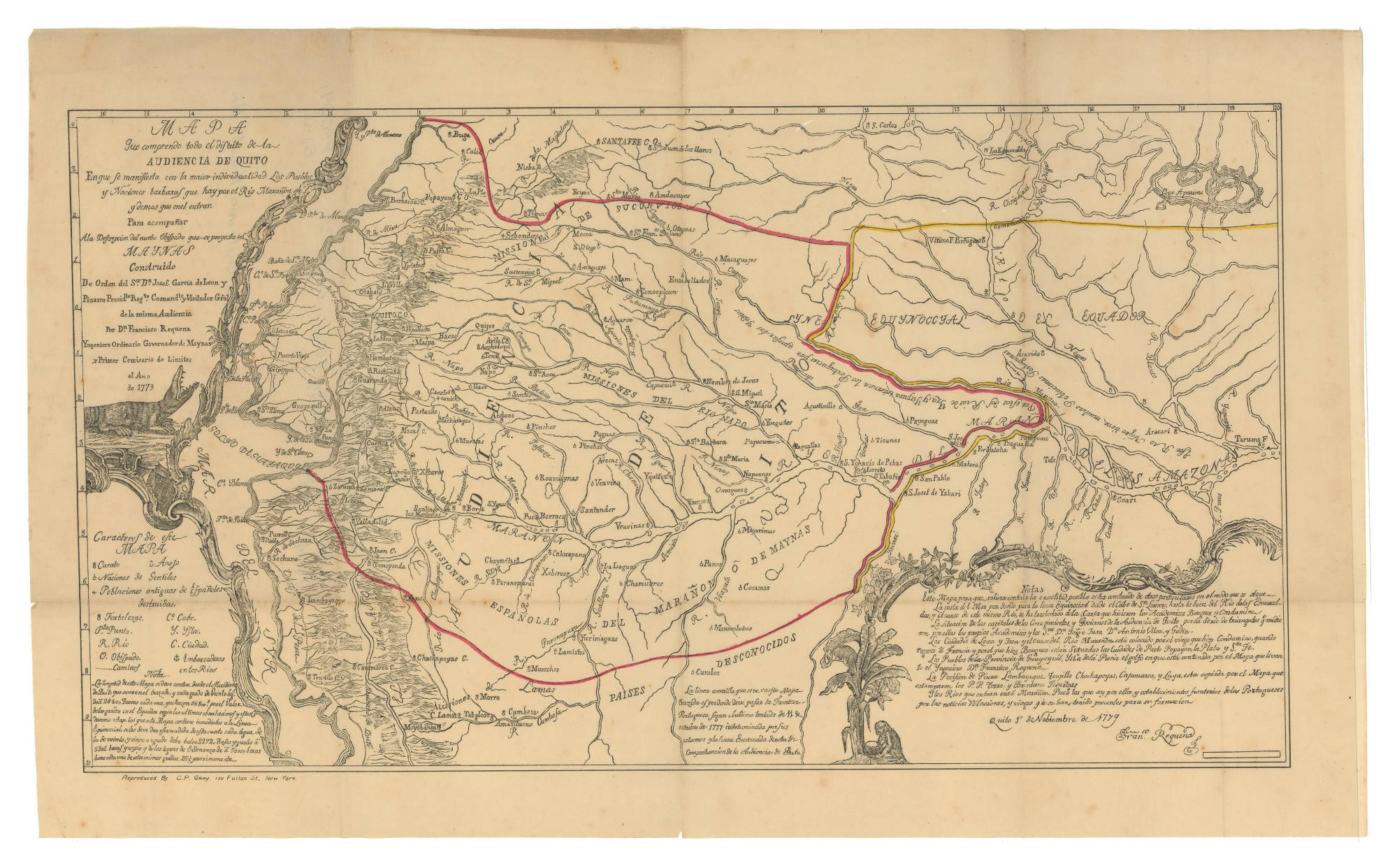
MAPA QUE COMPRENDE TODO EL DISTRITO DE LA AUDIENCIA DE QUITO
Mapa 1779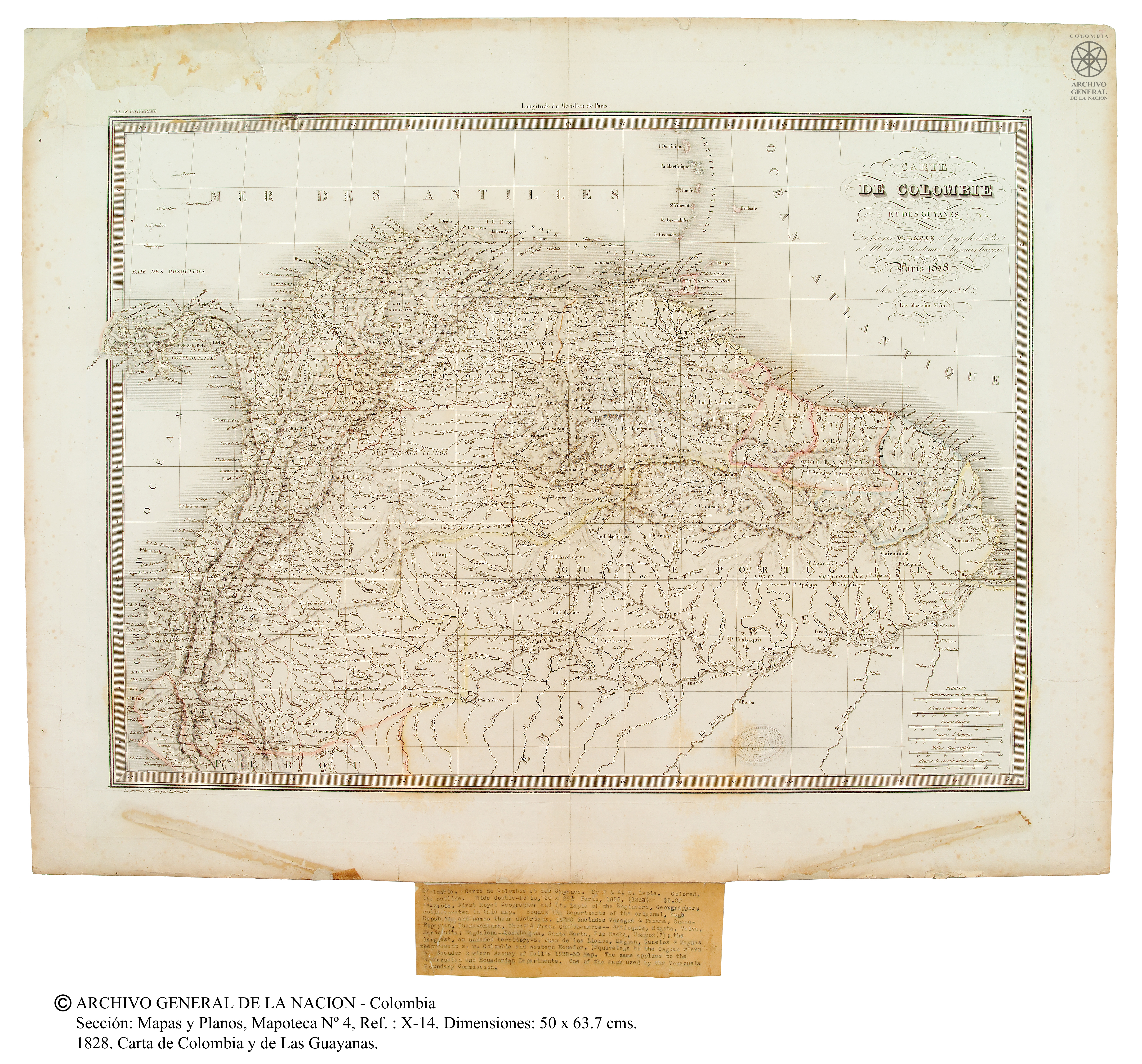
Carte de Colombie et des Guyanes
Mapa 1800 - 1899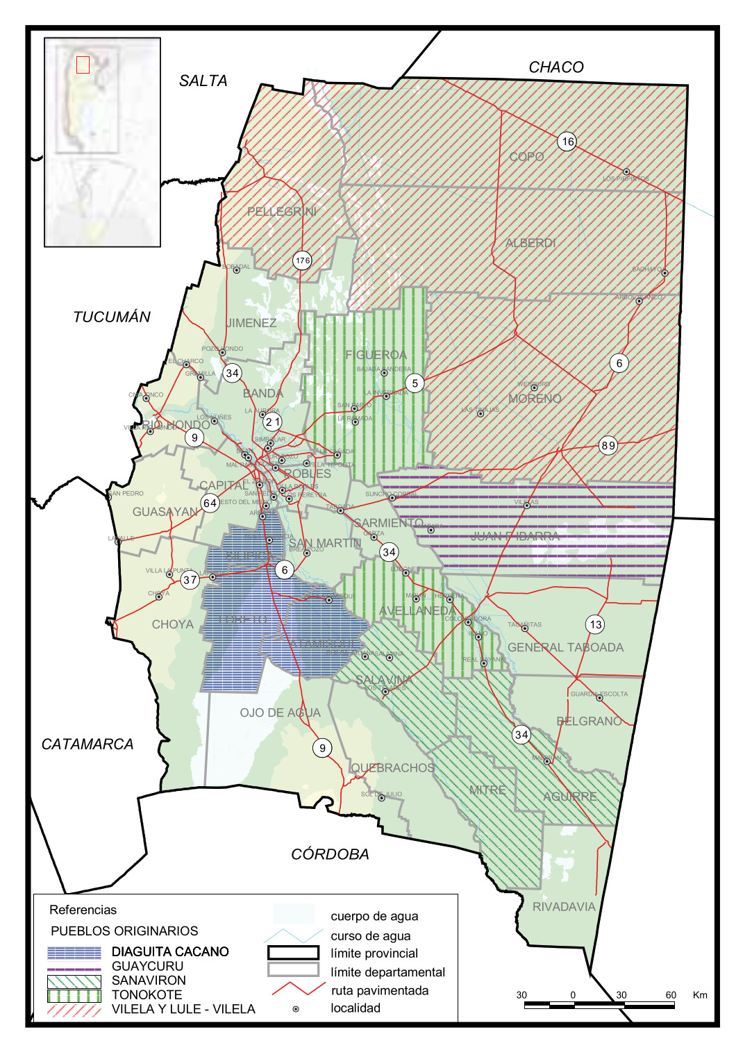
Pueblos Originarios, Santiago del Estero
Mapa 2016