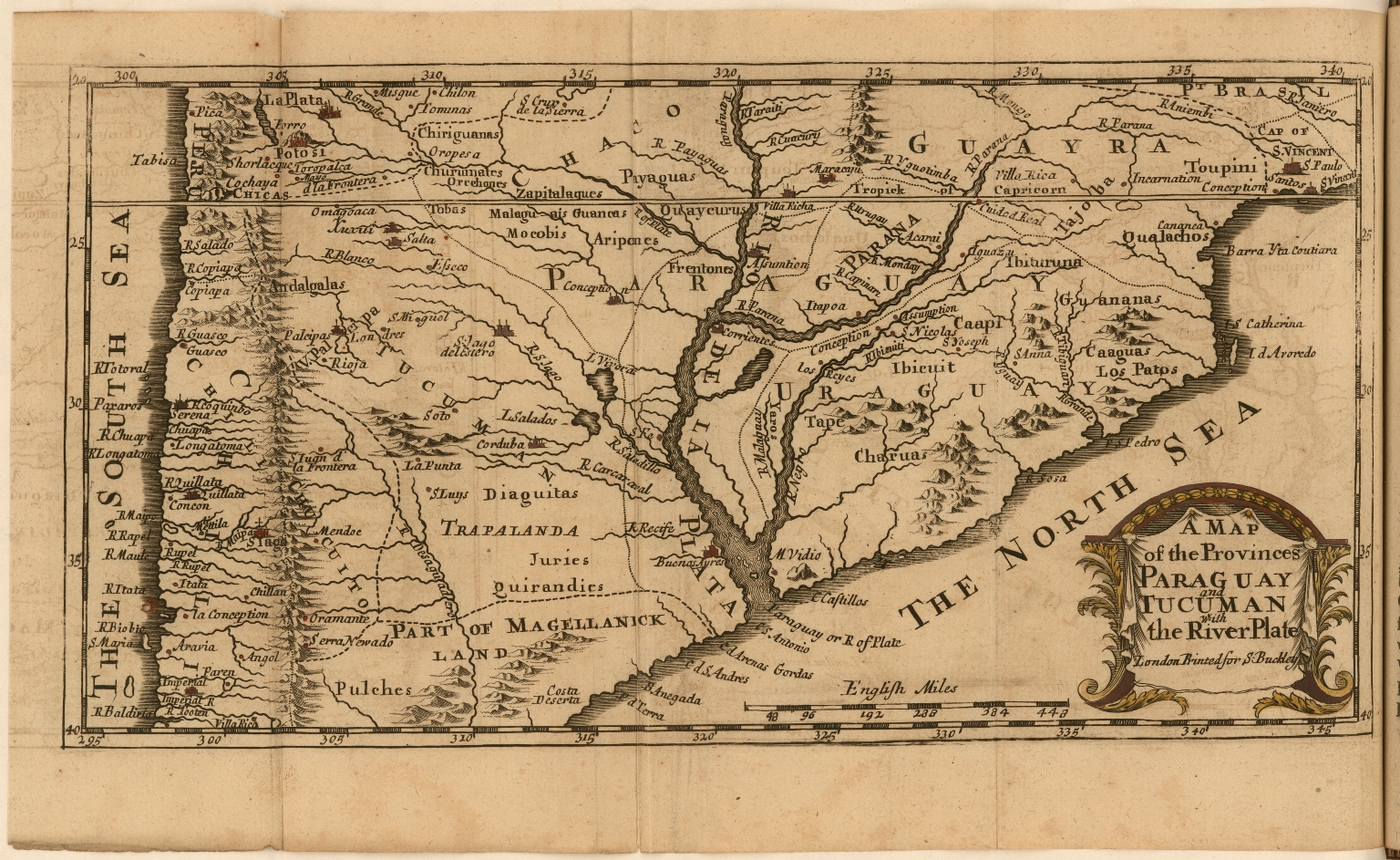
Pueblos
- DIAGUITAS
- QUERANDIES
- PULCHES
- MOCOBI
Cita
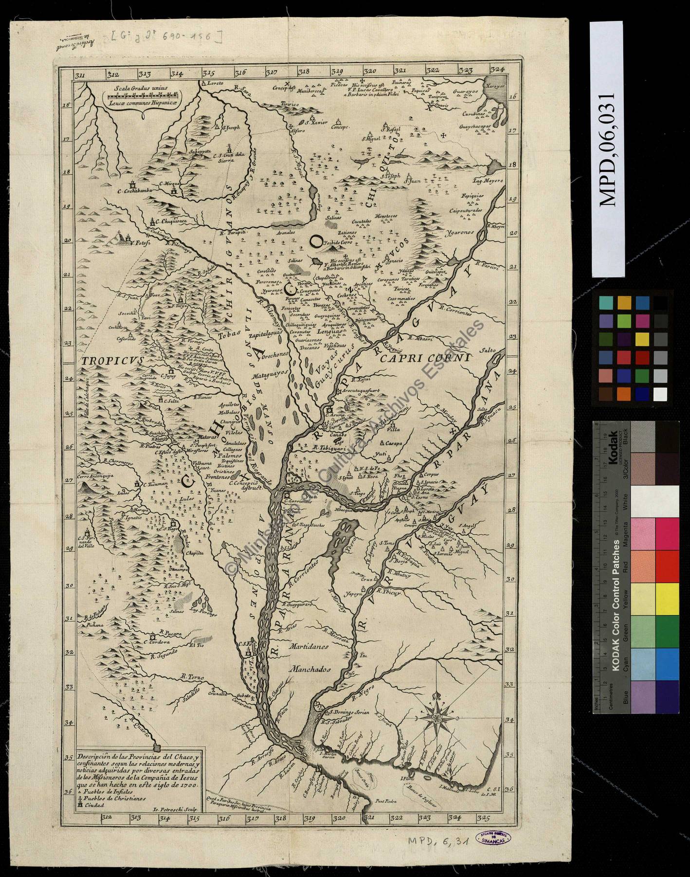
D'Acugna, Christopher. "A Map of the Provinces Paraguay and Tucuman with the River Plate." Map. 1698. Accessed March 10, 2022. https://jcb.lunaimaging.com/luna/servlet/detail/JCBMAPS~1~1~5556~115901221:A-Map-of-the-Provinces-Paraguay-and?sort=normalized_date%2Cfile_name%2Csource_author%2Csource_title#
![Pátria, sangue e nada mais [Patria, sangre y nada más]](https://dnet8ble6lm7w.cloudfront.net/art_sm/ABRA010.png)
![Tawahka homeland, 1916: Showing Río Wampú (Wanpo), Río Patuca (Butuk), Cerro Quigungun (Wangkibila Volc [anol]), and the first cartographical rendering of Krautara (Moravian Archives, Bethlehem, Pennsylvania, Heath 1916)](https://dnet8ble6lm7w.cloudfront.net/maps_sm/HON/HON0014.png)