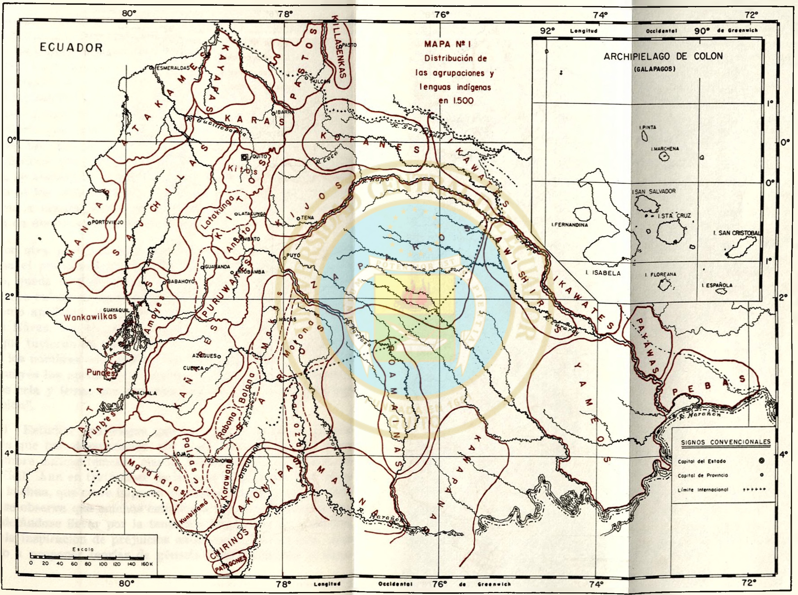
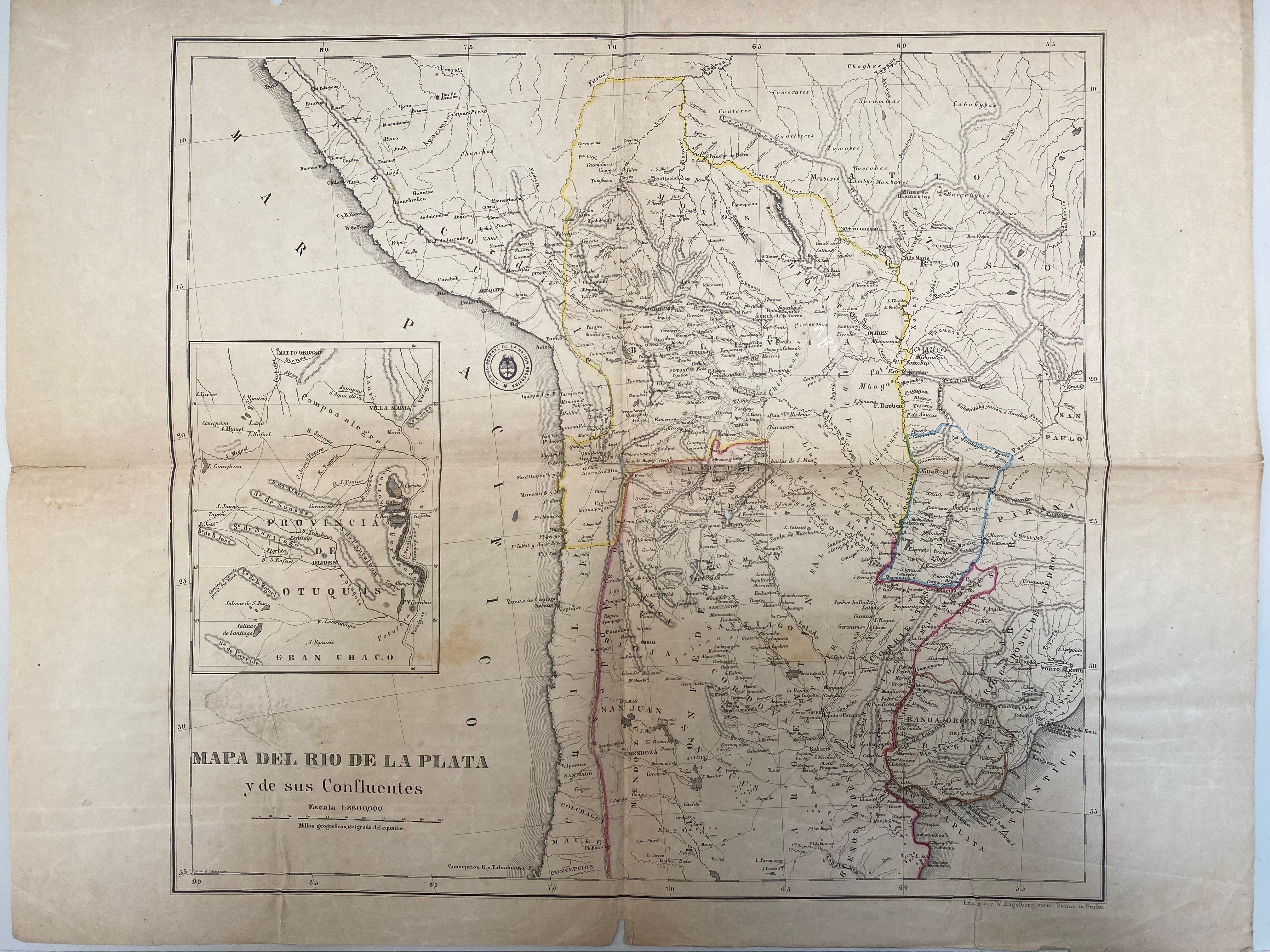
Dispossesions in the Americas

Dispossesions in the Americas

  • Inicio
  • Explorar
  • Autores
  • Sobre
  • Arte
  • Cuerpos
  • Planes de Estudio
  • Herencia Cultural
  • Mapas
  • Territorios
Volver a Explorar

Leyendo en Inglés

Mapa 1716

A New Map of Part /of the Great River / De la Plata, /of Tucuman / and the adjacent Countries, from Buenos Ayres to Potosí

  • Moll, H.

Publicado: 1716

  • Descargar Imágen
  • Descargar Imágen
Mapa 1716

A New Map of Part /of the Great River / De la Plata, /of Tucuman / and the adjacent Countries, from Buenos Ayres to Potosí

  • Moll, H.

Publicado: 1716

  • Descargar Imágen

Pueblos

  • MATACOS
  • TOBAS
  • GUAYCURUES
  • MOCOVIES
  • CHIRIGUANOS
  • OVANAS
  • GUISNAIS
  • TIRUMBAES

Cita

Moll, H. "A New Map of Part /of the Great River / De la Plata, /of Tucuman / and the adjacent Countries, from Buenos Ayres to Potosí." Map. 1716. 7 - 134 (1). Archivo General de la Nacion Argentina.

  • Descargar Imágen

Leyendo en Portugués

Mapa 1716

A New Map of Part /of the Great River / De la Plata, /of Tucuman / and the adjacent Countries, from Buenos Ayres to Potosí

  • Moll, H.

Publicado: 1716

  • Descargar Imágen

Pueblos

  • MATACOS
  • TOBAS
  • GUAYCURUES
  • MOCOVIES
  • CHIRIGUANOS
  • OVANAS
  • GUISNAIS
  • TIRUMBAES

Cita

Moll, H. "A New Map of Part /of the Great River / De la Plata, /of Tucuman / and the adjacent Countries, from Buenos Ayres to Potosí." Map. 1716. 7 - 134 (1). Archivo General de la Nacion Argentina.

  • Descargar Imágen

Artículos Relacionados

PUEBLO HUAVE

PUEBLO HUAVE

Mapa 2020
Map of El Salvador with Specific indigenous communities in El Salvador, and the archaeological zone of Chalchuapa in western El Salvador. The Department of San Vicente is also highlighted.

Map of El Salvador with Specific indigenous communities in El Salvador, and the archaeological zone of Chalchuapa in western El Salvador. The Department of San Vicente is also highlighted.

Mapa 2010
VENEZUELA: INDIAN LANDS IN CRISIS

VENEZUELA: INDIAN LANDS IN CRISIS

Mapa 1995
Mapa VI.5 Lenguas indígenas de Venezuela

Mapa VI.5 Lenguas indígenas de Venezuela

Mapa 2009
MAPA N. 1 DISTRIBUCIÓN DE LAS AGRUPACIONES Y LENGUAS INDÍGENAS EN 1500

MAPA N. 1 DISTRIBUCIÓN DE LAS AGRUPACIONES Y LENGUAS INDÍGENAS EN 1500

Mapa 1500
Map of the Mosquito Coast;Nicaragua

Map of the Mosquito Coast;Nicaragua

Mapa 1894
Area of Tarascan Speech around 1800

Area of Tarascan Speech around 1800

Mapa 1800
Territorios significativos

Territorios significativos

Mapa 2010 - 2020

Despojos en las Américas

Un Proyecto de

University of Pennsylvania

Copyright 2024

Con el apoyo de

Mellon Foundation

Diseño y Desarrollo del Sitio

Element 84

Créditos Artísticos

Moll, H. “A New Map of Part /of the Great River / De la Plata, /of Tucuman / and the adjacent Countries, from Buenos Ayres to Potosí.” Map. 1716. 7 - 134 (1). Archivo General de la Nacion Argentina.

Páginas del Sitio

  • Inicio
  • Explorar
  • Autores
  • Sobre
  • Arte
  • Cuerpos
  • Planes de Estudio
  • Herencia Cultural
  • Mapas
  • Territorios