Dispossesions in the Americas
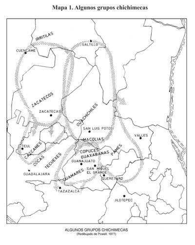
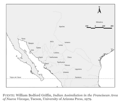
Algunos grupos chichimecas
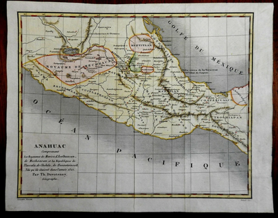
ANAHUAC Comprenant les Royaumes de Mexico, d'Acolhuacan, de Mechoacan, et les Republiques de Tlascala, de Cholula, de Huexotxinco & Tels qu 'ils etaient das l'annee 1521
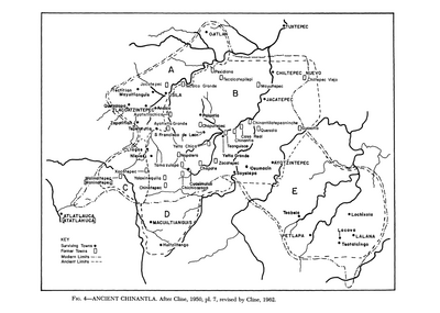
Ancient Chinantla
ARCHEOLOGICAL MAP OF MIDDLE AMERICA
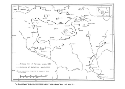
Area of Tarascan Speech about 1850
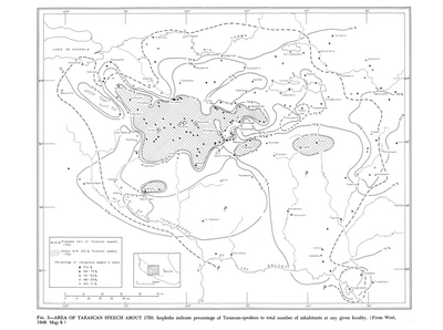
Area of Tarascan Speech around 1750
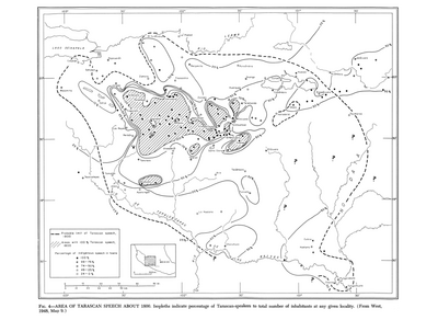
Area of Tarascan Speech around 1800
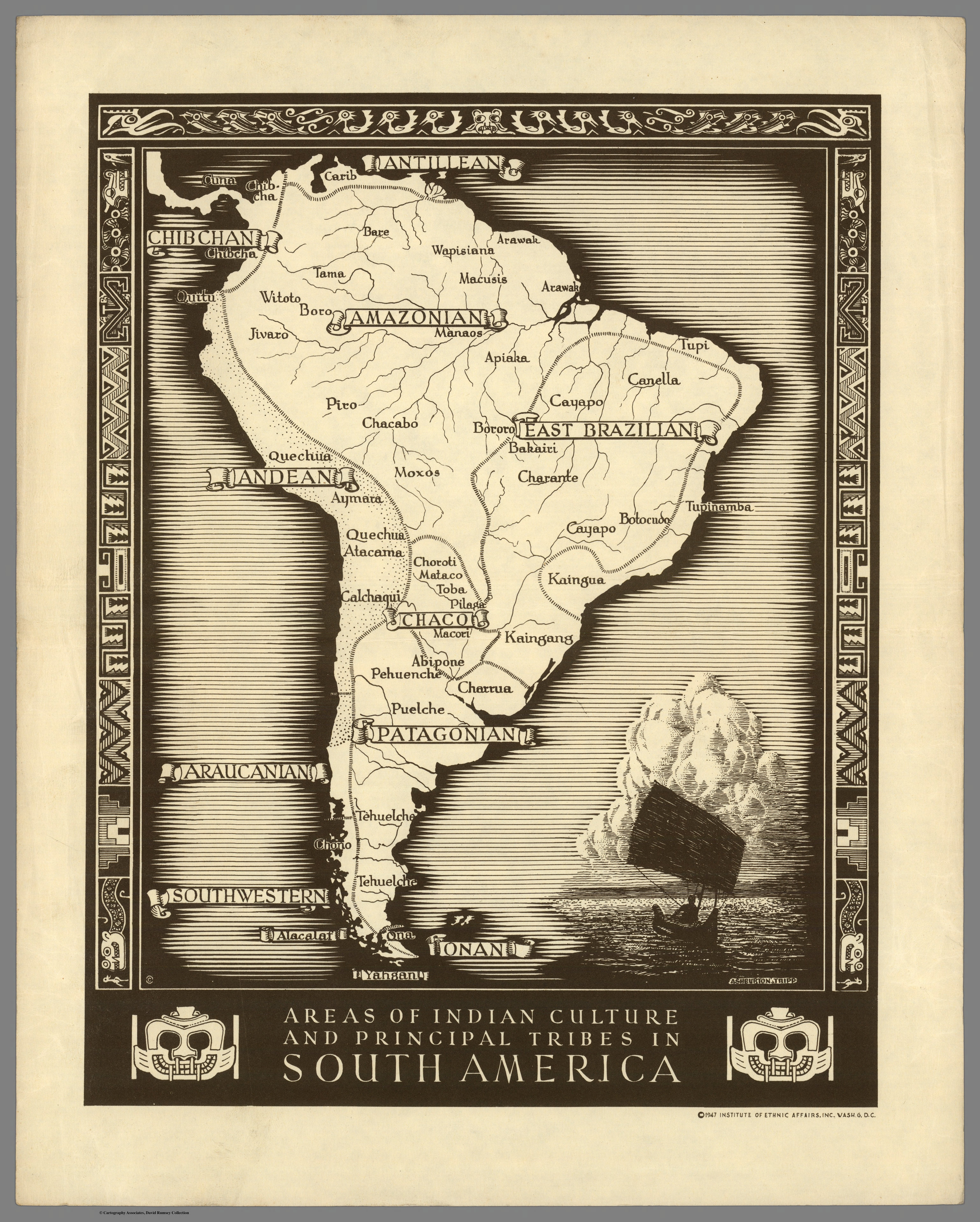
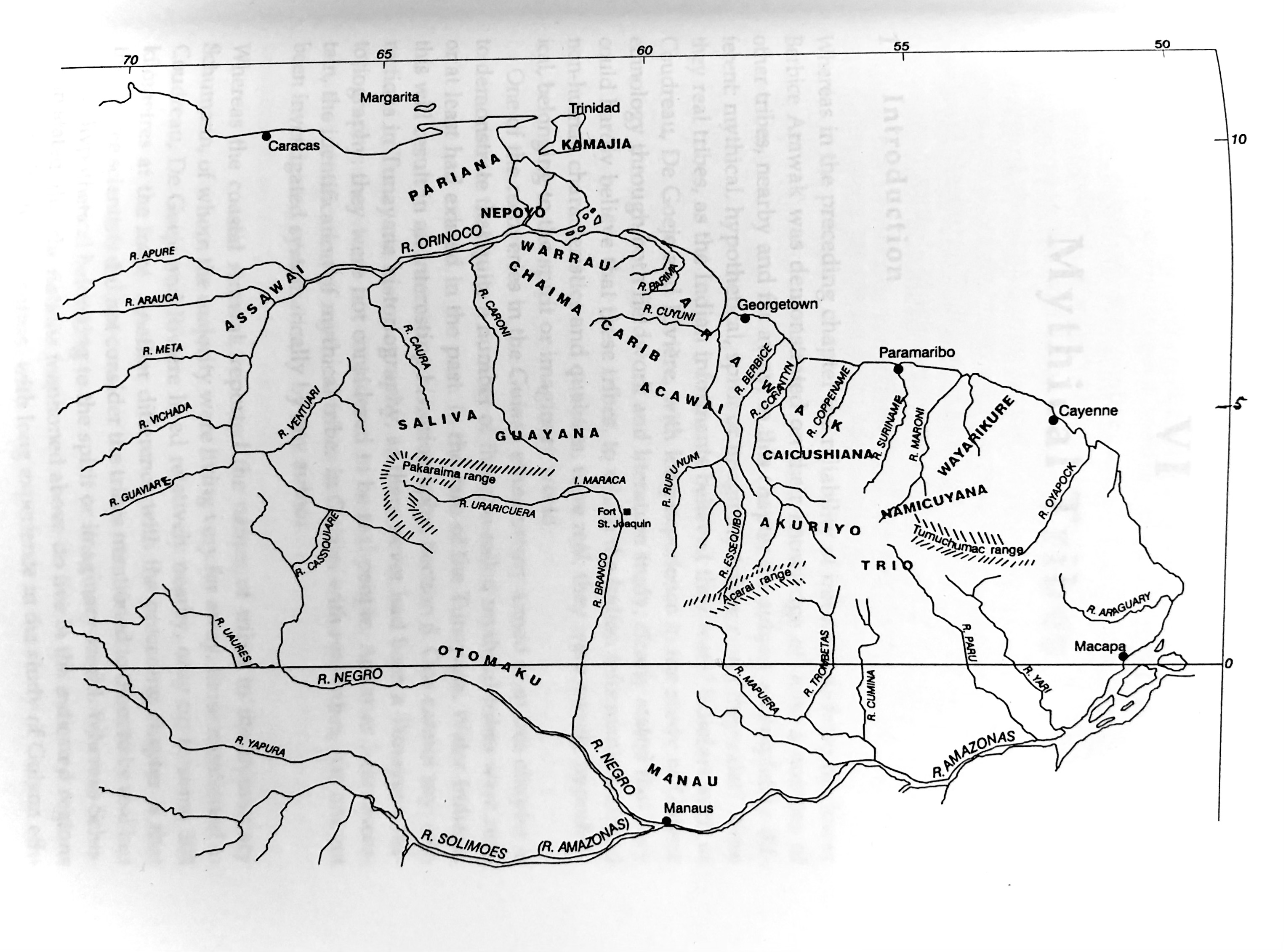
Areas of Indian Culture and Principal Tribes in South America
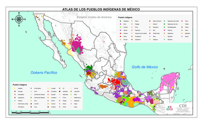
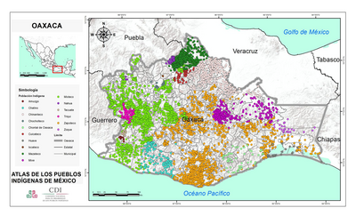
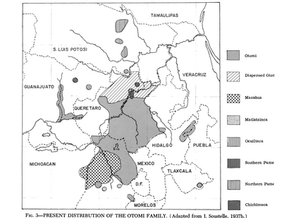
ATLAS DE LOS PUEBLOS INDÍGENAS DE MEXICO
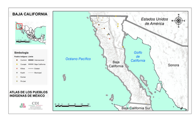
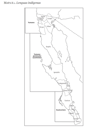
BAJA CALIFORNIA
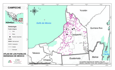
CAMPECHE
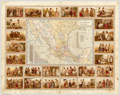
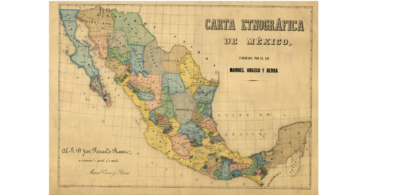
CARTA ETNOGRÁFICA
CARTA ETNOGRÁFICA DE MEXICO
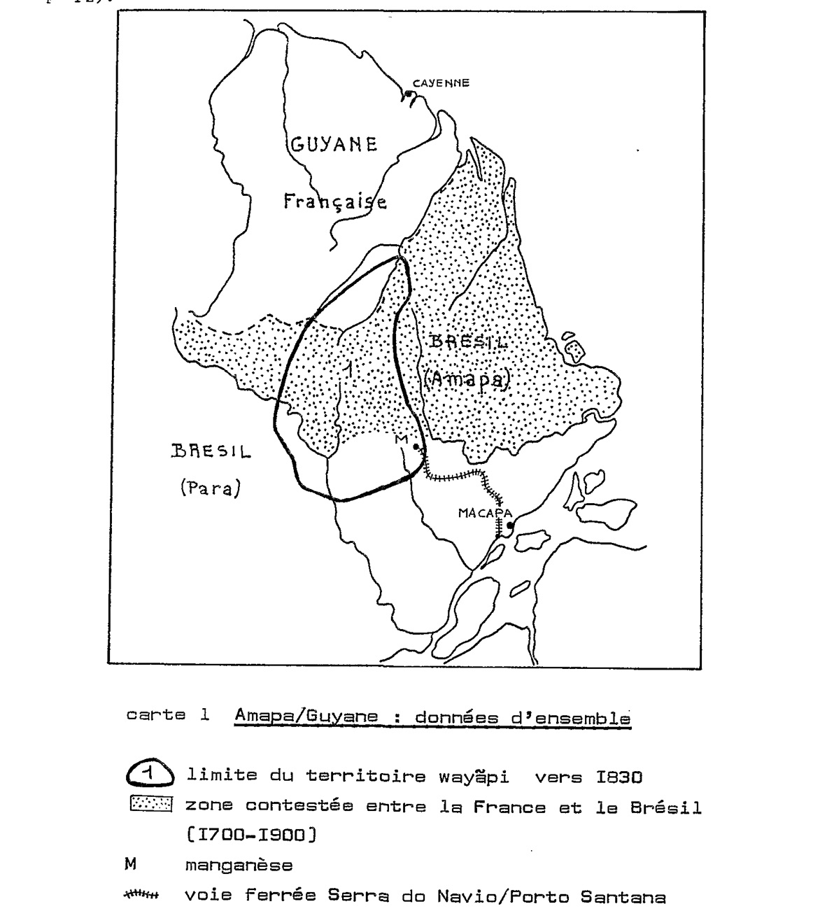
Carte 1. Amapaya/Guyane : données d'ensemble
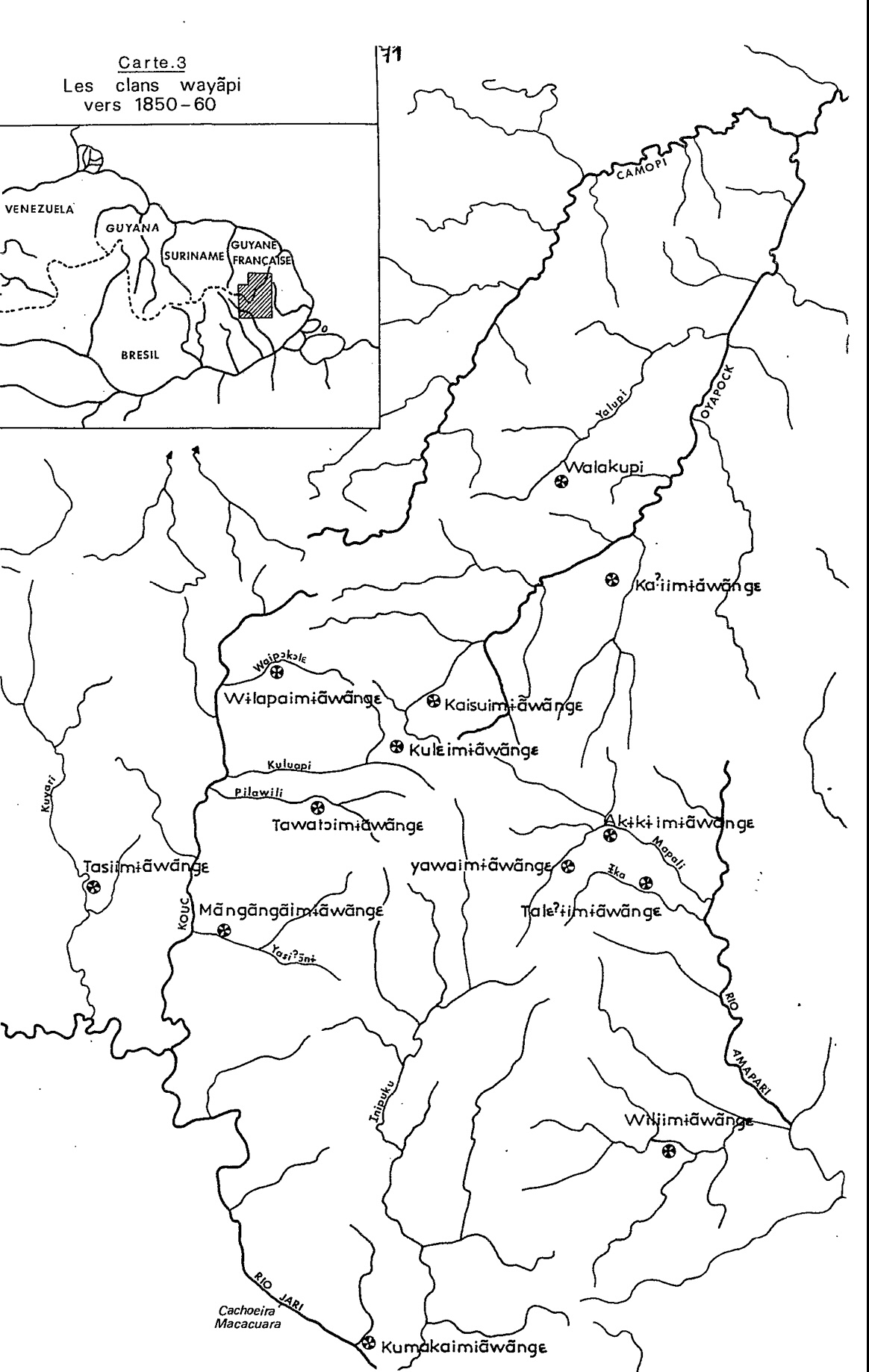
Carte 3. Les clans wayãpi vers 1850-1860
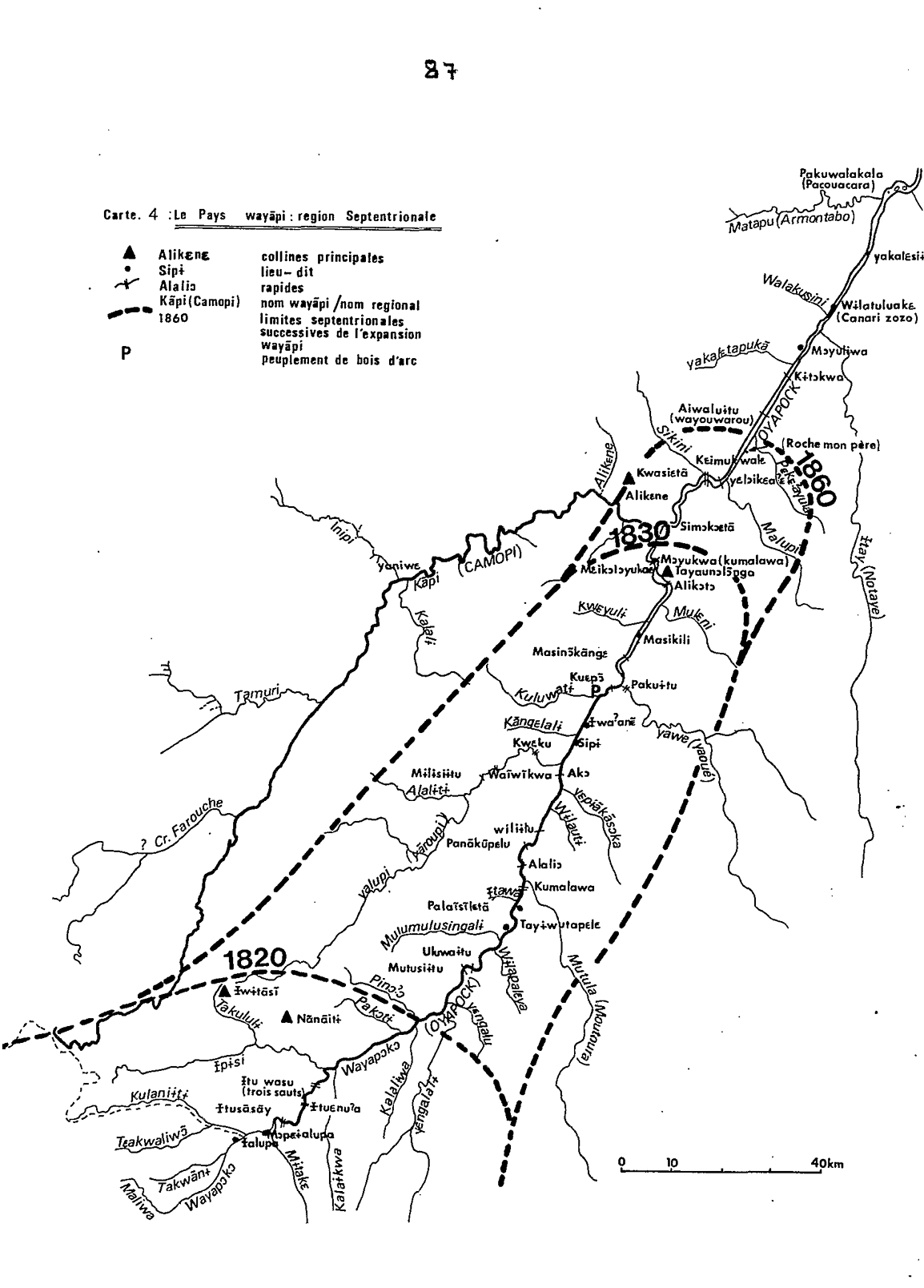
Carte 4: Le Pays Wayãpi : region Septentrionale
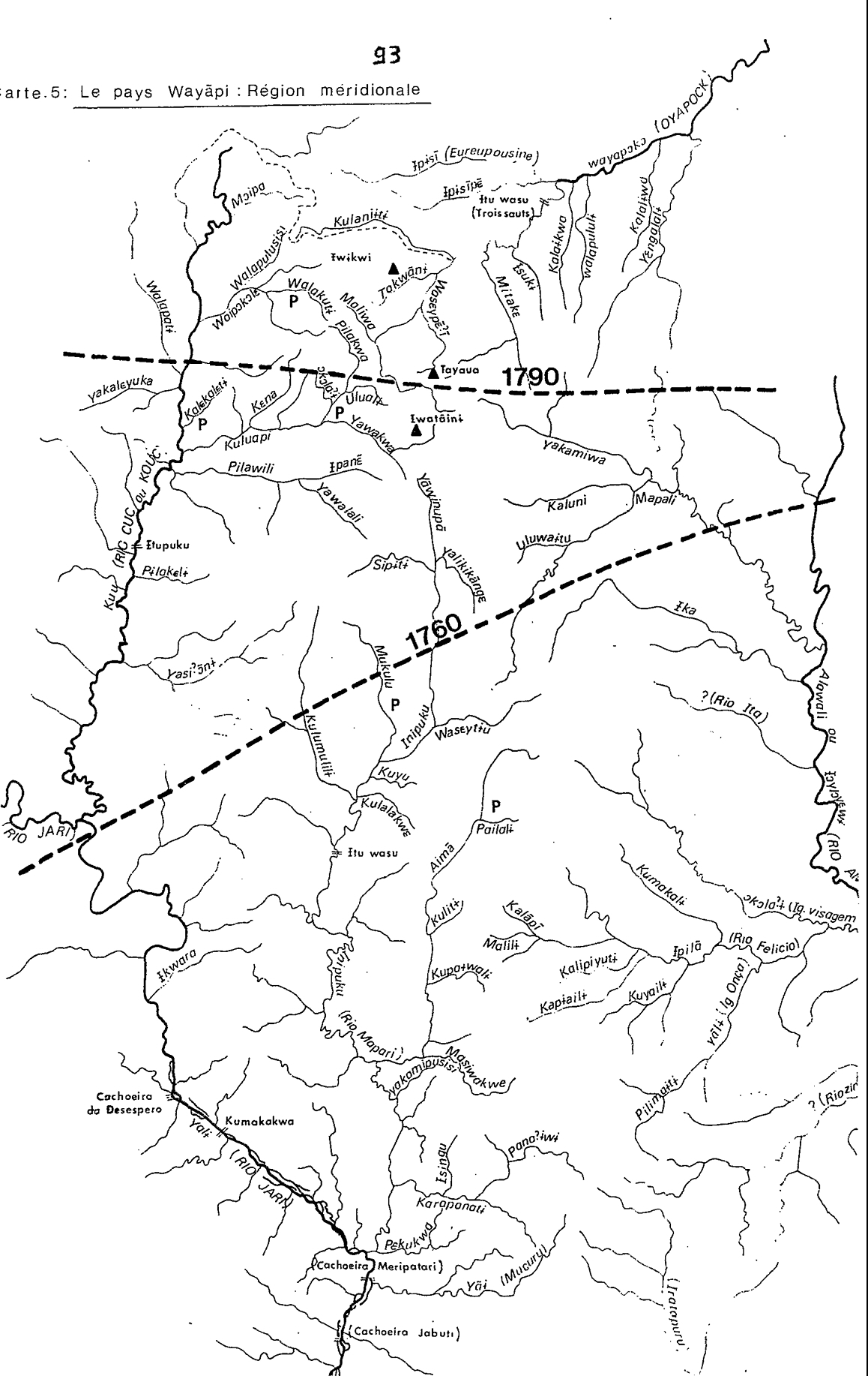
Carte 5: Le pays Wayãpi: Région méridionale
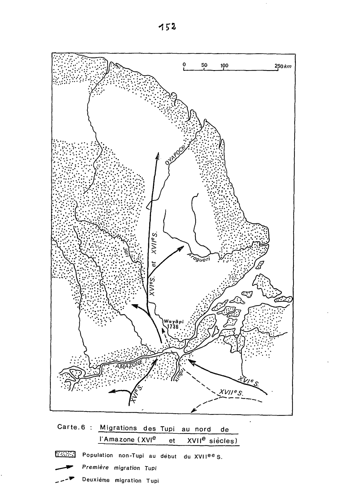
Carte 6: Migrations des Tupi au nord de l'Amazones (XVIe et XVIIe siècles)
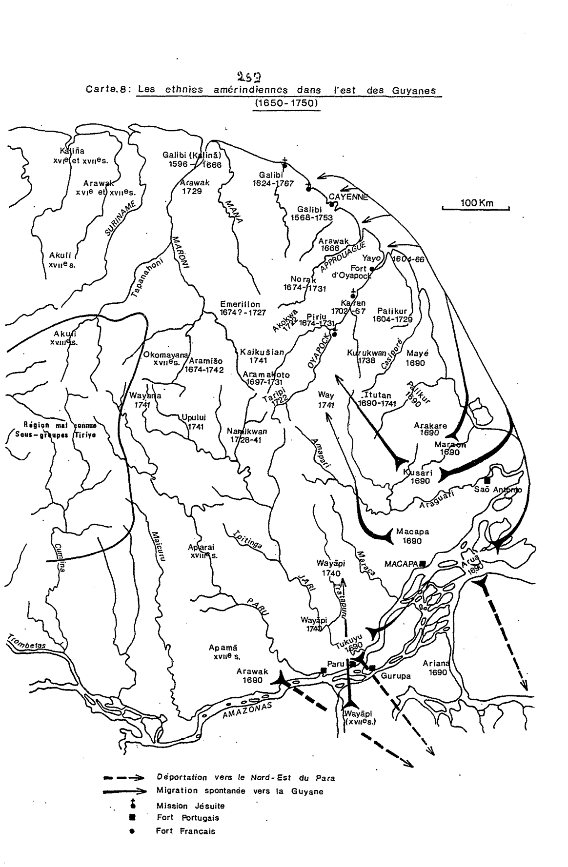
Carte 8: Les ethnies amérindiennes dans l'est des Guyanes (1650-1750)
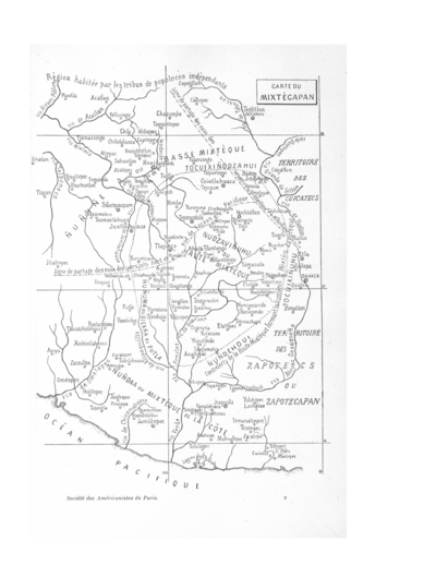
CARTE DU MIXTECAPAN
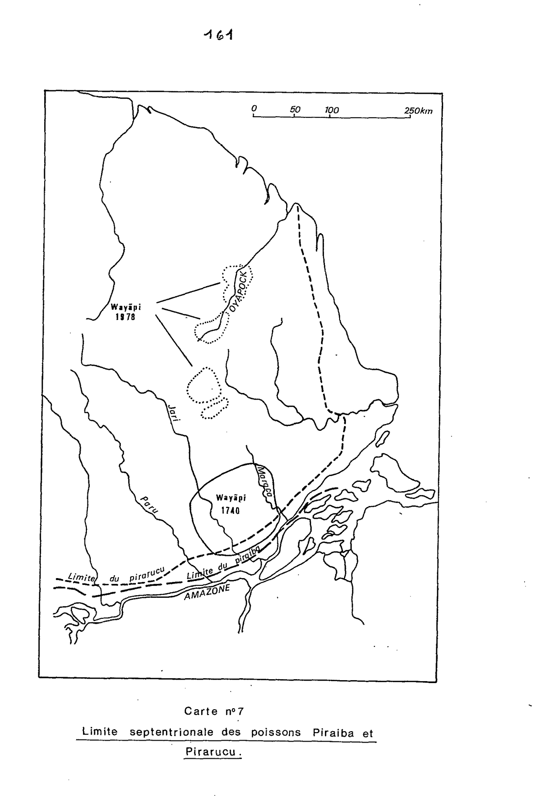
Carte n°7: Limite septentrionale des poissons Paraiba et Pirarucu
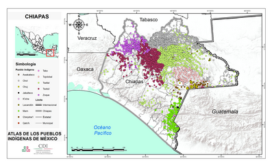
CHIAPAS
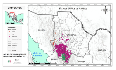
CHIHUAHUA
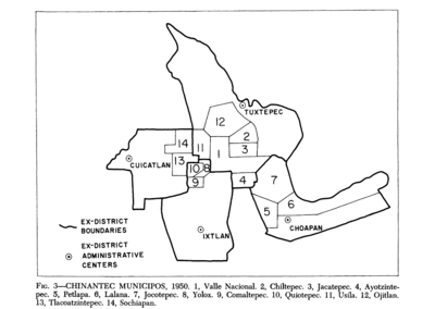
Chinantec Municipios, 1950
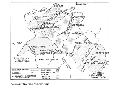
Chinantla Subregions
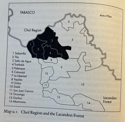
CHOL REGION AND THE LACANDON FOREST
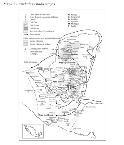
Ciudades-estado mayas
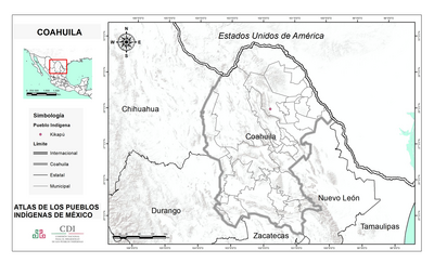
COAHUILA
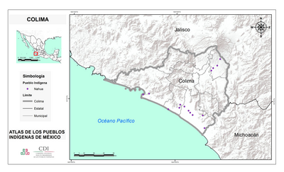
COLIMA
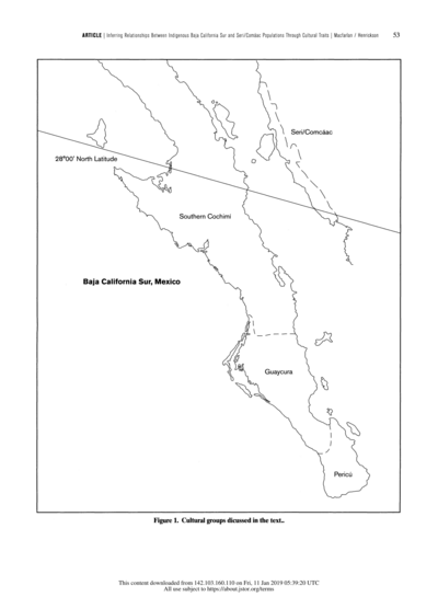
Cultural groups discussed in the text
DISTRIBUCIÓN DE LOS GRUPOS INDÍGENAS EN EL SIGLO XVI
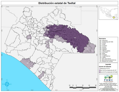
Distribución estatal de Tseltal
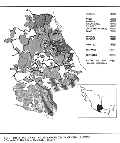
Distribution of Indian Languages in Central Mexico
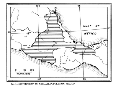
Distribution of Nahuatl Population, Mexico
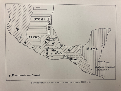
DISTRIBUTION OF PRINCIPAL NATIONS AFTER 1300 AD
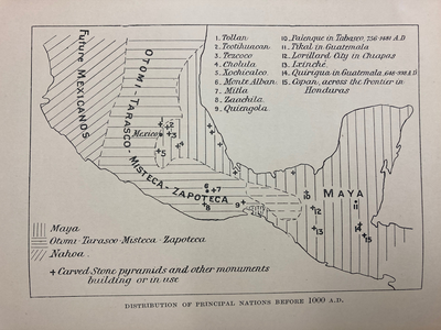
DISTRIBUTION OF PRINCIPAL NATIONS BEFORE 1000 AD
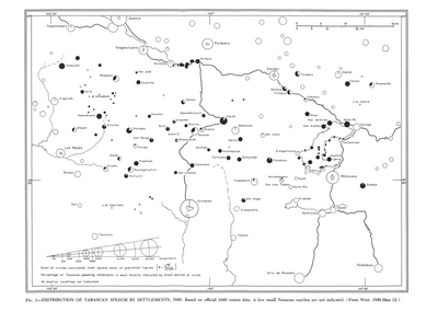
Distribution of Tarascan Speech by Settlements, 1940
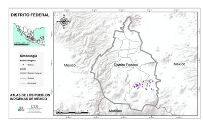
DISTRITO FEDERAL
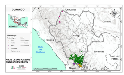
DURANGO
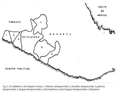
El cuitlateco y las lenguas vecinas
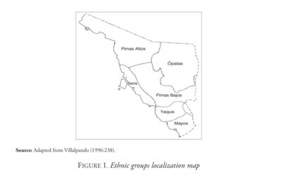
Ethnic Groups Localization Map
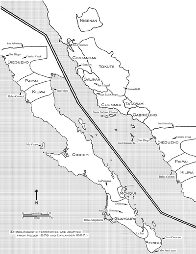
Ethnolinguistic territories of the Californias
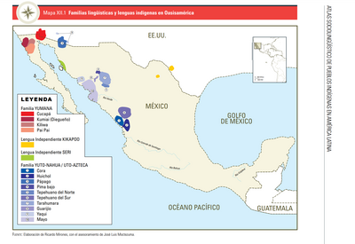
FAMILIAS LINGUÍSTICAS Y LENGUAS INDÍGENAS EN OASISAMÉRICA
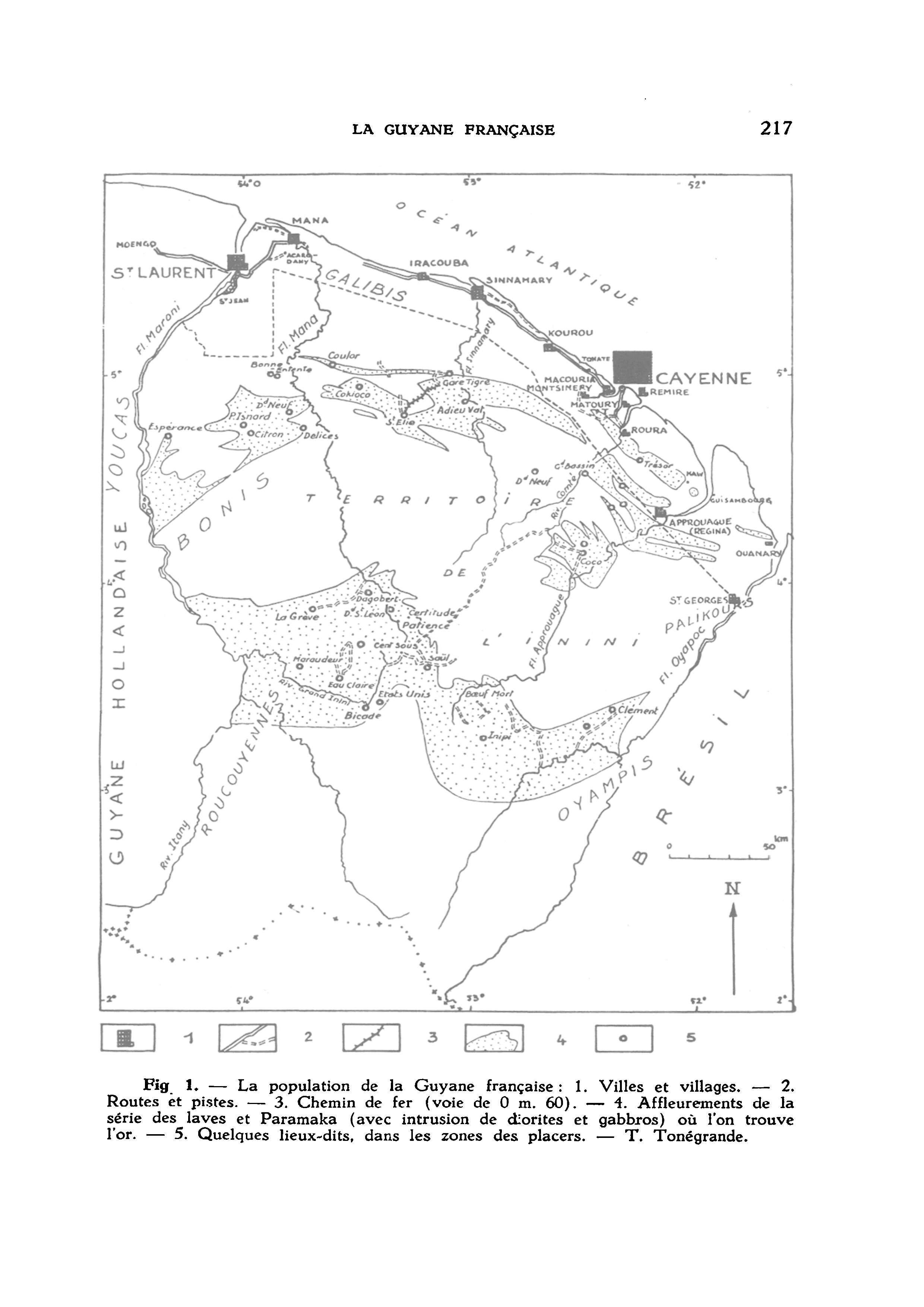
Fig. 1. La population de la Guyana française
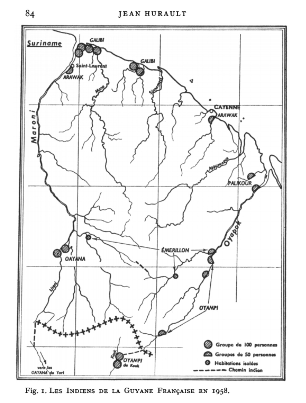
Fig. 1. Les Indiens de la Guyane Française en 1958
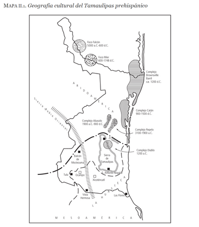
Geografia cultural del Tamaulipas prehispánico
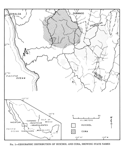
Geographic Distribution of Huichol and Cora, Showing State Names
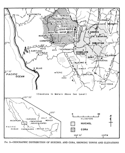
Geographic Distribution of Huichol and Cora, Showing Towns and Elevations
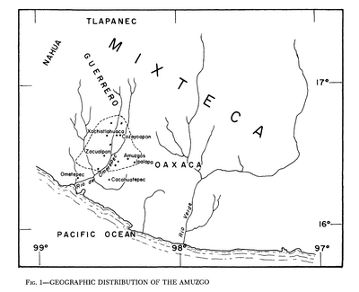
Geographic Distribution of the Amuzgo
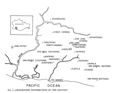
Geographic Distribution of the Chatino
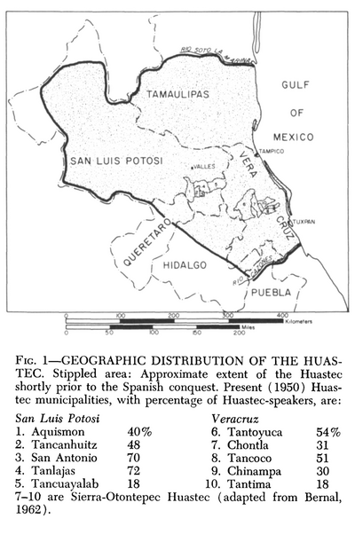
Geographic Distribution of the Huastec
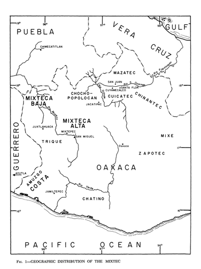
Geographic Distribution of the Mixtec
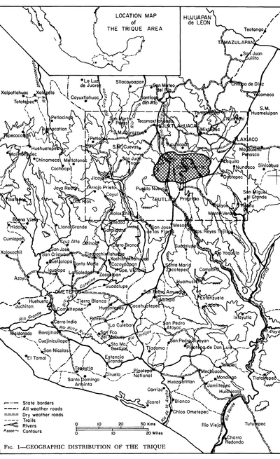
Geographic Distribution of the Trique
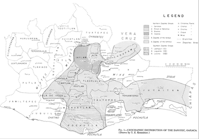
Geographic Distribution of the Zapotec, Oaxaca
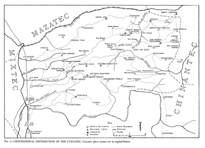
Geographical Distribution of the Cuicatec
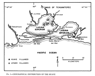
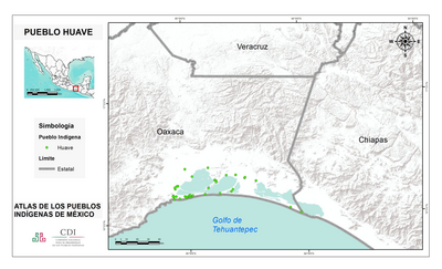
Geographical Distribution of the Huave
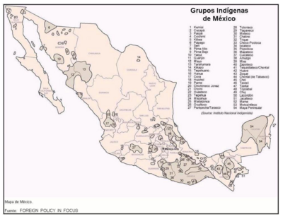
Grupos Indígenas de México
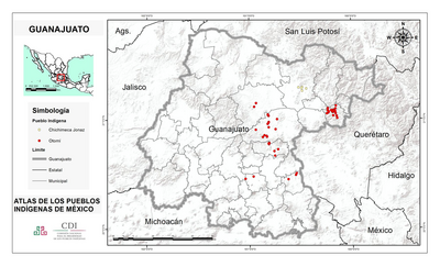
GUANAJUATO
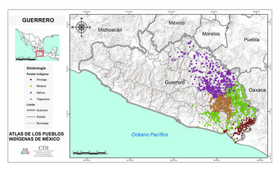
GUERRERO
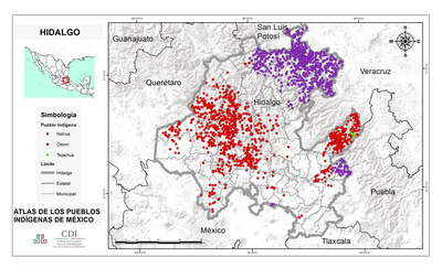
HIDALGO
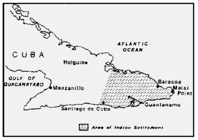
Indians in Cuba
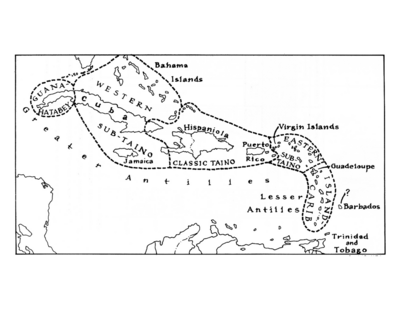
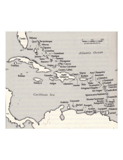
Indigenous Groups of the Caribbean
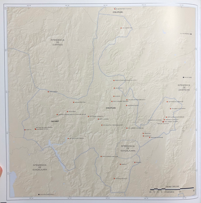
INTENDENCIA DE DURANGO
INTENDENCIA DE MÉXICO
INTENDENCIA DE MICHOACÁN
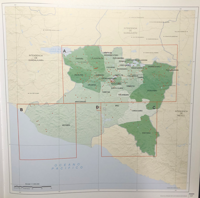
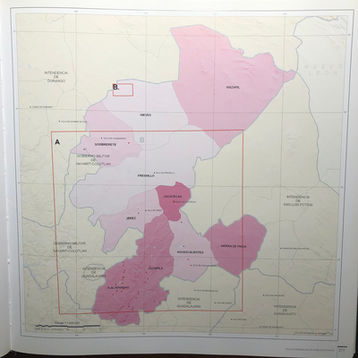
INTENDENCIA DE NAYARIT-COYOTLÁN
INTENDENCIA DE OAXACA
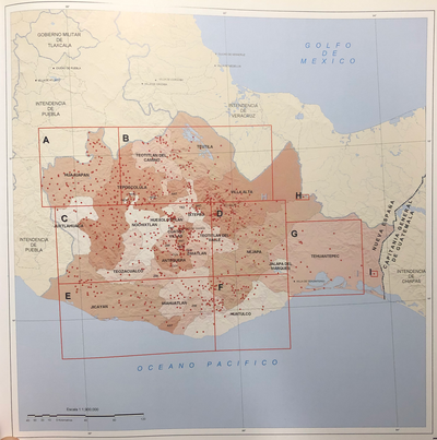
INTENDENCIA DE PUEBLA
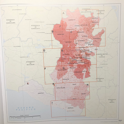
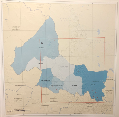
INTENDENCIA DE SAN LUIS POTOSÍ
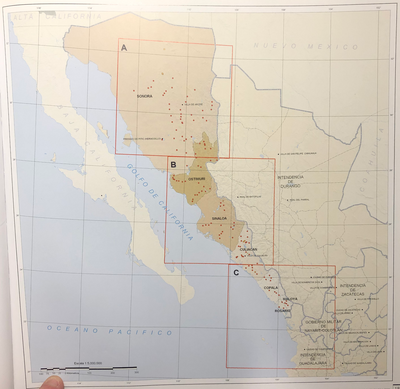
INTENDENCIA DE SONORA-SINOLOA
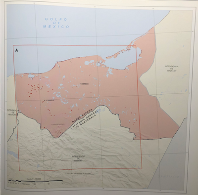
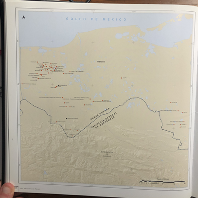
INTENDENCIA DE TABASCO
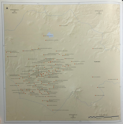
INTENDENCIA DE TLAXCALA
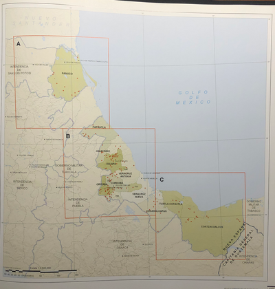
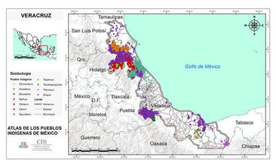
INTENDENCIA DE VERACRUZ
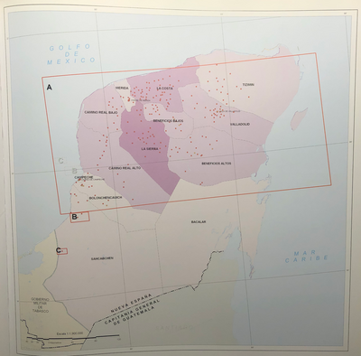
INTENDENCIA DE YUCATÁN
INTENDENCIA DE ZACATECAS
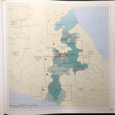
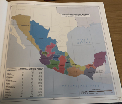
Intendencias y gobiernos militares de la Nueva España en 1800
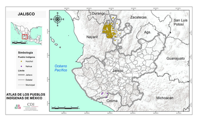
JALISCO
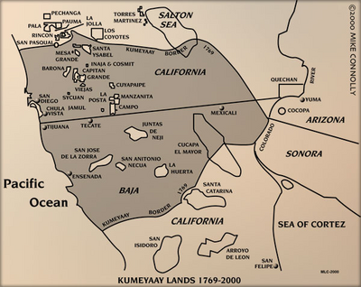
KUMEYAAY LANDS 1769-2000
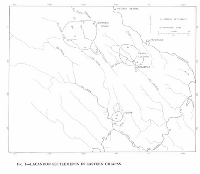
Lacandon Settlements in Eastern Chiapas
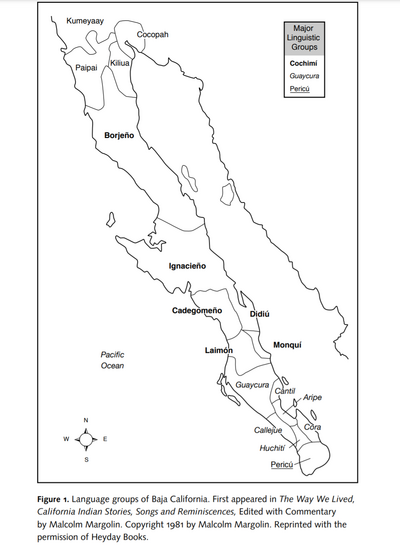
Language Groups of Baja California
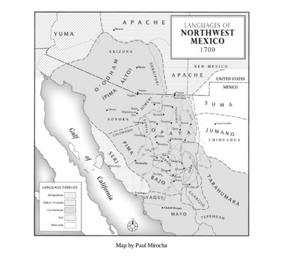
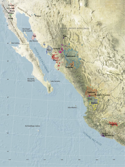
Languages of Northwest Mexico
Las tribus indígenas de las misiones
LENGUAS INDÍGENAS
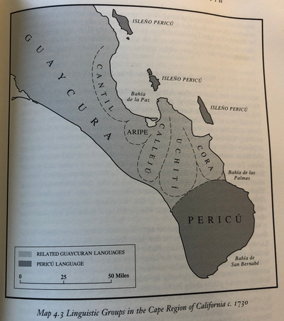
Linguistic Groups in the Cape Region of California
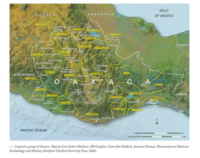
LINGUISTIC GROUPS OF OAXACA
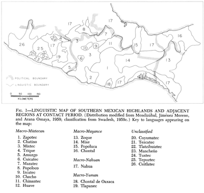
Linguistic Map of Southern Mexican Highlands and Adjacent Regions at Contact Period
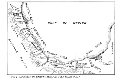
Location of Nahuat Area on Gulf Coast Plain
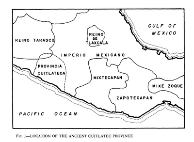
Location of the Ancient Cuitlatec Province
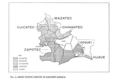
Main Native Groups in Eastern Oaxaca
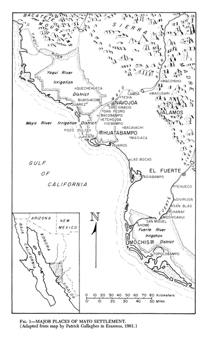
Major Places of Mayo Settlement
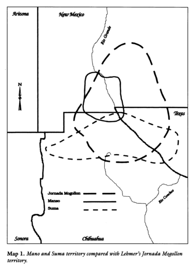
Mano and Sutna territory compared with Lehtner's Jornada Mogotton territory
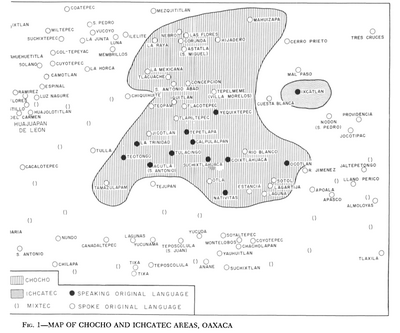
Map of Chocho and Ichcatec Areas, Oaxaca0
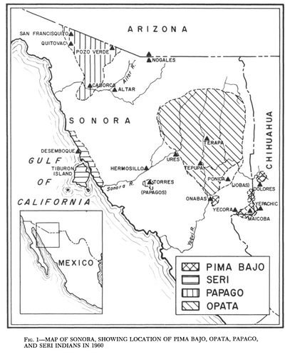
Map of Sonora, Showing Historic Location of Pima Bajo, Opata, Papago, and Seri Indians in 1960
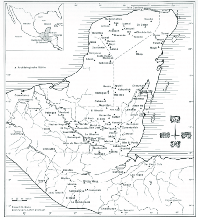
MAP OF THE YUCATAN PENINSULA WITH MAJOR ARCHEOLOGICAL SITES
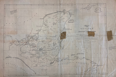
MAP OF YUCATAN AND THE ADJACENT TERRITORIES OF THE ITZAEX OR MAYA INDIANS, THE TIPUANS, QUECHEACHES, MOPANES, LACANDONES, CHOLES, & WITH THE DISTRICT OF VERA PAZ
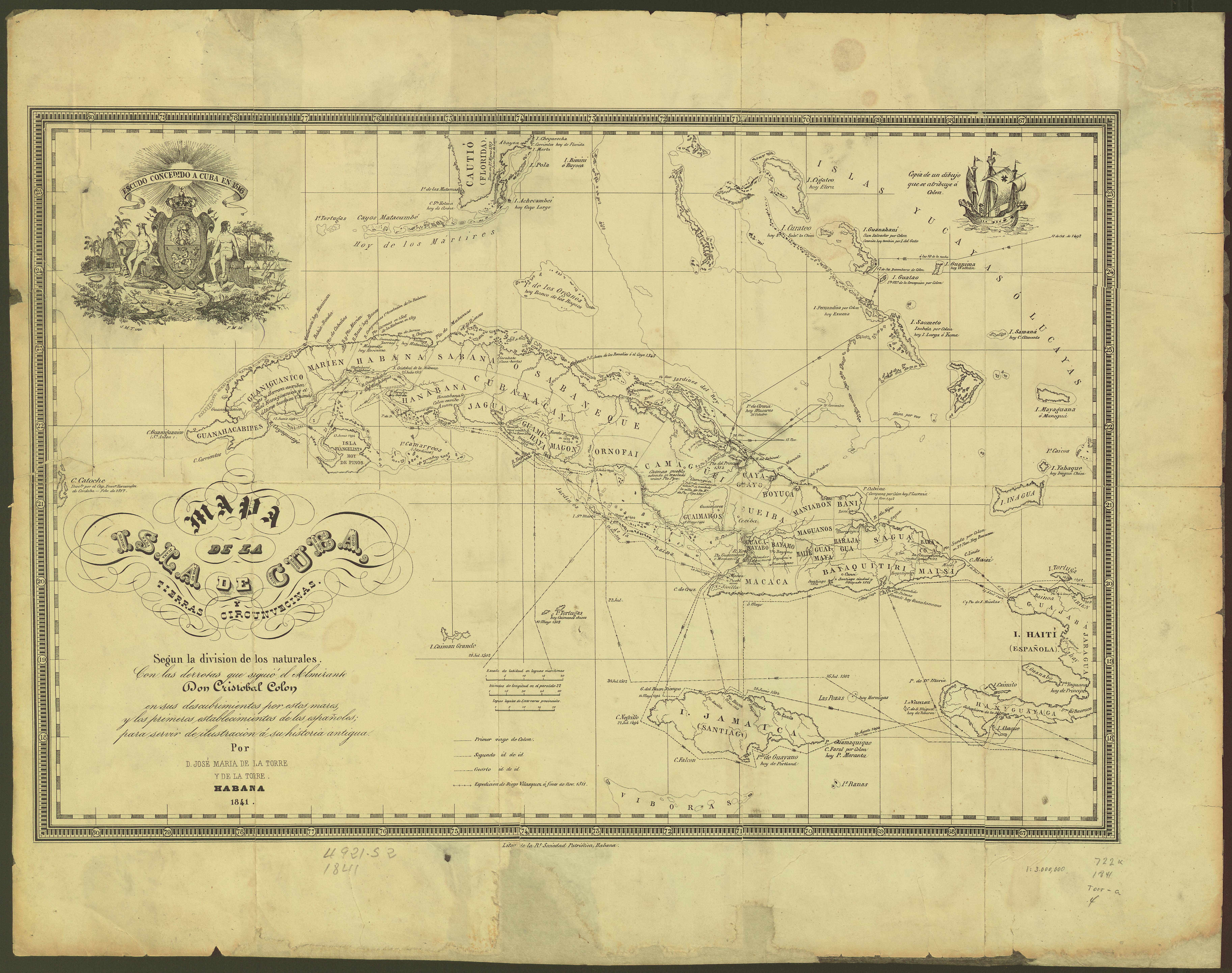
Mapa de la Isla de Cuba y tierras circunvecinas según la división de los naturales con las derrotas que siguió el Almirante Cristóbal Colón para servir de ilustración a su historia antigua
MAYA CITIES
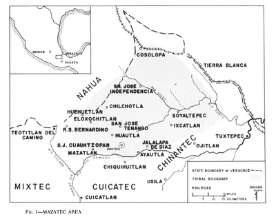
Mazatec Area
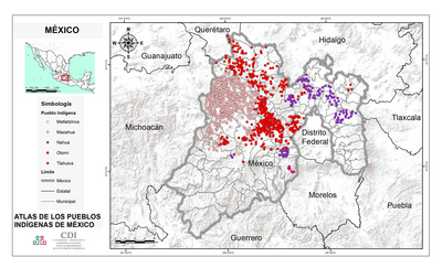
MÉXICO
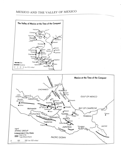
Mexico at the Time of the Conquest
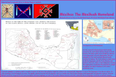
Mexico at the time of the conquest (1519), showing the extent of the Culhua Mexica (Aztec Empire) and of the Maya holdings
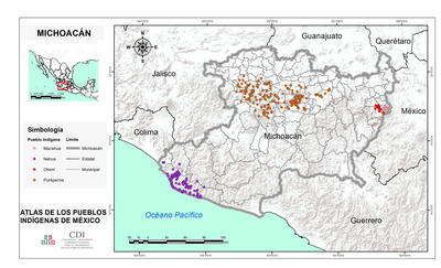
MICHOACÁN
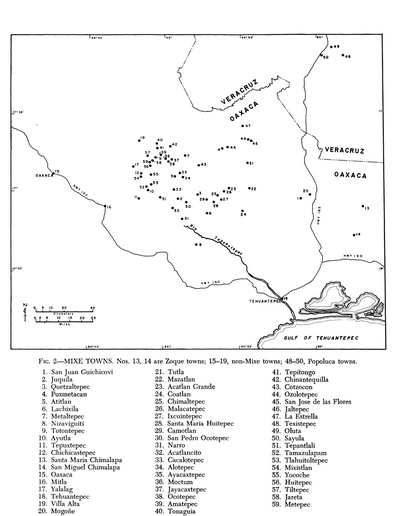
Mixe Towns
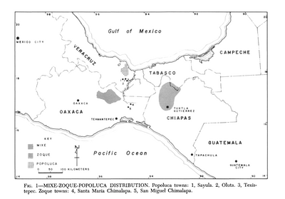
Mixe-Zoque-Popoluca Distribution
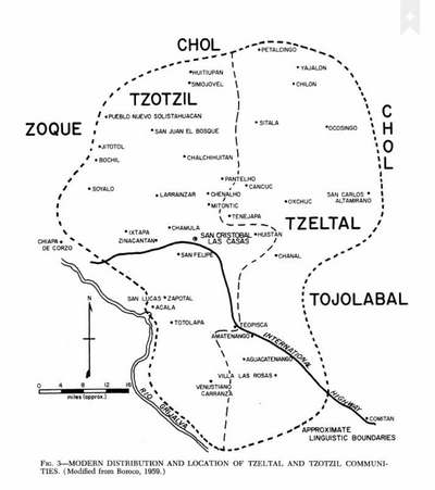
Modern Distribution and Location of Tzetzal and Tzotzil Communities
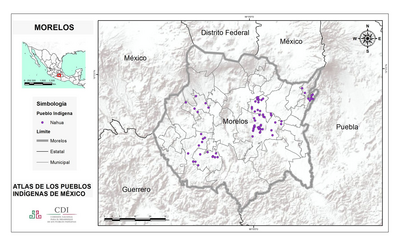
MORELOS
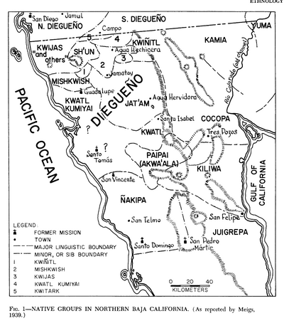
Native Groups in Northern Baja California
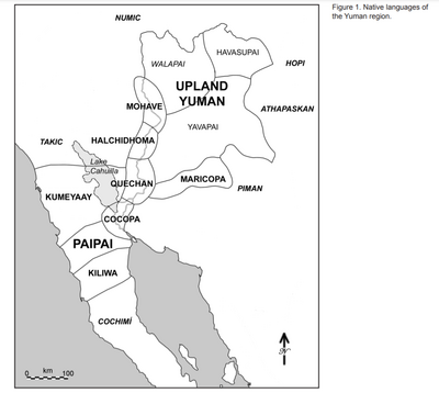
Native languages of the Yuman region
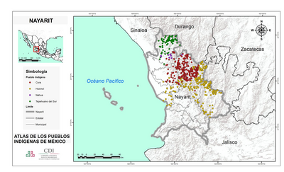
NAYARIT
No Title
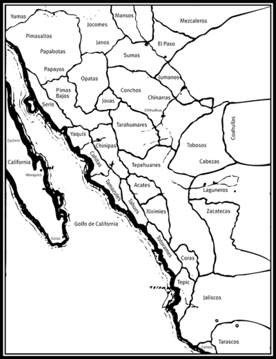
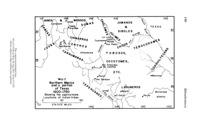
Northern Mexico and a Portion of Texas 1600-1750 Showing the approximate Locations of Indian tribes
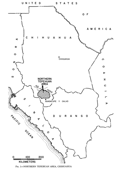
Northern Tepehuan Area, Chihuahua
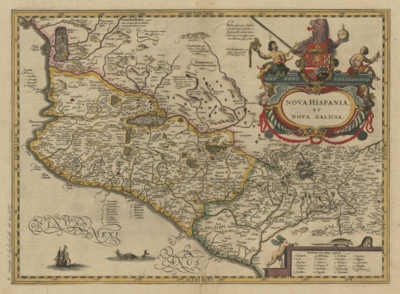
Nova Hispania et Nova Galicia
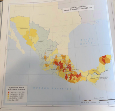
NÚMERO DE INDIOS EN LAS SUBDELEGACIONES EN 1800
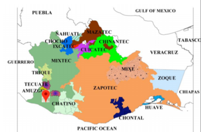
OAXACA
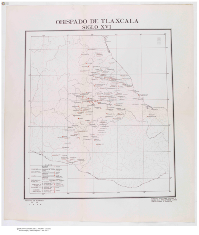
Obispado de Tlaxcala
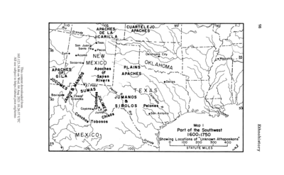
Part of the Southwest 1600-1750 Showing Locations of "Unknown Athapaskans"
Plate 8. The 18 tribes reported by the Berbice Arawak
Población comcaac (seri) en 2010
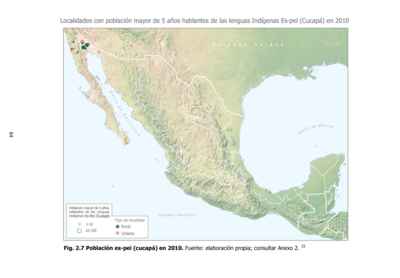
Población es-pei (cucupá) en 2010
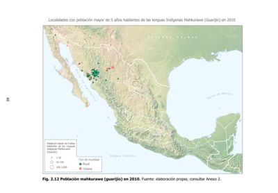
Población mahkurawe (guarijío) en 2010
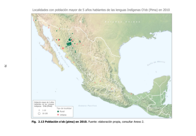
Población o'ob (pima) en 2010
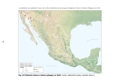
Población tohono o'otham (pápago) en 2010
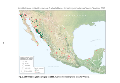
Población yoeme (yaqui) en 2010
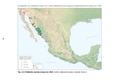
Población yoreme (mayo) en 2010
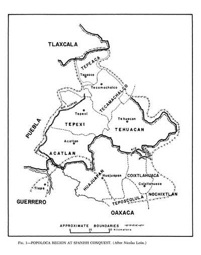
Popoloca Region at Spanish Conquest
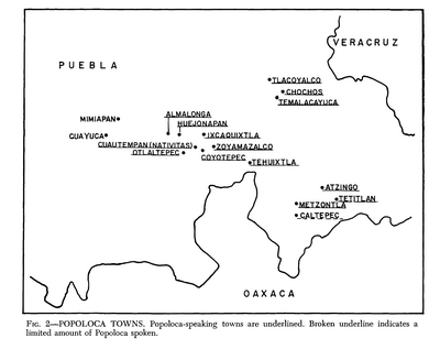
Popoloca Towns
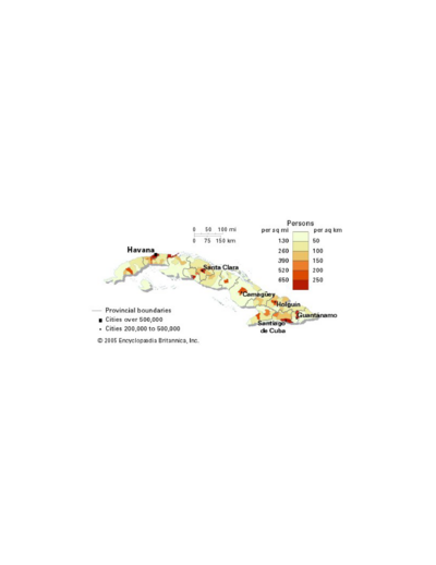
Population density of Cuba
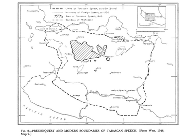
Preconquest and Modern Boundaries of Tarascan Speech
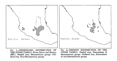
Prehispanic Distribution of the Otomí Family
Present Distribution of the Otomi Family
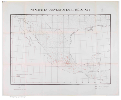
Principales Conventos en el Siglo XVI
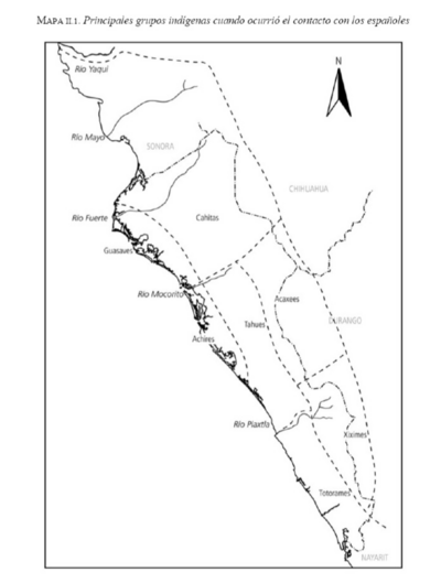
Principales grupos indígenas cuando ocurrió el contacto con los españoles
Provinces depéndant de la triple alliance
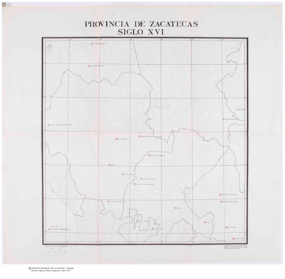
Provincia de Zacatecas
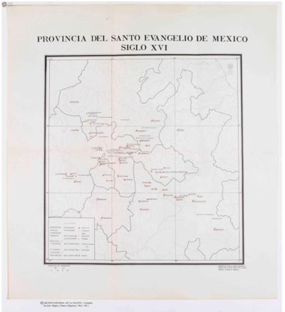
Provincia del Santo Evangelio de Mexico
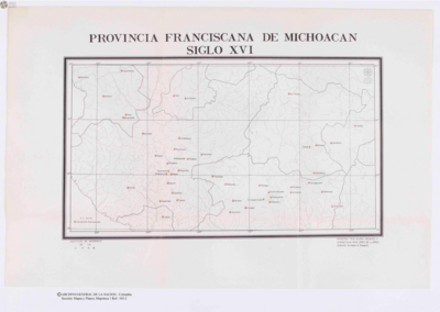
Provincia Franciscana de Michoacán
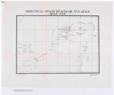
Provincia Franciscana de Yucatán
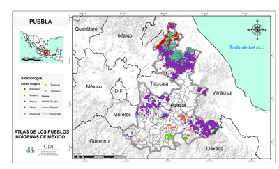
PUEBLA
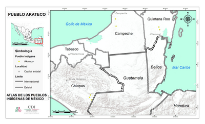
PUEBLO AKATECO
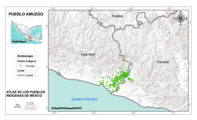
PUEBLO AMUZGO
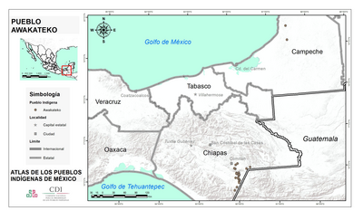
PUEBLO AWAKATECO
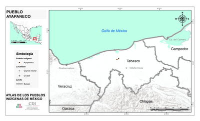
PUEBLO AYAPANECO
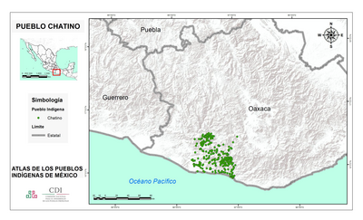
PUEBLO CHATINO
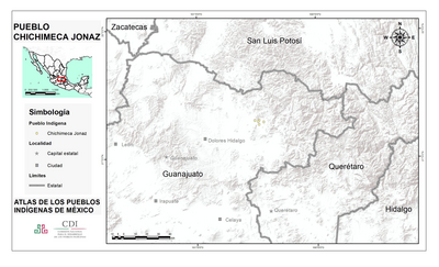
PUEBLO CHICHIMECA JONAZ
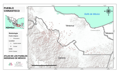
PUEBLO CHINANTECO
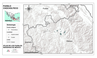
PUEBLO CHOCHOLTECO
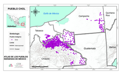
PUEBLO CHOL
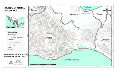
PUEBLO CHONTAL DE OAXACA
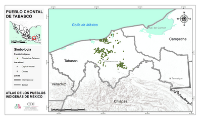
PUEBLO CHONTAL DE TABASCO
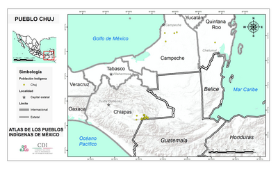
PUEBLO CHUJ
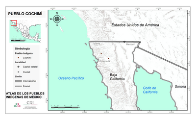
PUEBLO COCHIMI
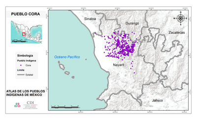
PUEBLO CORA
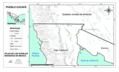
PUEBLO CUCAPA
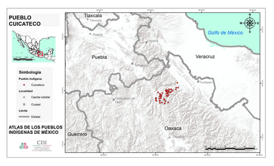
PUEBLO CUICATECO
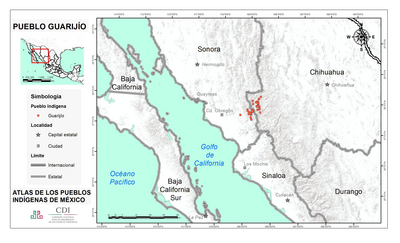
PUEBLO GUARIJIO
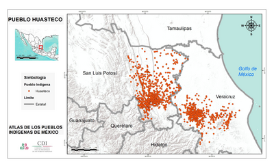
PUEBLO HUASTECO
PUEBLO HUAVE
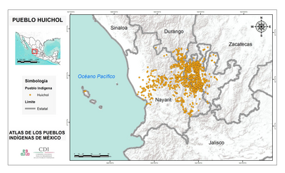
PUEBLO HUICHOL
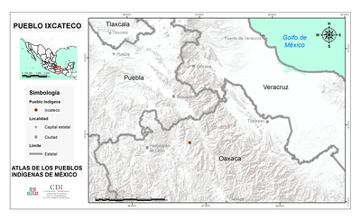
PUEBLO IXCATECO
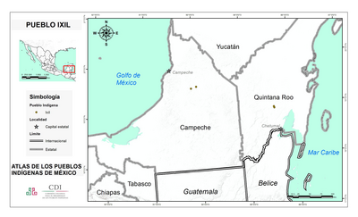
PUEBLO IXIL
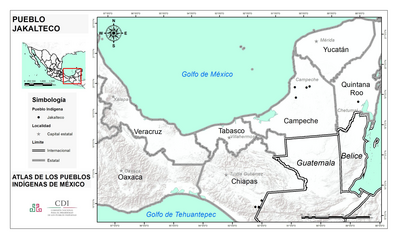
PUEBLO JAKALTECO
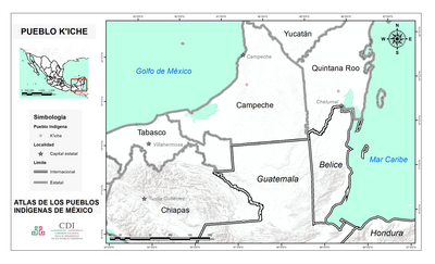
PUEBLO K'ICHE
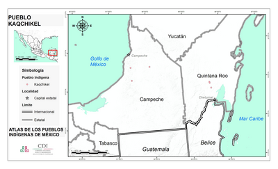
PUEBLO KAQCHIKEL
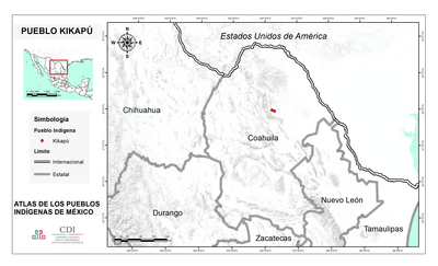
PUEBLO KIKAPU
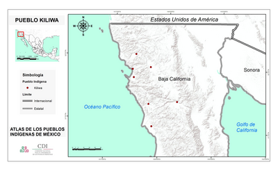
PUEBLO KILIWA
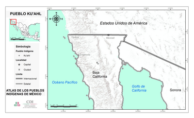
PUEBLO KU'AHL
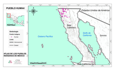
PUEBLO KUMIAI
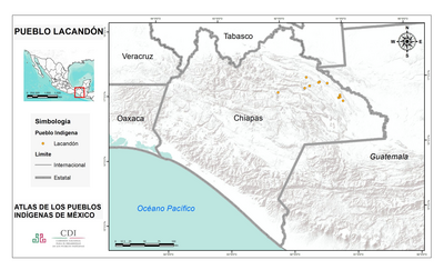
PUEBLO LACANDON
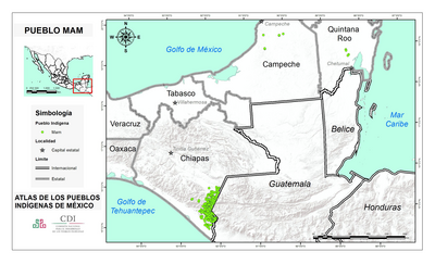
PUEBLO MAM
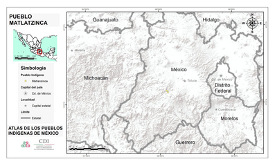
PUEBLO MATLATZINCA
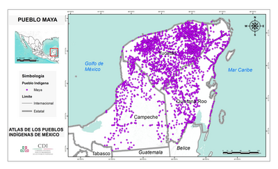
PUEBLO MAYA
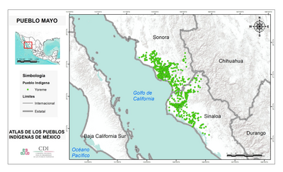
PUEBLO MAYO
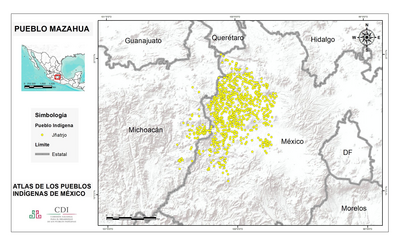
PUEBLO MAZAHUA
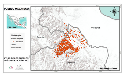
PUEBLO MAZATECO
PUEBLO MIXE
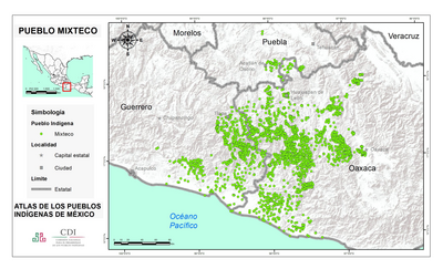
PUEBLO MIXTECO
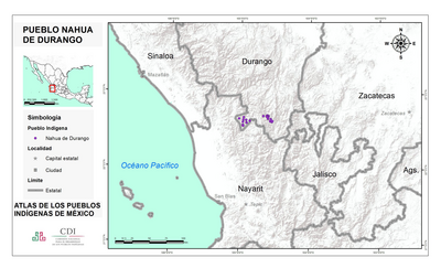
PUEBLO NAHUA DE DURANGO
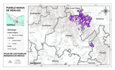
PUEBLO NAHUA DE HIDALGO
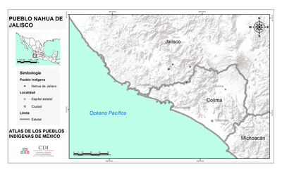
PUEBLO NAHUA DE JALISCO
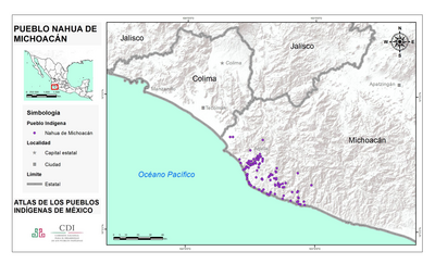
PUEBLO NAHUA DE MICHOACAN
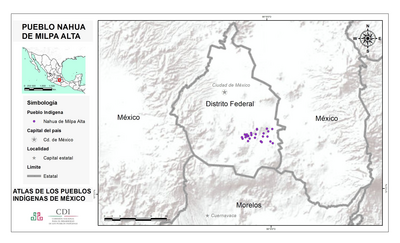
PUEBLO NAHUA DE MILPA ALTA
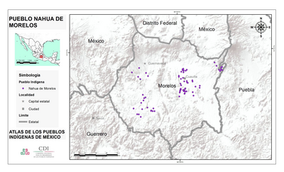
PUEBLO NAHUA DE MORELOS
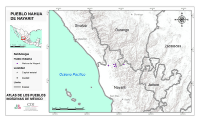
PUEBLO NAHUA DE NAYARIT
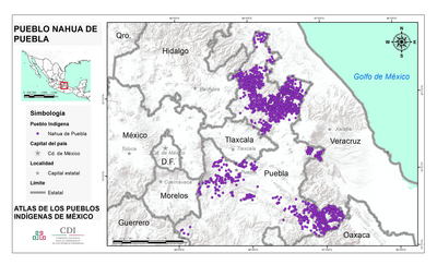
PUEBLO NAHUA DE PUEBLA
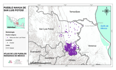
PUEBLO NAHUA DE SAN LUIS POTOSI
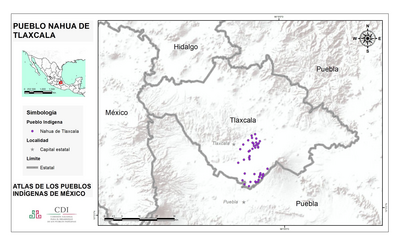
PUEBLO NAHUA DE TLAXCALA
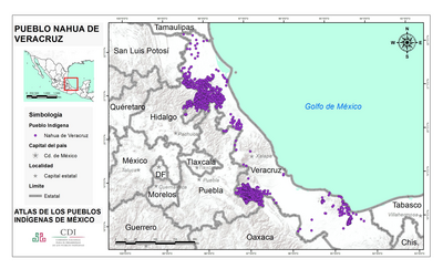
PUEBLO NAHUA DE VERACRUZ
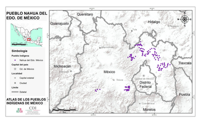
PUEBLO NAHUA DEL EDO DE MEXICO
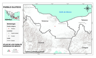
PUEBLO OLUTECO
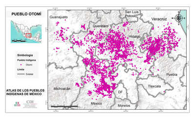
PUEBLO OTOMI
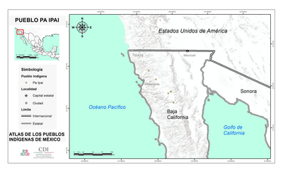
PUEBLO PA IPAI
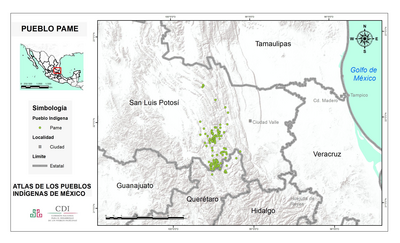
PUEBLO PAME
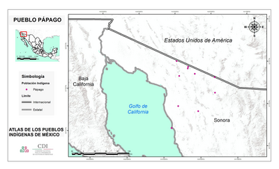
PUEBLO PAPAGO
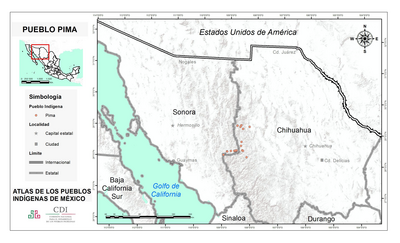
PUEBLO PIMA
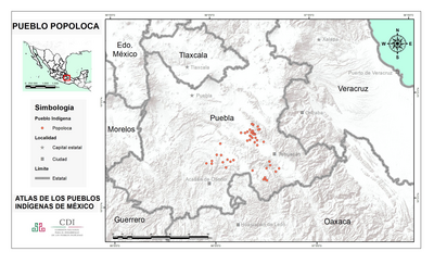
PUEBLO POPOLOCA
PUEBLO POPOLUCA DE LA SIERRA
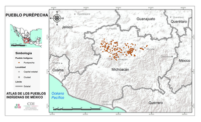
PUEBLO PUREPECHA
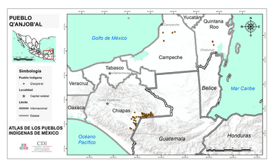
PUEBLO Q'ANJOB'AL
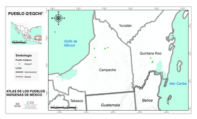
PUEBLO Q'EQCHI'
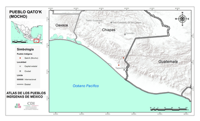
PUEBLO QATO'K
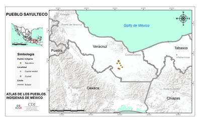
PUEBLO SAYULTECO
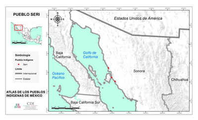
PUEBLO SERI
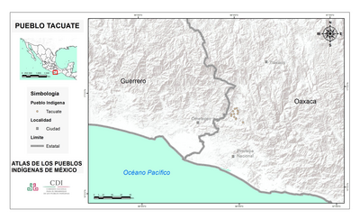
PUEBLO TACUATE
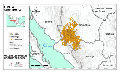
PUEBLO TARAHUMARA
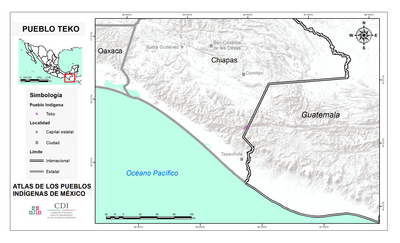
PUEBLO TEKO
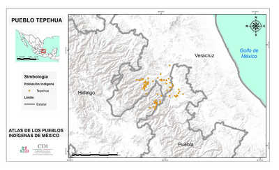
PUEBLO TEPEHUA
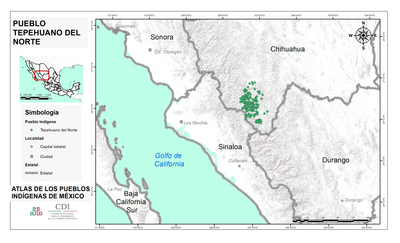
PUEBLO TEPEHUANO DEL NORTE
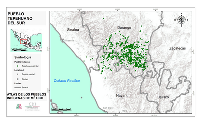
PUEBLO TEPEHUANO DEL SUR
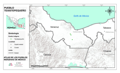
PUEBLO TEXISTEPEQUENO
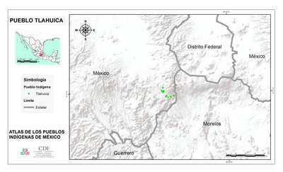
PUEBLO TLAHUICA
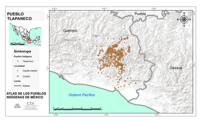
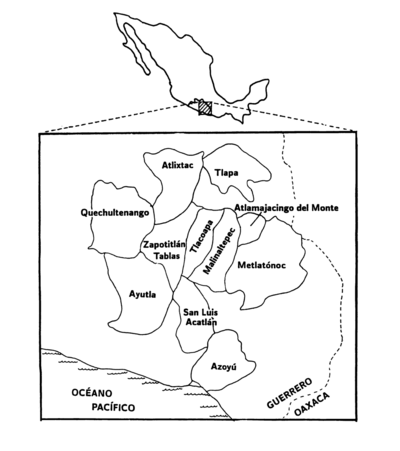
PUEBLO TLAPANECO
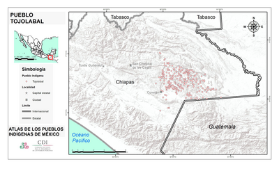
PUEBLO TOJOLABAL
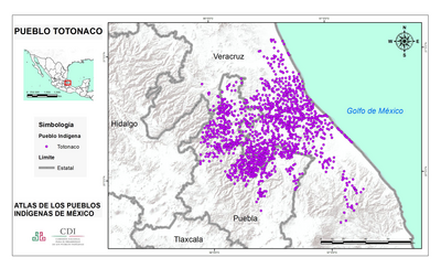
PUEBLO TOTONACO
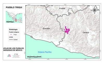
PUEBLO TRIQUI
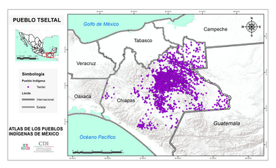
PUEBLO TSELTAL
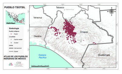
PUEBLO TSOTSIL
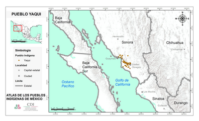
PUEBLO YAQUI
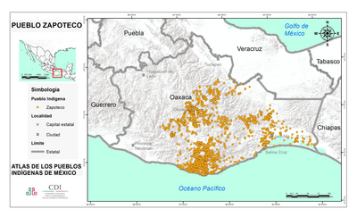
PUEBLO ZAPATECO
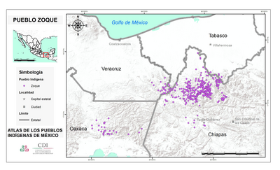
PUEBLO ZOQUE
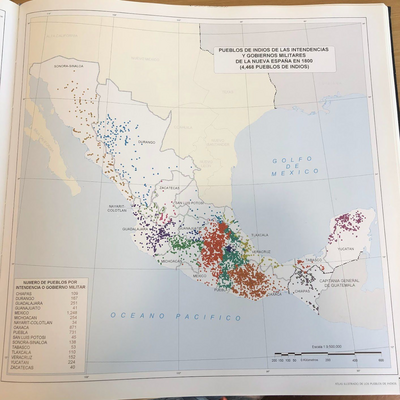
PUEBLOS DE INDIOS DE LAS INTENDENCIAS Y GOBIERNOS MILITARES DE LA NUEVA ESPAÑA EN 1800 (4,468 PUEBLOS DE INDIOS)
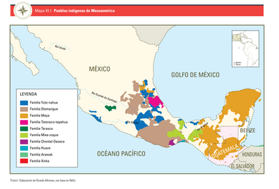
PUEBLOS INDÍGENAS DE MESOAMÉRICA
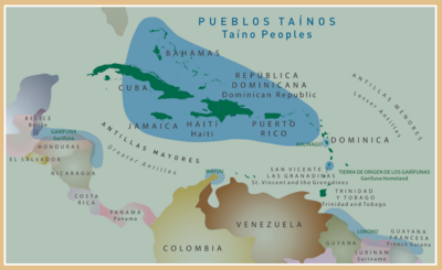
Pueblos Taínos
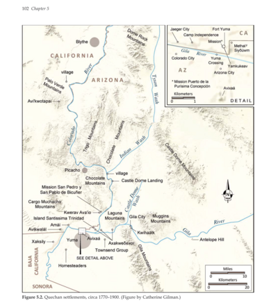
Quechan settlements, circa 1770-1900
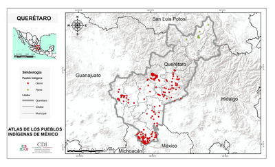
QUERÉTARO
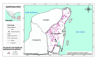
QUINTANA ROO
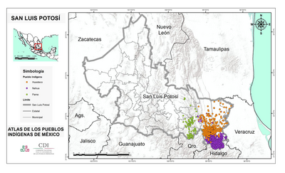
SAN LUIS POTOSÍ
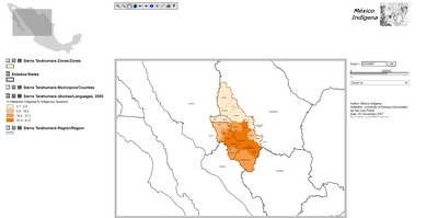
Sierra Tarahumara Study Area - Online GIS
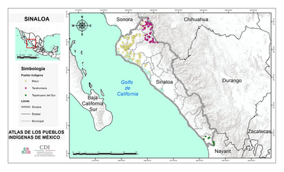
SINALOA
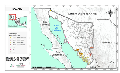
SONORA
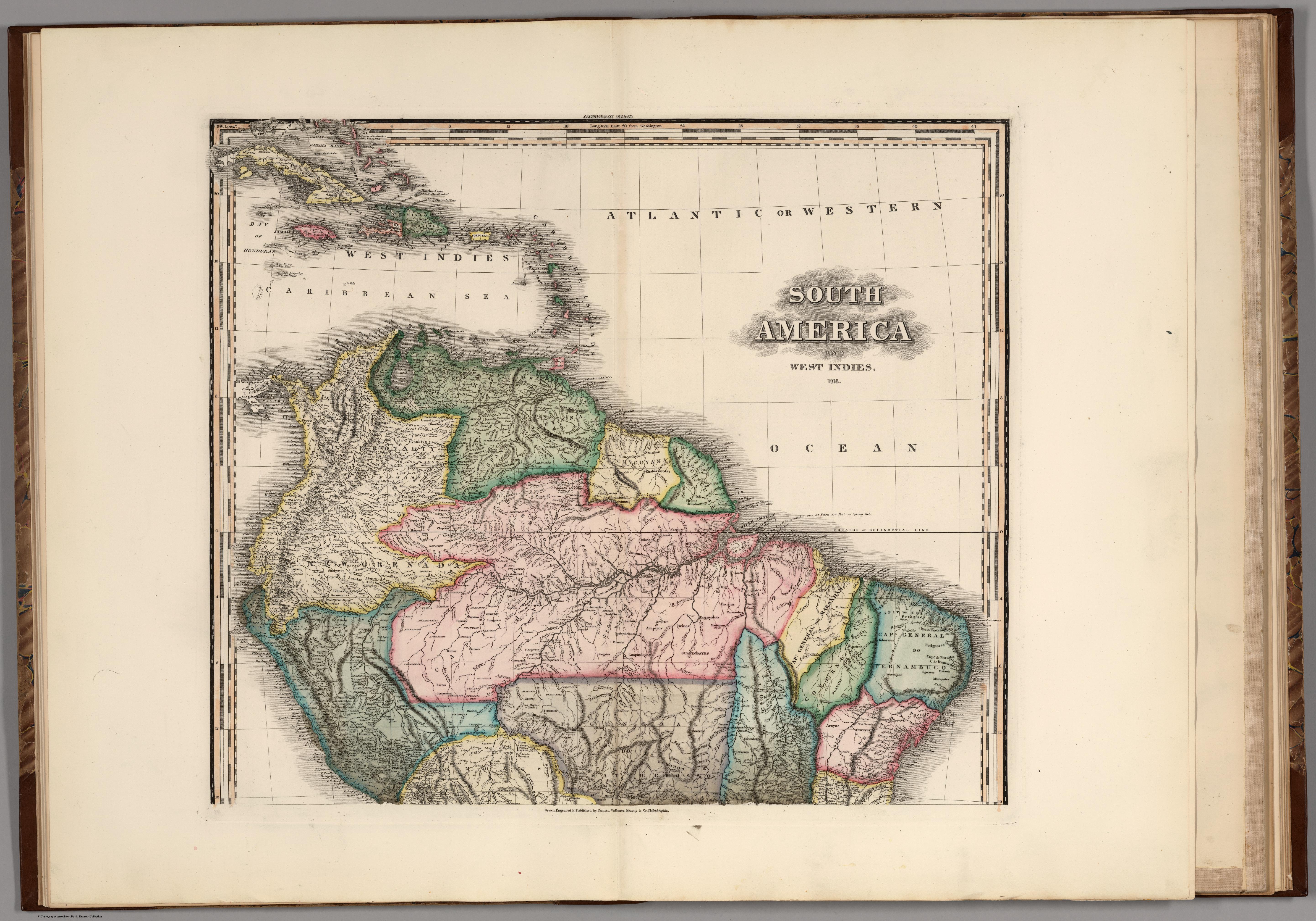
South America and West Indies. 1818
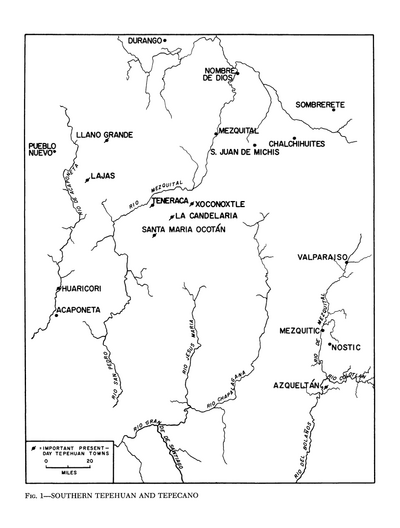
Southern Tepehuan and Tepecano
Subdelegaciones de la Nueva España en 1800
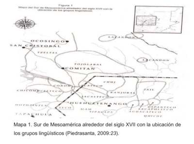
Sur de Mesamérica alrededor del siglo XVII con los grupos lingüísticos
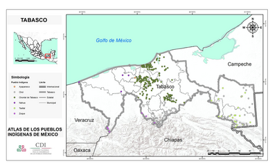
TABASCO
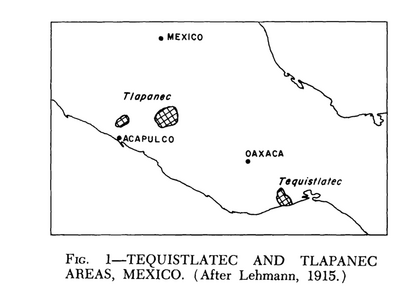
Tequistlatec and Tlapanec Areas, Mexico
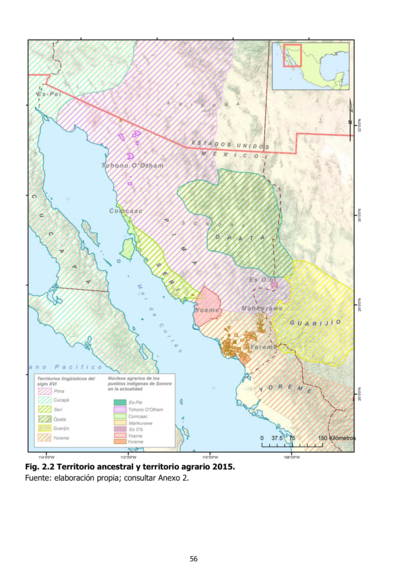
Territorio ancestral y territorio agrario 2015
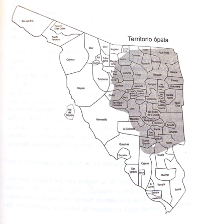
Territorio ópata
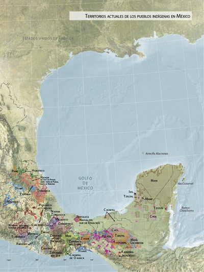
Territorios actuales de los pueblos indígenas en México
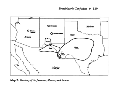
Territory of the Jumanos, Mansos, and Sumas
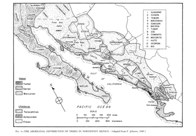
The Aboriginal Distribution of Tribes in Northwest Mexico
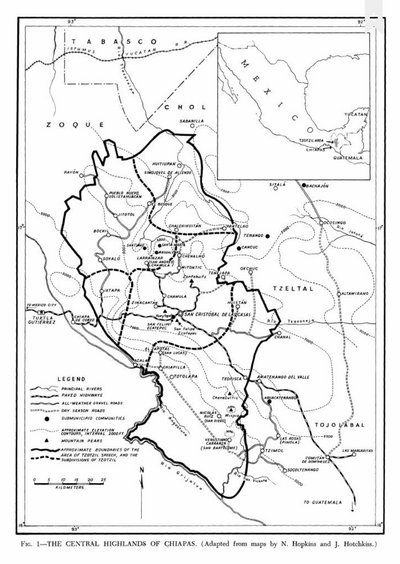
The Central Highlands of Chiapas
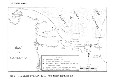
The Eight Pueblos, 1947
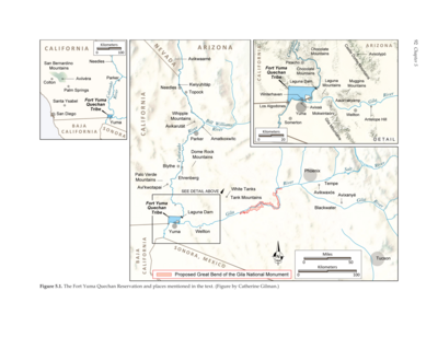
The Fort Yuma Reservation and Places Mentioned in the Text
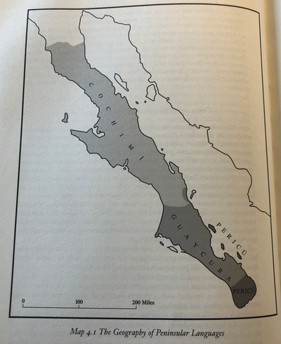
The Geography of Peninsular Languages
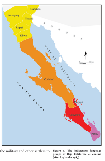
The indigenous language groups of Baja California at contact
The Taino names of the Caribbean islands based on Jalil Sued-Badillo
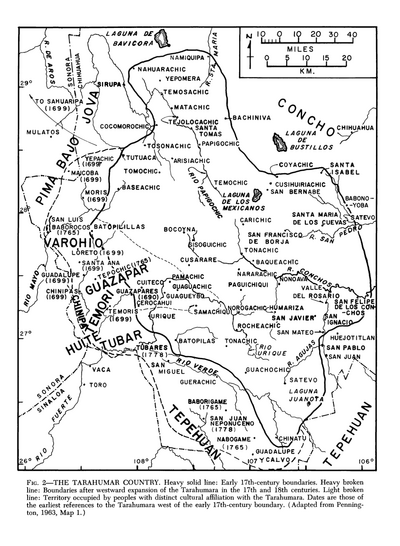
The Tarahumar Country
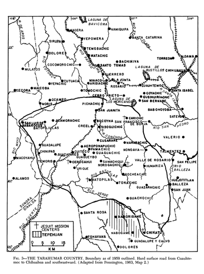
The Tarahumar Country, 1959
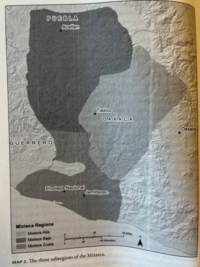
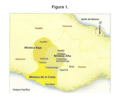
THE THREE SUBREGIONS OF THE MIXTECA
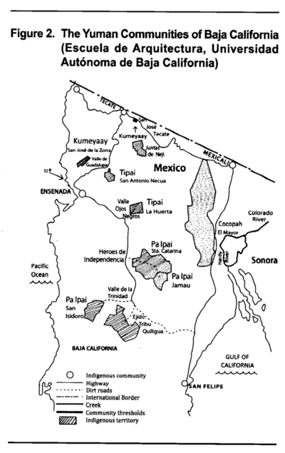
The Yuman Communities of Baja California
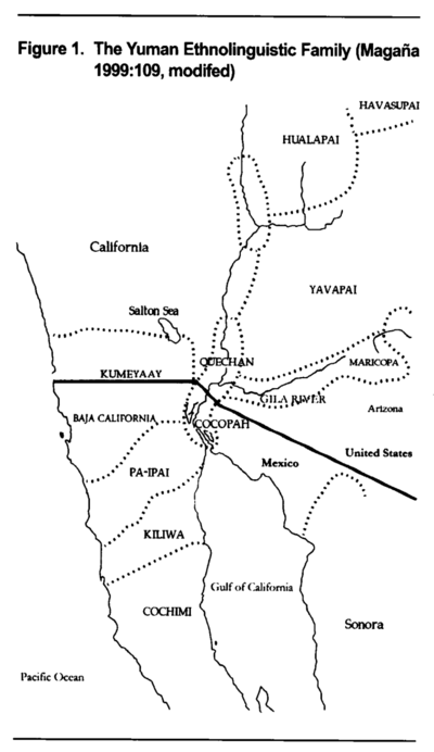
The Yuman Ethnolinguistic Family
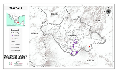
TLAXCALA
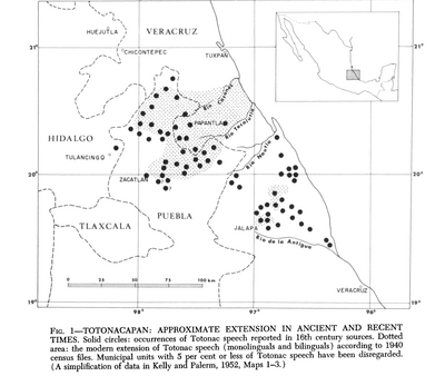
Totocanapan: Approximate Extension in Ancient and Recent Times
Ubicación geográfica del pueblo mixteco
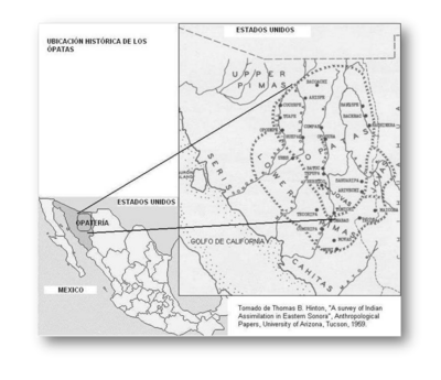
Ubicación histórica de los ópatas
Variantes de la lengua tlapaneca
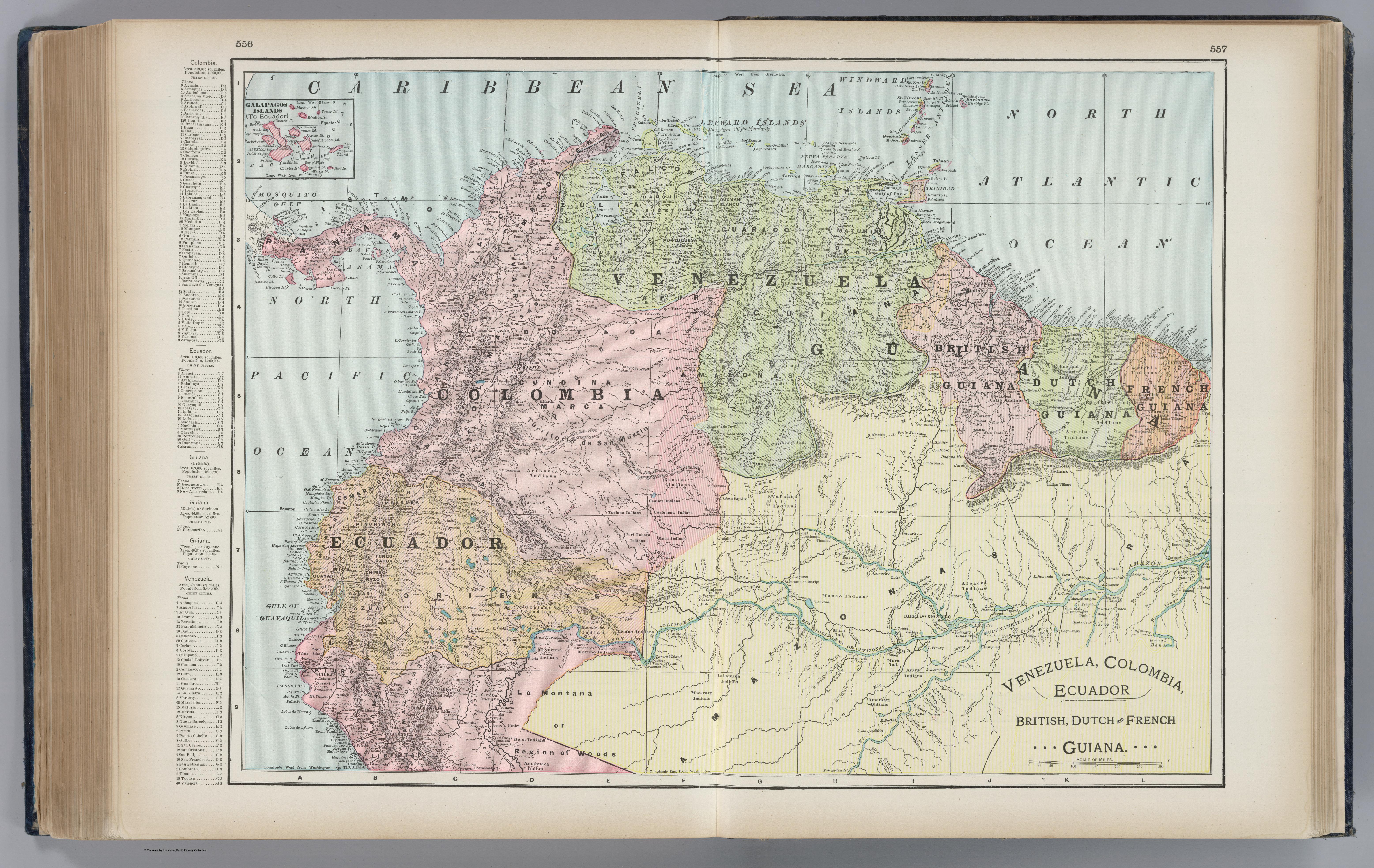
Venezuela, Colombia, Ecuador;British, Dutch, and French Guiana
VERACRUZ
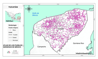
YUCATÁN
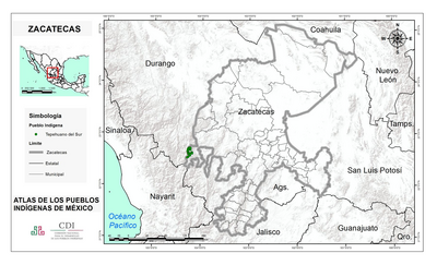
ZACATECAS
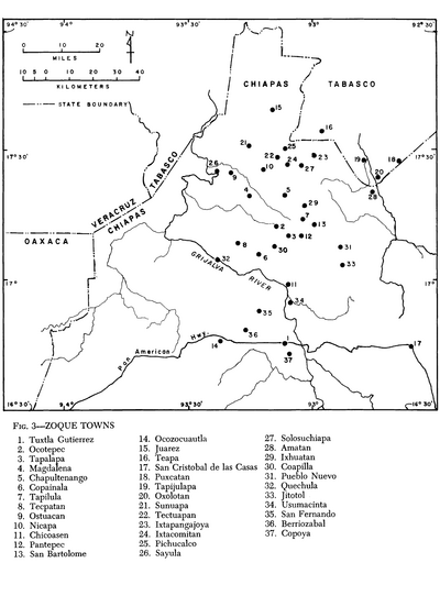
Zoque Towns