Dispossesions in the Americas

Dispossesions in the Americas

  • Home
  • Explore
  • About
  • Authors
  • Art
  • Bodies
  • Curricula
  • Cultural Heritage
  • Maps
  • Territories
Back to Explore
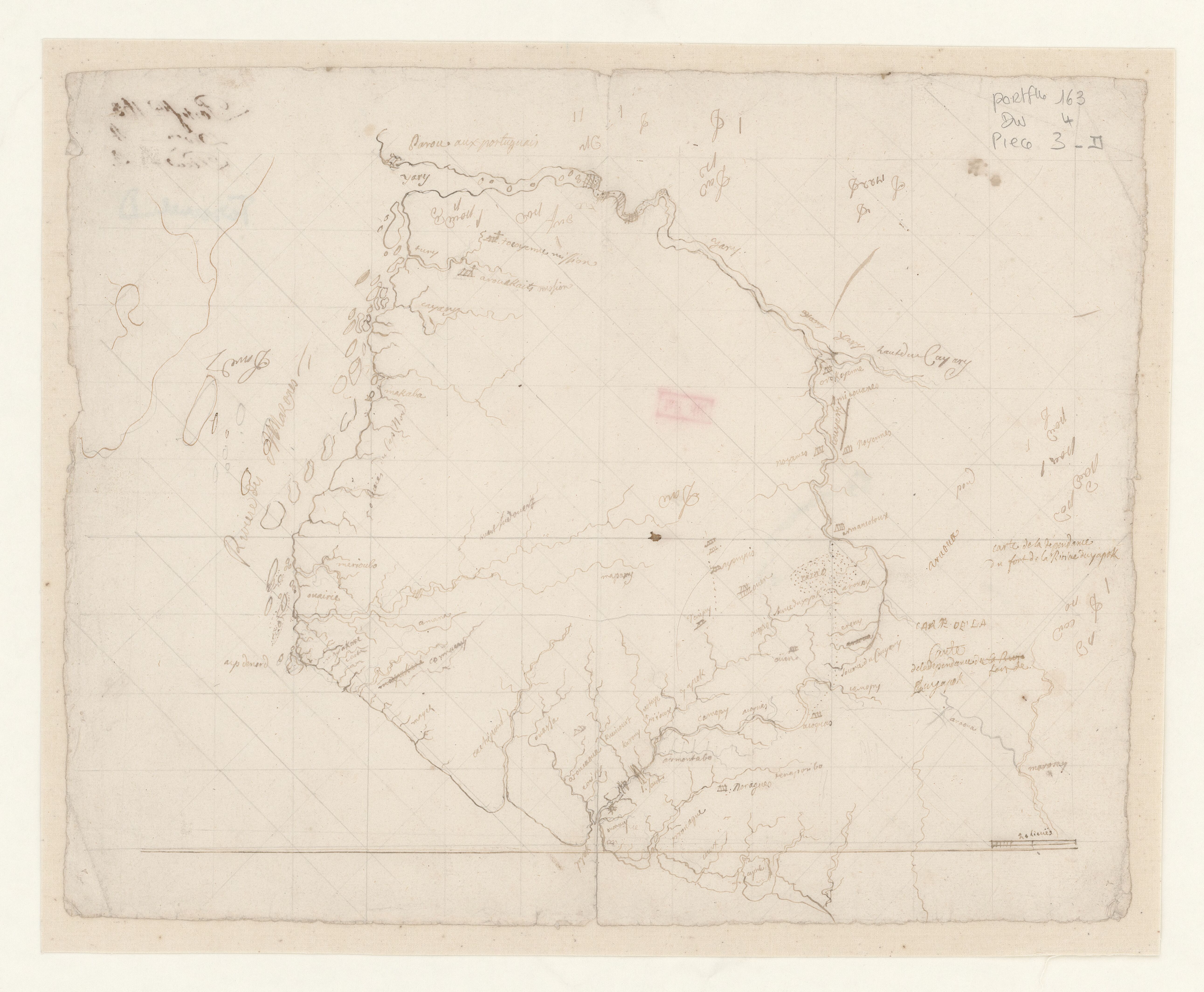
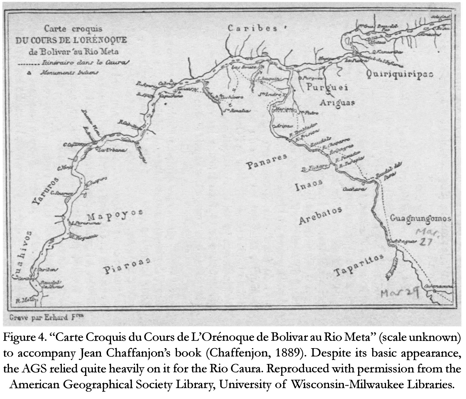
Map 1884

Carte Croquis DU COURS DE L'ORÉNOQUE de Bolivar àu Rio Meta

  • CHAFFANJON;JEAN

Published: 2015

  • Download Image

Peoples

  • CARIBE
  • QUIRIQUIRIPAS
  • PURGUEI
  • ARIGUAS
  • ENEPA
  • INAOS
  • AREBATOS
  • TAPARITAS
  • GUAGNUNGOMOS
  • YARURO
  • MAPOYO
  • PIAROA
  • JIVI

Citation

Chaffanjon;Jean. "Carte Croquis du Cours de L'Orénoque de Bolivar au Rio Meta." Map. In Revealing the 'Lost World': The American Geographical Society and the Mapping of Roraima during the 1930s;by Alastair Pearson and Michael Heffernan;188. Vol. 14. Journal of Latin American Geography;2015. Accessed March 4;2023. https://www.jstor.org/stable/43964634?seq=19.
  • Download Image

Reading in Spanish

Map 1884

Carte Croquis DU COURS DE L'ORÉNOQUE de Bolivar àu Rio Meta

  • CHAFFANJON;JEAN

Published: 2015

  • Download Image
  • Download Image

Related Content

Language Groups of Baja California

Language Groups of Baja California

Map 1981
PRESENT-DAY MAYA LANGUAGE BOUNDARIES OF GUATEMALA

PRESENT-DAY MAYA LANGUAGE BOUNDARIES OF GUATEMALA

Map 1961
Familias lingüísticas en Andes Centro y Sur

Familias lingüísticas en Andes Centro y Sur

Map 2000 - 2024
IDIOMAS DE GUATEMALA Y BELICE

IDIOMAS DE GUATEMALA Y BELICE

Map
A draught of the Bay of Honduras and part of the Musquetto Shore by George Robertson

A draught of the Bay of Honduras and part of the Musquetto Shore by George Robertson

Map 1766
Laguna

Laguna

Map 1997
Na Luum Caj

Na Luum Caj

Map 1997
"Territorios Indígenas de Costa Rica"

"Territorios Indígenas de Costa Rica"

Map 2010

Dispossessions in the Americas

A project by

University of Pennsylvania

Copyright 2024

With support from

Mellon Foundation

Site design & development

Element 84

Art Credits

Chaffanjon;Jean. “Carte Croquis du Cours de L’Orénoque de Bolivar au Rio Meta.” Map. In Revealing the ‘Lost World’: The American Geographical Society and the Mapping of Roraima during the 1930s;by Alastair Pearson and Michael Heffernan;188. Vol. 14. Journal of Latin American Geography;2015. Accessed March 4;2023. https://www.jstor.org/stable/43964634?seq=19.
Site Pages

  • Home
  • Explore
  • About
  • Authors
  • Art
  • Bodies
  • Curricula
  • Cultural Heritage
  • Maps
  • Territories