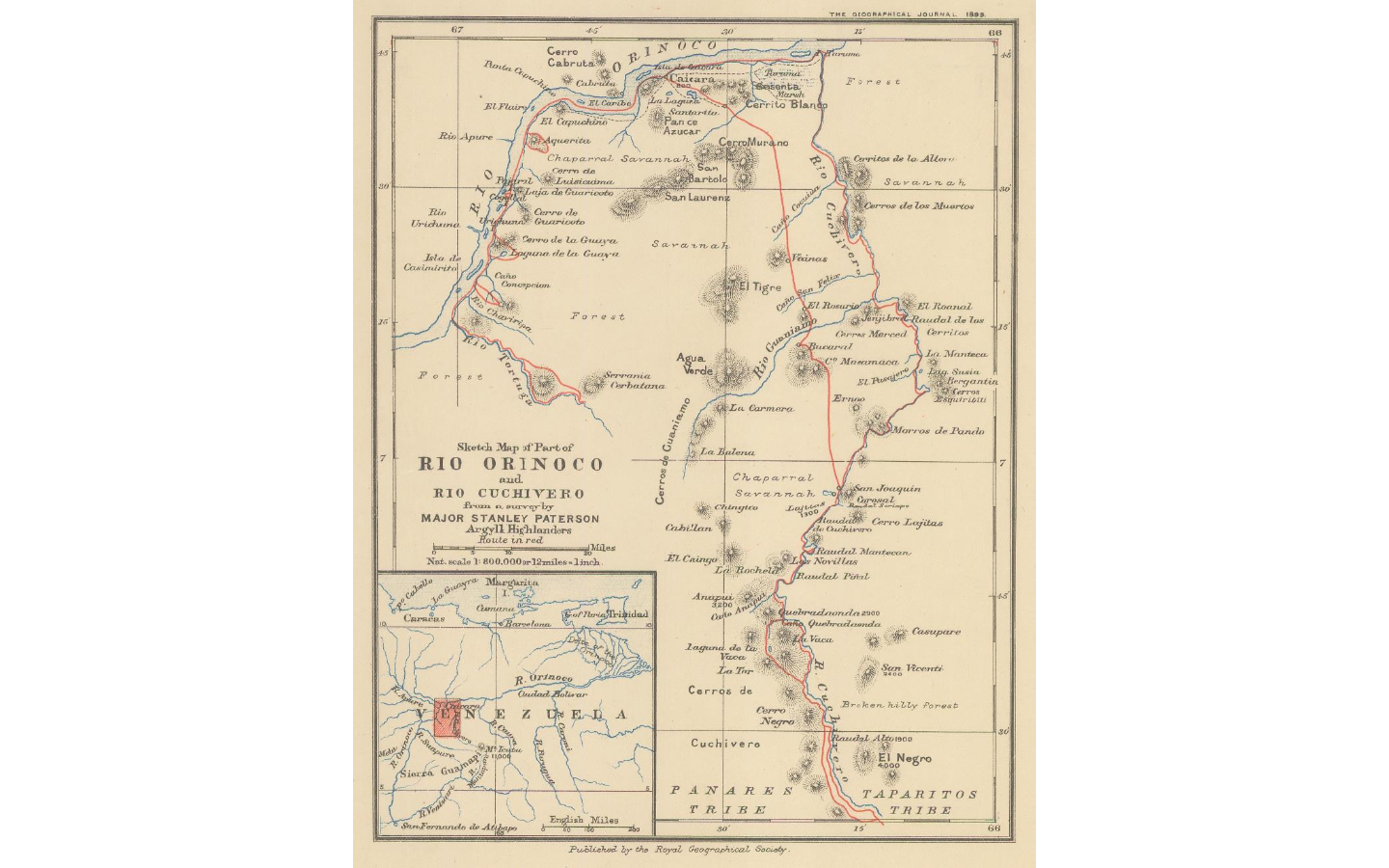
Dispossesions in the Americas

Dispossesions in the Americas

  • Home
  • Explore
  • About
  • Authors
  • Art
  • Bodies
  • Curricula
  • Cultural Heritage
  • Maps
  • Territories
Back to Explore
Map 1896

Sketch map of part of RÍO ORINOCO and RIO CUCHIVERO from a survey by MAJOR STANLEY PATERSON

    Published: 1899

    • Download Image

    Peoples

    • ENEPA
    • TAPARITAS

    Citation

    "Sketch map of part of Rio Orinoco and Rio Cuchivero from a survey by Major Stanley Paterson." Map. In The Geographical Journal. London: Royal Geographical Society;1899. Accessed February 26;2023. https://www.themaphouse.com/search_getamap.aspx?id=129676&ref=SAM3271.

    • Download Image

    Reading in Spanish

    Map 1896

    Sketch map of part of RÍO ORINOCO and RIO CUCHIVERO from a survey by MAJOR STANLEY PATERSON

      Published: 1899

      • Download Image
      • Download Image

      Reading in Portuguese

      Map 1896

      Sketch map of part of RÍO ORINOCO and RIO CUCHIVERO from a survey by MAJOR STANLEY PATERSON

        Published: 1899

        • Download Image

        Peoples

        • ENEPA
        • TAPARITAS

        Citation

        "Sketch map of part of Rio Orinoco and Rio Cuchivero from a survey by Major Stanley Paterson." Map. In The Geographical Journal. London: Royal Geographical Society;1899. Accessed February 26;2023. https://www.themaphouse.com/search_getamap.aspx?id=129676&ref=SAM3271.

        • Download Image

        Related Content

        Wampis Cosmovision

        Wampis Cosmovision

        Artwork
        REGIÓN TUXTLAS, POPOLUCA-NÁHUATL DE VERACRUZ

        REGIÓN TUXTLAS, POPOLUCA-NÁHUATL DE VERACRUZ

        Map 2000
        Mapa de las culturas indígenas en vísperas de la conquista española.

        Mapa de las culturas indígenas en vísperas de la conquista española.

        Map 1650 - 1750
        Official Map of Nicaragua.

        Official Map of Nicaragua.

        Map 1898
        Nova Hispania et Nova Galicia

        Nova Hispania et Nova Galicia

        Map 1636
        "Descripción del Valle de Chimo y planisphérica de la Ciudad de Truxillo del Perú".

        "Descripción del Valle de Chimo y planisphérica de la Ciudad de Truxillo del Perú".

        Map 1760
        Lugares sagrados y seculares asociados a los caminos del Kuwai

        Lugares sagrados y seculares asociados a los caminos del Kuwai

        Map 1399
        La región andina septentrional ecuatoriana

        La región andina septentrional ecuatoriana

        Map -500 - 1550

        Dispossessions in the Americas

        A project by

        University of Pennsylvania

        Copyright 2024

        With support from

        Mellon Foundation

        Site design & development

        Element 84

        Art Credits

        “Sketch map of part of Rio Orinoco and Rio Cuchivero from a survey by Major Stanley Paterson.” Map. In The Geographical Journal. London: Royal Geographical Society;1899. Accessed February 26;2023. https://www.themaphouse.com/search_getamap.aspx?id=129676&ref=SAM3271.

        Site Pages

        • Home
        • Explore
        • About
        • Authors
        • Art
        • Bodies
        • Curricula
        • Cultural Heritage
        • Maps
        • Territories